The 70 best hikes in L.A. and Southern California - Los Angeles Times
Advertisement
Filters

Neighborhood

Filter

Parks & Trails

Difficulty

Length

Sort by

Showing  Places
Filters
Map
List
Animated type reading "HIKE L.A." floats against wispy clouds and blue sky above a rocky hilltop.
(Mat Voyce for The Times; photo by Myung J. Chun / Los Angeles Times)

The 70 best hikes in L.A.

Share via

My single favorite sound, if pressed to choose, would be crunching gravel on a hike.

Hiking, for me, is a sensual experience. It starts the moment I step out of my car, whether that’s on a mountain road in the Angeles National Forest, in a parking lot at Debs Park or on a residential street in the Hollywood Hills. All of my senses immediately engage — call it “hiking foreplay” — while surveying the open vistas, or dusty switchbacks, or the forested path ahead; while tuning in to the chorus of birds, rustling tree leaves and, as I climb upward, my own rhythmic breathing; while inhaling the commingling scents of, say, wild fennel, sage and sweat. Even the dry air on my dehydrated tongue or my aching glutes on an especially long journey somehow add to the experience. The body responds, unfurling.

Join the L.A. Times on a hike along the Lower Arroyo Seco Trail, led by wellness writer Deborah Vankin.

May 30, 2024

The effect, no matter how rigorous the trek, is calming. Hiking, more than anything else, is what grounds me.

Los Angeles is a mecca for hiking, if just because of the topographical diversity in such uniquely close proximity — not to mention the weather. From the San Bernardino Mountains to the east to the Santa Monica Mountains to the west, there are miles upon miles of strikingly different trails offering ocean views or desert landscapes or soaring mountain peaks, some more than 10,000 feet high. And you can experience all of those terrains in a day, if you time it correctly.

A few writers and I trekked more than 150 miles between us to bring you this guide. We encountered rattlesnakes, coyotes and poison oak galore; we crossed creeks up to our thighs, one of us falling in once, the other slicing an elbow (it’s better now). We dodged a shady-looking character who others warned had been following hikers; but we also met new friends. We sang out loud on the trails, danced on them, kissed on them (with partners, not each other). We ate snacks on them, hatched ideas for books and columns on them, peed on them (you know you’ve done it too). We laughed on them.

Advertisement

We got lost plenty but found an overwhelming sense of peace on the trails, each of us in different ways.

“For me, it’s about feeling connected to the Earth, to Mother Nature, getting away from the city — the hustle and bustle, computer screens and phones buzzing — and being alone with my thoughts,” said Times contributor Matt Pawlik when I asked him why he hikes. “My most creative thinking comes on the trail. And it’s an adventure. It narrows your purpose of now — you have one job, to get to this destination and back.”

So lace up your boots (or your barefoot, nonslip hiking shoes, as is the trend), get out there and immerse yourself in the ever-present sound underfoot: “crunch, crunch, crunch.”

A few notes: The vast majority of these hikes are in Los Angeles County, but we’ve included some worthy ones further out for eager day-trippers. Distance and elevation below are based on our tracked hikes. The geolocation marks either nearby parking or the trail.

Advertisement

Deborah Vankin

Showing  Places
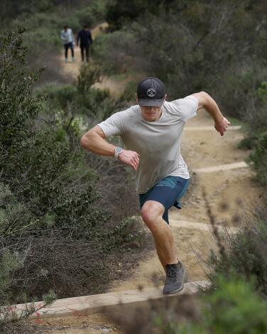
A man runs up a dirt trail among shrubs.
(Christina House / Los Angeles Times)

Runyon Canyon Trail

Hollywood Hills West Urban Trail
2.7-mile loop
Moderate
757
Here in L.A., we may take Runyon Canyon for granted — a popular, centrally located hike that’s become a staple for dog owners, seeing as it has on- and off-leash paths. It’s also become known as a destination for singles, in fitted activewear, looking to meet a match on the trail. But revisit Runyon Canyon Trail with a newcomer’s eye and you’ll quickly see why it’s so deserving of a spot on this list. The trail offers a challenging workout and some of the most magnificent urban views from any local hiking trail, period.

Parking at Runyon Canyon is sparse — you’ll likely have to find a spot in the neighborhood, then huff it up a modest residential hill to the trailhead. Start on the paved road just past the entrance to the park, which likely will be crowded if you’re there on a weekend. Quickly take a sharp left onto the narrower, dirt trail and wind your way upward. This portion of the hike gets steep — and rocky — very quickly. Hiking poles would not be out of place on some stretches. But the path through the Hollywood Hills is rugged and beautiful; and it passes by some dramatic-looking homes. There are also postcard-worthy views of all the expected, A-list sights: the Hollywood sign, the Griffith Observatory, the downtown L.A. skyline. On a clear day, the view stretches from the Santa Monica Mountains to the Pacific Ocean.

And yet the journey somehow also feels remote, or at least removed from the urban bustle below. When the wind kicks up, it’s so loud from the trail peaks it may pause conversation. The result is a rejuvenating escape in what still feels quintessentially L.A. You might even spot a celebrity.
Read All Read Less
Route Details
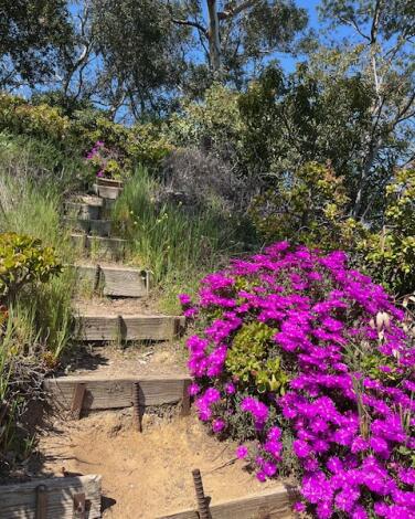
A wooden hillside staircase with pink blooming flowers at its base.
(Deborah Vankin / Los Angeles Times)

Amir’s Garden

Griffith Park Park Trail
1.1-mile loop
Moderate
275
The hike to Amir’s Garden, from the Griffith Park trailhead below, may be a short, mile-plus loop, but the destination is brimming with history, not to mention natural beauty. After a fire destroyed the hillside in 1971, hiker and Iranian immigrant Amir Dialameh spent more than three decades transforming it by hand, planting pine and jacaranda trees, geraniums, oleander, rose bushes and plenty of bougainvillea, among other flowers and plants. It’s now a shady, florescent respite for passing hikers and horseback riders in an otherwise well-trafficked section of the park.

The roughly 5-acre garden features enclaves with picnic tables and benches as well as multiple sets of wooden staircases that wind down the hillside to the starting point below, making for steep, workout-worthy shortcuts. Many of the staircases have seen better days, so tread carefully; some offer dramatic views, others enchanted wooded pathways.

Park in the lot at Griffith Park Drive and Camp Road by the Wilson and Harding Golf Courses. The Mineral Wells trailhead, to the right of the babbling creek, is clearly marked.
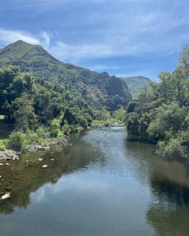
Read All Read Less
Route Details
A view of a creek, with trees on either side and mountains between them.
(Deborah Vankin / Los Angeles Times)

Rock Pool and Century Lake Trails

Unincorporated Santa Monica Mountains Park Trail
4.5-mile loop
Easy
341
Rock Pool and Century Lake Trails is a relatively easy hike in the Santa Monica Mountains that’s fully loaded with all of nature’s bells and whistles: a creek-adjacent trail, wide-open vistas, hillsides blanketed with flowers in spring and shady stretches under a canopy of oak trees. And that’s just to start.

Step out of your car and the drive is suddenly worth it; feel your breath slow and your chest open up.

You do have to pay to park here (do so in the second lot on your left and the hike starts opposite the lot, at the bottom of the stairs) and dogs are not allowed. But those inconveniences don’t stack up against the payoff: a naturally diverse hike that also includes some Hollywood sparkle. Parts of the 1968 movie “Planet of the Apes” were filmed here — the “Planet of the Apes wall,” at the rock pool, is a popular climbing destination — as were scenes from the long-running TV series “MASH.”

While this isn’t a steep or difficult hike, it does include at least one creek crossing near the end. The afternoon we visited, due to recent rain, the water was knee-deep, though the current was mild. Bring waterproof shoes if you have them.

Or just walk right in with regular sneakers on, as the young woman trudging behind us did. She appeared unfazed. Her open-midriff T-shirt summed it up best: “C’est la Vie.” A most appropriate message while on the trail.

Read All Read Less
Route Details
A group of turtles on a semi-submerged log in Debs Lake.

City, Lake and Valley View, Summit Ridge, Scrub Jay Loop 

Montecito Heights Park Trail
2.9-mile loop
Moderate
649
This trail, at Ernest E. Debs Regional Park in Montecito Heights, is the “snack variety pack” of hikes. It offers historical, recreational and natural points of interest throughout, breaking up the roughly 90-minute journey. The terrain varies too, from flat to steep, from windy, dry switchbacks to open hilltop vistas and narrow forested paths. Not to mention it offers city, lake and valley views, as its name suggests.

The initial climb, from the trailhead at Audubon Center at Debs Park (which is where you’ll park), takes you past the old (now shuttered) Southwest Museum in Mt Washington, L.A.’s oldest museum and an architectural gem. There’s a large gazebo roughly halfway through the hike, with a picnic table — perfect for a rest stop. And toward the end, atop a short, steep climb, is Debs Lake, with its dramatically draping pine trees, turtles and ducks. Press on: There’s a lookout point at the end of the hike, with a sweeping view of the area.

Forget your binoculars, a water bottle or backpack? Not to worry. The Audubon Center, a community and nature hub, lends hiking gear for free. The center also houses a 1.5-mile butterfly path on its property (open 8 a.m. to 4 p.m. Thursday to Sunday) as well as a short, ADA-accessible trail.
Read All Read Less
Route Details
Advertisement
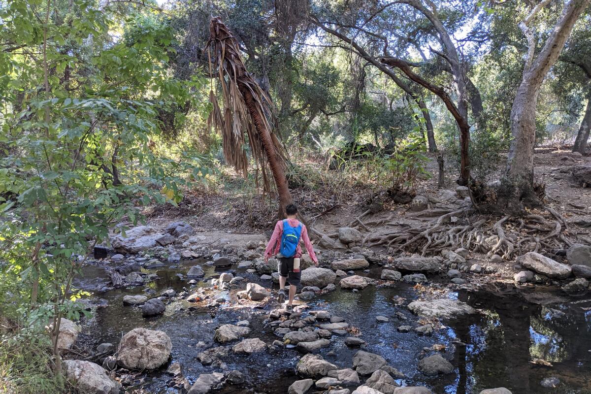
A hiker on the Walnut Creek trail walks on rocks in a stream.
(Matt Pawlik)

Walnut Creek Community Regional Park

San Dimas Canyon Trail
7.6-mile out-and-back
Moderate
450
Nestled among the busy freeway intersections of San Dimas in the eastern San Gabriel Valley is the Michael D. Antonovich Trail, a gentle and heavily shaded trek that’s perfect for anyone seeking some weekend solace. Throughout your peaceful trek, you’ll be paralleling the babbling waters of Walnut Creek and will encounter multiple stream crossings. You’ll also find healthy flora like the giant green leaves of palms and ferns, along with resident wildlife around the creek. Look for herons and egrets, who love to hunt along the shore during sunrise and sunset.

This trek takes you past a campground, multiple trail entry points and the entrance to a local Buddhist temple, the Tzu Chi Foundation, which welcomes visitors. Stop in and be reminded of Thich Nhat Hanh’s words: “Peace is every step.”

The trail ends at a connection with Oak Canyon Road, or you can head back the way you came at any point. If you want to see more water features, consider a short drive to neighboring Frank G. Bonelli Park for great views of the Puddingstone Reservoir.

Park at the free lot along San Dimas Avenue and find the trail heading west. Directions to trailhead.
Read All Read Less
Route Details
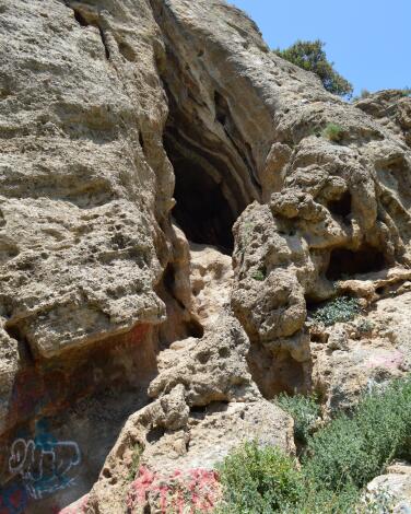
Cave of Munits in a large boulder up a hill
(Jaclyn Cosgrove / Los Angeles Times)

The Cave of Munits

West Hills Park Trail
1.6-mile loop
Moderate
203 feet
The Cave of Munits is an easy place to reconnect with your childlike wonder. There you can explore several caves, one of which is so large and chimney-shaped that you can (carefully) climb inside. Just be mindful of snakes and birds.

Getting there requires a mile trek that finishes off with a steep incline up a sandy path. While exploring, consider its namesake: a Fernandeño and Western Tongva story of tragic misunderstanding that involved a grieving chief, a sorcerer named Munits and a handful of murders. (Want to learn the full story? Read Chapter 10 of this academic article.)

To reach the caves, you can either take a wide exposed dirt path that starts at the El Escorpión Park gate or a narrow, shady route along the riverbed. Both are visible on maps on outdoors navigation apps. Grippy shoes are a must, and trekking poles could be helpful.
Read All Read Less
Route Details
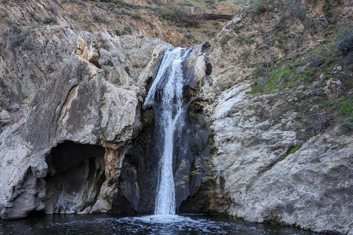
The waterfall at Paradise Falls.
(Matt Pawlik)

Paradise Falls

Thousand Oaks Mountain Trail
2.75-mile loop
Moderate
500
With 27 miles of trails in its 1,765 acres, Wildwood Regional Park in Thousand Oaks is home to spectacular geological formations (standouts include Lizard Rock and Indian Cave), lush valleys, riparian canyons and abundant wildflowers in the spring. But perhaps the most iconic feature of this diverse landscape is the aptly named 40-foot Paradise Falls.

To get there, park in the dirt lot and find the wide Mesa Trail at the northwestern end that maneuvers through grasslands (look to your left for some towering volcanic outcroppings). Take a left on the North Tepee Trail (note that the signs will always direct you to the falls), which descends past a re-created Chumash tepee structure before diving into the canyon. Before taking the stairs down to the canyon floor, take a left on the Wildwood Canyon trail for a stop at the top of the falls.

At the bottom, any view of the falls is photo-worthy, but the best angle can be found by crossing the creek to the south to get a direct vantage point on the powerful flowing water. You can continue west farther into the canyon here, or head back up the stairs and back to the tepee, where you’ll find benches to admire the panoramic vistas. On your way back, take the Moonridge Trail, a single-track offering to your right that heads east through cactus groves (look for a spur trail going to Indian Cave to extend your trip) all the way back to the lot to complete the loop.
Read All Read Less
Route Details
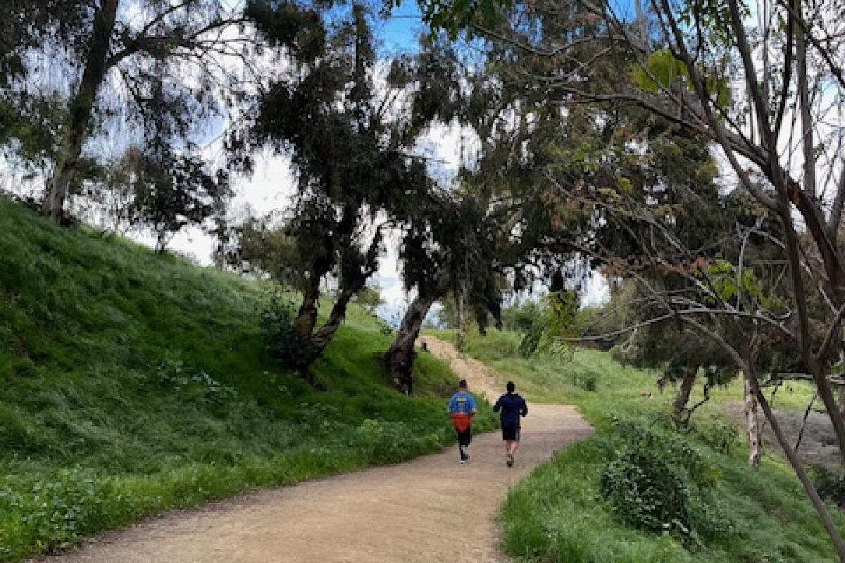
Two runners from behind, on a dirt trail.
(Deborah Vankin / Los Angeles Times)

Elysian Park West Loop Trail

Elysian Park Park Trail
2.4-mile loop
Easy
242
The Elysian Park West Loop may be the ultimate urban trail in L.A. — intimately connected to the surrounding city while also steeped in tranquil wildlife. The dirt trail is perfect for runners: It’s relatively smooth, well-maintained and wide enough for two athletes to run side by side. This is also a great introductory hike for out-of-towners as it’s fairly easy and offers an elevated perch of sorts, with views of iconic L.A. landmarks. The trail hovers over parts of the L.A. River and the bustling 5 Freeway in one area. In others, it faces the soaring skyscrapers of downtown L.A. and passes the lights of Dodger Stadium.

What is perhaps most charming about this hike is the commingling natural and urban elements. The sounds of sparrows, ravens and crows mix with Latino music from a nearby birthday picnic and intermittent cheers from a pickup soccer game in the park, for example. Meanwhile, the scent of fuchsia-flowered gooseberry, California wild rose and purple sage blend with wafting barbecue smoke.

The trailhead, off Stadium Way in Elysian Park — just minutes from downtown L.A. — is easily accessible and yet, as you wind around the cityscape, ensconced by coast live oaks, California walnut and spindly palm trees dotting the hilltop, you feel completely transported. This is why we live in L.A.
Read All Read Less
Route Details
Advertisement
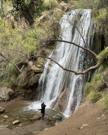
A hiker at the bottom of Escondido Falls.
(Raul Roa / Los Angeles Times)

Escondido Falls

Malibu Canyon Trail
3.7-mile out-and-back
Easy
500
Despite its name meaning “hidden” in Spanish, Escondido Falls is a popular and accessible trek — and the journey is quintessentially Malibu. The first segment gives you a look at the city’s extravagant homes, and as you climb, you’re rewarded with near-unobstructed views of the shimmering Pacific Ocean. You’ll then descend through a shaded woodland canyon filled with oaks, paralleling a quaint stream and colorful pockets of light purple chaparral mallows (find blooms from spring to fall). The surrounding hills of the Santa Monica Mountains provide a dramatic backdrop for it all.

Your endpoint will be the 50-foot lower cascades, which trickle year-round but are most impressive after it rains. It’s the perfect picnic spot — just grab a breakfast burrito at Lily’s Malibu beforehand. You’ll notice the falls are tiered, reaching 150 feet at the upper section. (You can’t climb all the way up there, though. Trail access is restricted.)

Park in the lot at Winding Way off PCH ($12) and follow the trail along the paved road about a mile to the Edward Albert Escondido Canyon Trailhead. Directions to the trailhead.
Read All Read Less
Route Details
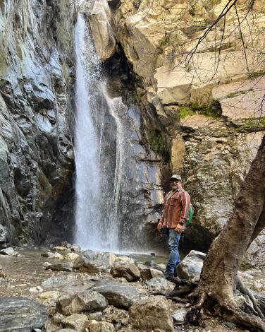
A person stands on rocks next to Millard Falls.
(Daniel Hernandez / Los Angeles Times)

Millard Canyon Falls

Altadena Mountain Trail
2.5-mile out-and-back
Moderate
557
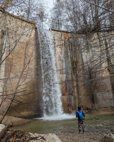
Millard Canyon Falls in Angeles National Forest is just above Altadena — just take Fair Oaks Avenue north, take a left at Loma Alta Drive, then a right onto Chaney Trail Drive and into the campground parking area — and yet it feels like it could be hundreds of miles away.

Park at the Millard Canyon campground. A craggy, tree-lined ravine anchored by a creek leads hikers up on a gentle climb toward a clearing. Here, the breathtaking swoosh of a 50-foot-tall waterfall will fill your eardrums; especially when rain gives this wash a healthy wallop of fresh water. The water is icy, but that won’t deter an occasional visitor from taking what looks like a soul-cleansing dip. That said, novice hikers and families, be warned — with the creek full, water reaches its bordering boulders and canyon walls, forcing you to cross the creek in a constant zigzag, on smooth rocks and loose logs, to reach the waterfall. Avoid creek tragedy by employing hiking sticks, waterproof shoes or water shoes.
Read All Read Less
Route Details
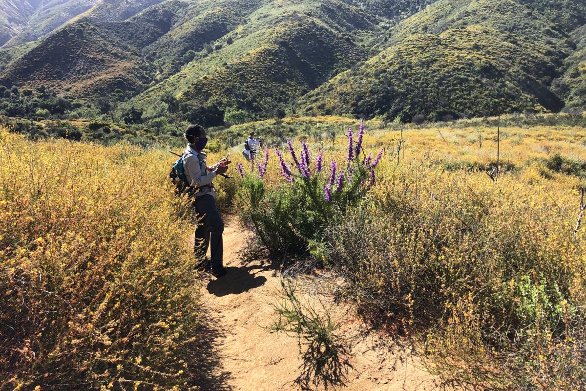
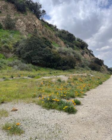
Wildflowers grow amid the grass along the edge of a dirt trail.
(Deborah Vankin / Los Angeles Times)

Brand Lateral Trail Loop

Glendale Mountain Trail
2.1-mile loop
Moderate
744
Did you know that Leslie C. Brand, the so-called “father of Glendale,” had a thing for Moorish architecture? Make it past this trail’s initial, steep climb and there’s a robust, outdoor display on the hilltop about Brand and the history of Glendale.

But first, the ascent: The first third of this hike is a somewhat steep climb. Bring shoes with good tread. The payoff is big: sweeping views of Glendale, Burbank and the downtown L.A. skyline below.

From there, head deeper into the Verdugo Hills. The trail leads you on a long, winding descent into the canyon, where it’s shadier and cooler — even flat in some parts — and the path follows a trickling creek. Wildflowers blanket the hillside during spring.

Park in the lot at the Brand Library & Art Center, and head north toward the trailhead. The library is a great place to pop into after your hike. There are interesting art exhibits on view and the building itself is magnificent — a Moorish-inspired former mansion from 1904 that was, yes, Brand’s home.

He called it “Miradero Estate,” which means “lookout” or “vantage point” in Spanish. And the name just about sums up this hike.
Read All Read Less
Route Details
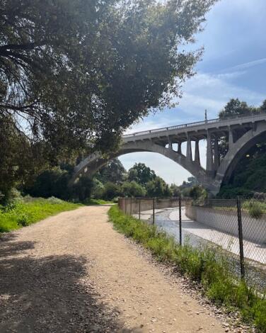
The dirt Lower Arroyo Seco Trail, with a bridge in the background.
(Deborah Vankin)

Lower Arroyo Seco Trail

Pasadena Urban Trail
3.2-mile loop
Easy
177
This is an easy, largely flat hike that will likely be of interest to both architecture buffs and nature lovers, not to mention joggers and dog owners. The path, along the Arroyo Seco, leads visitors under multiple, grand bridges and the wide, gravel-dirt-and-stone trail is in good condition — which is why it’s popular among runners and dog walkers (though your furry companions must be leashed).

The trailhead starts at San Pascual Stables, but there’s a parking lot for hikers adjacent to the baseball fields; there’s also bountiful street parking.

It’s nearly impossible to get lost on this hike — most of the walk follows the concrete river basin. But there are a few, more remote trails that veer off from the main path, with densely planted trees and spots of shade. There are also benches, for a rest, along the way.

For a relatively straightforward hike, there’s a lot to hold your interest here. The trail passes an archery range in its second half, at which point the colorful, mounted targets are visible through the trees, as are archers wielding bow and arrow .

Walking under the great arches of the 1922 San Rafael Bridge and the 1914 La Loma Bridge adds a touch of drama to an otherwise facile and peaceful hike.
Read All Read Less
Route Details
Advertisement
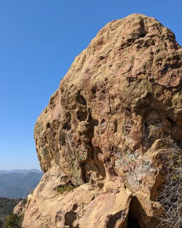
A large rounded rock on a hiking trail.
(Matt Pawlik)

Skull Rock

Pacific Palisades Canyon Trail
4.5-mile loop
Moderate
1,150
Are you bone to be wild? Then your next trek is a no-brainer — hike to the skeletal-shaped Skull Rock in Temescal Gateway Park to find a quirky quarry overlooking the stunning Pacific Palisades coast.

Enjoy heavily shaded switchbacks under oaks and coastal chaparral hillsides as you ascend on the Temescal Ridge trail toward panoramic viewpoints that stretch from Santa Monica to the Channel Islands on a clear day. Skull Rock and its boulder buddies are the midpoint of your geological journey and a great locale for some rock scrambling to a picnic perch (Skull Rock itself has a rope to help you scale the granite face). On your descent, the loop passes over a small bridge and a small waterfall en route to a grove of massive coast live oaks before passing a campsite on the way back to your car.

Park in the paid lot or find free street parking just off Sunset Boulevard and Temescal Canyon Road. Find the trailhead in the southwest corner of the lot. Directions to trailhead.
Read All Read Less
Route Details
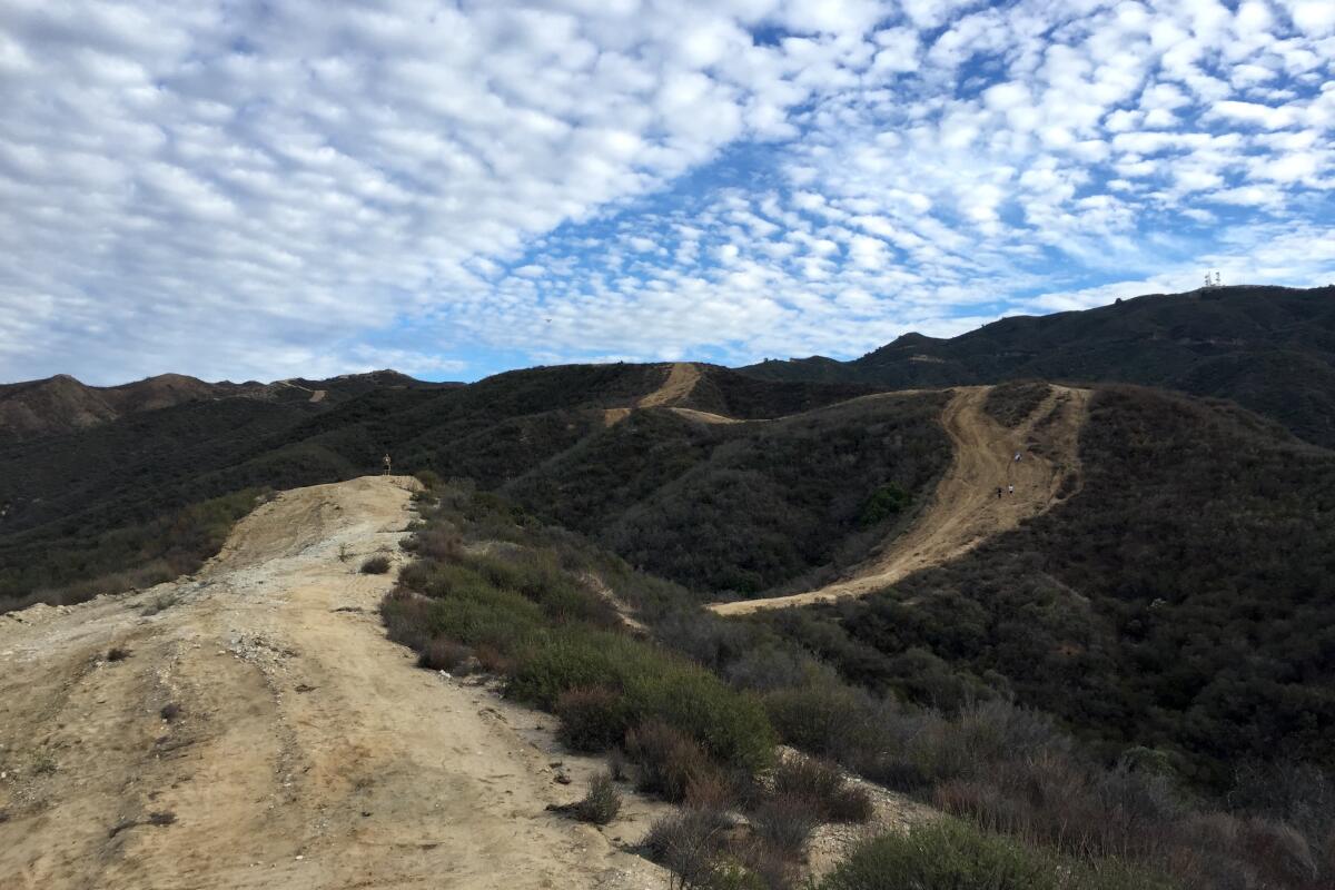
The Placerita Canyon trail stretches out under a cloudy sky.
(Matt Pawlik)

Placerita Canyon

Los Angeles County Canyon Trail
7.2-mile loop
Strenuous
1,800
Sometimes you just want it all. For one of the most relentless ascents in Los Angeles County, head to the Placerita Canyon Natural Area in Newhall to tackle the Seven Mile Loop (it’s 7.2 miles if we’re getting technical), which combines several trails to explore nearly all of the park. Before starting your journey on the Hillside Trail, head west to check out the educational nature center, rustic remains of the historic Walker Cabin and Oak of the Golden Dream, where gold reportedly was first discovered in California — six years before the Gold Rush was set off at Sutter’s Mill in Northern California.

Back on the trail, enjoy hiking through rolling chaparral-covered hills with a short spur trail to the peak of Manzanita Mountain. The views here are seemingly endless, stretching across the Antelope Valley to Santa Clarita and the Sierra Pelona. The highpoint of the hike is Wilson Saddle at 3,150 feet, an ideal rest stop before you start switchbacking into the oak woodland canyon. You’ll also traverse Placerita Creek, completing your highlight reel of SoCal’s diverse terrain.

Park in the lot just off Placerita Canyon Road next to the nature center and find the Hillside trailhead. Directions to trailhead.
Read All Read Less
Route Details
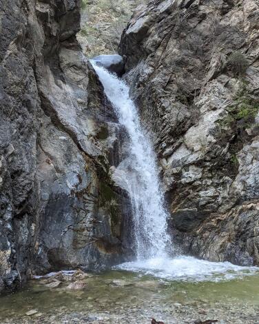
Waterfall at Eaton Canyon Falls.
(Matt Pawlik )

Eaton Canyon Falls

Pasadena Mountain Trail
4.0-mile out-and-back
Easy
550
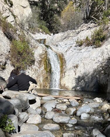
Pasadena’s Eaton Canyon is one of the most popular hiking destinations in Los Angeles County — and rightfully so. The scenery is idyllic, the trek is gentle and easy to follow, and the trailhead is incredibly accessible. What’s more, the picturesque 40-foot waterfalls flow year-round (in the summer, swimming hole!), but they’re best viewed after a good rain.

Park at the nature center lot, check out the interpretive exhibits (and native plant garden), and find the trailhead at the north end of the lot. The path follows a sandy, rocky wash alongside Eaton Creek (look for wildflowers in spring) as it heads deeper into the canyon. Ignore any side trails, such as those to Henninger Flats or Mt. Wilson, and continue north, following signs for the waterfall. At nearly the 1.5-mile mark, pass under a bridge and connect with a shortcut route that starts at Pinecrest Drive as the trail narrows and becomes enclosed by towering canyon walls.

Over the next half-mile, you will be doing plenty of stream crossings, so be prepared for a fun log-balancing and rock-hopping adventure. You may get wet! Come early for a more serene experience and the first pick of a boulder to perch on while you enjoy the mesmerizing cascade.
Read All Read Less
Route Details
A person stands on a dirt trail next to sand-colored hills in O'Melveny Park
(Matt Pawlik)

O’Melveny Park

Granada Hills Mountain Trail
4.25-mile loop
Moderate
1,450 feet
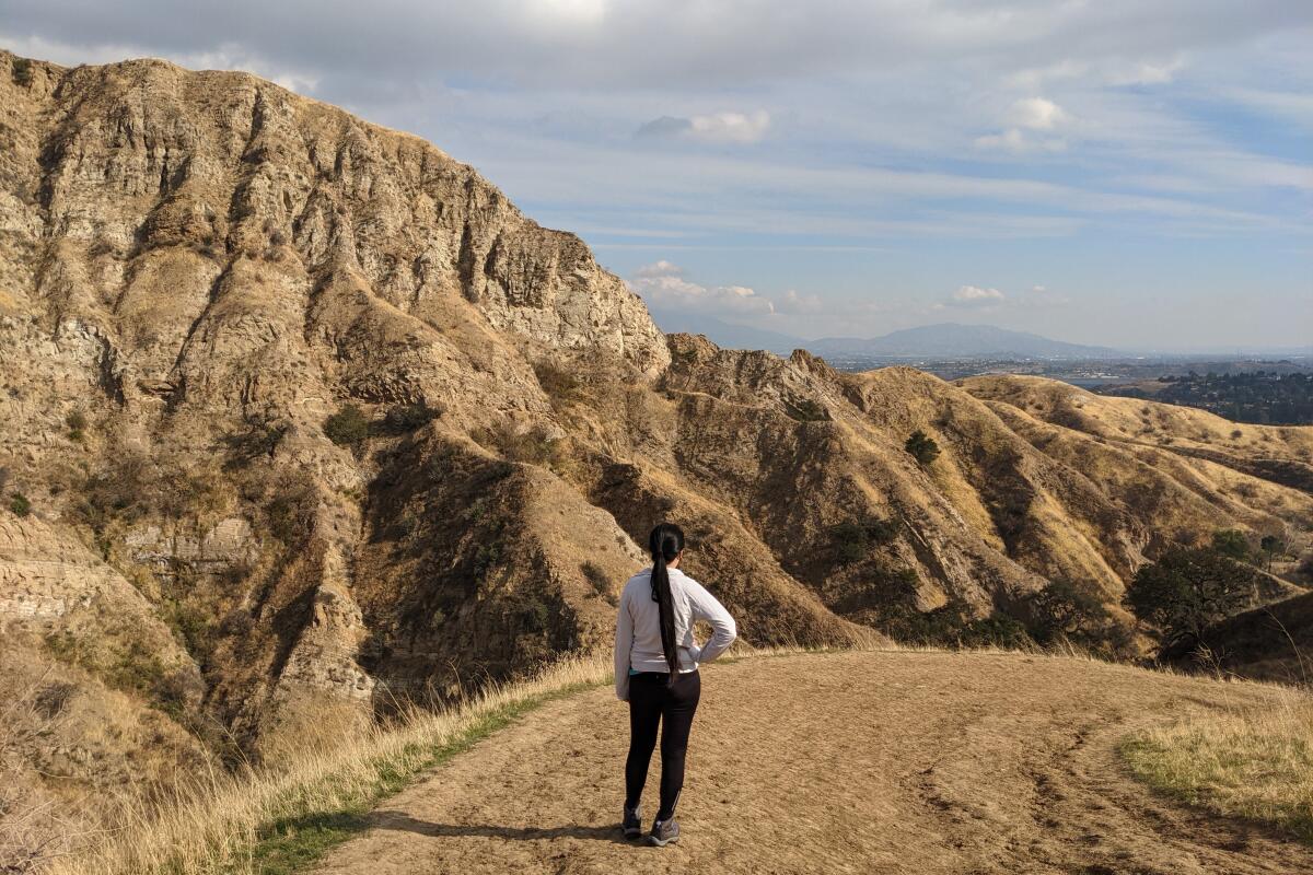
The hardest climbs should come with a reward of spectacular views. O’Melveny Park in the Granada Hills certainly does — it’s home to arguably the best overlook of the San Fernando Valley, with panoramic vistas that stretch from the downtown skyline to the hulking San Gabriels.

A loop trail takes you to the park’s highest peak — 2,730-foot Mission Point — after a challenging and dramatic ascent above the 672-acre green space. Scenery includes giant sandstone walls, sprawling meadows and the dramatic juxtaposition of rolling hills and rocky outcroppings. The park also is home to a historic grapefruit grove and a sprawling picnic area under oaks, sycamores and eucalyptus. Along with growing citrus, land donor Henry O’Melveny once grazed cattle and bred bulldogs on the land. Today, it’s the perfect spot to work out with your pooch.

Park in the lot just off Senson Boulevard and find the wide dirt trail on the right side of the citrus grove (labeled O’Melveny Trail). Directions to trailhead.
Read All Read Less
Route Details
Advertisement
Crystal Lake, surrounded by trees and hills, reflects the sky.
(Matt Pawlik)

Crystal Lake

Angeles Crest Lake Trail
1.5-mile loop
Easy
250
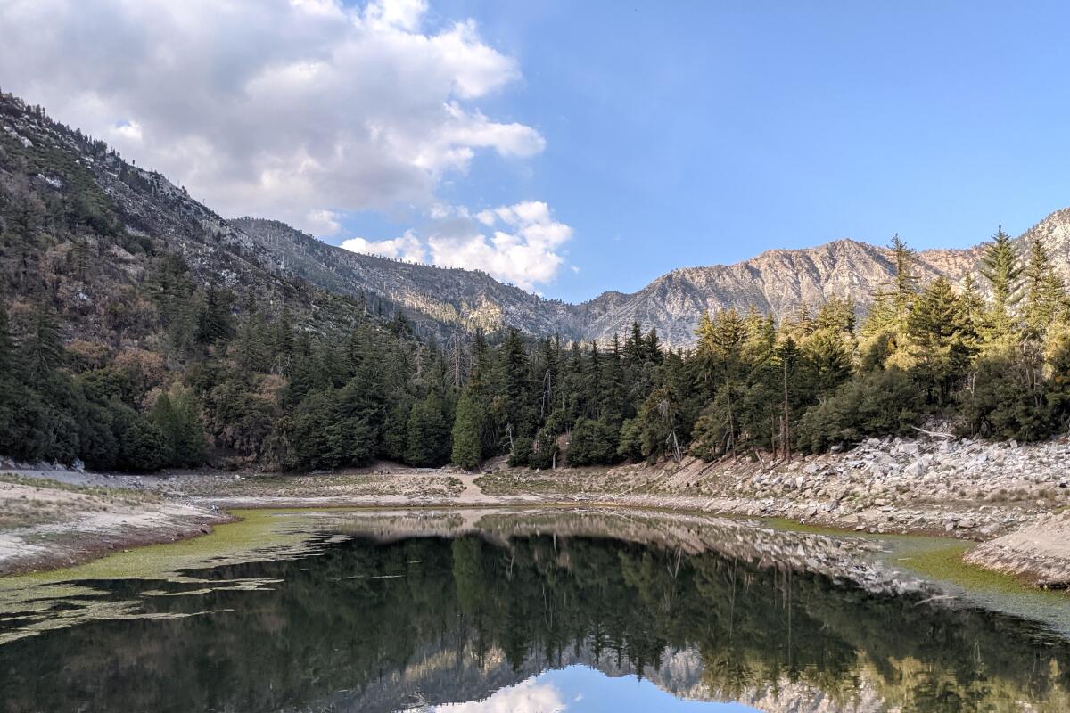
The snow-, rain- and spring-fed Crystal Lake is the only naturally occurring lake in the San Gabriel Mountains, perched at 5,539 feet, just 26 miles north of Azusa. After a scenic drive — CA-39 passes two massive reservoirs as well as the west and north forks of the flowing San Gabriel River — take a short walk around the shore. The shimmering waters are sometimes stocked with rainbow trout for fishing, but there’s no swimming allowed here. Search the surrounding towering Jeffrey pines for the beautiful crests of resident Steller’s jays as you complete your serene saunter. You can conquer the peak of Mt. Islip if you’re up for continuing on a 10.1-mile loop, but otherwise, don’t leave before checking out the campground and cafe (Frito pie, anyone?). The grounds here are truly picturesque and you can cop views of Mt. Islip and Mt. Hawkins. On the drive down, consider a stop at the Lewis Falls Trail for a short walk to a 50-foot cascade.

Park at the lot just off Crystal Lake Road, a mile south of the campground. Directions to trailhead.
Read All Read Less
Route Details
A hiker next to a waterfall at Switzer Falls.
(Matt Pawlik / Los Angeles Times)

Switzer Falls

Los Angeles County Mountain Trail
3.7-mile out-and-back
Moderate
700 feet
Water, water, water. It’s the most sought-after item on a Southern California hike, whether it’s bottled in your pack or streaming down a hillside. The waterfalls in the front range of the Angeles National Forest are popular (code for “expect big crowds, especially on hot weekends”), but that’s no reason to avoid them.

The site was one of the first mountain resorts to open to “tourist hikers” in 1884, and it’s easy to see why. The downhill hike takes you to the top of the falls and then into cool Bear Canyon. Refresh yourself at the 50-foot lower falls and maybe swim in its pool (the upper falls are hard to access on a sketchy route). Hang out by the water or in one of the shady picnic areas along the way. The way out is the same — only uphill. Go early to snag a parking spot and beat the hordes.

Park and start at the Switzer Picnic Area on Angeles Crest Highway about 10 miles north of La Cañada Flintridge. Directions to trailhead.
Read All Read Less
Route Details
Hikers on a trail to Sandstone Peak walk among green and shrubby hills.
(Matt Pawlik)

Sandstone Peak

Mountain Trail
6.0-mile loop
Moderate
1,350
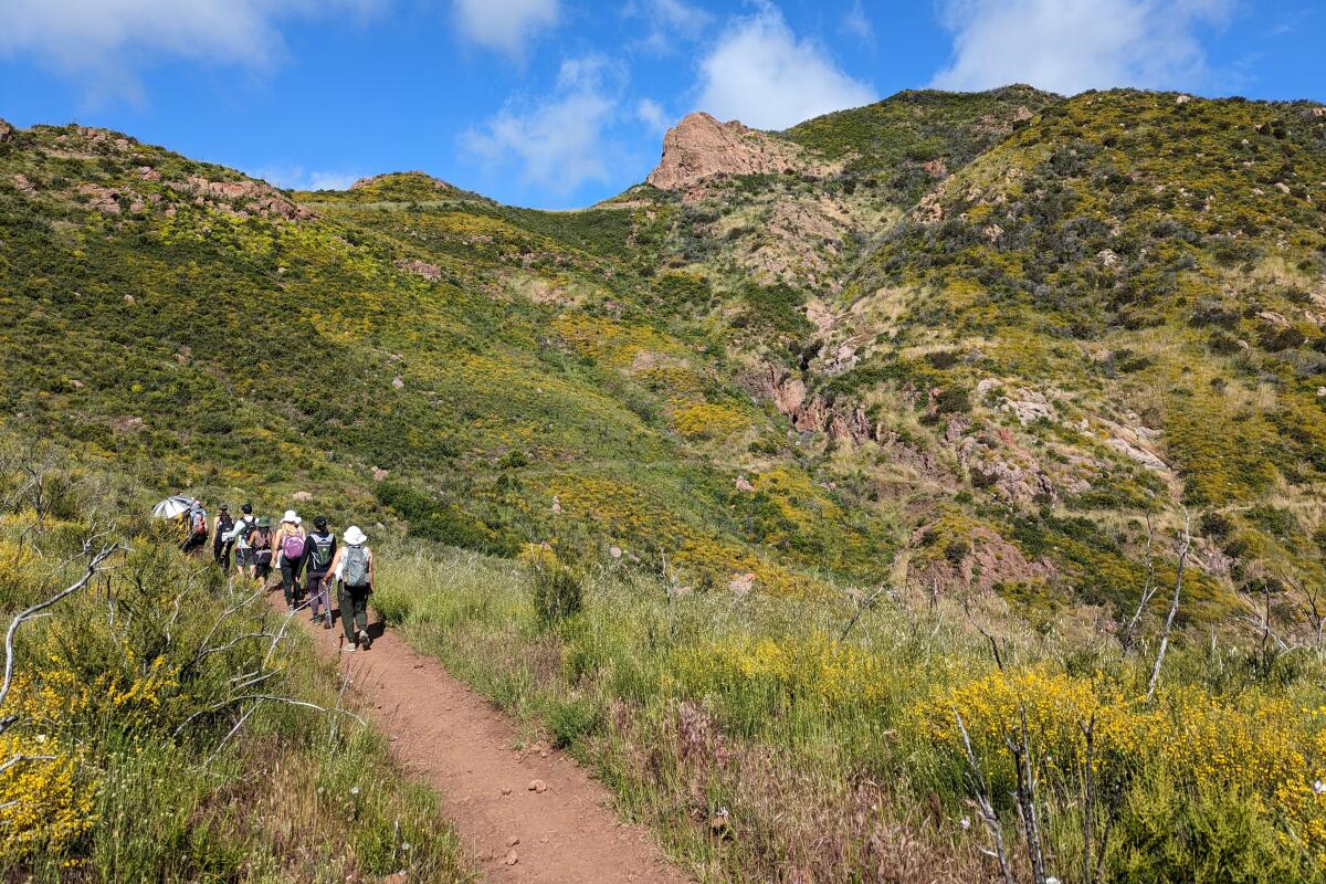
It’s hard to pick a more iconic Los Angeles hike than Sandstone Peak in the Santa Monica Mountains. It has phenomenal coastal and canyon views, interesting geological features and eye-popping wildflowers in the spring. And it’s a great workout.

There are plenty of ways to enjoy Sandstone, but for a more gradual ascent and the most rewarding scenery, take the classic Mishe Mokwa loop. As you ascend, views of the dramatic sandstone Echo Cliffs over a ravine draw you in (you may see rock climbers scaling the walls — it’s a popular spot with more than 200 routes). You’ll also find two popular geological sites: Balanced Rock, a wicked rock formation that seems to be truly defying gravity, and Split Rock, where you’ll often find hikers trying to squeeze through the cracks. Continuing on, you’ll run into Tri-Peaks, a summit with a rocky outcropping (which can be tacked onto your hike via a quick 1-mile out-and-back if you’re craving more), and another short spur trail that leads you to Inspiration Point.

Continue onto Sandstone and find incredible views, a rock that makes for a perfect picnic spot and a plaque honoring W. Herbert Allen, who donated many acres of land including nearby Circle X Ranch. (Mt. Allen is Sandstone Peak’s alternate name — in the 1960s, the Boy Scouts tried to change the name officially but Allen was still alive at the time and a policy prohibited naming geological features after a living person.) Enjoy the view — at 3,111 feet, you’ve made it to the tallest peak in the Santa Monica Mountains.

Park in the dirt Sandstone Peak trailhead lot just off Yerba Buena Road, east of Circle X Ranch. Directions to trailhead.
Read All Read Less
Route Details
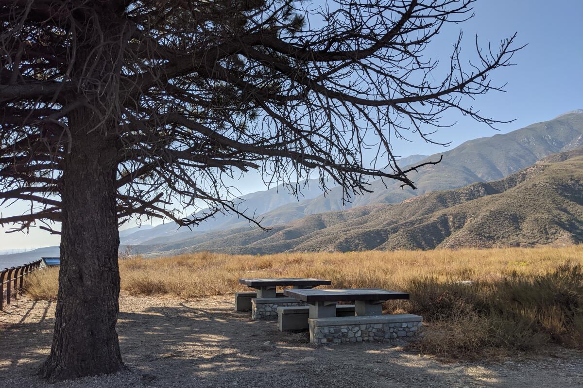
A picnic table under a tall tree with hills in the distance at North Etiwanda Preserve.
(Matt Pawlik)

North Etiwanda Preserve

Rancho Cucamonga Mountain Trail
4.7-mile loop
Moderate
900
Take a natural, historical and cultural tour through the picturesque San Bernardino suburb at the foothills of the San Gabriels in Rancho Cucamonga’s North Etiwanda Preserve. Hike toward the kiosk overlooking the valley and follow the loop to pass remnants of a water delivery system.

At the three-way junction, head right to check out a Native American interpretive site before heading left to the charming 15-foot waterfalls, crossing into the San Bernardino National Forest. More delightful sites await, including a dam, an antique pumping station and a bridge over a surprise riparian area, before you reach a panoramic viewing area under towering pines. Check out the expansive valley, with signs pointing out notable landmarks. You can see Mt. Baldy at 10,050 feet in elevation, the tallest summit in L.A. County. On the descent, look for a cool boardwalk vista spot.

Park in the lot at the corner of Etiwanda Avenue and Decliff Drive. Directions to trailhead.
Read All Read Less
Route Details
Advertisement
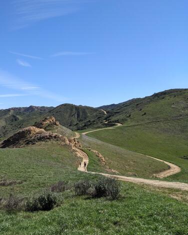
Long Canyon trail winds among green hills.
(Matt Pawlik)

Long Canyon

Simi Valley Canyon Trail
2.8-mile loop
Easy
550
The hills are alive in Simi Valley! The secluded 2.8-mile Long Canyon Trail loop in Woodridge Open Space is a hidden gem that rewards with lush rolling hills reminiscent of Salzburg, Austria. While you won’t find the Alps, grassy meadows, unique rock formations and wildflowers in the spring make for a fairy-tale-like landscape.

The hike kicks off with a climb that is well worth it — magical views stretch into all the way to the Santa Susana Mountains in the northeast. Look for prominent Simi Peak (the tallest nearby, at 2,400 feet) to the southeast as you head west on the Autumn Ridge Trail at the junction. You can keep heading southeast through Lang Ranch Open Space and all the way to Cheeseboro Canyon, which is particularly gorgeous in spring but should be explored year-round. It’s an incredible trail connector, but the short loop will do just fine — continuing on, you’ll encounter a quaint pond and, in spring, purple blooms of blue dicks, striking blue lupines, white radish flowers and, of course, those famous orange poppies.

Park at the free lot at the intersection of Long Canyon Road and Bannister Way and find the trailhead at the southeast end of the lot. Directions to trailhead.
Read All Read Less
Route Details
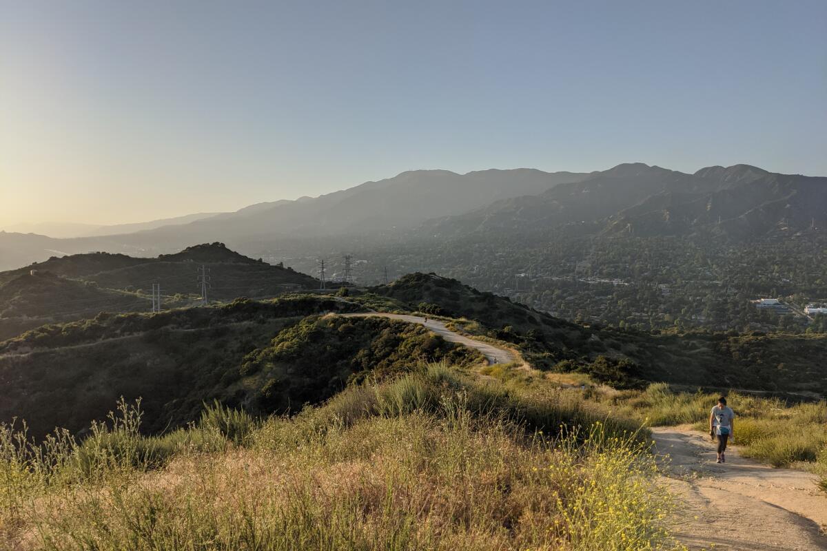
A person walks through Cherry Canyon Park
(Matt Pawlik)

Cherry Canyon Park

La Cañada Flintridge Canyon Trail
2.8-mile loop
Moderate
650 feet
Nestled neatly in La Cañada Flintridge, a rigorous route through Cherry Canyon Park leads you to an old fire tower and a panoramic point called the Ultimate Destination. The name might be a bit dramatic, but the views here are beautiful and expansive.

You’ve got two ascent options: Venture up the straightforward, exposed hillside on the wide Cherry Canyon Motorway or wind through a shaded canyon on a narrow but technical single-track to reach a five-point junction. Continue on the Ridge Motorway south (heading north takes you all the way to the Descanso Gardens) to the Cerro Negro fire tower, where you’ll find 360-degree views of nearby Glendale and the Verdugo Mountains that stretch into the San Gabriel Valley to the east. Just below a lone, picturesque bench, find a spur trail that leads you through dense fields of mustard plants under gnarly oaks to the self-proclaimed Ultimate Destination, where a picnic table awaits. As you savor the scenery, try to locate the hulking peaks of the San Gabriels, the most prominent being Mt. Wilson.

Park along Hampstead Road or in one of the few spots on the Cherry Canyon Motorway next to the trailhead. Directions to the trailhead.
Read All Read Less
Route Details
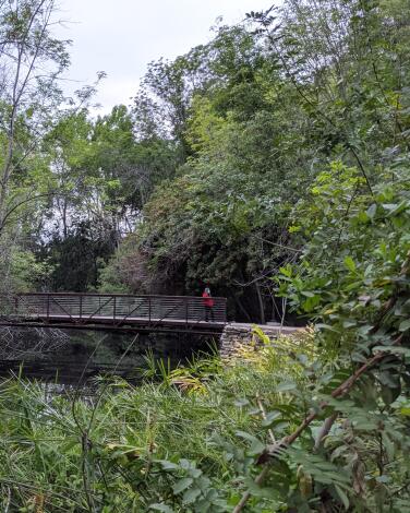
A person stands on a bridge on El Dorado Park Trail
(Matt Pawlik)

El Dorado Regional Park

Park Trail
2.5-mile loop
Easy
65
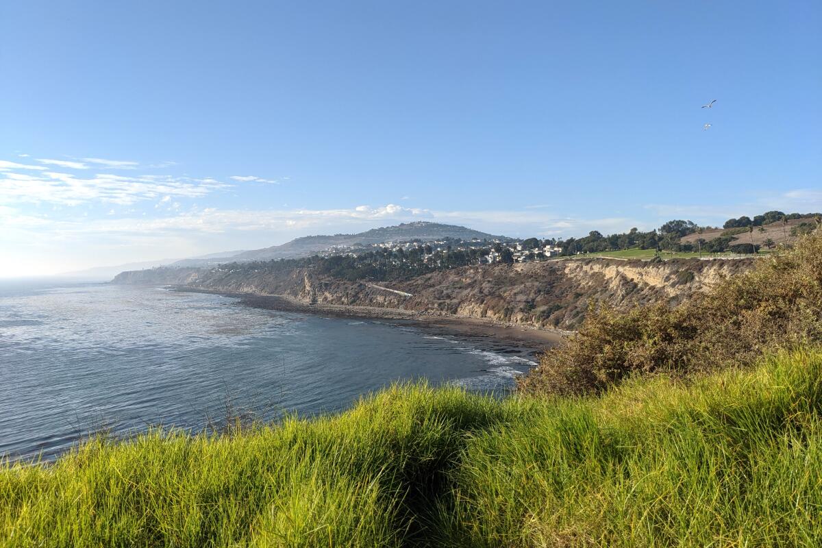
Every city has its flagship green space and there’s no question Angelenos point to Griffith and Elysian parks as SoCal favorites. But every competition has a dark-horse candidate, right? Enter the 642-acre El Dorado Regional Park in east Long Beach. While it may be a lesser-known outdoor recreation hub, the massive park has a disc golf course, archery range, dog park, model plane field, campsites, a frontier theme park and a pristine Nature Center with a gorgeous hike suitable for all ages and skill levels. The entire trail system is just 2½ miles, and with plenty of signage, it’s hard to get lost. Along the way, you’ll pass five bridges with views of two lakes — sanctuaries for turtles, egrets, great blue and night herons, coots and other waterfowl. There’s also a babbling stream that winds through massive oak groves. Be sure to stop at interpretive signs detailing local flora and fauna, such as wild blackberry bush, and predatory birds like the great-horned owl or resident raptors you may spot hidden in the trees. Outside of the nature center, it’s worth checking out the other green spaces, particularly the north park, where you’ll find duck ponds lined with cattails and frequented by Canada geese.

Park at the Nature Center lot ($6 to $9) or outside of the lot. Entry by foot to the nature center is free. Directions to trailhead.
Read All Read Less
Route Details
The coastline of San Pedro and Palos Verdes.
(Matt Pawlik)

San Pedro Coastal Hike

San Pedro Coastal Trail
4.25-mile out-and-back
Easy
250
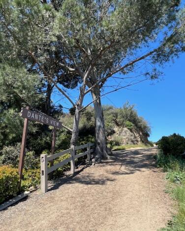
For a new coastal perspective, try a park-to-park-to-park urban foray in San Pedro that focuses on big trees and big ocean views. Start at the southeast corner of Point Fermin Park and peek over the gate for views of Cabrillo Beach and Sunken City, eerie remnants of cliffside foundations from a 1929 landslide. Walk north along the cliff-adjacent path, enjoying giant Moreton Bay fig trees and the Point Fermin Lighthouse, a Victorian-style landmark constructed in 1874. Hug the coast for consistent ocean views and then climb the prominent hill to Angels Gate Park, home to the Fort MacArthur Museum, the Korean Bell of Friendship (a bronze bell that was a gift to Los Angeles from the South Korean government) and even more expansive seascapes. The 360-degree views are awe-inspiring, but scan the skies for the true treasure among the clouds: peregrine falcons. A bit north you’ll find Wilders Addition Park, which has a dirt bluffs trail under the palms, and White Point Nature Preserve, a 102-acre coastal chaparral preserve with a 1.3-mile loop and perfect turnaround point.

Park on the street at the southeastern end of Paseo del Mar Drive. Directions to trailhead.
Read All Read Less
Route Details
Advertisement
A steep dirt trail, with trees and a Dante's View sign at left.
(Deborah Vankin)

Dante’s View

Griffith Park Park Trail
4.26-mile out-and-back
Moderate
896 feet
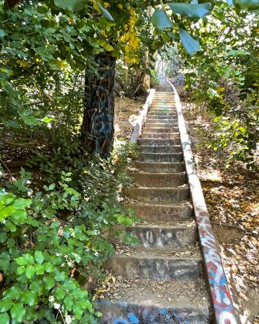
Dante’s View is a popular Griffith Park destination, just below the Mt. Hollywood Summit, that’s accessible via multiple routes, including from the Griffith Observatory. We like the route from the Greek Theatre parking lot, which is simple and scenic. (Bonus: free, easy parking at the Greek, lot G, when there’s not a concert scheduled that night.) The Riverside trailhead starts right at Vermont Canyon Road and is a gradual ascent on a wide dirt path with multiple switchbacks. It tends to get crowded, especially on weekends.

The Riverside trail connects to the Hogback Trail, which is slightly steeper and more of a workout in the portion immediately before depositing you at Dante’s View. You’ll have to navigate a particularly rocky stretch here — watch your step.

The lookout point offers spectacular views of the city as well as the Griffith Observatory and Greek Theatre, and it includes an enclave of benches and picnic tables nestled into lush foliage. The spot is named for Brazilian entertainment journalist and artist Dante Orgolini, who clearly had a green thumb. He was an avid hiker and personally landscaped the small, shady garden here — with his own pick and shovel, as the story goes — aided by fellow hikers and park rangers.

There’s a great hidden picnic table here too. At the Dante’s View sign, take the wooden staircase to the left and follow the path to the right. Continue around to the left, up another set of wooden stairs and again farther around to the left. You’ll have to poke around to find the picnic table from here. It’s blue, scribbled with a bit of graffiti and tucked away in a small clearing. On a clear day, you can see all the way to the ocean.

Have a seat and take refuge from the sun. Fill up your water bottle (there’s a fountain nearby) and enjoy the palms, pine trees and enormous, flowering jade plants. It’s what Dante would have wanted.
Read All Read Less
Route Details
A long staircase winds up a trail surrounded by full trees.
(Myung J. Chun / Los Angeles Times)

Murphy Ranch Trail

Brentwood Park Trail
3.4-mile out-and-back
Moderate
626
If you like navigating the secret staircases of Los Angeles — or if you just like secrets, period — this hike is for you. The moderately challenging journey, through Rustic Canyon Park in the Santa Monica Mountains, starts off tame enough with a walk through a residential neighborhood to the trailhead — the magnificent homes along the way provide plenty of eye candy. (Park on Casale Road, east of Capri Drive.) You’ll soon be walking along a fire road with sweeping views of the ocean.

Then things get especially interesting.

The land, once known as Murphy Ranch, has a storied if opaque history that’s largely been passed down orally. It was developed in 1933 by a man named Jesse Murphy, and historians believe a colony of Nazi sympathizers took up residence there through the mid-’40s. In 1948, supermarket millionaire Huntington Hartford purchased the property and opened an artists colony there, housing more than 400 artists into the mid-’60s. The city of Los Angeles purchased the land in 1973. Many now-crumbling, graffitied concrete and steel structures still remain, adding an ominous mystique to the otherwise stunning natural landscape.

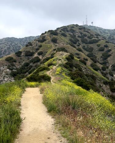
The hike includes a narrow and very steep staircase. We’re talking 524 steps, descending about 260 feet, many of them covered with overgrown weeds, wildflowers and grasses. Tread carefully, especially after a rainfall, which may leave still-slick mud on the shallow stairs. The steps — and nearly every concrete surface along this hike — are slathered with multicolored graffiti. Which, contrasted against the mountain peaks and dense foliage, is quite beautiful, especially in springtime. The graffitied marks and swirls blend into the surrounding yellow, white and purple flowers.

And the near-constant whooshing wind teases secrets: If only these trees could talk.
Read All Read Less
Route Details

Mt. Hollywood

Griffith Park Urban Trail
5.5-mile loop
Moderate
1,100 feet
You can’t call yourself a Los Angeles hiker without a trek to this Griffith Park peak. Views from the top start at Griffith Observatory below and then sweep west from downtown L.A. to Hollywood, Century City and the ocean, when there’s no haze or fog. Along the ascent, you’ll pass by the Berlin Forest, a pine sanctuary dedicated to L.A.’s German sister city, and Captain’s Roost, the original site for Dante’s Garden.

At night, the panorama changes to a carpet of twinkling lights. Griffith J. Griffith donated the land to the city in 1896 as “a resort for the rank and file, for the plain people.” There are plenty of routes to this peak, but starting on the Fern Dell trail gives you a serene bonus: The nature trail hugs a quaint stream among ferns, sycamores and coastal redwoods.

Park on the street and start at Fern Dell Nature Trail at Black Oak and Fern Dell Drive in Griffith Park. Directions to trailhead.
Read All Read Less
Route Details
Advertisement
Hikers rest on the Hoyt Mountain trail, with hills and Los Angeles in the distance.
(Mary Forgione / Los Angeles Times)

Hoyt Mountain

Los Angeles County Mountain Trail
5.5-mile loop
Strenuous
1,699 feet
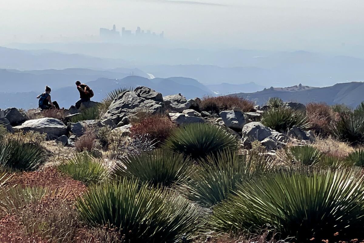
Hoyt, just 11 miles north of La Cañada-Flintridge, is one of the close-to-home front-range peaks in the Angeles National Forest that is easily overlooked. The broad, flat summit has vertical rock slabs that frame views of distant downtown Los Angeles. At less than 5,000 feet in elevation, it seems as if it should be an easy climb. Don’t be fooled. The goat trail to the top makes this a serious workout, and a few false summits will keep you sucking in air to the end. Start on an easy canyon trail from Clear Creek Junction and make a loop on the return route through a picnic area dense with pine trees.

Park in the lot and start at the Clear Creek Visitor Information Center (currently closed) on the Angeles Crest Highway. Directions to trailhead.
Read All Read Less
Route Details
A woman walks on the Beaudry South Motorway trail in Glendale next to a sign with the trail's name.
(Glenn Koenig / Los Angeles Times)

Beaudry Loop

Glendale Urban Trail
5.8-mile loop
Moderate
1,368 feet
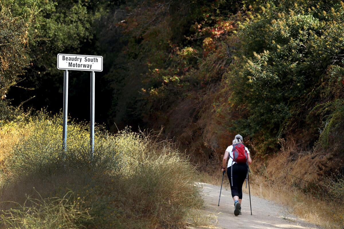
Don’t be put off by the cushy Glendale neighborhood at the trailhead. Soon you’re climbing up fire roads in the Verdugo Mountains that get your heart pumping. The trail slowly reveals views of more of the mountain range between Glendale and Burbank and the neighborhoods that sprang up below. At the intersection with a north and south loop, go either way to 2,656-foot Tongva Peak, named for the Native Americans who thrived in the local mountains. Take a break at the top and marvel at how wild this spot feels despite the urban clutter below. Complete the loop and you’re done.

Park on the road and start at Beaudry Boulevard off Country Club Drive in Glendale. Directions to trailhead.
Read All Read Less
Route Details
People sit on a bench shaded by trees.
(Mary Forgione / Los Angeles Times)

Henninger Flats

Pasadena Urban Trail
7.25-mile out-and-back
Moderate
1,575 feet
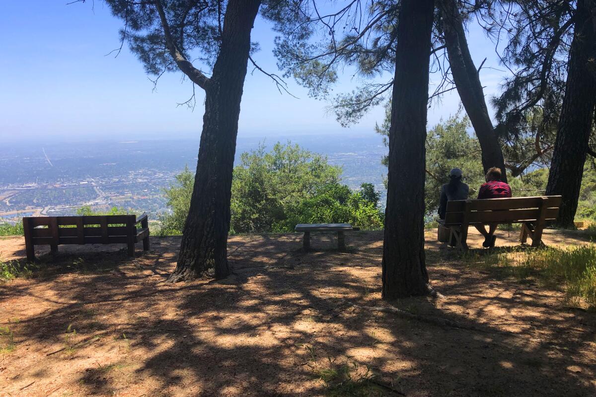
There’s nothing but shade and trees on this ridge high above Altadena. The pop-up nursery started here more than a century ago raised baby trees used to replant forests after fires and other catastrophes. The route up follows the Eaton Canyon Trail to the Mt. Wilson Toll Road, an exposed steep fire road that leads you to benches and picnic tables amid tall pines, cedars and firs. At the junction (and Chuck Ballard Memorial Bridge), consider tacking on a trip to the beautiful Eaton Canyon Falls at the beginning or end of your trek. At the flats, there’s overnight camping, a 1925-era fire lookout moved to this site from the Santa Monica Mountains and a visitor center (currently closed). A shorter 5.25-mile route starts at the Pinecrest Drive gate on the Mt. Wilson toll road, but be sure to read parking signs for weekend restrictions.

Park and start at Eaton Canyon Nature Center in Pasadena. Directions to trailhead.
Read All Read Less
Route Details
Hikers walk on a trail in Solstice Canyon.
(Al Seib / Los Angeles Times)

Solstice Canyon

Malibu Urban Trail
6.0-mile loop
Moderate
Less than 1,000 feet
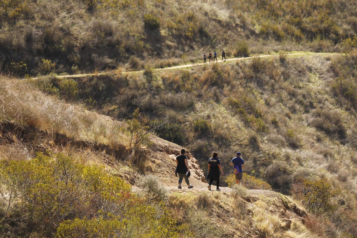
The shady Malibu canyon takes you mental miles from the city and provides a sweet introduction to the Santa Monica Mountains. The hike gets high marks for a small waterfall (which may or may not be flowing) and the ruins of Roberts Ranch, which belonged to the successful grocery-chain operator Fred Roberts. The brick fireplace, foundation and other fragments of the midcentury home remain. It was designed in 1952 by Black architect Paul Revere Williams, who had designed much of the remodeled Beverly Hills Hotel. Start up the Rising Sun Trail that winds through sycamores, oaks and alders, walk the loop at the top and then descend on the main road.

Park and start at Solstice Canyon park entrance in Malibu. Directions to trailhead.
Read All Read Less
Route Details
Advertisement
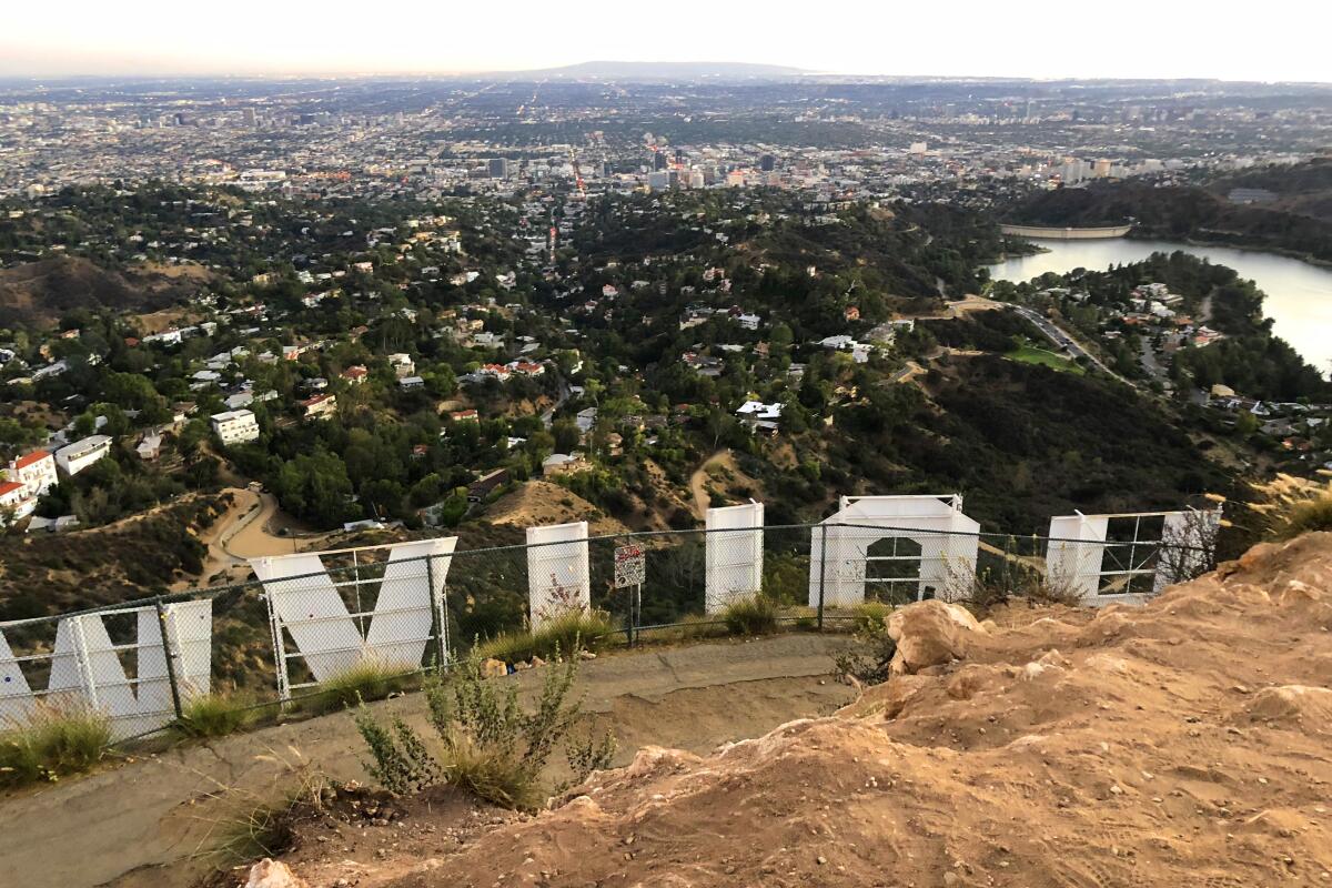
A view of Los Angeles out over the back of Hollywood sign on Mt. Lee.
(Mary Forgione / Los Angeles Times)

Mt. Lee

Hollywood Hills Urban Trail
6.5-mile out-and-back
Moderate
1,098 feet
Every visitor to L.A. you host will pester you to take them to the Hollywood sign. The best way is to go on foot in Griffith Park. Spoiler alert: It’s forbidden to touch or get close to the city’s most recognizable landmark. It’s blocked off by a chain-link fence. You can, however, hike to 1,709-foot Mt. Lee, where you’ll be above and behind the sign. The 50-foot letters stand like sentinels on the hillside, a sign put up in 1923 with “land” tacked to the end to advertise a real estate development. Now hikers look down from this point at mansions surrounding the deep blue Hollywood Reservoir. (Try to ignore the 300-foot broadcast tower and complex off to the side.) There are several ways to get to the sign, including a hike along the Brush Canyon Trail with an add-on (a three-quarter-mile out-and-back) to see the Bronson Caves, which provided the backdrop for the Bat Cave from the 1960s “Batman” TV series. The caves are blocked off with a fence, but you can still peer inside — and you should.

Park in a lot and start at Brush Canyon/Canyon Drive West in Griffith Park. Directions to trailhead.
Read All Read Less
Route Details
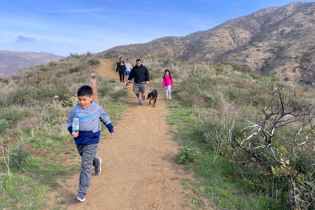
A boy runs in front of his family and their dog on the Nicholas Flat trail.
(Mary Forgione / Los Angeles Times)

Nicholas Flat

Unincorporated Santa Monica Mountains Mountain Trail
6.9-mile out-and-back
Moderate
2,000 feet
You need a good reason to turn your back on a Malibu beach. This hike may be it. The Nicholas Flat trail starts at Leo Carrillo State Park and travels inland and uphill to a ridge in the Santa Monica Mountains. The terrain and the views make this one of the best coastal hikes around; savor the views as you take breaks along the way. The “flat” part of the hike leads to grassy meadows, a pond you can loop around and stands of live oaks. Stay a while and explore, looking for coreopsis, big shaggy yellow flowers that dot the hillsides in early spring, before heading back to the beach to explore rocky tidepools and picturesque sea caves. For a shorter hike, at the 1-mile mark (look for signs for “Ocean Vista” point), descend on the Willow Creek trail to complete a 2.25-mile loop.

Park at Leo Carrillo State Park in Malibu and start from there. Directions to trailhead.
Read All Read Less
Route Details
A view of the San Fernando Valley from Rocky Peak Road near the Los Angeles County - Ventura County line.
(Myung J. Chun / Los Angeles Times)

Rocky Peak

Mountain Trail
5.0-mile out-and-back
Moderate
1,100 feet
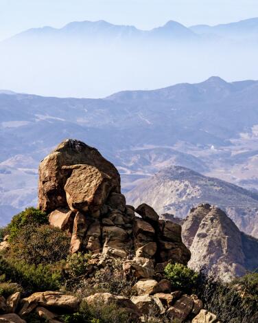
This Simi Valley hike isn’t on the radar of many hikers. It should be. Locals know these hills as the place where pioneers set up ranch life in the early 19th century. It’s easy to conjure the Old West as you hike amid dramatic rock slabs and grassy hillsides that are brown in summer, green in spring. The small 2,717-foot peak lives up to its name; it’s just a few slabs that are hard to find and hard to get to.

On the ascent, look for a sandstone cave just before the junction with the Hummingbird Trail. The peak approach requires a bit of scrambling, but the views of the surrounding Santa Susana Mountains and the Simi and San Fernando valleys are worth it. Here, you’re at eye level with turkey vultures riding thermals in lazy loops. Take this hike on a cool day; you’ll hate yourself if you go in summer. “No shade ever,” states one trail app. Spend some time looking for the grooves of covered-wagon wheels etched in the rocks beneath your feet.

Park and start at the Rocky Peak Trail on Rocky Peak Road in Simi Valley. Directions to trailhead.
Read All Read Less
Route Details
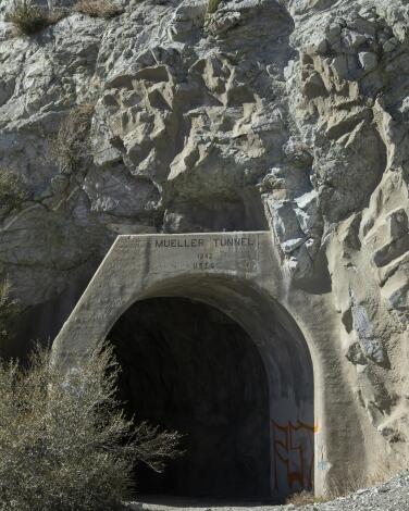
The Mueller Tunnel
(Myung J. Chun/Los Angeles Times)

Eaton Saddle

Mountain Trail
6.5-mile out-and-back
Moderate
2,000 feet
It’s time for peakomania! The saddle off Mt. Wilson Road in the Angeles National Forest is a stepping-off point to four peaks, which you can do in a day. It’s a good uphill workout if you haven’t been hiking in a while. Don’t be misled by the low mileage; the ups and downs keep this route challenging and filled with panoramas of L.A. and beyond. From the trailhead, walk a half-mile through the Mueller Tunnel, constructed by the US Forest Service in 1942.
The first peak is Mt. Markham (5,729 feet), a hulking mass with a trail that climbs a steep, rocky spine. Then take out-and-back routes to bag Mt. Disappointment (5,968 feet), which has radio towers on top; the prettier San Gabriel Peak (6,161 feet); and Mt. Lowe (5,574), the farthest away.

Park and start at Eaton Saddle near Red Box, about seven miles north of La Cañada Flintridge on Angeles Crest Highway (California 2). Directions to trailhead.
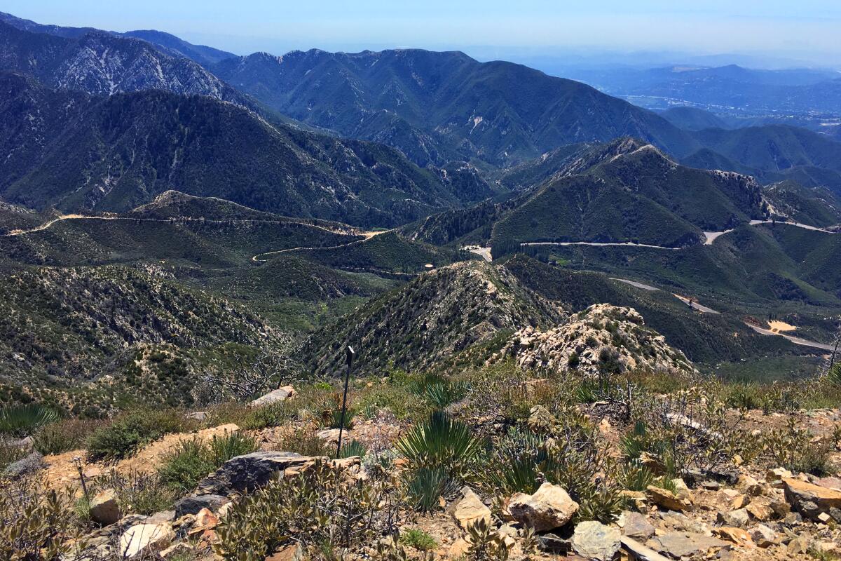
Read All Read Less
Route Details
Advertisement
Strawberry Peak
(Mary Forgione / Los Angeles Times)

Strawberry Peak

Mountain Trail
7.2-mile out-and-back
Strenuous
1,788 feet
Hikers supposedly named the peak for its shape, an upside-down strawberry. At 6,142 feet, it’s the high spot in the front range of the San Gabriel Mountains, barely nosing out San Gabriel Peak. The trail starts gently and then comes to a long saddle. The goat trail on the left starts steeply down before heading upward, at times on slippery loose dirt and scree. You’ll come to what you think is the top but it’s a false summit. Press on. Eventually, you’ll arrive at the rocky top and a chance to pause and enjoy the well-earned views of the Arroyo Seco and Big Tujunga watersheds.

Start at Red Box, almost seven miles north of La Cañada Flintridge on Angeles Crest Highway (California 2). Directions to trailhead.
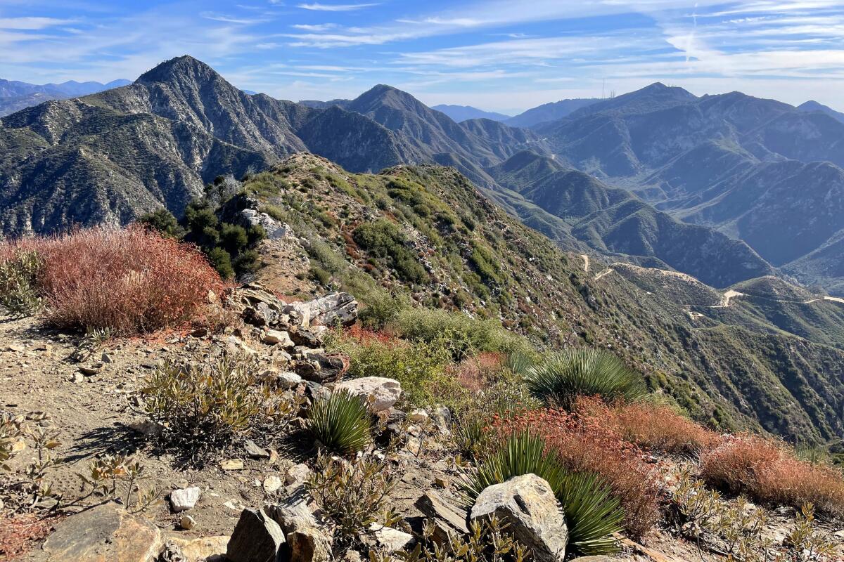
Read All Read Less
Route Details
Mt. Josephine
(Mary Forgione / Los Angeles Times)

Mt. Josephine

Los Angeles County Mountain Trail
8.7-mile out-and-back
Strenuous
2,050 feet
Let this peak be your gateway to the 700,000-acre Angeles National Forest. The most scenic route starts at Colby Canyon, which winds past a small creek (when there’s water) with big rock walls. The climb continues on a narrow trail that switchbacks up the canyon. Soak up the views and the terrain before continuing past Douglas firs and pines that add a big forest feel. Three lime-green shelves stand at the 5,558-foot summit, remnants of a fire tower that burned in 1976. Visitors seem compelled to place rocks and keepsakes on the shelves.

Park at a pullout and start on the trail at Angeles Crest Highway (California 2), 10 miles north of La Cañada Flintridge. Directions to trailhead.
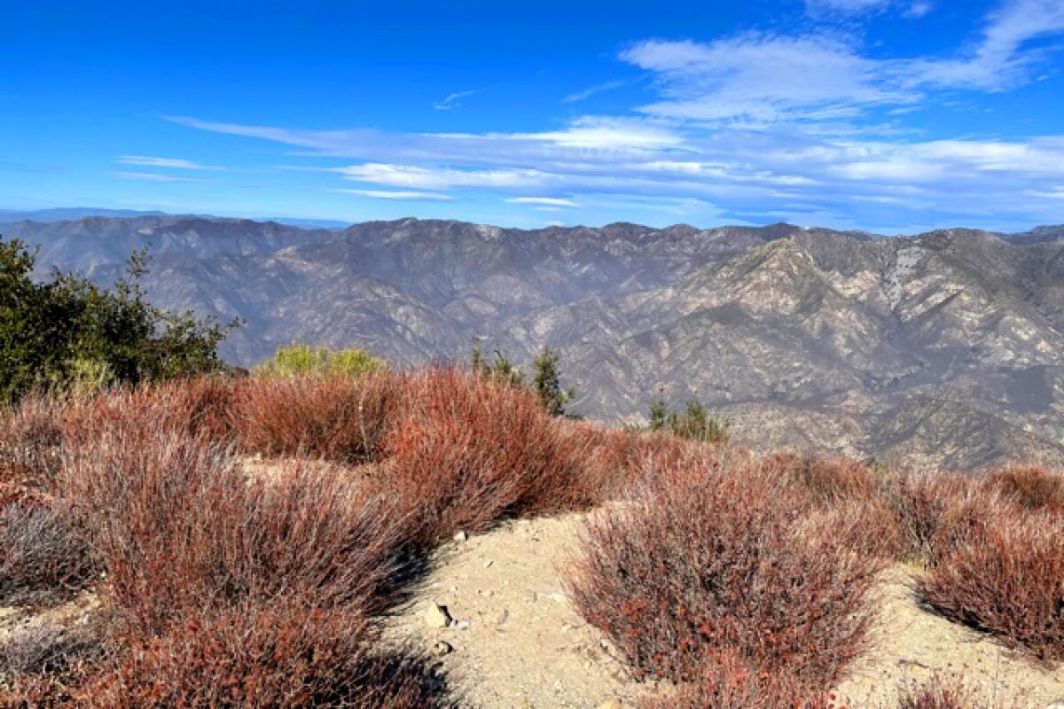
Read All Read Less
Route Details
Lukens, Stone Canyon
(Mary Forgione / Los Angeles Times)

Mt. Lukens

Tujunga Mountain Trail
7.9-mile out-and-back
Strenuous
3,300 feet
To experience L.A.’s highest and lowest points, dip your toe in the Pacific then hike to the 5,066-foot summit of Mt. Lukens. It’s barely within city limits, but it counts as the top of the city. (By comparison, the Wilshire Grand skyscraper in downtown L.A. rises just 1,100 feet.) The peak doesn’t impress; it hosts several communications towers, some that hum noisily. It’s the journey and the views that make Lukens worthwhile. The most popular routes start at George Deukmejian Wilderness Park in Glendale, where buckwheat, paintbrush and monkeyflowers bloom in spring. The shorter, but more challenging trail winds up at quieter, shaded Stone Canyon; you may not see another soul all day.

Park on the road and start at the Wildwood Picnic Area, 3299 Big Tujunga Canyon Road, Tujunga. Directions to trailhead.
Read All Read Less
Route Details
A person stands among brush and flowering plants, with green hills in the background
(Mary Forgione / Los Angeles Times)

Hidden Pond/Coyote Trail

Thousand Oaks Urban Trail
9.1-mile out-and-back
Moderate
1,742 feet
The hike takes you to the lonely northwest corner of Point Mugu State Park. The vernal pond is elusive; it may not appear even after heavy rains. When it does, ducks and red-winged blackbirds can be seen amid the tall grasses on the perimeter. Even without water, the pond’s wide, shallow meadow makes a nice rest stop. Keep going on the Coyote Trail, which rolls up and down through greened-up hillsides dotted with shrubs charred by previous fires. This hike puts you in the heart of the Santa Monica Mountains, reaching a few high points that offer ocean views of Malibu and the Oxnard Plain.

Park in a lot and start at Rancho Sierra Vista/Satwiwa on Sycamore Canyon Road. (Pre-trek, you can check out the Satwiwa Native American Indian Culture Center, open on weekends from 9 a.m. to 5 p.m.) Coyote Trail adds 2.2 miles and less than 1,000 feet of gain. Directions to trailhead.
Read All Read Less
Route Details
Advertisement
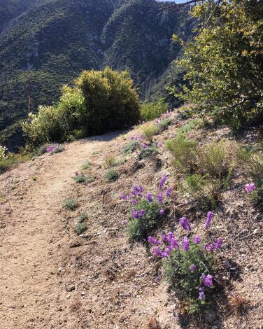
Inspiration Point, Echo Mt., Altadena
(Mary Forgione / Los Angeles Times)

Inspiration Point

Mountain Trail
10.0-mile loop
Strenuous
2,750 feet
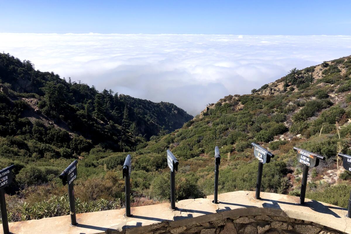
It’s a big boast to claim the name Inspiration Point. The wooden shelter with picnic benches on a flat stretch in the San Gabriels above Altadena proclaims the title with a huge sign. There is also a slew of metal spotting scopes labeled “Locating Redondo Beach,” “Locating the Rose Bowl” and so on, pointed at landmarks and destinations around Southern California. On a clear day, you might see the ocean and Santa Catalina; under thick fog, you’ll be lucky to find the trail down. The trail climbs 2½ miles to Echo Mountain, the site of a one-time resort hotel and railway that welcomed visitors during L.A.’s great hiking era (1880s to the 1930s). Only ruins are left. This is roughly the halfway point and a good turnaround point if your legs are getting weary. Otherwise, from there, make a loop by going up the Sam Merrill Trail and down the steep but beautiful Castle Canyon. Inspiring? Sometimes, and a good workout too.

Park on the street, start at the end of Lake Avenue in Altadena. Directions to trailhead.
Read All Read Less
Route Details
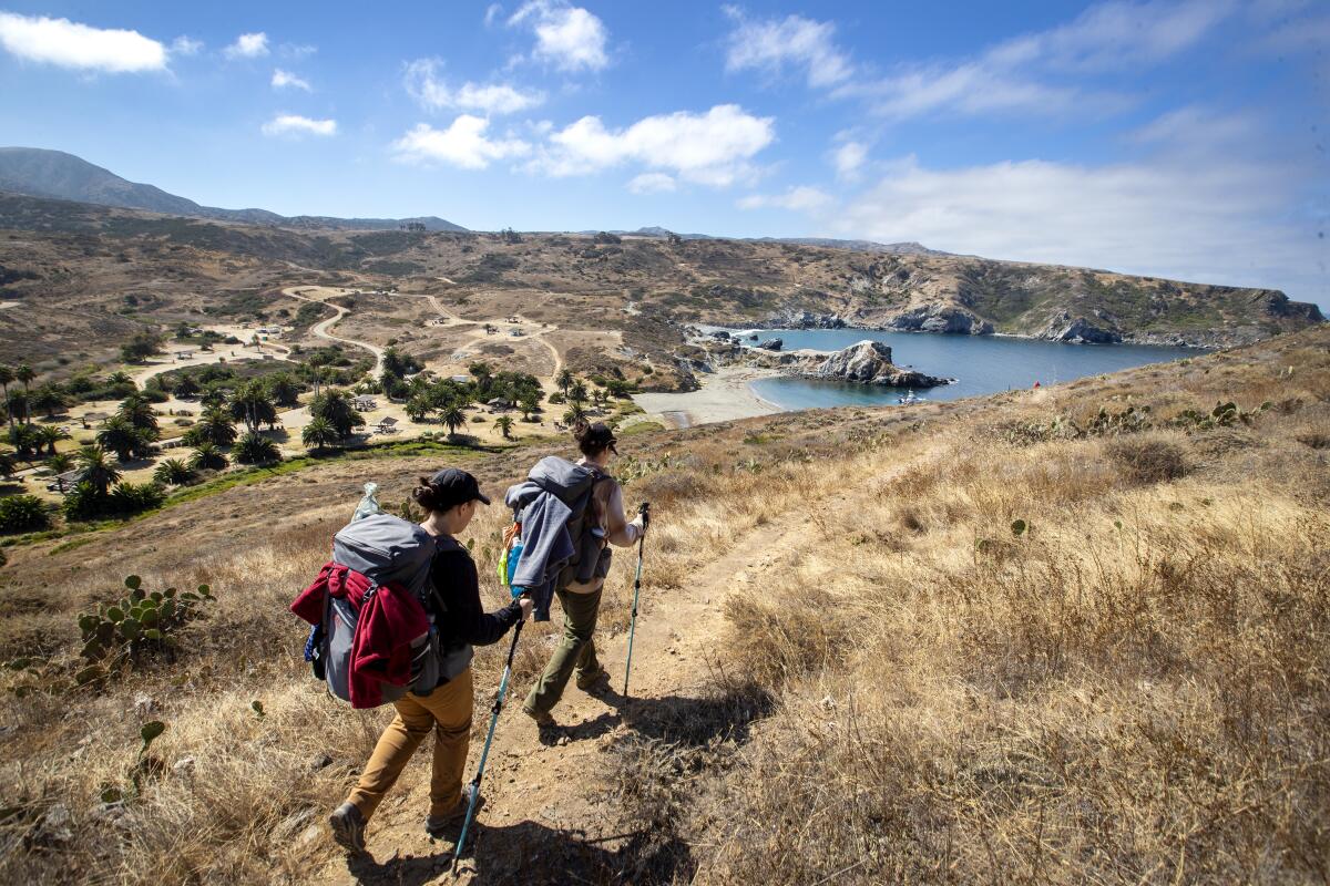
A beach-goer walks his dog at sunset in front of the campground, overlooking Little Harbor
(Allen J. Schaben / Los Angeles Times)

Little Harbor

Catalina Island Coastal Trail
10.2-mile out-and-back
Moderate
1,300 feet
L.A. is lucky to have Santa Catalina just an hour away. Hiking has exploded since 2009 when the Trans-Catalina Island Trail opened, a rugged 38-mile east-west route across the island. One of the prettiest segments starts at Two Harbors on the island’s quieter side and winds on fire roads and trails to a beach at Little Harbor. On the way, look for bison and island fox — just enjoy their company from afar. Relax before retracing your steps, then treat yourself to a meal at Harbor Reef Restaurant. Check hiking rules and permits at catalinaconservancy.org.

Start and end at Two Harbors. Directions to trailhead.
Read All Read Less
Route Details
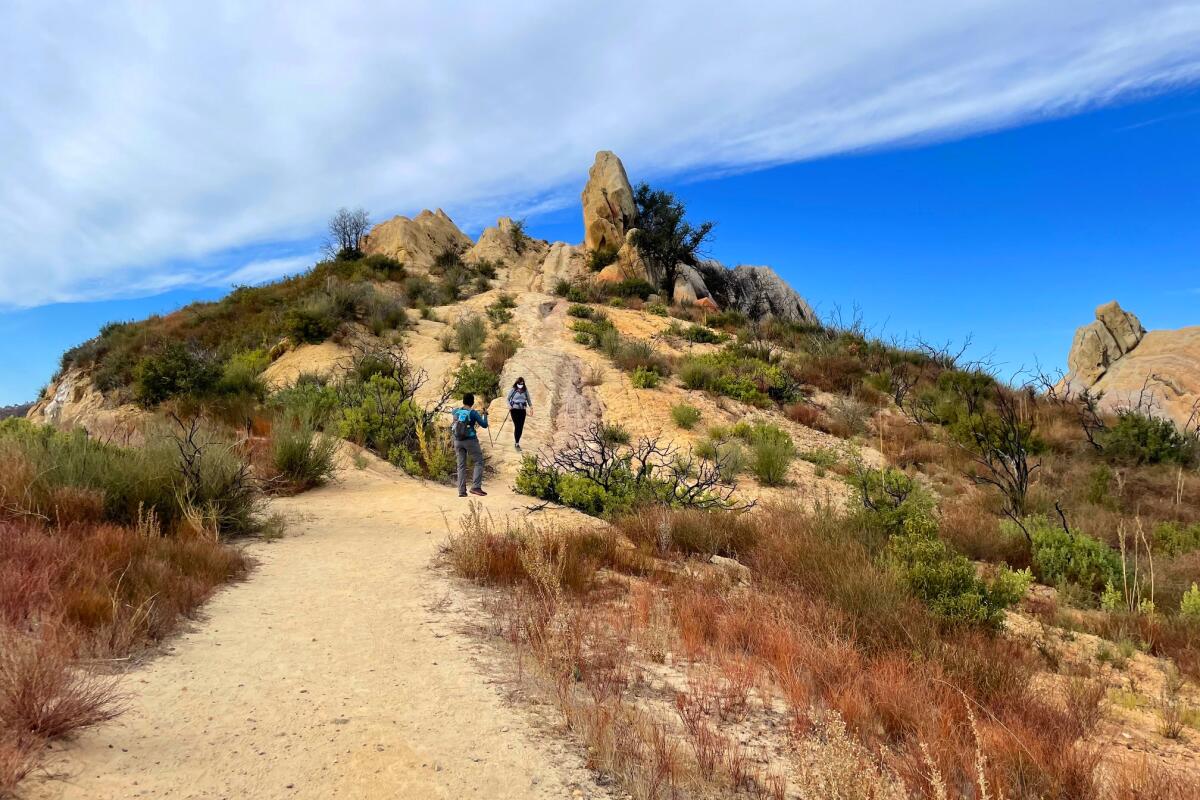
Mt. Pacifico
(Mary Forgione / Los Angeles Times)

Mt. Pacifico

Palmdale Mountain Trail
12.0-mile loop
Strenuous
2,200 feet
The hike follows the Pacific Crest Trail on one of its less traveled segments in Southern California. In early spring, look for fast-moving thru-hikers doing the entire 2,650-mile journey from Mexico to Canada. The route that begins in the Sunland area winds uphill to a flat ridge and, as you move higher, to pine-covered hillsides. In spring, you’ll find wildflowers and bright red snow plants that pop up after the melt. A short, steep, calf-burning trail leads straight to the summit. On top, you’ll see a ring of boulders — plus a campground, picnic tables and a bathroom — and expansive panoramas of the San Gabriels as well as the desert-flat Antelope Valley and Little Rock below.

Start at Mill Creek Summit Picnic Area off Angeles Forest Highway. Directions to trailhead.
Read All Read Less
Route Details
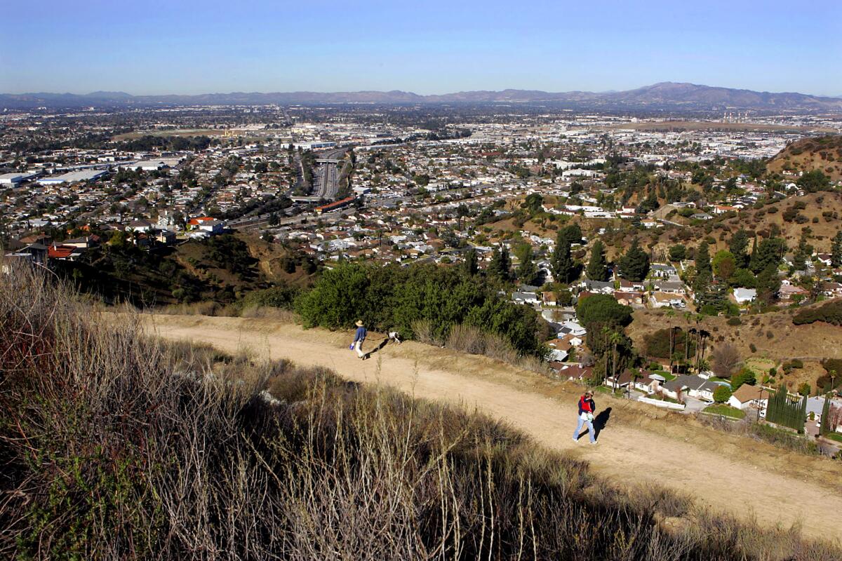
Verdugo Traverse
(Carlos Chavez / Los Angeles Times)

Verdugo Mountains Traverse

Shadow Hills Urban Trail
12.6-mile point-to-point
Strenuous
2,559 feet
The one-way route crosses the lesser-known Verdugo Mountains in the northeast end of the San Fernando Valley. Views are good all along the trail, which takes the sting out of hiking on wide dirt roads that start and end in residential neighborhoods. It follows three named “motorways” — Chandler, Verdugo and Las Flores — and passes Verdugo and Tongva peaks. You can cross the range many different ways; AllTrails has a good route, starting in Sun Valley and ending in Glendale, that’s easy to follow. Don’t forget to leave a car at the endpoint.

Park on the street and start on Olive Terrace Trail in Sun Valley. Directions to trailhead.
Read All Read Less
Route Details
Advertisement
50 hikes for the Hiking Issue 2021. Bulldog Motor
(Mary Forgione / Los Angeles Times)

Bulldog Loop Trail

Unincorporated Santa Monica Mountains Mountain Trail
14.7-mile loop
Strenuous
3,047 feet
Get ready for a tough, long hike in the Santa Monica Mountains that starts inland and circles out to lofty ocean views. The best part of the trail follows the 67½-mile Backbone Trail high above the coast to Corral Canyon, where massive sandstone slabs impress. More impressive: They were formed in the ocean during ancient times, which is hard to believe as you look down on the distant water. The hike follows the wide, dirt Bulldog Motorway, which feels like an endless climb, before swinging out toward the ocean and back inland. Along the way, look for man-made Century Lake, the filming site of the 1970s-’80s TV show “MASH,” a meditation circle made from small rocks and oak-filled Tapia Park. Take care on the short walk on Las Virgenes Road before rejoining the trail.

$12 to park, start at Malibu Creek State Park in Calabasas. Directions to trailhead.
Read All Read Less
Route Details
A hiker uses poles to climb up a steep dirt and gravel road
(Brian van der Brug / Los Angeles Times)

Mt. Baldy

Mountain Trail
13.4-mile out-and-back
Strenuous
4,000 feet
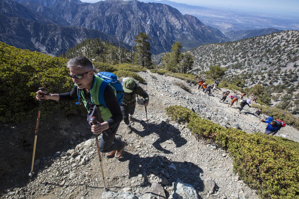
This jewel of Southern California has a classier name: Mt. San Antonio. Baldy is just its nickname, probably because of its treeless flanks. The highest point in L.A. County soars above Claremont and offers the best hard training around. Need elevation? Baldy sits at 10,069 feet. Need aerobic conditioning? One route rises 1,000 feet per mile. Need comfort? Stop for a beer or a burger at Top of the Notch, a slope-side restaurant that hums with skiers in winter and mountain cyclists and hikers in summer. But first you must bag the peak. Start up the wide fire road to the restaurant and continue uphill where the path narrows to one-way foot traffic on the Devil’s Backbone. At the top, views are epic in all directions; continue the loop south and catch the seasonal San Antonio Falls on your descent. Once you’ve mastered this hike, take on longer and steeper routes. But first, catch your breath.

Park at the trailhead; start at Manker Flat near Mt. Baldy Village. Directions to trailhead.
Read All Read Less
Route Details
San Gorgonio, South Fork Trail, with tall trees and plenty of boulders
(Mary Forgione / Los Angeles Times)

Mt. San Gorgonio

Mountain Trail
19.0-mile loop
Strenuous
4,567 feet
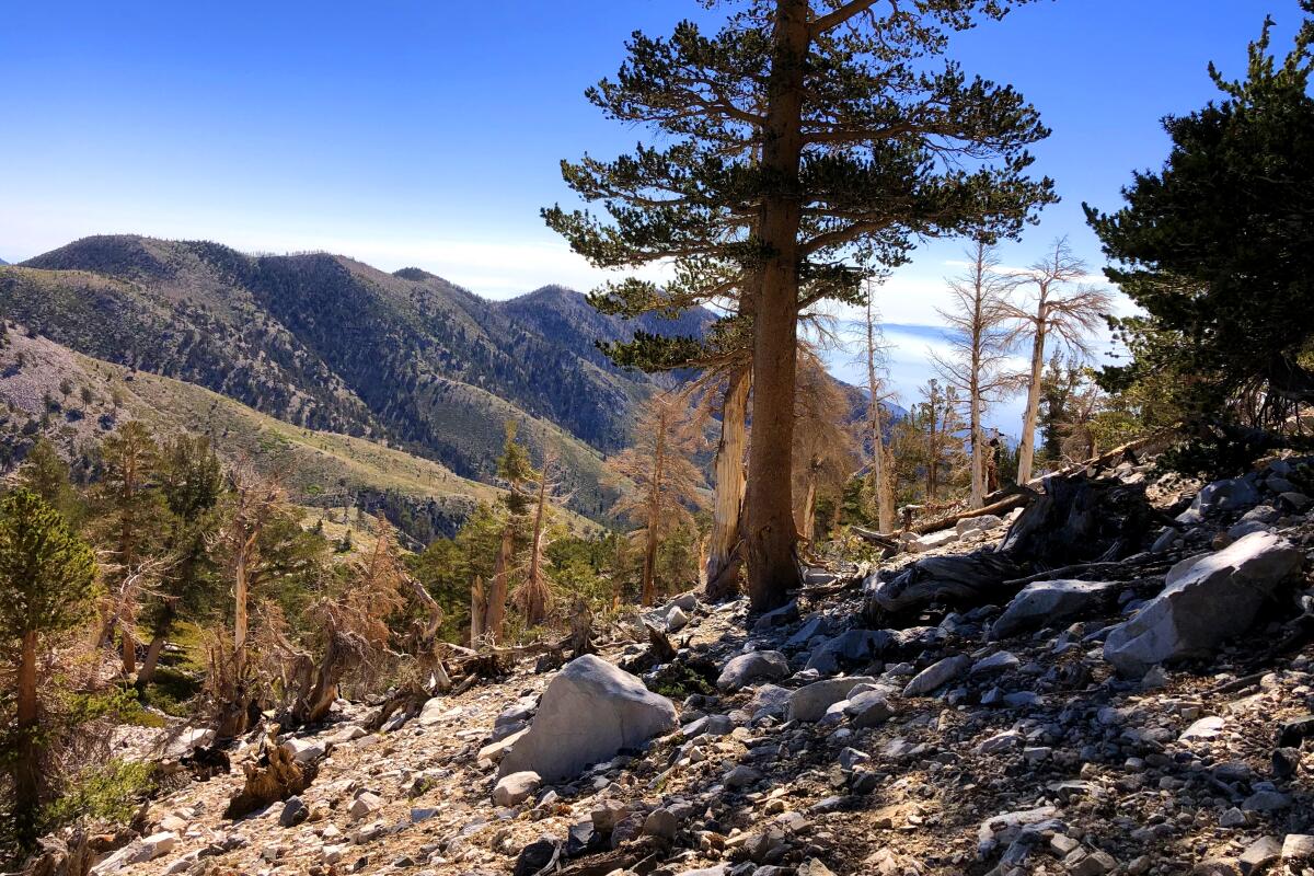
San G tops out at 11,499 feet in elevation, the tallest in Southern California, and is located in the San Bernardino National Forest. It’s a desirable peak, but wildfires have not been kind to the mountain. The trail from South Fork to the top burned in the 2015 Lake and 2020 El Dorado fires and still shows charred trees and other signs of damage.

The long, winding way starts at South Fork and passes a pretty meadow and a (sometimes) lake before emerging from the trees for the exposed push to the top. The last mile or so may exhaust you; stop and savor the rugged beauty and your accomplishment. On clear days, the 360-degree views are awe-inspiring, stretching from the Pacific to the Mojave Desert and as far as the Eastern Sierras.

Take the South Fork Trail to Dollar Lake and on to the peak. Directions to trailhead.
Read All Read Less
Route Details
Fox Mountain
(Mary Forgione / Los Angeles Times)

Fox Mountain

Los Angeles County Mountain Trail
12.1-mile out-and-back
Strenuous
3,166 feet
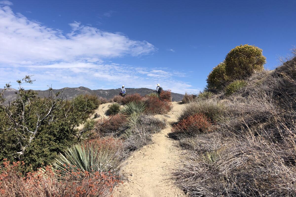
Prepare for a long, rolling hike through some of the nicest scenery in the Tujunga area. The trail rises through chaparral scrub and weaves through a canyon that surprises with ferns and a small, seasonal creek. It rolls along the flanks of mountains until you come to a flat saddle. The summit is to the right, about 500 feet up a short vertical stretch. (Hiking poles will really come in handy here.) Look for large yucca that bloom until late spring.

Start at Big Tujunga Canyon Road near Vogel Flats in Tujunga. Directions to trailhead.
Read All Read Less
Route Details
Advertisement
A view from Mt. Wilson
(Mel Melcon / Los Angeles Times)

Mt. Wilson

Sierra Madre Mountain Trail
14.5-mile out-and-back
Strenuous
5,640 feet
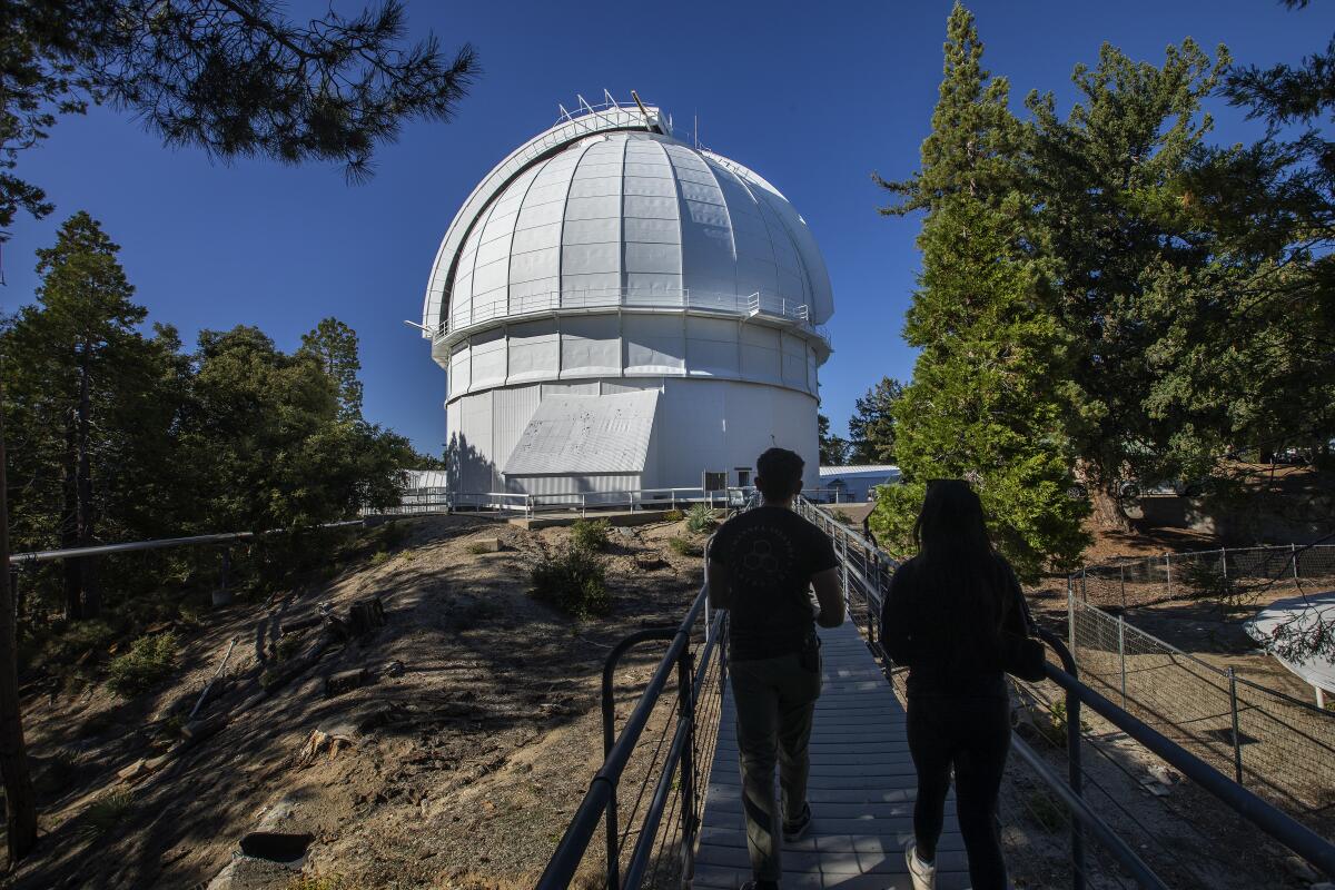
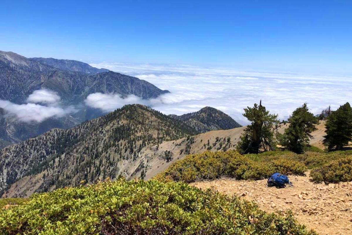
If there’s one challenging trek that adventurous Angelenos should brave, it’s the 14.5-mile round-trip grind to the summit of Mt. Wilson. You’ll be rewarded with some of the most awe-inspiring views in L.A. County. On your ascent, stop at the ruins of Orchard Camp, a popular retreat in the early 20th century and the perfect halfway rest point. Hike up a steep stretch to Manzanita Ridge, which has a resting bench, and then the final two miles to the top. Trees change throughout the hike from alder and oak to fir and pine. When you reach the wide dirt Mt. Wilson Toll Road, take a small trail to your right that takes you to the summit and Mt. Wilson Observatory, home of the 100-inch Hooker Telescope, which was once the largest in the world. Retrace your steps down.

Start at the Mt. Wilson Trail Park in Sierra Madre, next to Lizzie’s Trail Inn, a museum that details the history of the 1864 trail. Directions to trailhead.
Read All Read Less
Route Details
Baden-Powell hike
(Mary Forgione / Los Angeles Times)

Mt. Baden-Powell

Southeast Antelope Valley Mountain Trail
8.0-mile out-and-back
Strenuous
2,800 feet
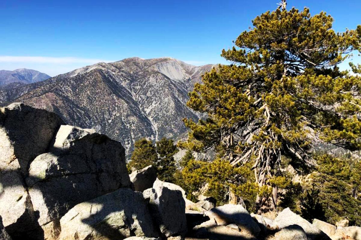
The most surprising thing atop this Angeles National Forest peak is the sturdy monument to Robert Baden-Powell, founder of the Boy Scouts. The 9,406-foot high point stands a little beyond the marker. The shortest route to the summit follows part of the Pacific Crest Trail and packs in 40 switchbacks and wide-angle views — a good place for high-elevation conditioning. There are longer ways to reach the summit (from Islip or Dawson saddles), if you prefer a more gradual approach. Regardless of your starting point, enjoy Jeffrey, Ponderosa and Lodgepole pines along the way to some truly epic vistas.

Park and start at Vincent Gap off Angeles Crest Highway (California 2). Directions to trailhead.
Read All Read Less
Route Details
Ontario Peak, with views of mountains in the distance
(Mary Forgione / Los Angeles Times)

Ontario Peak

Mountain Trail
12.1-mile out-and-back
Strenuous
3,894 feet
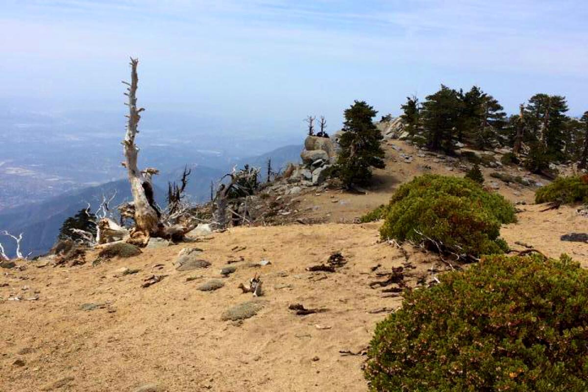
The route starts at Icehouse Canyon, the busy gateway to a number of peaks in the Mt. Baldy area. Ontario sometimes is overlooked, which is a good thing if you are craving uncrowded time. The hike starts with 3½ miles of switchbacks up to Icehouse Saddle, where you have a choice of routes. The sign to Ontario is well marked and will lead to a camp and meadows of downed trees that in good years have a nice show of wildflowers. A short, steep pitch takes you to the small summit, which features a bottle opener mounted on a tree (just in case you need one).

Park at the Icehouse Canyon lot and start up the trail. Directions to trailhead.
Read All Read Less
Route Details
Cucamonga Peak
(Mary Forgione / Los Angeles Times)

Cucamonga Peak

Mountain Trail
12.0-mile out-and-back
Strenuous
4,300 feet
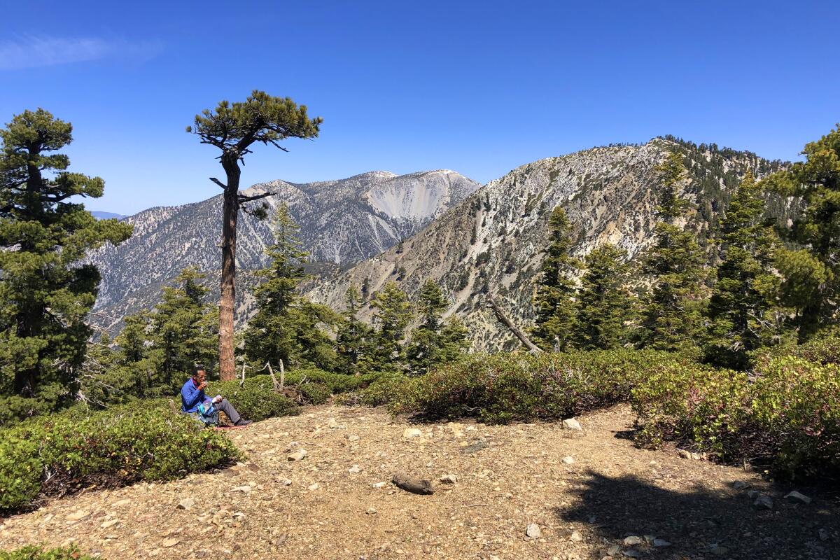
The trail to the top follows the same Icehouse Saddle route and turns at the well-signed intersection. The rocky trail weaves along canyons before leading uphill in tight switchbacks. As you climb, pines and Bighorn Mountain come into view. It’s easy to miss the short side trail that leads to the 8,858-foot summit; miss it and you’ll wind up at Etiwanda Peak in a few miles. The top has plenty of room to spread out amid manzanita and soft sand. Permits are required.

Park at the Icehouse Canyon lot and start up the trail. Directions to trailhead.
Read All Read Less
Route Details
Advertisement
Timber Mountain
(Mary Forgione / Los Angeles Times)

The Three Ts

Mountain Trail
12.5-mile point-to-point
Strenuous
4,200 feet
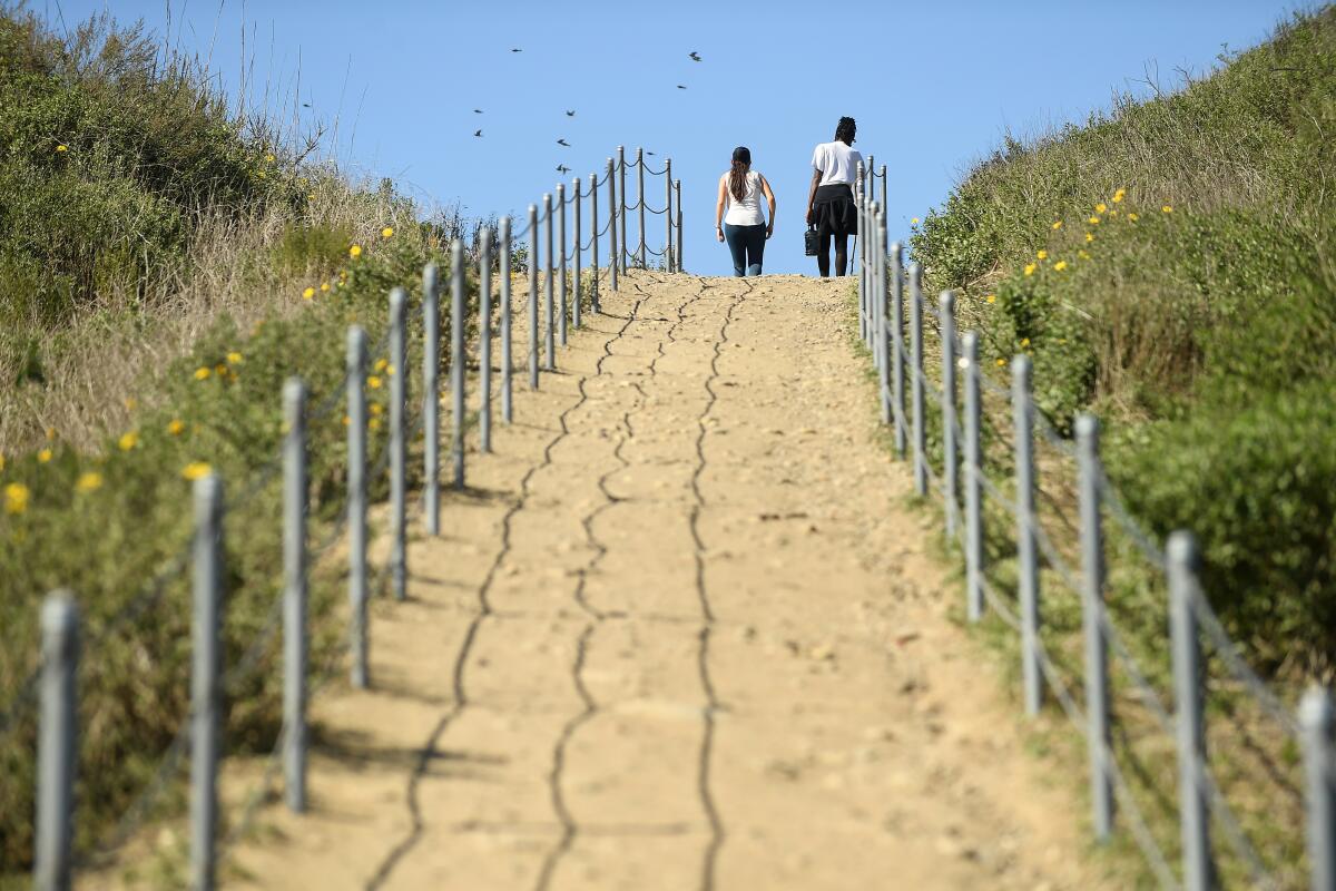
The Three Ts in the Mt. Baldy area — Thunder, Telegraph and Timber — is a point-to-point hike that will take you up and down all day starting at the base of Mt. Baldy. You’ll hit Thunder Mountain first, an exposed ski run with a lift at the top. Next comes Telegraph, which offers nice views of the surrounding San Gabriels. The best is saved for last: Timber, a sweet, quiet spot off the main trail to Icehouse Saddle. Take a well-earned break before heading down the canyon. Go with a friend and drop a car at the end point (Icehouse Canyon). You can do this hike in reverse order too.

Park at Manker Flat and start up the Mt. Baldy Trail. Directions to trailhead.
Read All Read Less
Route Details
Hikers walk a trail on the Park to Playa Trail in Culver City
(Wally Skalij/Los Angeles Times)

Park to Playa Trail

View Park-Windsor Hills Urban Trail
11.0-mile point-to-point
Moderate
700 feet
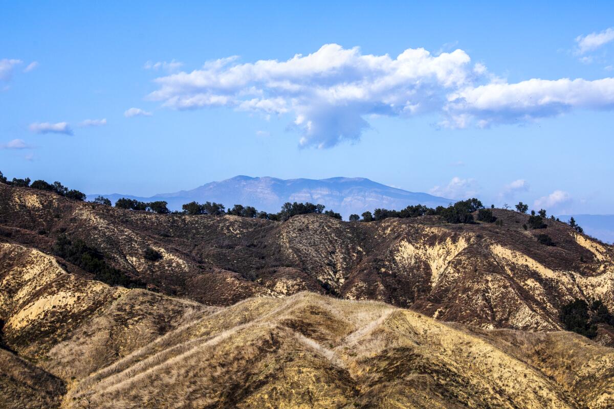
Urban trails help us navigate Los Angeles in new ways. Put the Park to Playa Trail on your to-do list. Parts of the 13-mile route have been open for years, but it wasn’t until November that it was completed. Good views of L.A. are guaranteed on the dirt-and-paved route from Baldwin Hills to Playa del Rey. Enjoy side trips in Kenneth Hahn State Recreation Area (the MLK Memorial has great views of L.A.), Stoneview Nature Center, the Baldwin Hills Scenic Overlook and the Ballona Creek Bike Path that will keep you going in the right direction. Set up a car shuttle, call a ride-share or use public transit to return to the start.

Park or take transit to the start at the Stocker Corridor Trail in the Baldwin Hills area. Directions to trailhead.
Read All Read Less
Route Details
The treelined ridge marks the northern boundary of Harmon Canyon Preserve with the Topa Topa Mountains and Ojai
(Myung J. Chun / Los Angeles Times)

Harmon Canyon Preserve

Canyon Trail
3.8-mile loop
Easy
350
Ventura welcomed its first nature preserve with a trail network that takes you to groves of native oak trees, along streams and up to high points for vistas of the surrounding mountains and the Channel Islands. Being here feels as if you’re taking a trip through Old California. You can piece together routes on the 10 miles of trails in the preserve, but the upper portion of the reserve is currently closed due to winter storm damage.

For now, hike the lower trails, including a 3.8-mile lollipop loop through beautiful coastal sage scrub on the main road and the Farr Family Trail. The turnaround point is the closed “no dogs allowed” gate. If you crave more mileage, check out nearby Arroyo Verde Park.

Park at the trailhead off McVittie Place in Ventura. Directions to trailhead.
Read All Read Less
Route Details

Wisdom Tree

Hollywood Hills Urban Trail
2.2-mile out-and-back
Moderate
850
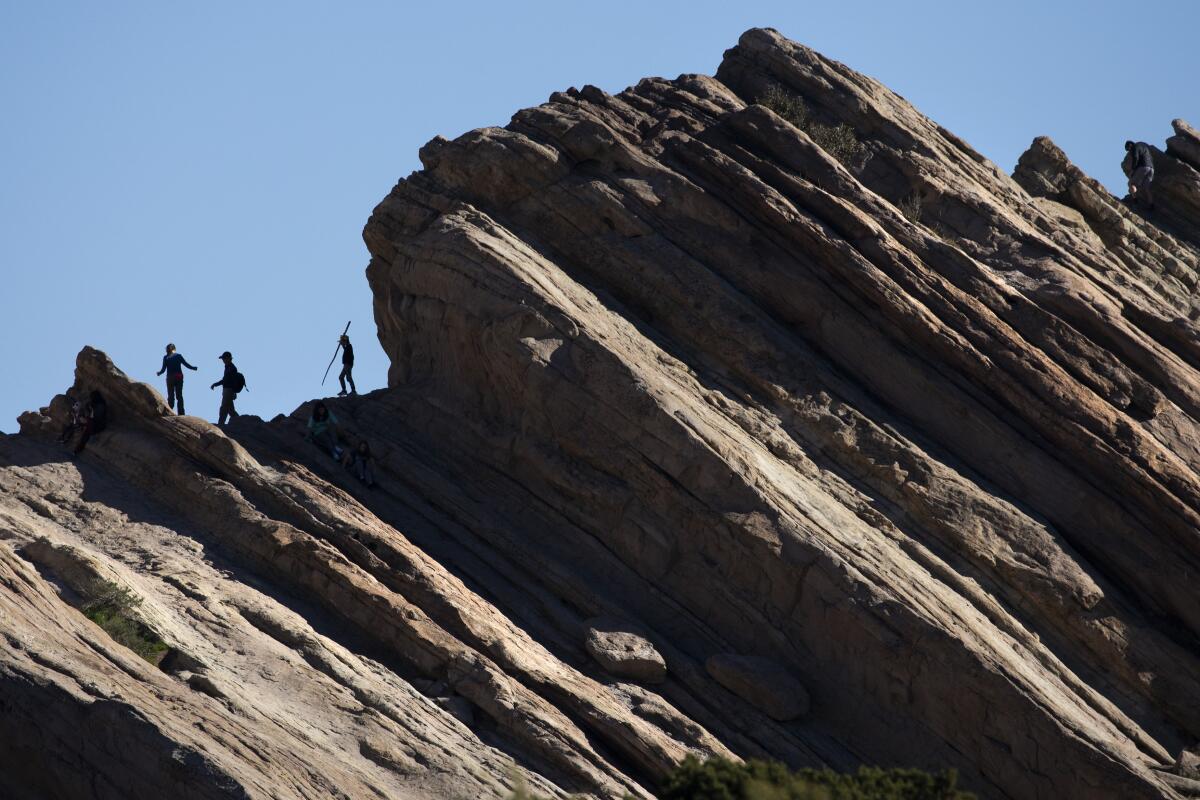
The iconic arboreal landmark is just a 15-minute walk from the Hollywood sign and goes by various names: the Wisdom Tree, Wishing Tree, Giving Tree, Magic Tree, you get the idea. Everyone seems to have a name for the lone, scraggly pine tree that’s being loved to death near Cahuenga Peak in Griffith Park. Sometimes it’s decorated with a few mementos, sometimes it’s honored with a box (containers change from time to time) at its feet that holds notes and journals from people who have something to tell the tree.

Park on Lake Hollywood Drive and start on paved Wonder View Drive near Lake Hollywood Reservoir. Directions to trailhead.
Read All Read Less
Route Details
Advertisement
People walk atop jagged rock formations at Vasquez Rocks Natural Area
(Myung J. Chun / Los Angeles Times)

Vasquez Rocks

Agua Dulce Desert Trail
3.4-mile loop
Moderate
325 feet
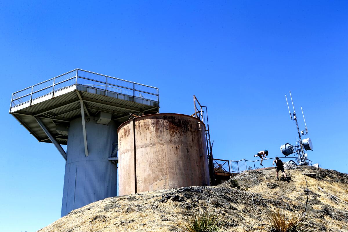
Where would you hide if you were chased by the law? Tiburcio Vásquez, a bona fide baddie who roamed the state in the mid-1800s, once eluded the law by hiding out in this wonderland of 25-million-year-old sedimentary slabs and rocks in modern-day Agua Dulce. He was charming, well-dressed, educated and one of the bandits who inspired the fictional Zorro. Hidden gems to look for: rock art created by the Tataviam people who once called the area home. First-timers may find the rocks eerily familiar, with good reason: The 45-degree-angle behemoths have been featured in film and TV shows, serving as backdrops for alien terrain (“Star Trek”) and westerns (“Blazing Saddles,” “Westworld”).

Park and start at the Vasquez Rocks Natural Area and Nature Center off of Escondido Canyon Road. Directions to trailhead.
Read All Read Less
Route Details
San Vicente Mountain Park on the Santa Monica Mountains
(Damian Dovarganes/AP)

Mt. San Vicente

Brentwood Mountain Trail
7.4-mile out-and-back
Moderate
730 feet
Come face to face with Cold War-era fear at a Nike missile site in the Santa Monica Mountains. It’s one of 16 places in Southern California that housed anti-aircraft missile launch sites. The site has been preserved and turned into San Vicente Mountain Park, which means you can see the missile structures up close. Signs help explain the era and the hardware. It’s a drive-up park, but better to go on foot and enjoy time on the trail in the Santa Monica Mountains. You’ll get good views from atop the 1,960-foot peak.

Park and start at Westridge and West Mandeville fire roads. Directions to trailhead.
Read All Read Less
Route Details
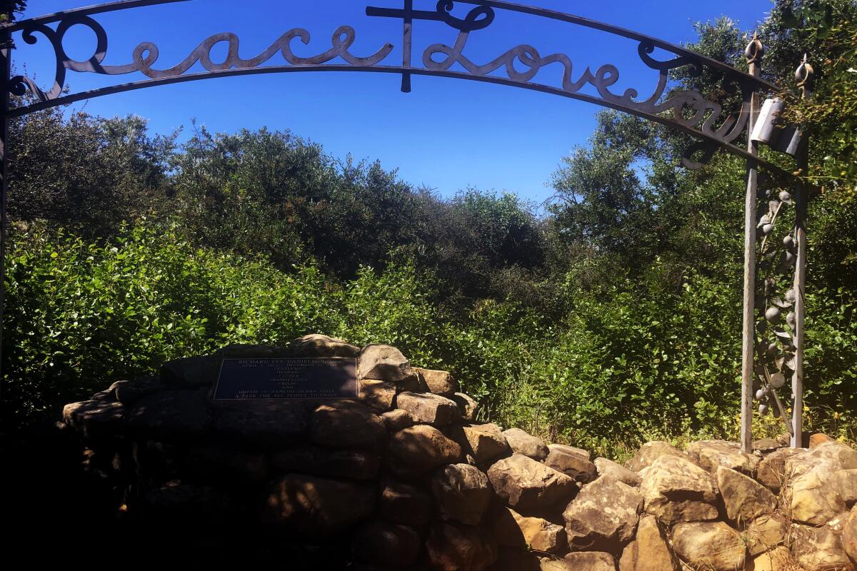
Danielson Monument in the Santa Monica Mountains

Danielson Monument

Thousand Oaks Mountain Trail
5.25-mile out-and-back
Moderate
800
Peace out, man. The burial site of rancher Richard E. Danielson Jr. in Pt. Mugu State Park is framed by a large metal arch proclaiming “Peace, Love, Joy.” What better words to inspire? The memorial stands in a quiet place near the site of his old cabin. It’s about a mile or so beyond a seasonal waterfall below Boney Ridge. Danielson, who died in 1988, donated more than 5,500 acres to what eventually became the state park.

Start at the trail from Rancho Sierra Vista/Satwiwa in Point Mugu State Park, Newbury Park. Directions to trailhead.
Read All Read Less
Route Details
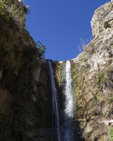
A 30-foot waterfall

Trail Canyon Falls

Tujunga Canyons Mountain Trail
4.6-mile out-and-back
Moderate
1,003
This is a truly magnificent getaway in the Angeles National Forest. The hike can be divided into two parts. The first is a relatively gradual ascent through a forested area with plenty of shade. You’ll have to navigate about 10 creek crossings, which after rain can be challenging if you struggle with balance issues.

One tip: Rather than taking a precarious route across the water on slippery rocks or a jiggly log so as to keep your feet from getting wet, consider plunging your feet into the cool water, shoes and all, and walk across the mostly flat, muddy creek base. (Still, be mindful of rocks.) On a hot day, it’s quite pleasant, not to mention safer.

The second part of the hike is straight up and without any shade whatsoever. Bring sunscreen, plenty of water and a hat.

This hike gets crowded on weekends. But considering the many creek crossings, it’s helpful to run into fellow hikers who can assist you over the water. Aren’t the characters you meet on the trail part of the hiking experience, anyway?

The 30-foot waterfall at the end of the journey is worth the trek. Enjoy views of it from the peak or, for those who don’t get vertigo, descend the last part of the trail — mostly on rocks — with the help of built-in ropes, the condition of which we can’t confirm, as it may vary over time. Descend at your own risk. It’s quite steep but will take you to the base of the waterfall, where you can wade in the water.

Additional tips: Buy a $5 National Forest Daily Adventure either online, from any San Bernardino National Forest Office or at an affiliated vendor, such as Big 5, and leave it in your car after you park (along the side of the road). Watch out for poison oak, as it’s bountiful on this hike. Also consider bringing along a towel and an extra pair of shoes and socks to leave in your car. Your wet feet will appreciate it afterward.
Read All Read Less
Route Details
Advertisement
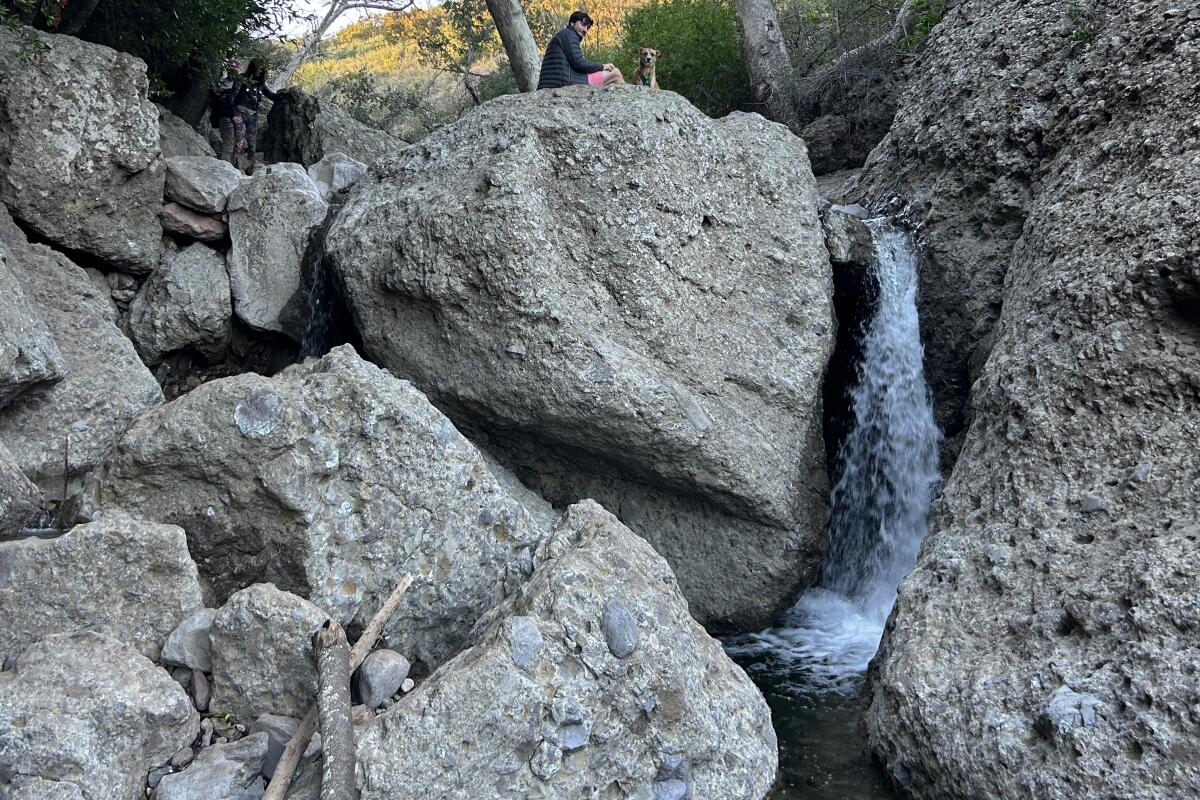
Hiker sitting on rock over a waterfall.
(Rachel Kraus)

The Grotto at Circle X Ranch

Mountain Trail
2.5-mile out-and-back
Moderate
261
In the farthest reaches of Malibu, the Grotto at Circle X Ranch is a two-and-a-half mile hike that contains the variety and scenery payoff of a much longer trek. At times, you’ll be walking over a rolling trail through trees bursting with white flowers. Then, around a corner, you’ll find a creek that requires something just short of parkour moves to ford.

That creek occasionally careens down some large drops, making for multiple dramatic waterfalls you can view, and even cross over. The end point, the grotto, is basically one big bouldery waterfall to explore.

The trail is well-marked and maintained, and a small parking lot up top makes the grotto trail a logistical breeze. But it’s also a schlep. To get to the trailhead from Pacific Coast Highway, you’ll have to actually cross into Ventura County before turning onto Yerba Buena Road. Creek crossing points could also be a gamble: While some have clear paths to follow, others are more choose-your-own-adventure, and kudos to you if your socks remain 100% dry. Hiking shoes or boots could help with this endeavor, and their grippy soles also come in handy for staying on the rocks and enabling grotto rock climbing.
Read All Read Less
Route Details
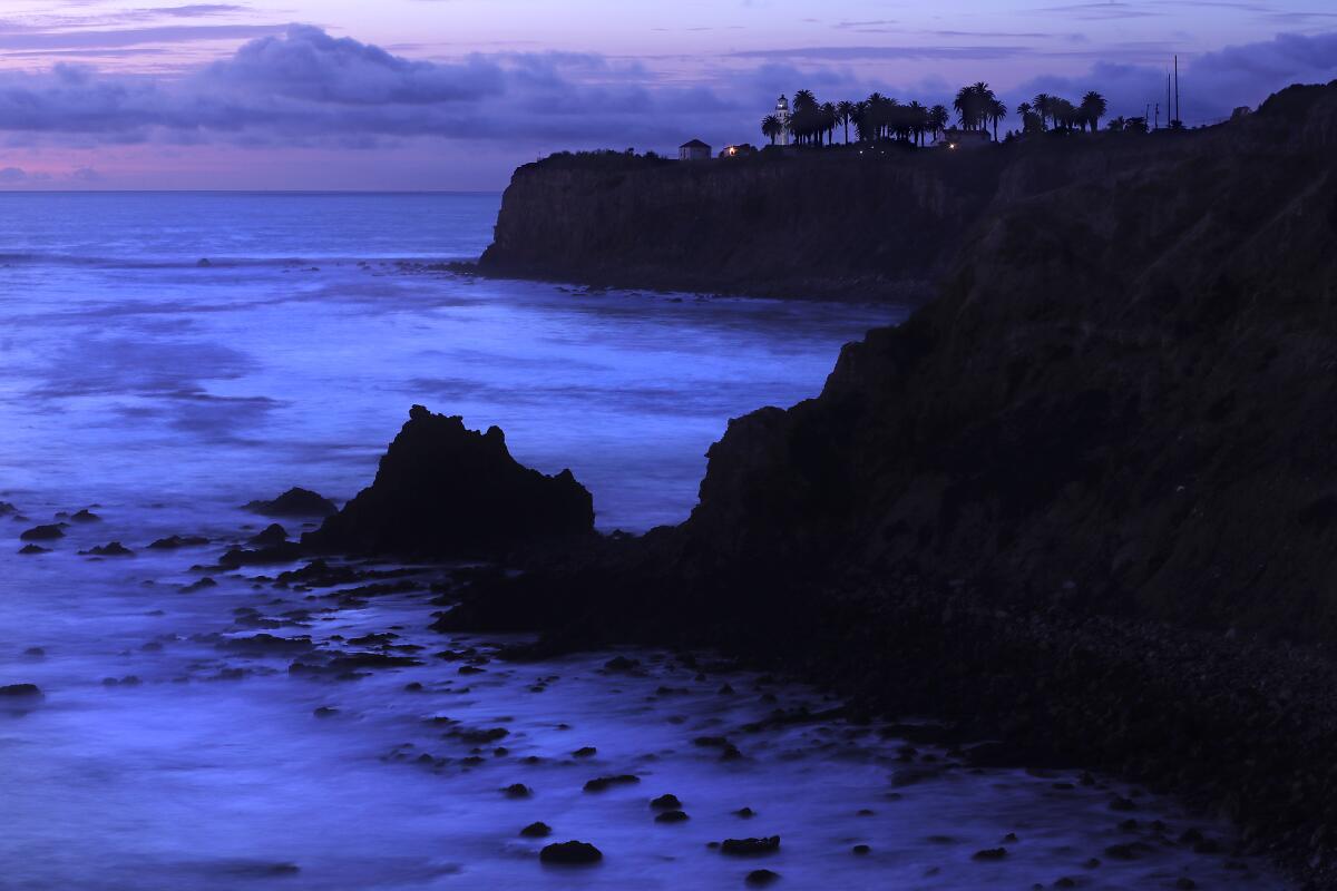
 Waves wash ashore near a lighthouse surrounded by  a few trees.
(Luis Sinco / Los Angeles Times)

Seascape Trail and Golden Cove Trail

Rancho Palos Verdes Urban Trail
0.7-mile out-and-back
Easy
40 feet
The Seascape Trail is one of the easiest ways to get to know the rocky bluffs of the Palos Verdes Peninsula. The walking is easy, with the ocean always to your left. From above, the views trace the contours of shale and mudstone cliffs almost to Redondo Beach. Narrow, rocky beaches below look hand-carved as they curl in and out of coves. On a sunny day with deep blue waters, these views are the stuff postcards are made of.

The wide trail starts at the Point Vicente Interpretive Center, a small museum and gift shop with a large deck. From December through late May, whale watchers gather daily to record the number of migrating gray whales that pass the peninsula. From the deck, the path is clearly marked as it heads up the coast and intersects with the Golden Cove Trail. Continue to the Calle Entradero vista point (you’ll know it when you see it), then turn around and retrace your steps.

This is also a place to linger. Bring a feast and kick back at one of the picnic tables with the five-star ocean views. Take a look at the nearby Point Vicente Lighthouse, which in 1926 was “the brightest beach in Southern California,” the website says. It typically opens for visitors one day a month. Parking is free.
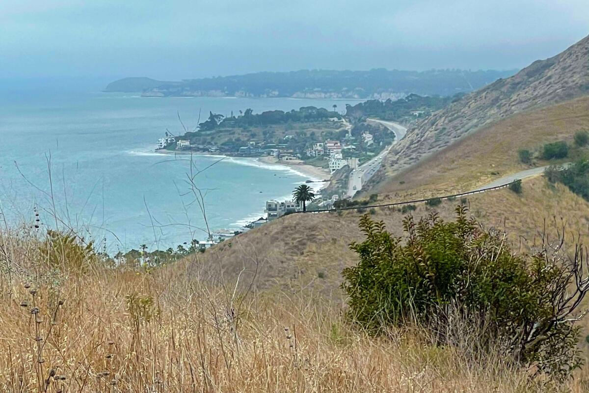
Read All Read Less
Route Details
A trail goes along the coast and up into the hills.
(Mary Forgione / Los Angeles Time)

Sara Wan Trail

Malibu Mountain Trail
2.5-mile loop
Easy
600 feet
Malibu has some of the prettiest parts of the coast north of Santa Monica. There’s beach access along Pacific Coast Highway as well as trails that lead into the Santa Monica Mountains. Why would you leave the beach and hike inland? For the views, of course.

The Sara Wan Trail starts along a dusty path that leads down to a creek and then quickly turns left at the first intersection and begins to climb. You’ll find good inland views of the rolling mountains, some topped with exquisite homes, and trees in the canyon below that bear charred signs of the 2018 Woolsey fire. It may feel like more than 600 feet of gain but stick with the trail, which snakes back toward the ocean after the first mile. At the last turn, the views show the crescent curve of the coastline below and, in the distance, Point Dume.

Ocean views stay with you during the descent that completes the loop. You’re never out of earshot of the traffic hum, but it doesn’t diminish the payoff views at the top. The trail is named for the late activist and former California Coastal Commission chair who worked to maintain public access to SoCal’s precious coastline.

Start at Corral Canyon Park (25653 Pacific Coast Highway, Malibu). It’s an easy turn off the highway into a small parking lot ($12) or park on PCH. If you want to reward yourself, Malibu Seafood patio cafe is next door.
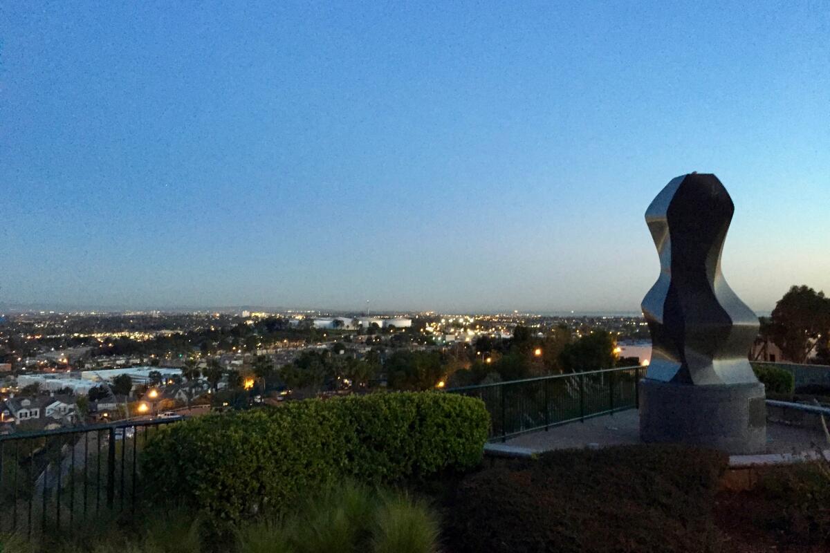
Read All Read Less
Route Details
An art installation at sunset in Hilltop Park.
(Matt Pawlik)

Hilltop Park

Signal Hill Urban Trail
2.0-mile out-and-back
Easy
200 feet
Perched high above Long Beach, Signal Hill is home to one of the best urban hikes in the city, thanks to its ease and accessibility, rich history, unique art and awe-inspiring coastal views.

Start your suburban stroll at Discovery Well Park, where one of the biggest oil strikes in U.S. history happened in 1921. The gravel road starts next to one of the park’s many oil derricks (yes, there are still active wells here). Take the stairs on your left past the 9/11 Unity Monument. Head north along the paved Panorama Road, which soon connects to a dirt path that flanks a future nature preserve, workout machines and interpretive signs and offers incredible views down to the downtown skyline and San Gabriel Mountains backdrop.

After about a mile, you’ll reach Hilltop Park, where you’ll find some neat art installations (including frames for some gorgeous sunset photos), along with views-de-force. The night panoramas here are special — you get the glow of downtown Long Beach, the Port of Los Angeles and even the distant twinkle of Avalon on Santa Catalina Island. For this gentle jaunt, I recommend coming before dark for one of the most magical sunset viewings in L.A. with a picnic to enjoy during the transition to the shimmering coastal city light show.
Read All Read Less
Route Details
Advertisement

Vetter Mountain

Angeles Crest Mountain Trail
3.1-mile out-and-back
Easy
667 feet
Outdoor writers often describe the marine layer as a “phantom sea,” and there’s no better vantage point for understanding that description than the historic fire lookout on Vetter Mountain. From here, you can gaze at clouds that seem to crash in slow waves against Mt. Wilson, San Gabriel Peak and other mountains. The fire lookout was built in 1937 but burned down in the 2009 Station fire. A reconstructed lookout opened in April 2020 and is staffed by volunteers from the Angeles National Forest Fire Lookout Assn. (Ask them to show you how to use an Osborne Fire Finder, and they’ll do so gladly. It’s a uniquely analog tool in today’s digital world.)

This is an easy hike of about 3 miles on a paved road from the Charlton Flat day use site’s locked gate, or a shorter trek on a trail from deeper inside the picnic area near the Silver Moccasin Trail. An Adventure Pass is required for both. Head to anffla.org for more info on the fire lookouts and to learn how to become a volunteer yourself.
Read All Read Less
Route Details

Castro Crest

Unincorporated Santa Monica Mountains Mountain Trail
7.6-mile out-and-back
Moderate
1,250 feet
Castro Crest is a long east-west ridge in the Santa Monica Mountains on the southwestern corner of Malibu Creek State Park. It is lower in elevation than Sandstone Peak, but when the marine layer is below 2,000 feet, a trek on this section of the Backbone Trail provides a beautiful contrast in clouds. To your south, the cool, wet air of the Pacific blankets Santa Monica Bay. To your north, the clouds dissipate and unveil the stunning geography of the Goat Buttes, the higher-elevation formations that Malibu Creek curves around.

This hike can be an easy stroll along the mostly level Backbone and Mesa Peak trails or you can head down into the lower elevations in the state park via the Castro and Bulldog motorways. No dogs allowed.
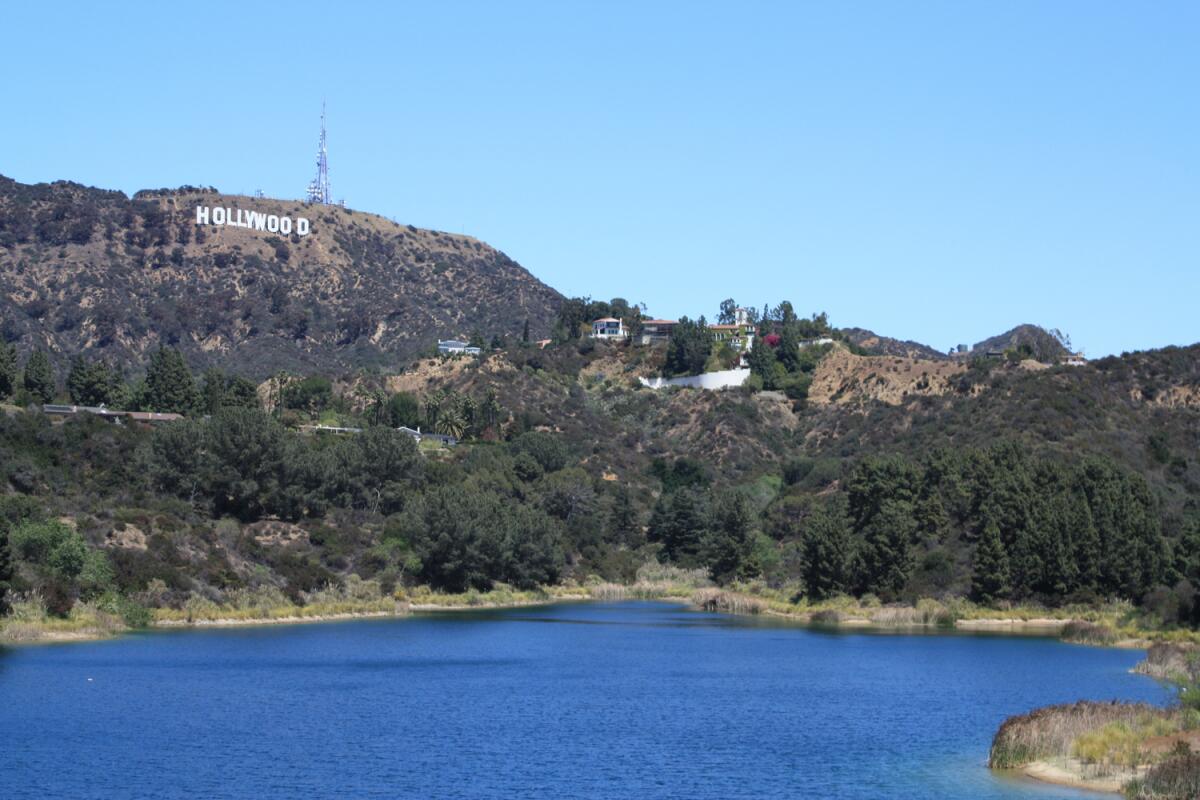
Read All Read Less
Route Details
The Hollywood sign above the water of the Hollywood Reservoir.
(Casey Schreiner)

Mulholland Dam

Hollywood Hills Urban Trail
3.3-mile loop
Easy
Completed in 1924, the Mulholland Dam is the second-to-last dam designed and built by William Mulholland. When his final dam — the St. Francis — catastrophically collapsed in 1928, engineers reinforced this dam perched above Hollywood and covered most of its base in earth. Today, it’s a unique spot to see the Hollywood sign with the waters of the Hollywood Reservoir beneath it. This mostly flat, mostly paved path is popular with neighborhood joggers and is open from 6:30 a.m. until dusk, with closures on some holidays and after storms or red flag days (the L.A. Department of Water and Power maintains the site and controls pedestrian access). Getting to the dam is an easy walk — about a mile from a gate on Lake Hollywood Drive and just a stone’s throw from the gate at Weidlake Drive. Both gates are in residential neighborhoods, so get there early (the Lake Hollywood Drive area has more available parking).
Read All Read Less
Route Details
The waterfall at Brown Mountain Dam.
(Matt Pawlik)

Brown Mountain Dam

La Cañada Flintridge Mountain Trail
8.5-mile out-and-back
Moderate
700
For a whirlwind workout, head to the Angeles Crest Fire Station a short ways up the Angeles Crest Highway. There, you’ll find a secret, strenuous shortcut to the historic falls of the Brown Mountain Dam. An alternative to the 8.4-mile trip that starts near Jet Propulsion Laboratory (JPL), this route features a 600-foot descent on a narrow trail and offers stunning panoramas into the canyon.

Take a breather during the steep switchbacks to catch a unique perspective of the 81-foot falls peeking through a dense display of willows, oaks and sycamores. On your way to the canyon floor, you’ll pass by a collection of interesting ruins and chaparral staples, like sage, chamise and laurel sumac. At the base, turn left to connect with the main Brown Mountain Dam Trail.

Follow this wide, dirt path as it parallels (and sometimes crosses) Arroyo Seco Creek under oaks, pines, firs and walnut trees. After passing the stone ruins at the Paul Little Picnic Area, you’ll soon reach the dam, which was built in 1943 as the first project in the U.S. Forest Service Los Angeles River Watershed program. Now, it’s the perfect waterfall destination. The cascade surges after rainfall and even has a narrow ledge that allows brave hikers to experience the backside of the falls, too. From any angle, it’s a truly awe-inspiring sight.
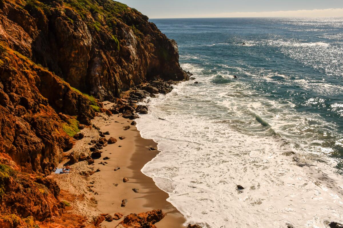
Read All Read Less
Route Details
Advertisement
Rocky cliffs loom over the beach at Point Dume State Preserve, part of Point Dume State Beach in Malibu.
(Christopher Reynolds / Los Angeles Times)

Point Dume Cove Trail

Malibu
1.4-mile loop
Easy
347
This busy but highly satisfactory network of trails is near Point Dume State Beach in Malibu. From Cliffside Drive, a slight uphill walk of a few hundred yards brings you to the point’s highest part, a flat-topped hill with a commanding panorama of ocean, beach and coastal bluffs.

I showed up on a brisk day ideal for a beach walk, and there were dozens of us on the paths. I can picture some nasty foot traffic in the hour before sunset, but I can’t imagine a better place to stand and scan the sea for gray whales, which are common from February through April.

You get a wide view of Santa Monica Bay from the point’s high ground or the 200-yard boardwalk near the top of the hill. As a plaque notes, Point Dume got its name from English explorer George Vancouver, who sailed by in 1793 and attempted to name it for Francisco Dumetz, a Franciscan priest at the Ventura mission, and apparently left out the “tz.”


Northwest of the high point, follow the main trail to a rocky promontory that looks down on Pirate’s Cove Beach and a jumble of black rocks and tide pools. To your right, the broad, sandy expanse of Point Dume State Beach reaches northwest and blends into Zuma Beach.

I covered the network of paths at the point in about 90 minutes (with plenty of time for photography). You can add more steps by strolling north up the beach toward Zuma and doubling back . It’s all flat sand.

Tip: To start at the beach, take Malibu’s Westward Beach Road to Birdview Avenue, then park at Point Dume State Beach. To start atop the bluffs, head for the 29200 block of West Cliffside Drive where there are 10 two-hour parking spots. If they’re full, continue to Grasswood Avenue, turn left and look for street parking once it’s legal.
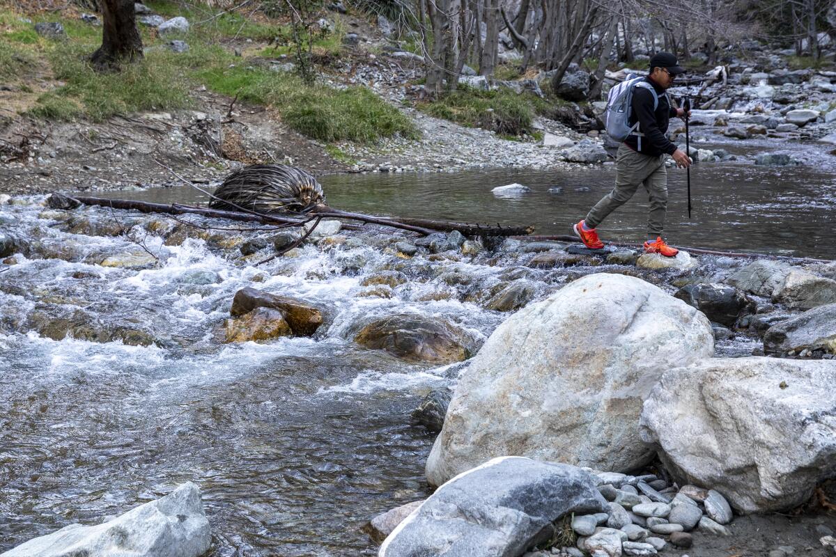
Read All Read Less
Route Details
AZUSA, CA - FEBRUARY 11: Besman Ginping, 33, of Loma Linda, balances across logs and rocks as he crosses the East Fork of the San Gabriel River, one of several river crossings on the Bridge to Nowhere trail on Thursday, Feb. 11, 2021 in Azusa, CA. (Brian van der Brug / Los Angeles Times)
(Brian van der Brug / Los Angeles Times)

Bridge to Nowhere

Angeles Crest Mountain Trail
9.5-mile out-and-back
Moderate
1,246
Deep in the folds of the San Gabriel Mountains, five miles from the nearest paved road, stands the Bridge to Nowhere.

To reach it, park at the end of Camp Bonita Road near LaVerne and start walking along the East Fork of the San Gabriel River, with steep slopes rising on either side.

On the East Fork Trail, you’ll gain about 800 feet of elevation, ford the river several times, tiptoe amid loose rock and sidle past enough Spanish bayonet cactus (a.k.a. chaparral yucca) to pop every balloon in the American West. It’s a mostly flat path but with plenty of rock-hopping. And as the trail wriggles, you have no choice but to cross the river. At least six times.

For me, the water never reached knee level. But you do need to watch your step and check the weather first. Even in light rain, the river swells, often for days. That fast, cold water makes crossings risky, and several fatalities have been reported along the river’s East Fork in recent years.

If you can get to the Bridge to Nowhere and back again, unharmed and uncrowded, leaving only footprints and carrying a renewed recognition of the puniness of mankind and the might of the San Gabriels, you’re absolutely winning.

The Forest Service requires hikers to have an Adventure Pass ($5 per day or $30 per year).
Read All Read Less
Route Details
Advertisement