That perfect Big Sur road trip? Start rerouting
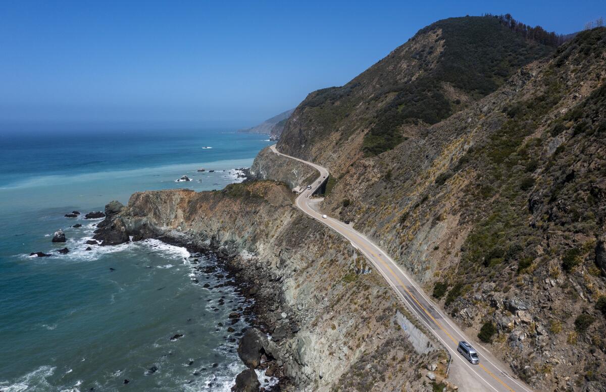
With storm-damaged Highway 1 under reconstruction in three different places, California Transportation Dept. officials say northbound drivers on that route won’t be able to reach Big Sur directly for at least two months.
In other words, Southern Californians, it may be time to reroute your early summer road-trip plans.
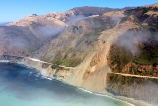
The Big Sur stretch of the highway, globally known for its views but vulnerable to mudslides since the highway opened in 1937, took a beating from 12 “atmospheric river” storms over the winter. It shut down in January.
When the closure began, more than 50 miles of the roadway were out of commission. Now road crews have reduced the closed zone to about 30 miles in southern Monterey County. The closure covers the communities of Lucia and Gorda and extends south to a point just north of the Ragged Point Inn (which remains open).
This means that through at least mid-June, northbound drivers can use the coastal route to reach Cayucos, Cambria, Hearst Castle and San Simeon (all in San Luis Obispo County), but not Big Sur attractions farther north, such as Nepenthe restaurant, McWay Falls, Deetjen’s Big Sur Inn, the Big Sur River Inn and the Bixby Creek Bridge.
To reach those spots (which also remain open), northbound drivers will need to take U.S. 101 from San Luis Obispo to Salinas, then cut over to the coast and double back on Highway 1. The northern end of the highway closure is now at Big Creek Vista Point, Monterey County post mile 27.
Driving this stretch of Highway 1 is still one of the most amazing things you can do in California. Here’s how to find hints of history along the way.
“The truth is we’re America’s most beautiful cul-de-sac right now,” Deetjen’s Big Sur Inn general manager Matt Glazer told SFGate.com recently. (His business is 15 miles north of the closure.)
There are few businesses along the rugged stretch of highway that is closed. One of them, temporarily closed until the road reopens, is Treebones, a boutique lodging that features yurts with big ocean views.
Caltrans spokesman Kevin Drabinsky said the repair and reconstruction efforts are focused on three points where landslides and rockfalls have either torn away the road or buried it
“We’re going to be about two months” opening the southernmost problem, the Gilbert’s Slide area at Post Mile 10, just north of Gorda, Drabinsky said.
Even you’ve already done the most obvious attractions — Hearst Castle in San Simeon, for instance — why not spend more time exploring roadside nooks and ocean-adjacent crannies along Highway 1?
About 10 miles north of that problem waits the next challenge, an area known as Paul’s Slide at post mile 21.7. There, Drabinsky said, crews must move an estimated 500,000 cubic yards of slide material, which has buried the roadway. The timeline for that is unclear, he said, but it is likely that this portion will open first with alternating one-way traffic, with full opening to follow, perhaps months later.
Finally, about a mile north of that, is the Dani Creek Slide (post mile 22.6), where most of the blacktop has crumbled and fallen down the hill. At that location, “We’re still doing site assessments” with no strategy in place yet, Drabinsky said. Because of that, Caltrans has no estimate yet on how long that problem will take to solve.
More to Read
Sign up for The Wild
We’ll help you find the best places to hike, bike and run, as well as the perfect silent spots for meditation and yoga.
You may occasionally receive promotional content from the Los Angeles Times.

