Major heat wave expected to broil much of California over Fourth of July week

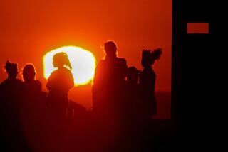
A major heat wave expected across California over Fourth of July week is already prompting heat warnings for much of the state, with triple-digit temperatures forecast and little overnight relief.
Forecasts are still developing about just how extreme and widespread the heat will be, but weather officials are confident that inland California will see several days of dangerously hot conditions, expected Tuesday through at least Friday.
Daniel Swain, a UCLA climate scientist, said the “major heat wave” also has the potential to bring hot temperatures to the coast, which he called uncommon for early July.
“Early hints at potential for some record-breaking heat and very high grass/brush fire risk,” Swain wrote this week on X.
Along with the high temperatures, officials are warning the next week could see elevated fire conditions, especially on Monday and Tuesday in the Sacramento Valley, when gusty winds will be particularly strong and humidity low.
The San Joaquin Valley is still battling several large fires sparked this week after extreme lightning activity in the area, including the Fresno June Lightning Complex in eastern Fresno County, which as of Friday afternoon had surpassed 10,000 acres with 37% containment, according to the California Department of Forestry and Fire Protection. The Basin fire, farther east in Fresno County, ignited Wednesday and had grown to 5,692 acres with no containment.
Giving fireworks’ propensity to spark fires, Cal Fire officials are reminding residents to be safe and use them only on concrete and to have water nearby.
An excessive heat watch has already been issued for much of California, from the northern Sacramento Valley to the Antelope Valley , for Tuesday through at least Friday. The advisory was also extended to most of the Bay Area and much of southwest California.
“Dangerously hot conditions with high temperatures of 105 to 115” are expected, the heat watch said, while overnight lows will range from the upper 60s up to around 80.
A strong high-pressure system building over the central Pacific Ocean is forecast to move into the West Coast early next week, when “a hot air mass will develop over the region,” the National Weather Service wrote in its extended forecast. The weather pattern, known colloquially as a heat dome, is expected to be centered over Northern California.
“Heat could significantly impact outdoor holiday activities,” the weather service wrote in the excessive heat watch. “Area waterways will continue to run cold and fast, creating dangerous conditions for those seeking relief in rivers and lakes.”
By Thursday of next week, the National Weather Service is warning of major to extreme heat risk, which officials say is “very dangerous to anyone without proper hydration or adequate cooling.”
In Death Valley, temperatures are expected to reach 120 by next weekend, according to the National Weather Service.
In the interim, temperatures this weekend across the state are expected to be average or even slightly below what is seasonally normal before the rapid warmup next week, forecasters said.
“If you’re making outdoor plans [for the Fourth of July], big and/or small, keep an eye on the forecast as it evolves through this weekend (while enjoying the seasonal temps we’re currently getting),” the weather service wrote on X.
More to Read
Sign up for Essential California
The most important California stories and recommendations in your inbox every morning.
You may occasionally receive promotional content from the Los Angeles Times.


