The magical California state park that doesn’t allow visitors
SUTTER BUTTES, Calif. — About 60 miles north of Sacramento, the Sutter Buttes rise starkly from the floor of the Central Valley, the remnants of a volcano active more than 1.4 million years ago. Their cathedral-like spires twist upward, some reaching more than 2,000 feet into the sky — an imposing circular formation, 10 miles in diameter, that’s been called “the smallest mountain range in the world.”
Sheltered within these lava domes is an oasis of rolling hills, rich with wildflowers and Native American artifacts, and watched over by hawks and countless other species of birds.
Bitter debates over the lack of public access to the Sutter Buttes have roiled for years. But most everyone on both sides agrees on this: They encompass some of the most magical and otherworldly terrain in California. Long sacred to Native American tribes, the formation is now home mainly to cattle that chomp grass behind stone walls built by Chinese laborers more than a century ago, oblivious to the fact that some people want to throw open the gates and some want to keep them locked forever.
For the last two decades, the Sutter Buttes have also been home to a California state park that almost no one is allowed to visit.
For the record:
7:30 a.m. May 20, 2024An earlier version of this article misspelled the last name of the famed landscape architect who helped establish the National Park Service as Frederick Law Olmstead Jr. His last name is spelled Olmsted.
In 2003, the state of California spent about $3 million to buy 1,800 acres on the north side of the buttes, including an idyllic stretch of emerald called “Peace Valley.” The government has eyed a park in this ruggedly beautiful landscape since the inception of the state parks system in the 1920s. Frederick Law Olmsted Jr., the famed landscape architect who helped establish the National Park Service and also surveyed potential parkland for California in those early years, put it on a state park wish list, along with such gems as Point Lobos on the Monterey County coast and Donner Lake in Northern California.
In 2005, the state finally achieved its goal — sort of. The State Park and Recreation Commission officially declared its 1,785 acres a park. The property has its own state-sponsored webpage and a budget for conservation and maintenance.
What it does not have is any way for the public to get in.
“Please note: There is currently no public access point to enter this park,” reads a notice in big red letters at the top of the webpage.
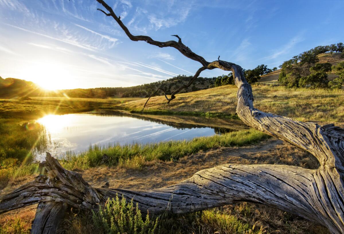
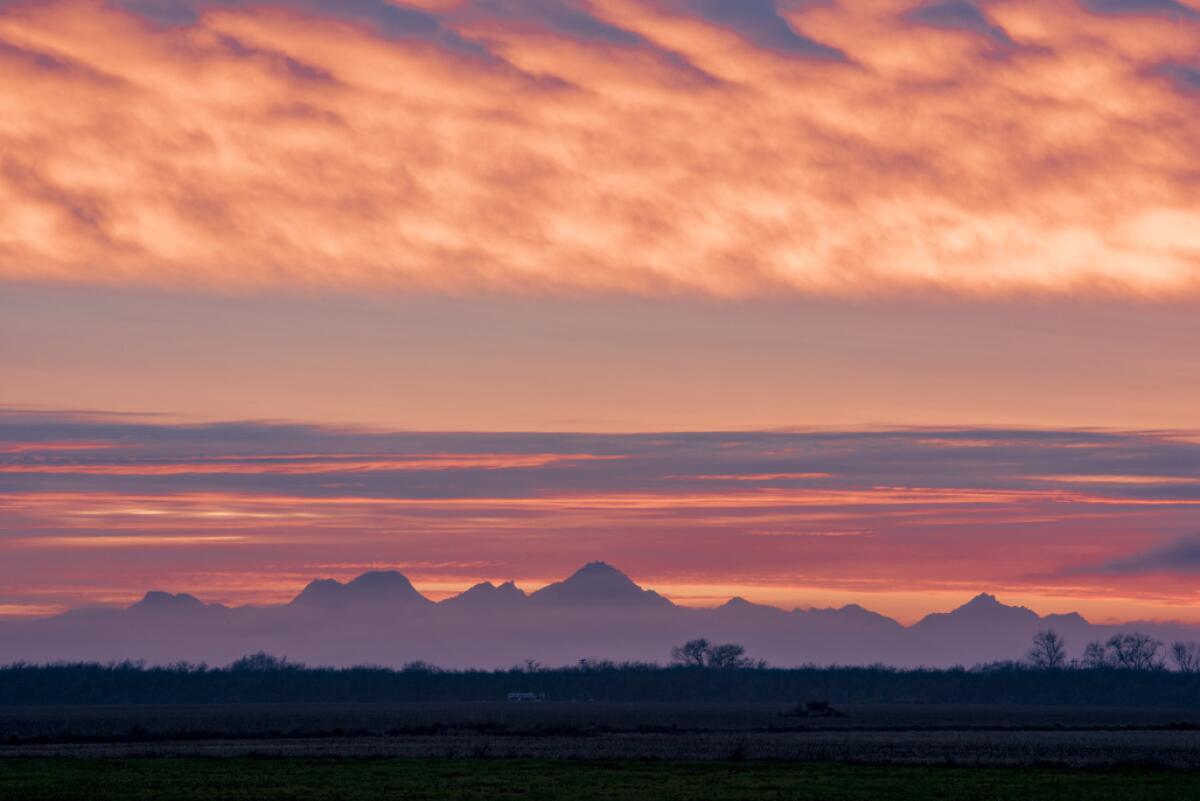
Beneath that are breathtaking photos: sunlight glinting off a placid lake; a dirt road leading up a verdant hill; a haunting photo of the buttes at sunset — from a distance.
That last image — the one from a distance — is the only way most people can view the park.
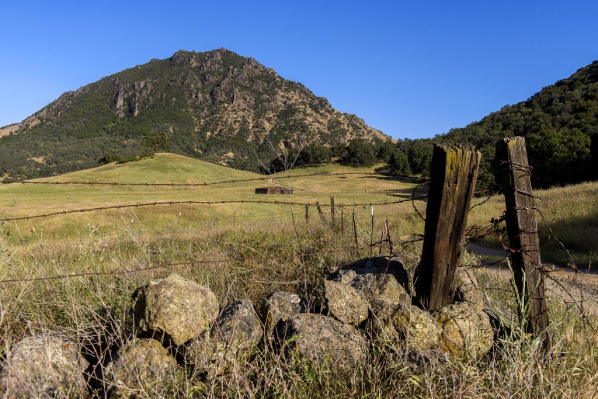
The issue, according to current and former parks officials, is that all the roads leading into the Sutter Buttes are privately owned. And none of the landowners — some of whom have had title to the land since before California entered the union — will give the state permission to use those roads for park visitors. Nor has the state found anyone willing to sell them property near a public road that could be used to access the park.
With the impasse in its 20th year, state officials instead allow a few people into the park on occasion for carefully guided visits.
State parks officials were not available for an interview to discuss the situation, but said in a statement that the department “continues to look for opportunities to either secure land or easements to provide access.” So far, nothing has come up.
Many locals say the current status — an empty state park — suits them just fine. The Sutter Buttes are a precious ecosystem, they say, filled with delicate tribal artifacts and threatened species. It isn’t the same, they argue, as a state park in the immense Sierra Nevada or vast inland deserts or along the glittering coast.
“This little blob in the middle of the Sacramento Valley is so sensitive to encroachment,” said Marty Steidlmayer, 59, whose family has owned land in the Sutter Buttes since the 1930s. A state park, he said, would “let people in, free and unattended,” which could lead to vandalism, fires and degradation. “It’s not a good idea,” he said.
Sutter County Supervisor Mat Conant agreed. “It is more important to protect those land rights,” he said, noting that “some families have held that land for close to 200 years.”
Francis Coats is one of the few local landowners who think the state needs to find a way to let in the public.
“It’s absolutely beyond me why it’s not open,” said Coats, whose family has been in the area since the 19th century. Coats said he owns a small interest in 160 acres on the north side of South Butte, and so strong is the antipathy toward access that he faced death threats when he first tried to visit his own parcel.
The Sutter Buttes, though little heralded in modern-day California, have played an outsize role in the state’s history.
The Maidu people took refuge there for thousands of years during periods when the Sacramento Valley flooded. They believed it was a resting point for spirits on their journey to the afterlife.
In the 1840s, Kit Carson and Gen. John C. Fremont, fresh from their savage massacres of Native Americans in the north state, hid out in the buttes and plotted to seize California from Mexico. Then they headed to Sonoma County to lend support to the Bear Flag Revolt of 1846. Their Republic of California was short-lived, but helped stoke the Mexican-American War, which paved the way for California to join the United States.
When state officials first proposed a park in the Sutter Buttes in the 1920s, local newspapers took the opportunity to celebrate this history.
“These rugged hills hold a prized place in the hearts of Californians,” the Sacramento Union wrote in 1931. “They are indelibly linked with the romance of the state’s secession from Mexican rule.”
The park didn’t come to fruition then, and the Depression and World War II created other priorities.
The state tried again in the 1970s, putting money in a parks bond to fund the purchase of tens of thousands of acres in the Sutter Buttes. Local landowners were horrified, and the county Board of Supervisors voted in opposition. “We’ll fight them, right down the line,” Supervisor J.A. Bagley told the local newspaper.
The state backed down. But within the parks department, some never dropped the dream.
The department’s chief of land acquisition, Warren Westrup, knew how to play a long game. Westrup, who worked for the state for 37 years, figured out how to put together parcels of land, piece by piece, until a vision came to fruition.
He did it in the Santa Monica Mountains, where state officials devised ways to purchase land for a trail that connects communities from Los Angeles to Malibu; and in Chino Hills, buying one canyon after another until eventually a whole park came to fruition.
In 2003, Westrup heard through an intermediary that someone with land in the buttes was looking to sell. He arranged for its purchase, even though he was aware the property was surrounded by private land blocked by private gates and accessible only via a private road.
Parks officials moved forward to establish the park with the notion that they eventually could persuade someone else to sell them land adjacent to a public road, where they could build a parking lot, bathrooms and maybe a few tents for people to camp.
The problem: No one would sell.
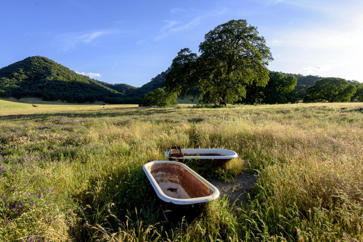
Most of the land in the buttes is held by a small number of legacy families who primarily use the fields for grazing cattle and sheep. No one lives in the interior, although there are a few homes on the outside.
After the state pushed for a park in the 1970s, some landowners feared the government might take their property. To stave that off, they began providing guided tours that granted limited access to the public and also to researchers. Local schoolchildren were also invited in.
They hired a manager, who moved into a cabin for the job, along with his wife, their golden retriever and their cat. They fell in love with the quiet grandeur of the area — all except for the cat, who was snatched by an eagle and never seen again.
“Some places just attract us more powerfully than others,” Walt Anderson, the manager, explained in a 2006 oral history. “I mean, everybody loves the profile of the buttes when they pass it, but once they get inside, I mean, they’re hooked.”
Steidlmayer, who owns land adjacent to the state park, said officials have told him “that the state will buy anything that we would be willing to sell. But that is the last thing my family would ever do.”
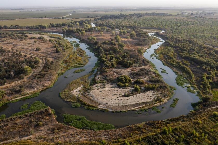
Towering oaks, converging rivers, vibrant wildlife. You’ll be able to see it all on the 1,600 acres near the confluence of the Tuolumne and San Joaquin rivers.
Even some outdoor enthusiasts have reservations about opening the park.
Lisa Lindman, executive director of the Sutter Buttes Regional Land Trust, said she has come to view the issue as “really complicated.”
She wants the public to be able to appreciate the peace and beauty of the buttes, but echoed landowners’ concerns about the delicate ecosystem and centuries-old Native American artifacts that remain largely untouched.
In lieu of full public access, Middle Mountain Interpretive Hikes, a sister organization to Lindman’s land trust, leads private tours for small groups of people who pay about $35 apiece for a carefully supervised hike. Reservations can be hard to come by. The Middle Mountain hikes do not enter the state parkland. Instead, they traverse private land near the park under a long-standing agreement with landowners that grew out of those early tours from the 1970s.
On a recent spring day, a tour group wound up dirt roads and through locked gates in a small caravan of cars, before parking near the center of the range. Volcanic domes rose above a green meadow. Wind rustled through the grass. A flock of snow geese passed overhead, their silver wings gleaming against a blue sky.
From atop the lava domes, it was possible to see Mt. Lassen and Mt. Shasta. The snow-capped Sierra stood to the east. After a precarious scramble down, group members traversed the grassy base of the domes and came to the edge of the state park at Peace Valley. A guide warned the tour group they did not have permission to enter.
Ruth Coleman, who was head of the Department of Parks and Recreation when the site was designated a state park, said she hopes California will keep pushing to find a way to change that, while putting measures in place to preserve the land.
“It’s classified as a state park. And a state park has access,” Coleman said, adding: “I’ve been there. ... It’s magic.”
More to Read
Sign up for Essential California
The most important California stories and recommendations in your inbox every morning.
You may occasionally receive promotional content from the Los Angeles Times.
