It’s Thursday night, and you’re dying to get out of the city.
You can no longer take the cacophony of leaf blowers, police helicopters and honking horns. The forecast for the weekend is, in typical Southern California fashion, clear, temperate and sunny. And you feel the human need to go off the grid. To touch grass. To wake up with the birds and the bees and the trees.
In other words, you want to go camping. But there’s one catch: You did not plan six months in advance to secure a camping spot in one of California’s highly sought-after parks. Lucky for procrastinators like you, L.A. County has an abundance of first-come, first-served campsites that offer a range of experiences for every level of camper. That’s because, unlike many of our state and federal parks, Angeles National Forest doesn’t use a reservation system for most of its campgrounds.
That means if you leave from the city early Friday afternoon you likely can score a weekend campsite, regardless of whether you want to drive, hike or bike in. (That is, unless it’s a crowded holiday weekend. Then your fate lies with Mother Nature and your friend who has never worked a 9 to 5.) It just takes a little bit of strategizing.
Below is a comprehensive guide for how and where you can escape to the mountains around L.A., including my recommendations for the best campsites to visit, organized by skill level. Choose your fighter and let’s go.
What to bring| Getting there | Things you should know | Beginner campsites| Intermediate campsites | Advanced campsites

What to bring
Even though Los Angeles’ first-come, first-served campsites don’t require an online reservation, they still cost money. You will need cash — generally $12 per site per night in Angeles National Forest and $5 per extra car — to pay for most of the campsites on this list. In some cases, like if you’re leaving your car in an area while you backpack, you will need either an annual Adventure Pass ($5 for one day, $30 annual) or America the Beautiful pass ($80 annual) for your vehicle. Only a rare few of these campgrounds allow you to stay overnight at no cost.
To set yourself up for success, peruse a camping packing list or backpacking list, and determine what best fits your needs. Remember that temperatures can vary widely in the mountains, especially as nighttime temperatures dip. Extra wool socks are your friend.
Most campgrounds are far from grocery or convenience stores. In your ice chest, remember to secure food in containers that will keep bread and other items from getting soggy as ice melts. Reusable plates, mugs and utensils will save you a lot of headache and trash.
If camping at a site that doesn’t have piped water, bring at least two liters per day per person for drinking, and then however much you think your group will need for cleaning dishes, washing hands and dousing your campfire. (I always pack water, regardless of whether the campground’s website lists it, just in case!)
Make sure you’ve packed a solid first aid kit. I’ve added to my store-bought one by adding blister treatment, instant cold packs and emergency items for my dog.
Think about what you need to sleep. Do you use white noise that you’ll need to download from your streaming app? Do you want to bring earplugs? What pillow situation will make you feel coziest in your tent? And don’t forget anyone’s favorite stuffed sleeping companion — including the dog’s! — at home.
Additionally, both for your sanity and safety, it’s good to keep your phone charged, regardless of whether you have service. While recreating, I generally leave a solar-charged light and charger sitting in my car window. In Yellowstone, my then 5-year-old niece used it as a night light, in the car, when she felt it was just much too dark outside. It’s multipurpose.
Before planning to build a campfire, you’ll need to check local regulations. You won’t be allowed to build one if the fire danger level is too high. If fire is allowed, register and then print a free permit from the California Department of Forestry and Fire Protection. If you’ve never built a campfire, consider watching some YouTube videos before leaving.
If you are traveling to Angeles National Forest and have more questions, you can call its offices or visitor centers for more information.

Getting there
Before heading out, check the weather and for road closures. Some of the campsites on this list are seasonal and will be closed if it has snowed.
As of mid-May, a portion of Highway 2, or Angeles Crest Highway, is temporarily closed as workers repair the roadway from major storm damage. For a few of these campsites, you’ll need to take a detour.
Make sure your vehicle’s gas tank or battery is full before heading out. Double check your tire pressure and car’s fluid levels.
Tell a friend or family member where you’re going, any day hikes you plan to take and when you plan to be back.
Assume you will not have cellphone reception. Consider downloading maps on your phone’s GPS app to use offline. If you plan to hike, download trail maps on your outdoors app, or print or buy maps of the trail.

What you should know
Some of the campgrounds on this list are popular. Others are not. Arriving at any of them on a Thursday afternoon should generally allow you to find a good spot. If you arrive on a Friday afternoon, you still should be able to find a spot at most places, but bear in mind that some of the smaller campgrounds fill up quickly.
I’ve experienced both disappointment and delight in last-minute camping here.
On my birthday weekend, my wife and I headed to a very popular campground (not on this list, as it had been closed until quite recently) in Angeles National Forest. It was full. Panicked, we rushed to a larger nearby campground — Chilao Campground (listed below) — on a Friday evening and found a spot. Did we set up our tent using our car’s headlights? Yes. Did we have a great time at our totally random spot? Very much so!
Under federal regulations, you can stay overnight up to 14 consecutive days per campground in a national forest, and are limited to a total of 30 days overnight per year per national forest.
Leashed dogs are allowed at every campsite on this list but one. (Dogs are generally allowed at Angeles National Forest but banned from many trails, buildings and historic sites at state parks.)
Lastly, before you scroll onto this curated list of magical places, please raise your right hand and repeat after me:
I, [your name], will be respectful of these campgrounds. I will not litter. I won’t let my friends or children burn random things in the fire ring. I will not poke snakes. I will be kind to my fellow campers. I will not drive erratically on the curvy roads that lead to this campground. I will not use fireworks. I will not blast Nickelback’s 2001 hit “How You Remind Me” at 10 p.m. In sum, I will respect the woods.
OK. Let’s get to those campsites!
For the city dweller who just wants to fall asleep under the stars (beginner)
At each of these beginner-level campgrounds, you will find potable (drinkable) water and vault toilets. Upon arrival, you can park directly at your site — no walking needed. There are picnic tables and a designated spot to build a campfire. And, although you should plan to be self-sustaining, each of these sites are close-ish to a fire station, nature center or cafe — if you just can’t silence that voice inside that wants you to track down a breakfast burrito.
Monte Cristo Campground
Are you a parent who just wants your child to touch some grass? Monte Cristo Campground is for you.
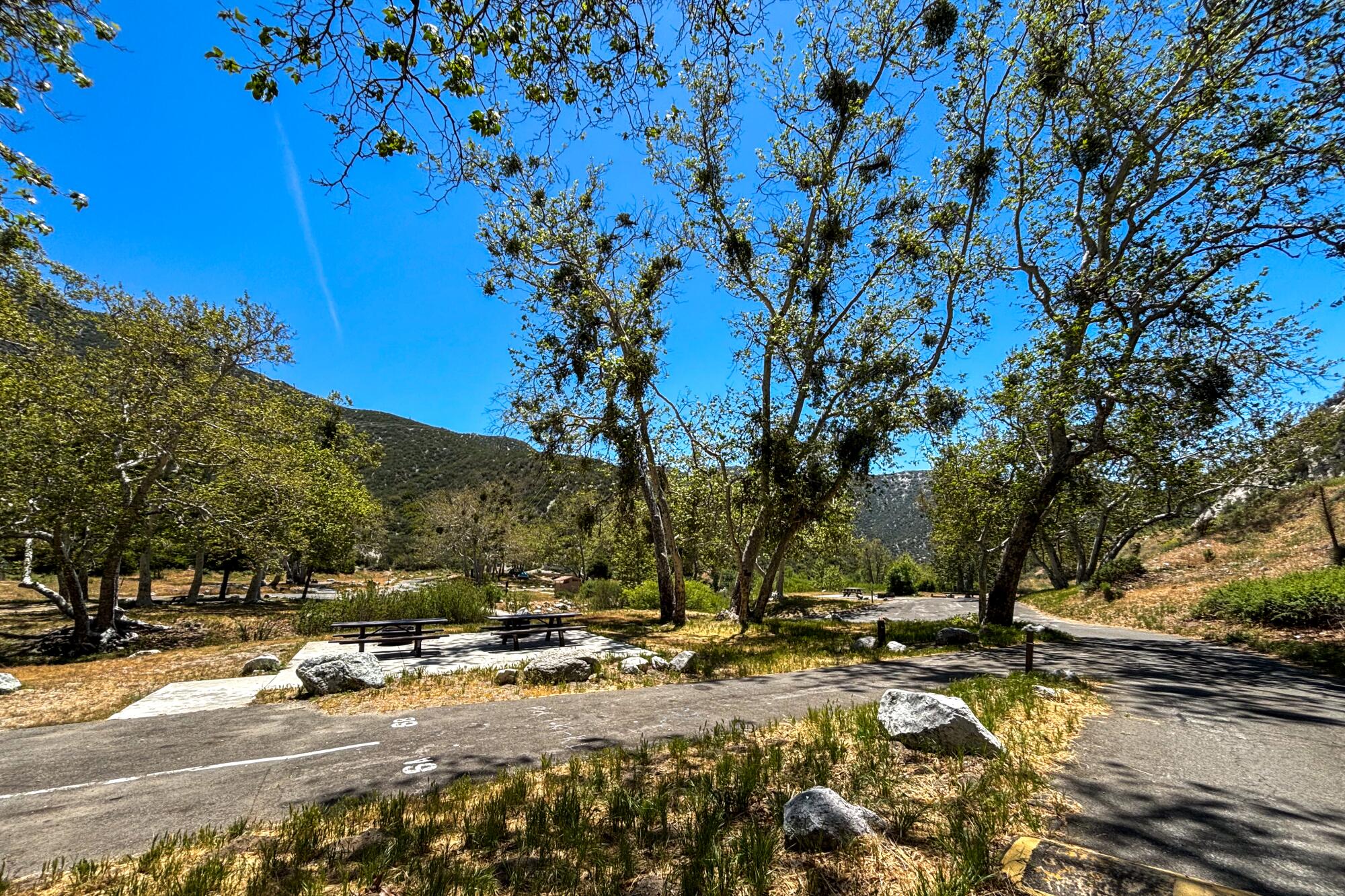
It has 19 individual drive-in sites, including some with large shady sycamore trees. A small creek runs through the middle of the campground and has small pools to splash in. Drive 2½ miles south to the nearby Hidden Springs Picnic Area for more swimming.
Monte Cristo Campground
For emergencies, the Monte Cristo Fire Station is nearby, and the Clear Creek Fire Station is a 10-mile drive.
The relatively short drive in is a double-edged sword. On one hand, you can get there quick. On the other, your campground is next to Angeles Forest Highway, meaning you will hear the whoosh of passing vehicles. And the campground is at a low enough elevation, 3,600 feet, that it can get hot in the late spring and summer.
Getting there: Driving north from L.A. on Highway 2, you will turn left, or northwest, next to the Clear Creek Fire Station, onto Angeles Forest Highway. You will follow that road for 10 miles. Enjoy driving through the tunnel. From La Cañada Flintridge, your last chance for last-minute snacks (and batteries), it’s about a 35-minute drive. Because of the site’s popularity, it’s best to leave early on a Friday to snag a spot and avoid Highway 2 traffic.
Crystal Lake Rec Area Campground
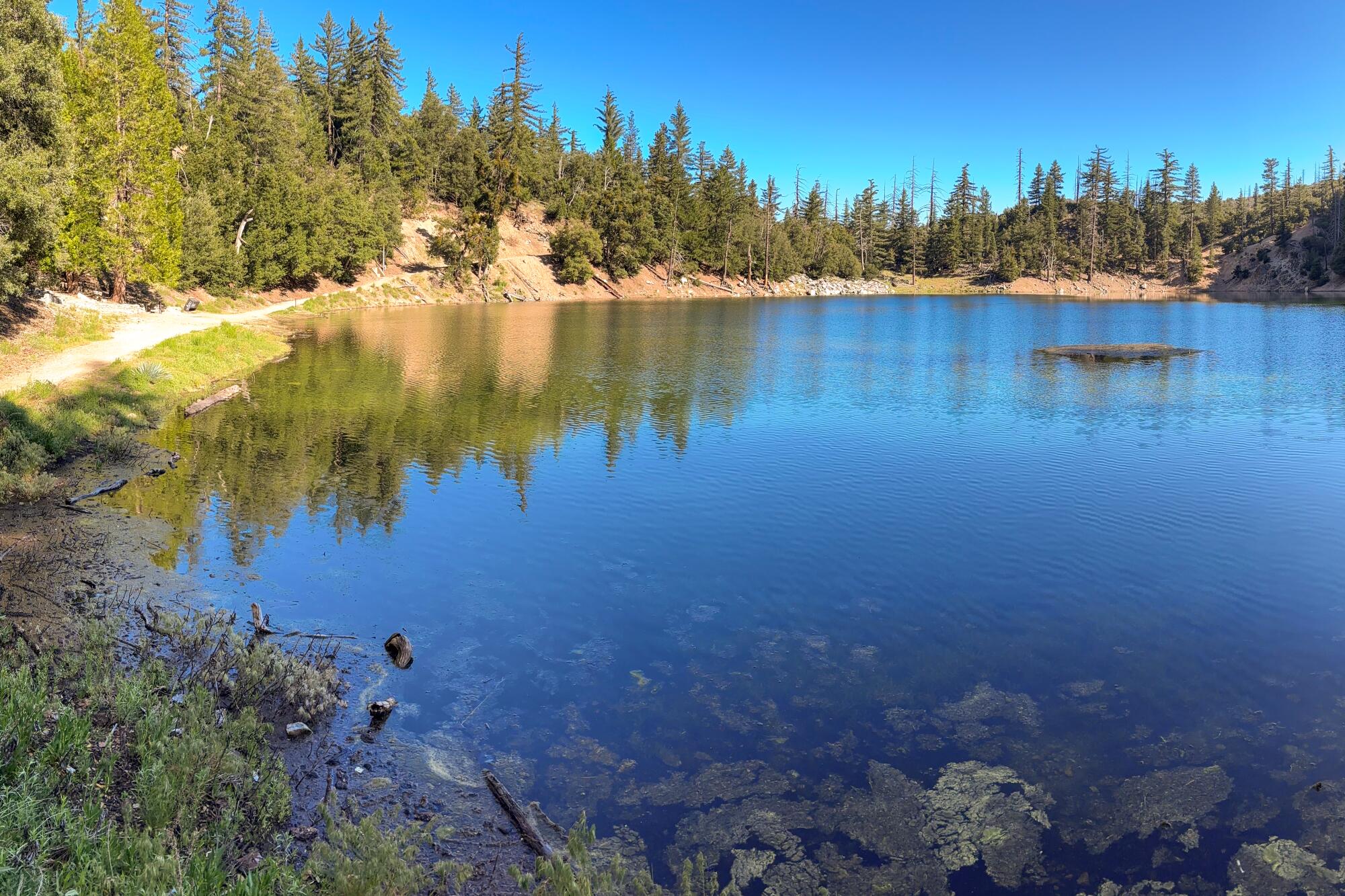
Up, up, up along Highway 39, north of Azusa sits Crystal Lake Rec Area Campground, which has five open loops with 50 total campsites.
The campground’s name is a bit of a misnomer, as you do not camp at the lake or near its shore. Instead, the campground sits about a mile northeast of the lake. You can either hike or drive there, although neither path is wheelchair-accessible. You’re not allowed to swim in the clear blue waters of Crystal Lake, but you can fish or walk around it and, of course, admire it. On a recent visit, I appreciated the shade of nearby oak and cedar trees as I watched a small fish, likely a trout, swim about.
Crystal Lake Rec Area Campground
The Crystal Lake Cafe is in the campground area and is generally open every day but Tuesday from about 7 a.m. to 5 p.m. Its menu includes breakfast burritos, burgers and, for the vegans, a peanut butter and jelly sandwich. Lots of snack options inside. Cafe owner Adam Samrah lives nearby and told me that he keeps the cafe open longer if he has a steady stream of customers. (He also has fun videos on his phone of bears who visit the campground, including one named Chili.)
And, if you arrive and are having second thoughts about sleeping outside, Adam has three cabins near the cafe that he’ll happily rent to you for $350 a night.
Getting there: Take Highway 39 north of Azusa to the Crystal Lake Recreation Area. This drive offers incredible views of nearby mountains, and the valley below is full of wildflowers in the spring — though it’s not for the faint of heart! Highway 39 is curvier (read: more dangerous) than Angeles Crest Highway. Drive with caution and care.
Chilao Campground
At 5,300 feet elevation, Chilao Campground provides both a high-desert and a forest vibe. It comes with a soundtrack of the wind breezing through nearby valleys — a peaceful whisper through this serene landscape.
Chilao Campground
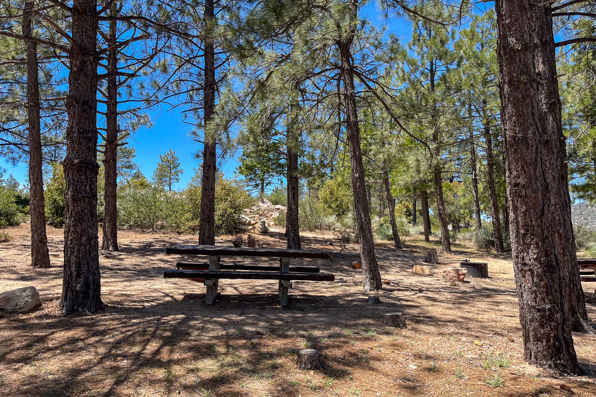
The campground has 84 drive-in sites and is divided into two loops: Manzanita and Little Pines.
Manzanita Loop is more desert-like. It has large rocks and boulders that are fun to climb on, as long as kiddos and kids at heart remain snake-aware. You’ll spot wildflowers, chipmunks and other ground friends, and take in sweeping views of the surrounding forest. Because of how this loop is laid out, campsites either come with shade or a great view. A few lucky campers might snag one with both.
Little Pines is more forest-like, and aptly named for all the small and medium pine trees that fill its campsites. It offers more shade and hammock-hanging opportunities than Manzanita, and is a great spot to kick back, read a book and forget about your phone.
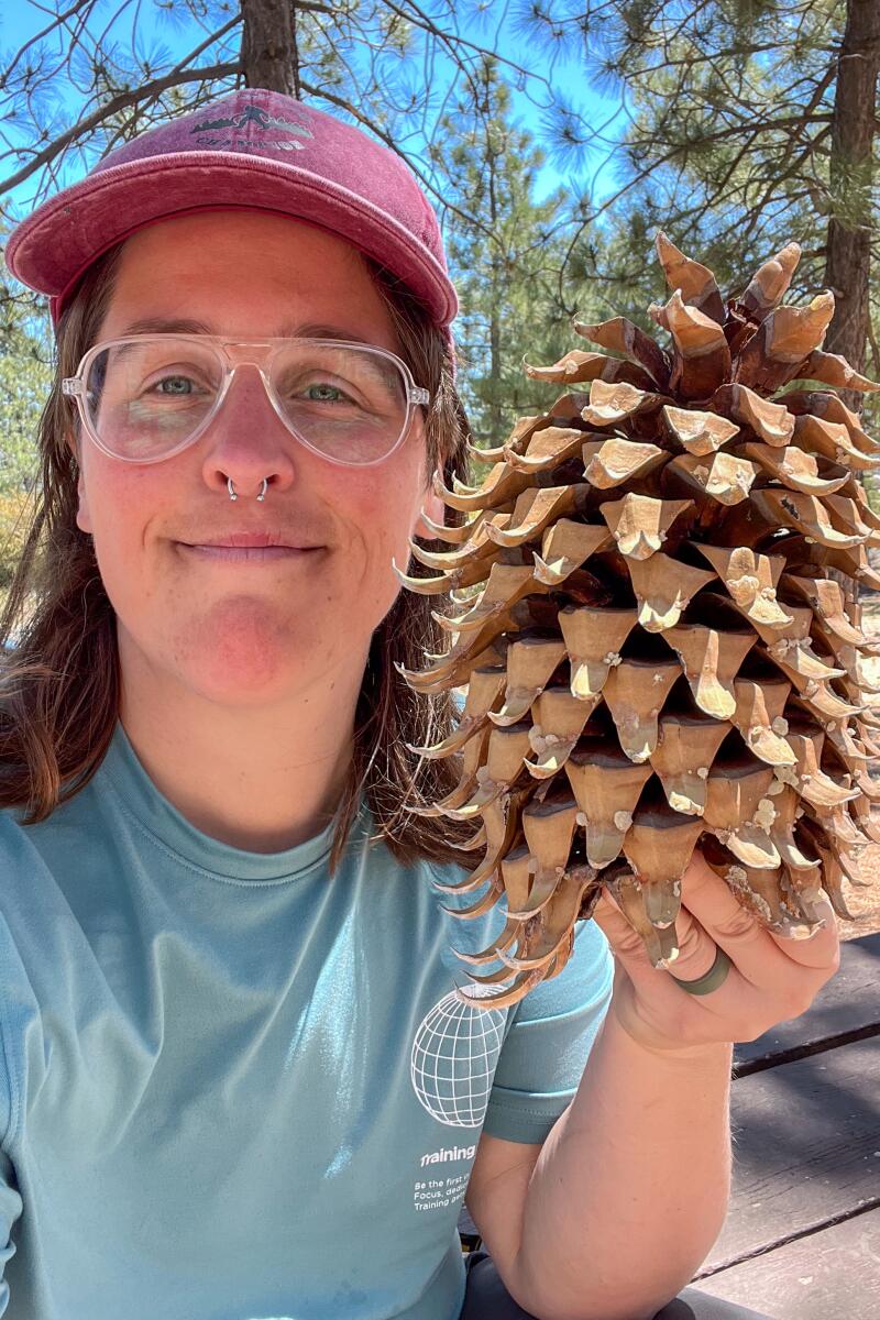
A giant pinecone at Chilao campground.
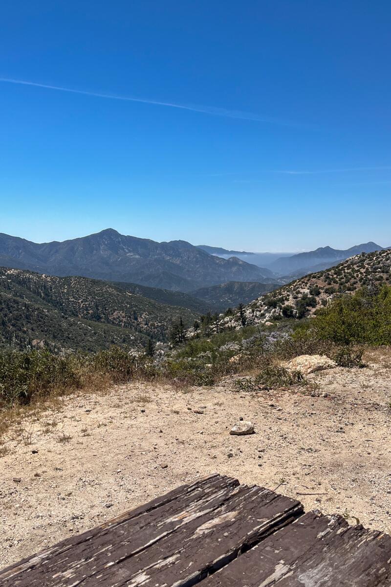
Chilao campground. (Jaclyn Cosgrove / Los Angeles Times)
The Chilao Visitor Center is nearby and open on Saturdays and Sundays from 10 a.m. to 3 p.m. It has a self-guided trail with exhibits and is a great spot for bird watching.
A word of caution: Watch your head, especially on a windy day. The Coulter pine trees in the area produce heavy, prickly pine cones, nicknamed “widow-makers.” They weigh about five pounds (or more) each, and could cause serious injury when falling from a tree.
Getting there: Because part of Angeles Crest Highway (Highway 2) remains closed, you will need to take a detour to arrive at Chilao. Please be mindful that Google Maps might suggest a route that sends you on a closed, dirt or generally rough road. That is not recommended.
Instead, from Los Angeles, take Highway 2 north until you reach the Clear Creek Visitor Information Center and fire station. Turn left (or northwest) onto Angeles Forest Highway. Drive about 8½ miles, and just past the Monte Cristo Fire Station, you will turn right (or south-ish) onto Upper Big Tujunga Canyon Road. You will drive about nine miles before reaching Highway 2 again. Turn left (or east) onto Highway 2. You will reach Chilao Campground in about seven miles.
For the REI co-op member who wants some quality dirt time (intermediate)
An interior designer might call these intermediate-level campgrounds “rustic.” They’re primitive, with only the bare essentials available. You’ll either have to bring your own water or filter it from a nearby creek. But thankfully each site does has toilets, so no need to pack your poop shovel.
These three sites are remote. The drive to two of them requires navigating mountain roads. They should provide the serenity you’re seeking, without requiring you to pack in and hike to your final destination. You’ll also get a sense of satisfaction for roughing it. Or at least that’s what you’ll say to your co-workers at your Monday morning meeting.
Oak Flat Campground
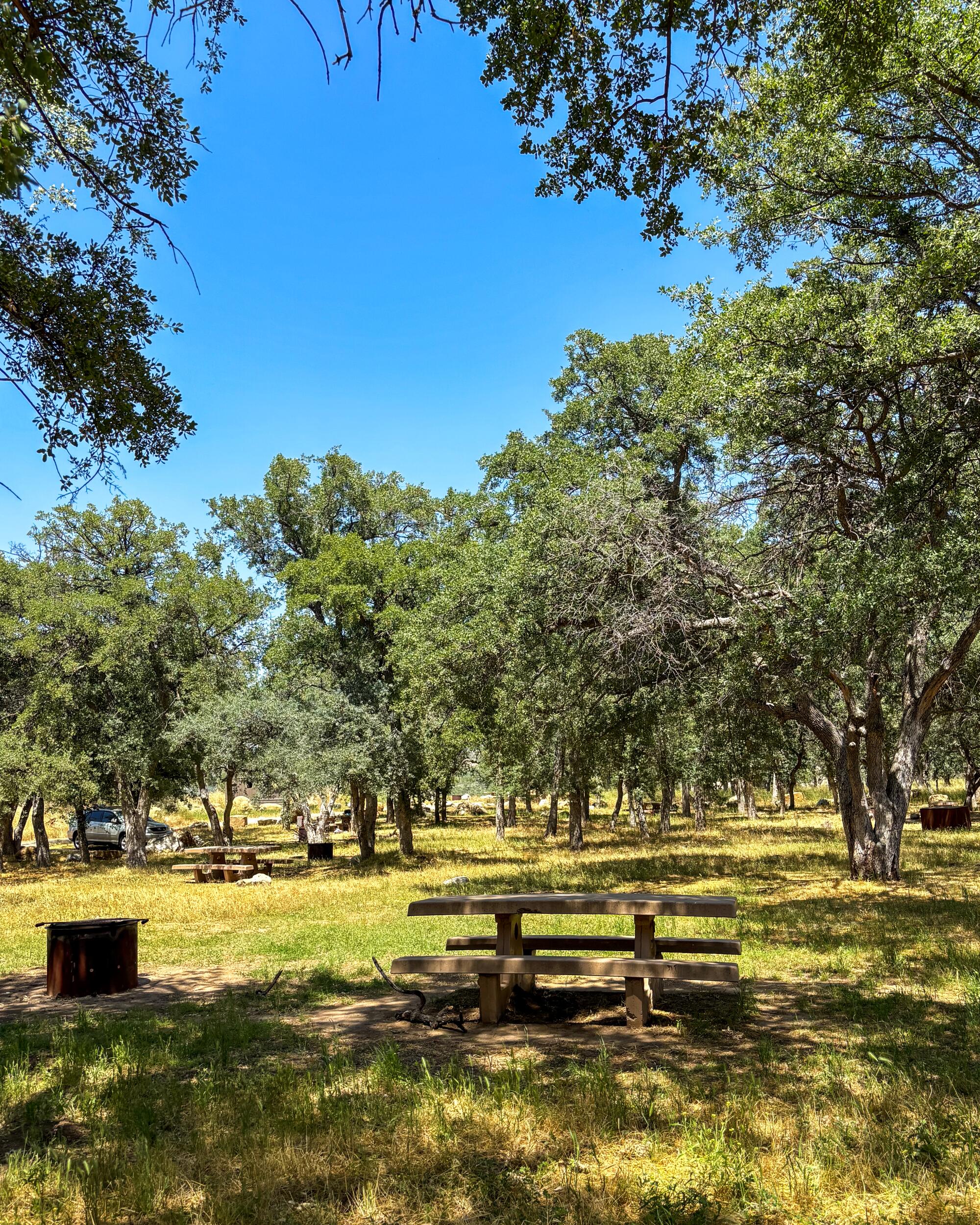
Oak Flat Campground has 20 sites situated around a nice small meadow shaded by several oak trees.
Oak Flat Campground
This is an ideal spot for hanging out with friends or swaying in a hammock. It has enough space for an impromptu ultimate Frisbee tournament or a game of tag. On a recent trip, I noticed one camper meditating in his tent as woodpeckers fluttered about. Unless some turkey with a boombox is next to you, the vibe here is peaceful. Just beware of rattlesnakes.
Insect repellent is a must. When I visited, a swarm of small flies descended on my face as soon as I got out of my car. The 5 Freeway is nearby, so you may hear some traffic. ( One camper told me she didn’t notice it in the evening.)
Getting there: It’s a straightforward drive to this campground. Grab your last-minute snacks in Castaic because there aren’t any convenience stores in proximity to the campground.
Sawmill Campground
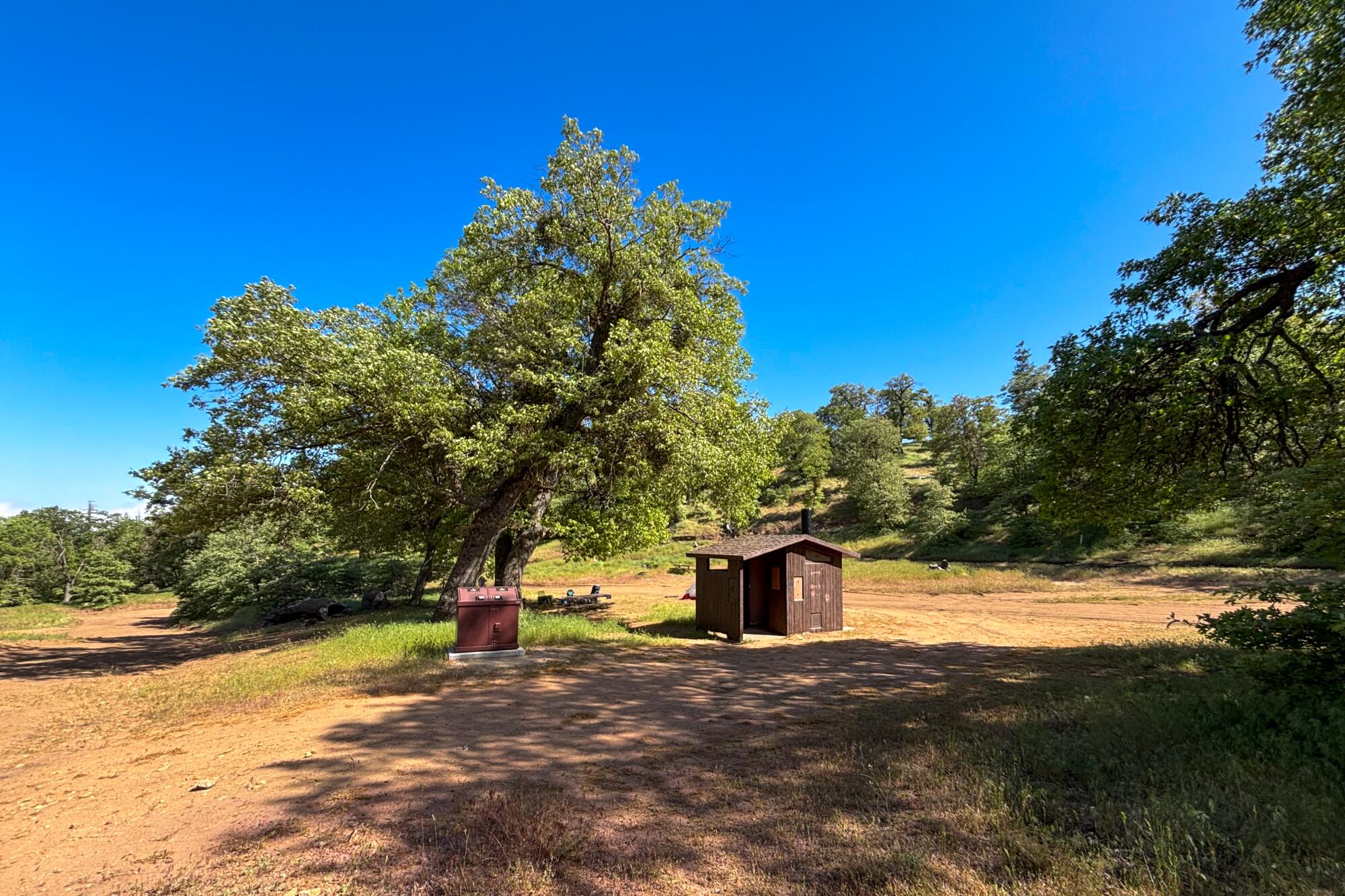
Sawmill Campground is a bare-bones spot where you’ll feel like you’re in the middle of nowhere — because you kind of are! Situated at 5,200 feet elevation, you can sit at your site’s picnic table, waiting for your food to cook at your campfire ring, and appreciate wide views of the Antelope Valley below. And maybe, without Wi-Fi or cell service, you can finally finish that novel you’ve been working on for the last few years. Or at least the latest book you’ve been reading.
This eight-site campground is close to the Pacific Crest Trail, meaning you have a great option for a day hike, and you’ll likely meet thru-hikers from all over the world in the spring and summer.
Sawmill Campground
Getting there: Navigating to this site is a little tricky, and Google Maps might suggest a route that’s closed. From the small community of Lake Hughes, your last stop for snacks, take Pine Canyon Road about five miles northwest to Forest Route 7N23, a dirt road. If Google Maps takes you to a horse ranch, you’ve missed your turn. Once on Forest Route 7N23, you will drive up, up, up around sharp corners and at times steep hills before reaching a sign for the campground. Going with a group? Let your most responsible friend (who isn’t afraid of heights) drive.
The Forest Service recommends high-clearance vehicles, but as of this writing, the road was nicely graded and was doable in a car with six inches of ground clearance. That said, use your best judgment when recreating.
Coldbrook Campground
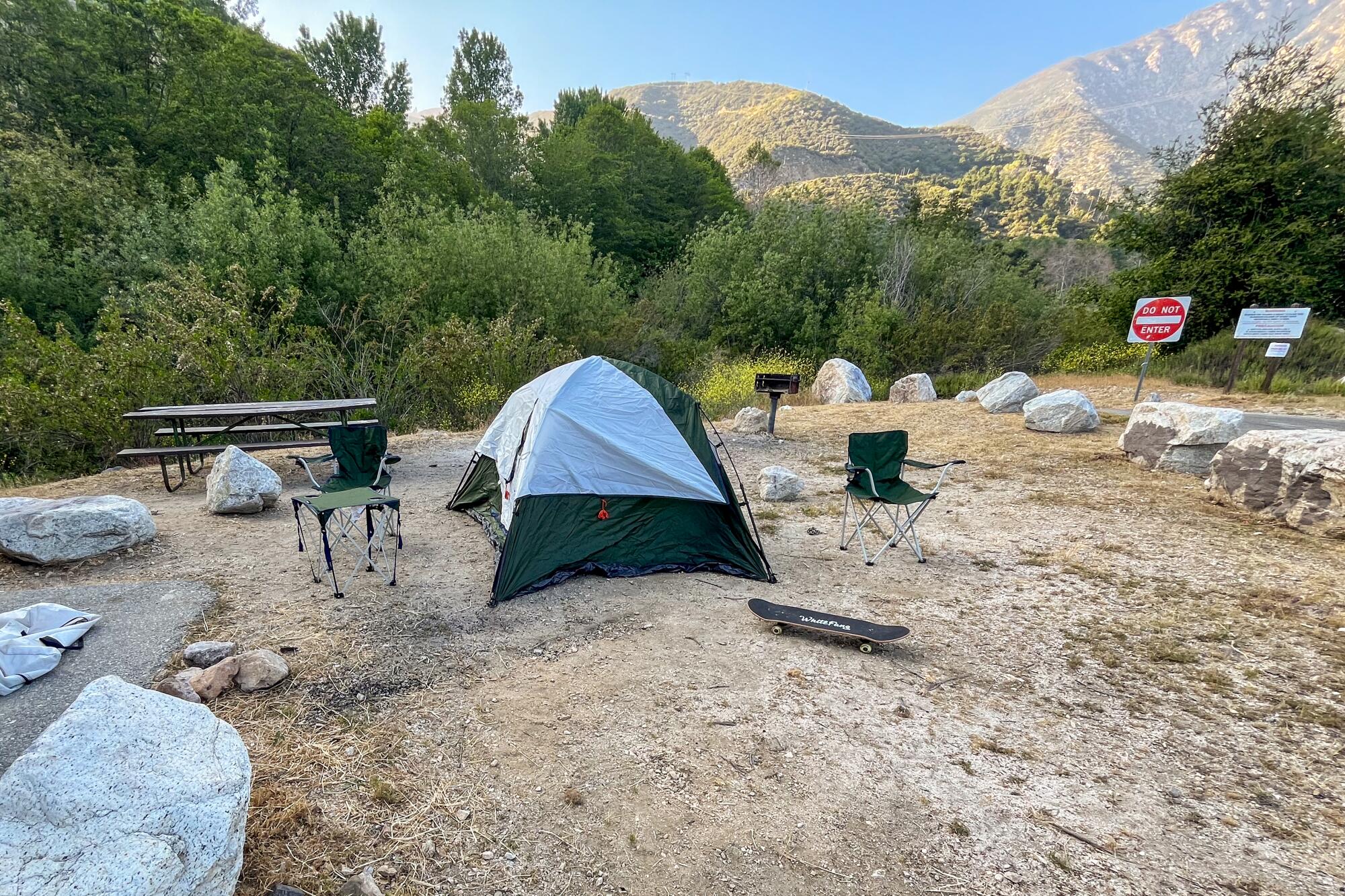
Coldbrook Campground sits on the north fork of the San Gabriel River, where visitors can splash around its cool waters. Its 22 campsites offer shade and the relaxing sound of the river flowing nearby. At some of them, you can easily hang a hammock next to the river for a satisfying nap or meditation.
Coldbrook Campground
If this popular campground is full, you can drive about eight miles north on Highway 39 to the Crystal Lake Rec Area Campground and try to snag a spot in that 50-site campground.
Getting there: Take Highway 39 north of Azusa to this site at mile marker 32.18. This drive offers incredible views of nearby mountains and the valley below, is full of wildflowers in the spring and — is not for the faint of heart. Highway 39 is curvier (read: more dangerous) than Angeles Crest Highway. Drive with caution and care.
For the consummate peak bagger searching for new bragging rights (advanced)
All right, folks. This is where things get interesting. These advanced-level campsites require you to either hike or, in one case, bike in. You will need to pack in and out everything you need. At two of the sites, you will either need to bring your own water or filter water if streams are still flowing.
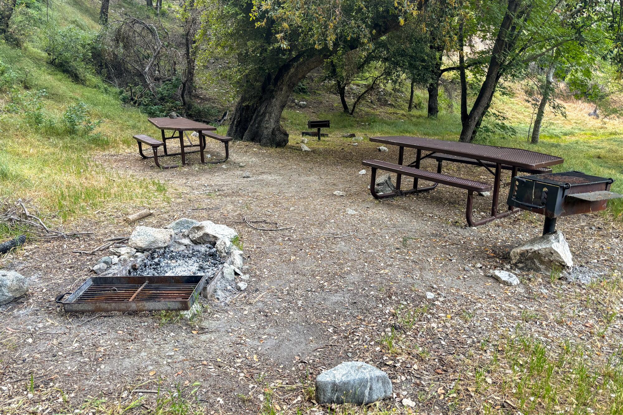
If you’re a hiker who is backpacking curious, this list is for you. If you’re a backpacker who needs a quick trip to the wilderness or you will vomit rage at the next person to say “Can you guys hear me?” on a work Zoom, this list is also for you.
Glenn Camp Campground
The Glenn Camp Campground would be a great practice run for those who’ve been flirting with the idea of bike-packing. To reach this 10-site campground, you can either hike or bike about seven miles from the West Fork trailhead and parking lot. This mostly paved path runs alongside the West Fork of the San Gabriel River.
Glenn Camp Campground
After a nice rainfall, waterfalls stream down the hillsides, providing a great place to cool off. Deer, squirrels and other animals are easy to spot.
Each site has a picnic table, grill and campfire grate. Make sure to bring a bear-proof canister, as the campground doesn’t provide bear boxes.
This area is popular among fishers and those wanting to swim in the river, so have clear expectations of when you’ll be able to find a parking spot. There are two parking lots when you arrive, one smaller lot that will lead you right to the paved path and a larger lot with 45 spots. You’ll need to carry your bike down a short set of stairs from this lot to the path.
Getting there: Take Highway 39 north from Azusa and park at one of the West Fork lots or elsewhere where permitted.
Cooper Canyon Trail Camp
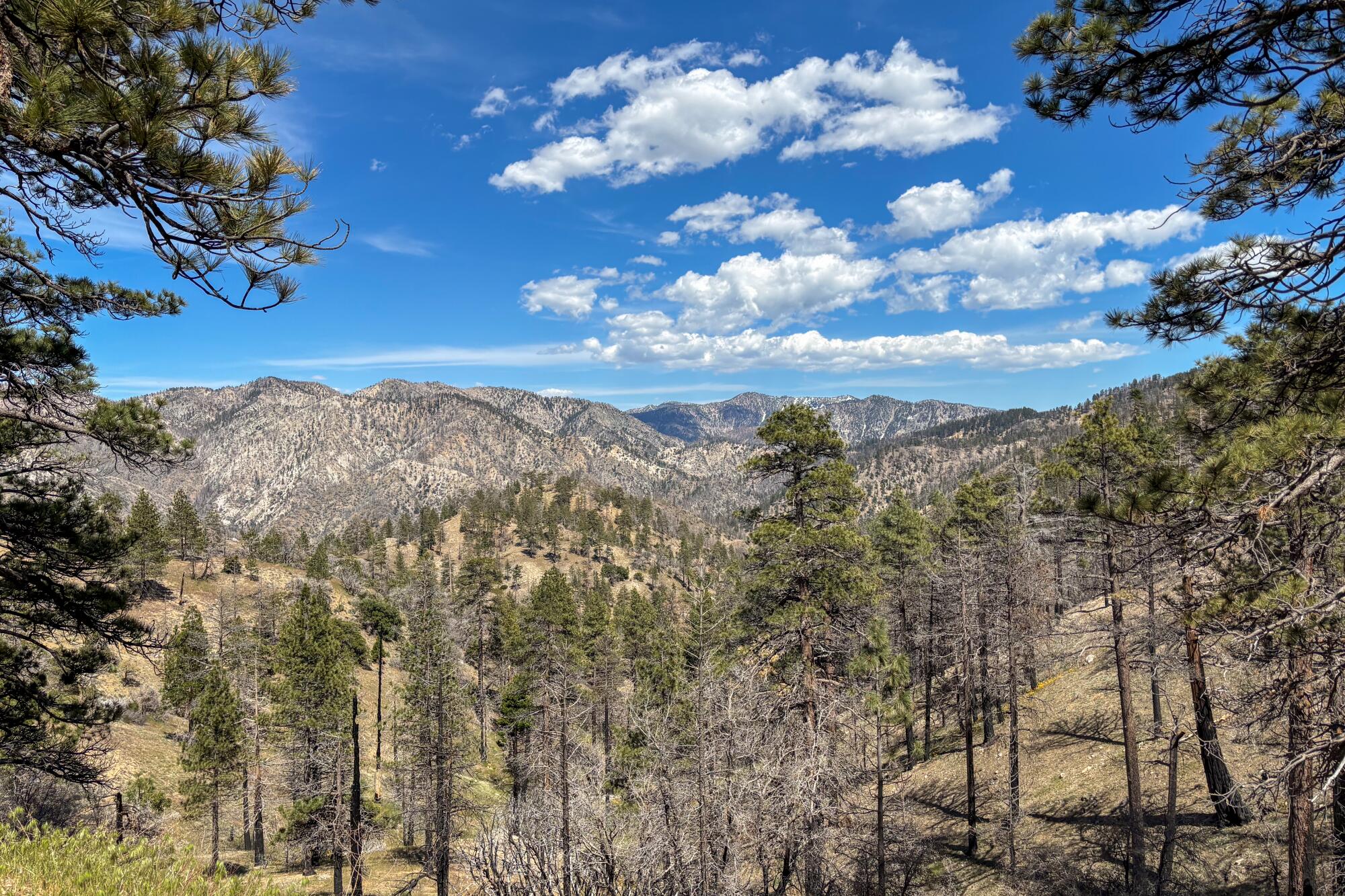
The Cooper Canyon Trail Camp is a hike-in campground in the heart of the forest. It has five sites and sits next to a stream with multiple pools to take a dip in. It has old-school camp stoves, campfire grates and family-style picnic tables.
To reach the campground, you can park at the trailhead of the Cloudburst Summit, which is open, and hike 2½ miles along the Pacific Crest Trail to the campground. For a slight shortcut, you can take the fire road, 3N02, either starting at the trailhead or about a mile in, when the trail forks.
Although there are other options, such as the Burkhart Trail, to reach this campground, this route is downhill, providing a nice reprieve if your pack is heavy. Along the way, you’ll likely spot wildflowers, like lupine. If you’re lucky, you’ll see a snow plant.
Cooper Canyon Trail Camp
Because this campground is on the PCT, you will meet thru-hikers from all over the world. In spring and summer months, people stream from Mexico and Canada into Southern California to complete this 2,650-mile journey.
Planes do fly overhead, so you won’t have complete silence (a rare thing in our world!). Be cautious hiking this area on a windy day. There are several trees that were burned in the 2020 Bobcat fire that could get knocked down with an especially strong gust.
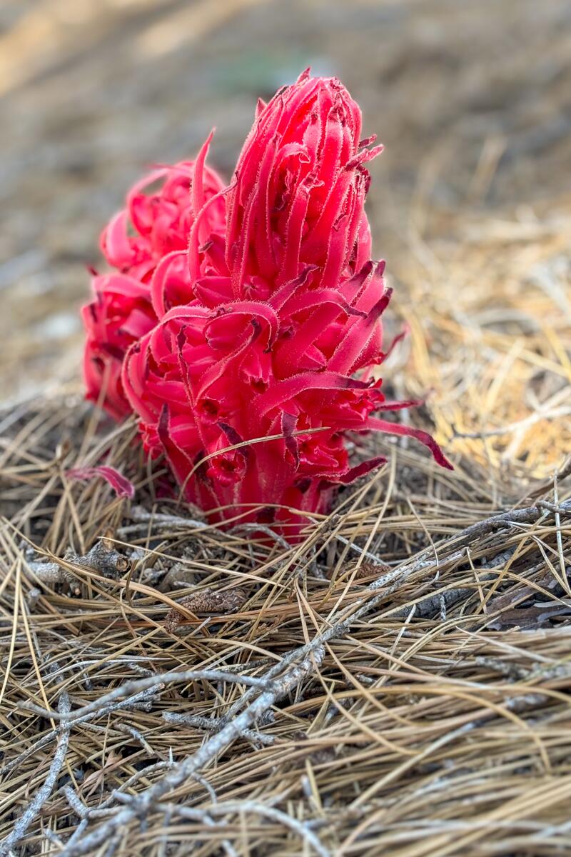
If you’re lucky, you might see a snow plant at Cooper Canyon Trail Camp.
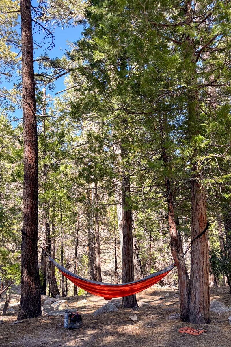
Cooper Canyon Trail Camp provides some good hammock-hanging trees. (Jaclyn Cosgrove / Los Angeles Times)
Getting there: Because part of Angeles Crest Highway (Highway 2) remains closed, you will need to take a detour to arrive at the trailhead. Please be mindful that Google Maps might suggest a route that sends you on a closed, dirt or unmaintained road. That is not recommended. Instead, from Los Angeles, take Highway 2 north until you reach the Clear Creek Visitor Information Center and fire station. Turn left (or northwest) onto Angeles Forest Highway. Drive about 8.5 miles, and just past the Monte Cristo Fire Station, you will turn right (or south-ish) onto Upper Big Tujunga Canyon Road. You will drive about nine miles before reaching Highway 2 again. Turn left (or east) onto Highway 2. You will reach Cloudburst Summit in about 14½ miles.
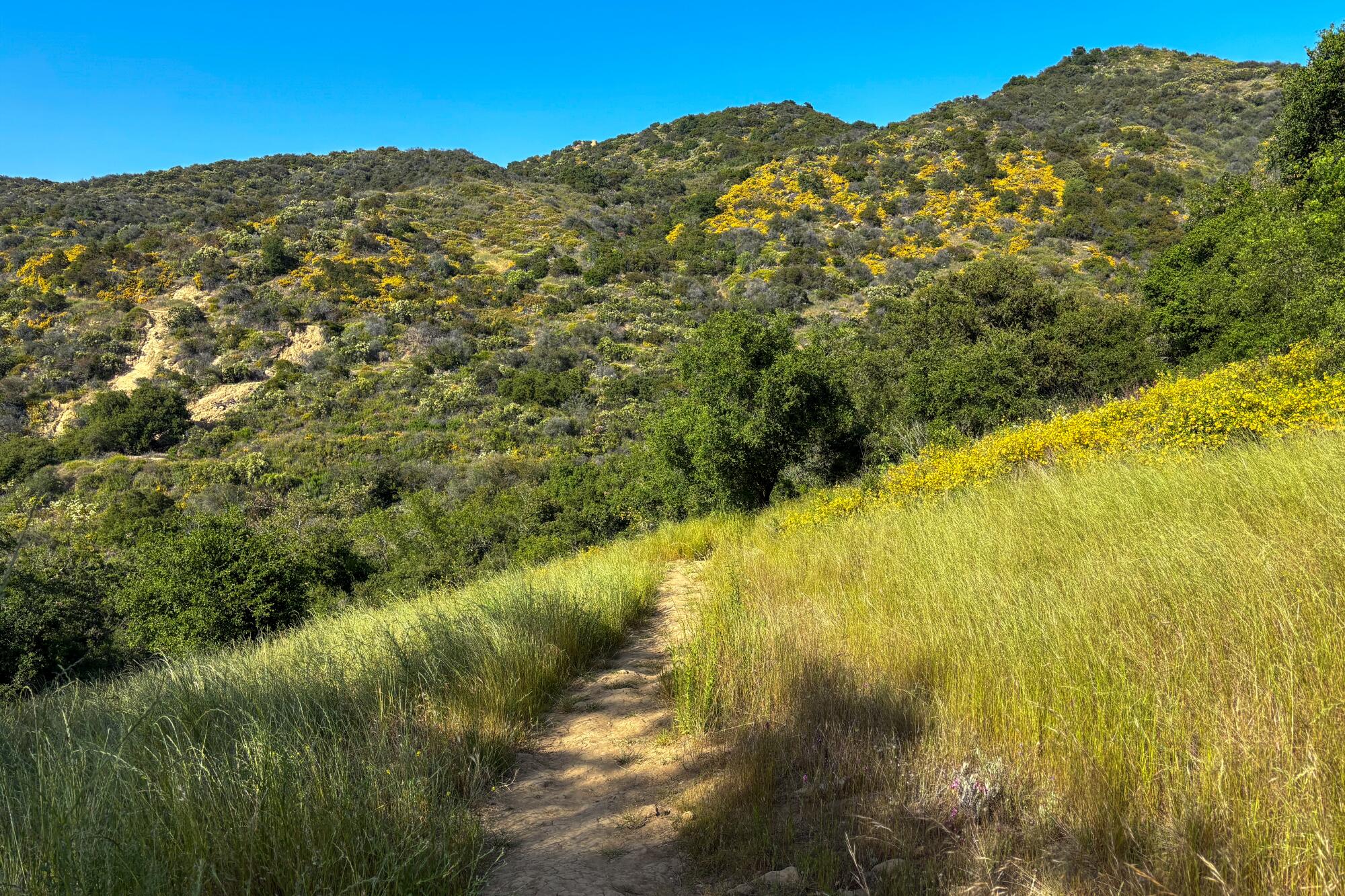
Musch Trail Camp
When I arrived at Musch Trail Camp I was surprised to discover flushing toilets, a water fountain, spigot and sinks. Consider this backglamping.
Musch Trail Camp
To reach the campground, you’ll hike a mile of the moderate Musch Trail from the Trippet Ranch parking lot of Topanga State Park. There are at least eight signs along the way telling you that dogs are not allowed on the trail, so do not bring one!
Along the way, you might spot wild blooms like the sticky monkey flower, canyon sunflower or golden yarrow. Watch where you step, as western fence lizards — and likely rattlesnakes — live here too. Lucky hikers might even spot a Pacific tree frog, especially near the small pond at the start of the trail.
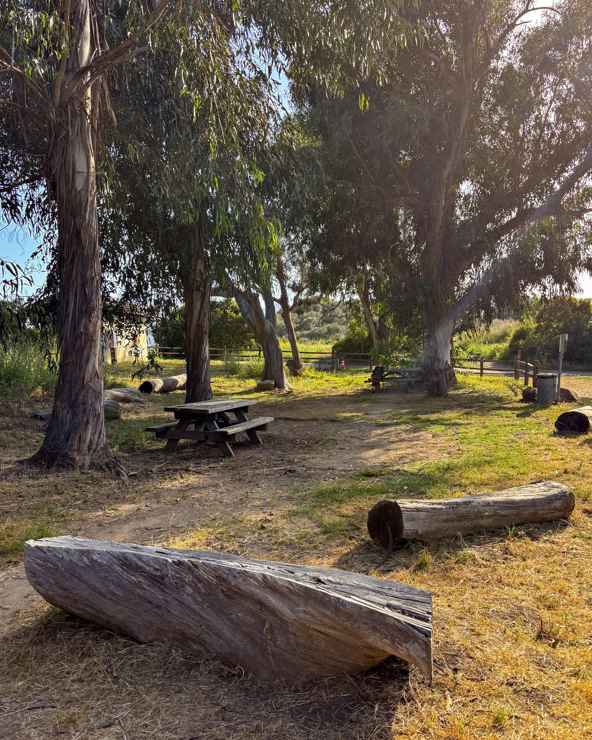
The campsite itself has room for eight tents. Once you arrive, sit quietly at the picnic table and you’ll start to feel like Snow White as various critters emerge. Rabbits shuffle out of the brush to nibble on grass. Quails flutter by, in a hurry to somewhere. Hummingbirds buzz overhead. A mole eyes you suspiciously.
This is the only spot on this list where campfires are never allowed. Plan accordingly, as it can get chilly this close to the ocean.
This place is a slice of heaven. Please treat it as such.
Getting there: After parking your vehicle at Trippet Ranch in Topanga State Park, take the Musch Trail about a mile to the campground.

We’re lucky to live in a place so close to nature. And now you have all the resources you need to find a last-minute spot to pitch a tent. Go forth, ease your feet into the dirt and unwind in the woods. You’ll be sure to return to the city with a perspective shift.
More to Read
Sign up for The Wild
We’ll help you find the best places to hike, bike and run, as well as the perfect silent spots for meditation and yoga.
You may occasionally receive promotional content from the Los Angeles Times.

