After a dry winter, the outlook calls for a wet start to April in all of California
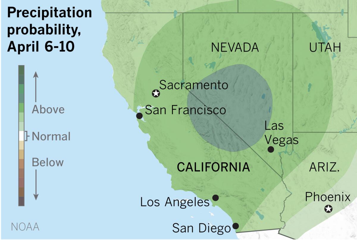
An extended forecast for California shows an above-normal probability of precipitation during the week of April 6-10, according to the National Oceanic and Atmospheric Administration’s Climate Prediction Center.
After a disappointingly dry winter that has left most of the state with below-normal precipitation, that’s good news, although it would take a lot of rain and snow to make up for the shortfall.
“This is a decent storm system,” said senior meteorologist Todd Hall with the National Weather Service in Oxnard. “It’s cold with potential for snow in the Sierra.”
The above-average probability of precipitation continues into Easter week, and the extended outlook also calls for below-normal temperatures during the period.
April isn’t one of the big three wettest months in California — those are January, February and March — and downtown Los Angeles normally gets less than an inch. But Hall says this storm could drop a half-inch on downtown Los Angeles.
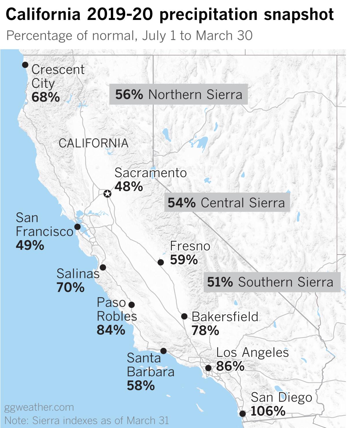
The effects of the dry winter are evident in many of California’s reporting stations. San Diego is a bright spot, having received 9.87 inches since July 1. The normal by March 30 is 9.33, so that puts San Diego at 106% of normal. A few other locations in Southern California are also above normal: Thermal has 175%, having received 5.42 inches to date when its normal is 3.09. Needles stands at 165% of normal, with 7.03 inches — 2.76 inches more than normal. Lancaster, with 1.58 inches more than normal, is at 123% of normal to date. A few other spots in the Southland are near or slightly above normal, but that’s pretty much where the good news ends.
Northern California, which got some relief in March, still is far behind normal. Sacramento and San Francisco are at 48% and 49% of normal to date, respectively. In other words, both have received lass than half of the rainfall they would normally receive. The Sierra Nevada reporting stations are all hovering around half of normal — with the Northern Sierra 8-Station Index at 56% of normal. This is an area where watersheds supply the state’s biggest reservoirs.
The state’s reservoirs are generally in good shape, but continuation of long-term drought doesn’t bode well for the future, especially the fire season.
Even Crescent City, which is normally extremely wet with 53.9 inches of rain from July 1 to March 30, is at 68% of normal, having received only 36.9 inches to date. Normal for the full season ending June 30 is 64.03 inches.
So while any rainfall is welcome and beneficial, it is unlikely to relieve drought conditions, especially in Northern California.
More to Read
Sign up for Essential California
The most important California stories and recommendations in your inbox every morning.
You may occasionally receive promotional content from the Los Angeles Times.

