Four points of the compass from city hall
Four views from City Hall
On Jan. 3, 2010, the Los Angeles Times published a special two-page Then and Now story. In 2009, I had located a series of 1951 images taken by Associated Press photographer Ellis R. Bosworth from the top of Los Angeles City Hall. I went up the City Hall observation deck and matched the images. That project helped launch the From the Archives blog six months later.
Since 2010, I’ve found several additional images taken from the observation deck of City Hall. Here’s a sample of these images.
Looking north from City Hall
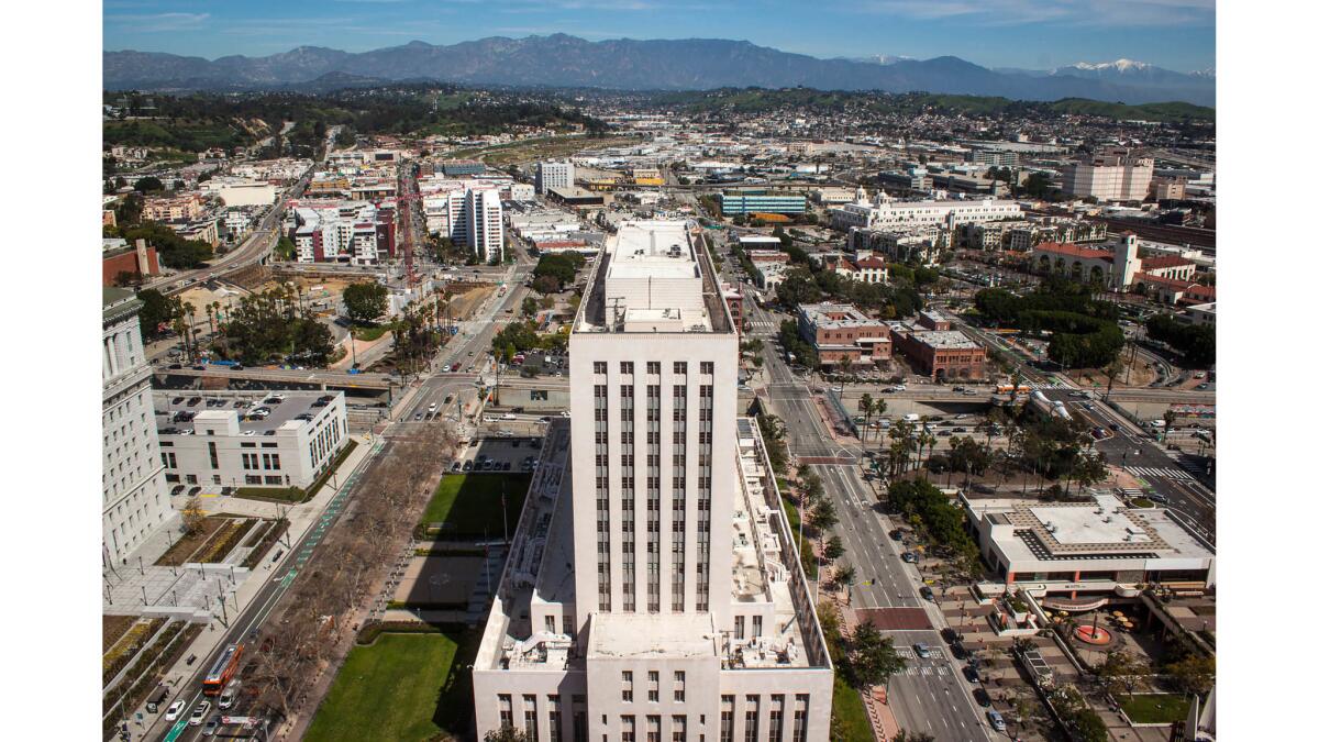
March 7, 2017: The federal courthouse, opened in 1940, sits in the middle looking north. North Spring Street is to the left of the courthouse, North Main Street on the right. Union Station is on the upper right edge.
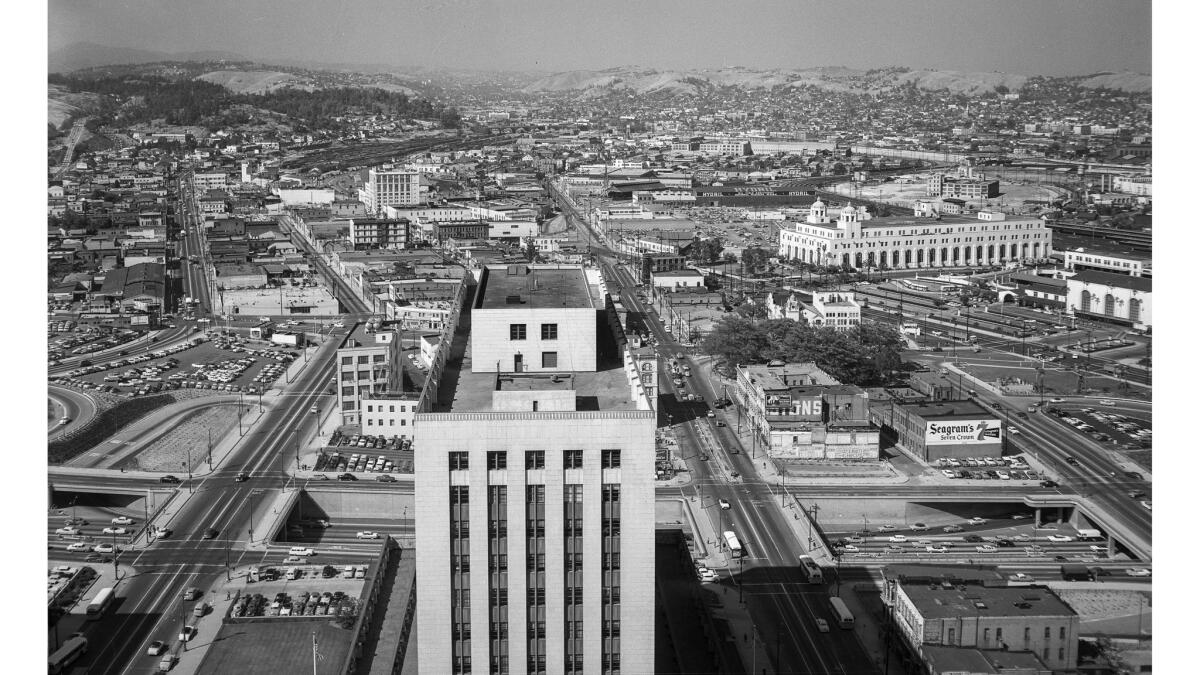
June 3, 1956: In the foreground are the top of the federal courthouse and the 101 Freeway. Off to the right are the clump of trees that is the Olvera Street Plaza and beyond it the post office Terminal Annex. At the extreme left, North Broadway heads toward the tree-covered hills of Elysian Park.
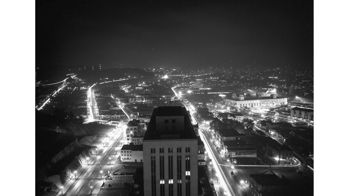
Nov. 1, 1943: Nighttime scene looking north at a dimmed-out Los Angeles in wartime.
Looking west from City Hall
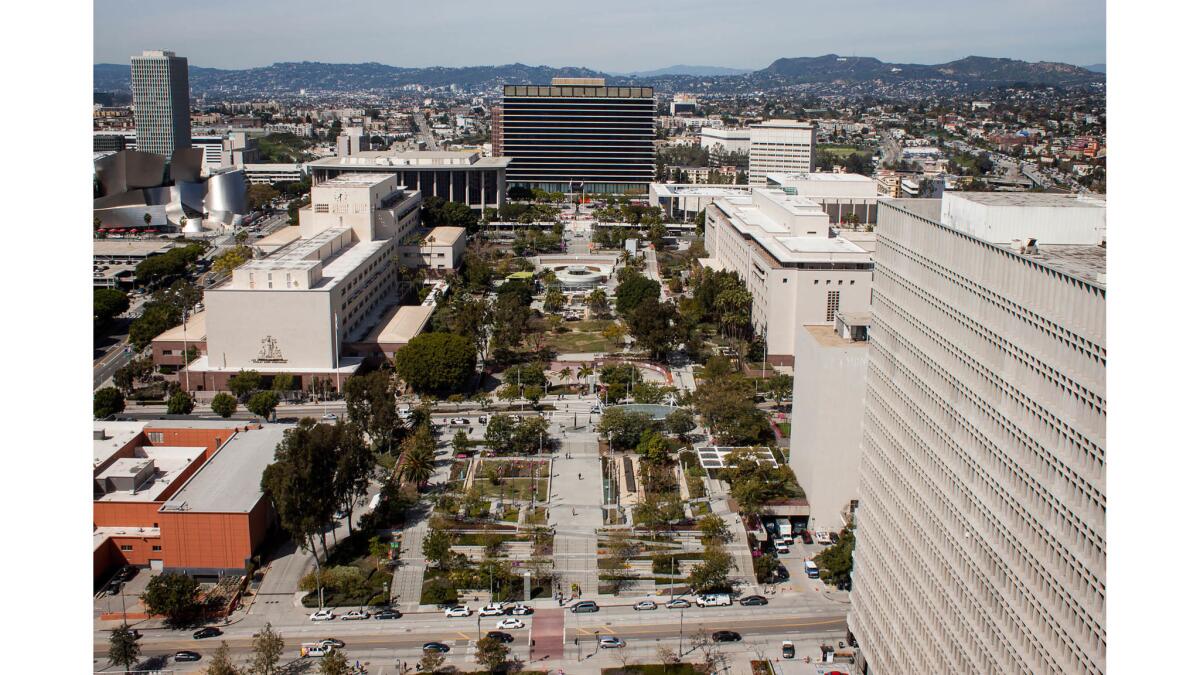
March 7 , 2017: Grand Park stretches out before you, leading all the way to the Department of Water and Power building. The Hollywood sign is barely visible on the mountain at upper right. Disney Hall is upper left.
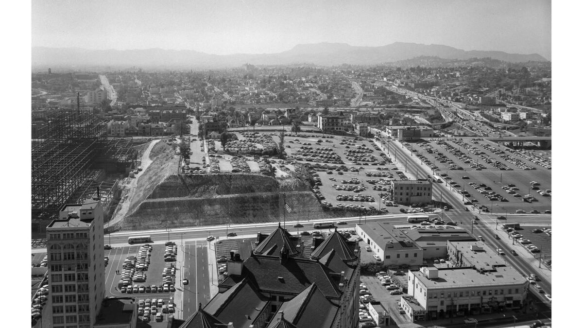
June 6, 1956: The scene looking West is very different here. That's the roof of the old Hall of Records in the foreground. Over at the left is the Law Building and the steel skeleton of the under-construction county courthouse. Beyond Temple Street at right is the four-level interchange of the freeways and, way at the left, Beverly Boulevard goes over Belmont Hill. Hollywood and the Hollywood Hills are out there in the haze.
Looking south from City Hall
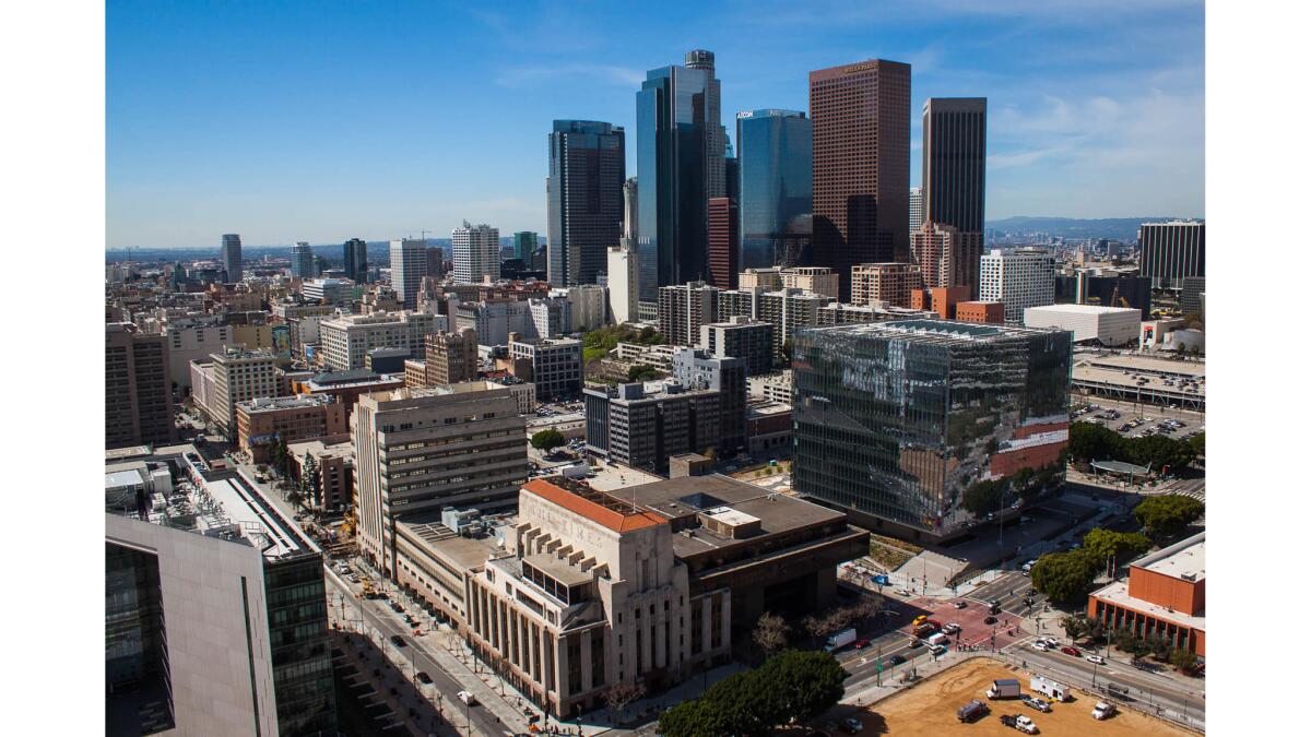
March 7 , 2017: The Los Angeles Times building is in the foreground and the skyline Bunker Hill is clustered beyond.
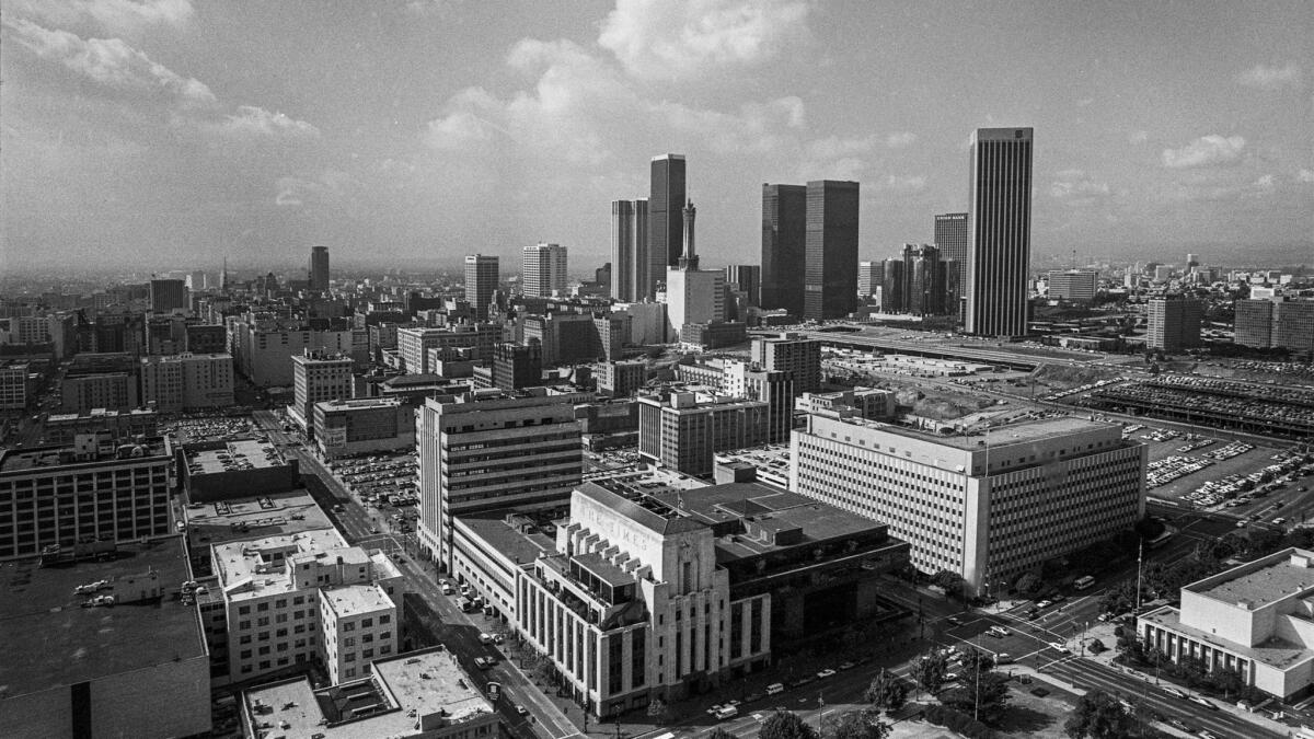
Nov. 8, 1979: The cluster of buildings on Bunker Hill is starting to grow.
Looking east from City Hall
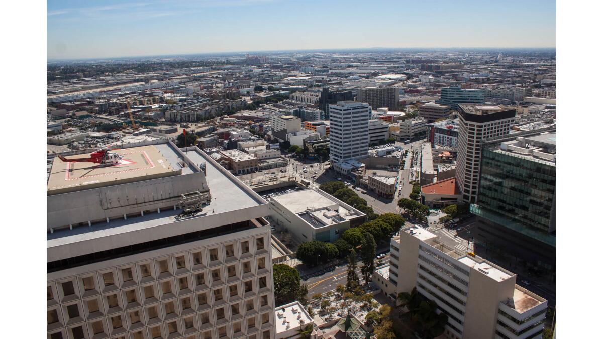
March 7, 2017: The industrial flatland stretching toward the Los Angeles River and rail yards
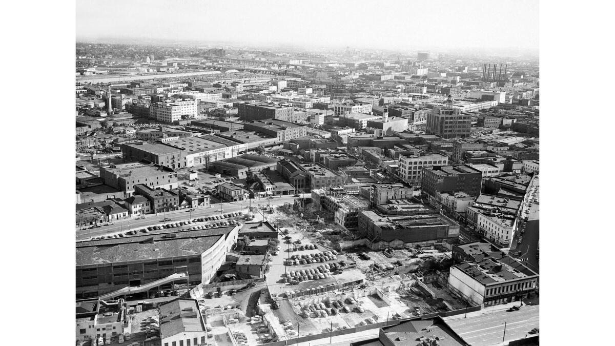
Jan. 12, 1951: Part of the Los Angeles industrial district as seen from the top of City Hall looking east. Bridges span the Los Angeles River in the background.
Over at the old Framework site, I’ve posted a complete 42-photo gallery, Views from the top of Los Angeles City Hall.
Enjoy,
Scott
Sign up for The Wild
We’ll help you find the best places to hike, bike and run, as well as the perfect silent spots for meditation and yoga.
You may occasionally receive promotional content from the Los Angeles Times.


