Opinion: 3 winter storms in the U.S. in a week? They all have a single cause
For Americans who believe in the old proverb that bad news comes in threes, this month’s weather should be no surprise: After two winter storms raked across much of the U.S. in recent days, a third has already started its march as well. These weather systems in rapid succession are unusual but predictable — even without superstition.
The first chapter began on Jan. 4, when a low-pressure system developed over the Sierra, delivering more than a foot of snow at higher elevations. From there, the storm made its way across the country over the next few days, snarling traffic in several Midwestern states and finally hitting the East Coast late on Jan. 6. Moisture pulled in off the Atlantic became almost a foot and a half of snow in upstate New York and interior New England.
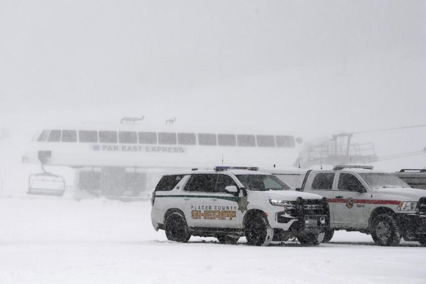
One person was killed and another was injured when an avalanche struck the KT-22 area of the Palisades Tahoe ski resort Wednesday morning, authorities said.
Before the flakes had even started falling in New Hampshire, a second storm was already depositing heavy snow near Lake Tahoe. That storm caused whiteout conditions from New Mexico to Nebraska. Conditions were too warm for snow on the Eastern Seaboard, but ideal for torrential rain and high winds, including several tornadoes in the Southeast.
The final (knock on wood!) storm, which is still ongoing, brought upward of 2 feet of snow in the northern Cascades, along with wind gusts of nearly 100 miles per hour in exposed locations. From there, it swept down the West Coast, bringing several inches of snow and high winds to higher elevations in Southern California. Over the next few days, it is expected to progress across the country in a similar manner to its predecessor: another round of heavy snowfall in the Midwest, more intense rainfall along I-95 and a chance of further tornadoes around the lower Mississippi.
After a worryingly weak start to the winter for California’s mountains, two storms are expected to dump several inches of snow on the Sierra Nevada this week.
The storm’s impacts won’t be over once it moves out to sea, however, because it will also drag cold air in its wake. Temperatures in Southern California are expected to flirt with freezing over the next couple of nights, while the Great Plains states will have lows around minus 15 degrees Fahrenheit for much of next week.
Why has there been so much winter weather within just a few days? Isn’t it incredibly unlikely that, after a December in which only 18% of the contiguous U.S. experienced a “white Christmas” (the lowest rate in at least two decades), all these snowstorms would happen back to back to back? In fact they were very likely, because the storms all have a single cause: waves in the jet stream.
The jet stream is a band of strong winds in the upper atmosphere, which serves as both a guide to weather systems as well as a dividing line between cold Arctic air and warmer air from the subtropics. During December, the jet stream was comfortably situated over southern Canada, meaning that the weather in the U.S. was warm and tranquil. But over the last week, the jet stream has looked like an enormous U, racing down from Seattle through California and the Four Corners before bottoming out in Texas and then traveling back north along the Appalachians. This dip has been bringing frigid air into the middle of the country and acting like a set of train tracks for the continual storms, which draw their strength from the interaction between warm and cold air.
With every snowstorm or blast of cold air, there are those who mutter derisively, “So much for global warming.” It’s possible, though, that in some cases the intensity of winter storms could be related to the planet’s warming trend. The science of the jet stream, winter weather and climate change remains an extremely active area of study. Some have proposed that climate change, which is expected to slow down the jet stream, could also cause more waviness and therefore increase the intensity of winter storms and cold air outbreaks. If this research is borne out, crazy weeks like the one we just experienced will become more common over the coming years.
One aspect of climate change that is far more settled is the effect it will have on mountain snowpack. While the recent storms did bring substantial snow to the Sierra — including in Lake Tahoe, where an avalanche killed one skier and injured three more — measurements taken at the very beginning of January showed that the snow depth in the mountains was only 25% of its normal levels for this time of year.
Before the winter began, many predicted that a strong El Niño could lead to a wet winter for California, but the El Niño pattern this winter has been sharply different from previous events — perhaps because of record warmth across the tropical Pacific — leading to inconsistent effects. Moreover, snowpack is dictated not only by the amount of moisture being deposited, but also by the amount of melt that is occurring. A recent study in Nature found convincing evidence that the ongoing decline in snowpack across the Northern Hemisphere is expected to continue and even strengthen because of climate change. And snow levels are important for much more than winter recreation: Despite some precipitation across the West last winter, the region remains in a historic drought, and snowpack plays a crucial role in water management.
After recent news that 2023 broke global temperature records by a staggering margin, a stretch of wild winter weather can feel like evidence that weather patterns really haven’t changed too much after all. But the effects of climate change are often unintuitive, and the truth is that we are rapidly entering an era when abnormal weather will become the norm.
Ned Kleiner is a scientist and catastrophe modeler at Verisk. He has a doctorate in atmospheric science from Harvard.
More to Read
A cure for the common opinion
Get thought-provoking perspectives with our weekly newsletter.
You may occasionally receive promotional content from the Los Angeles Times.
