Wettest start to an El Niño season in Pacific Northwest as storms hit California
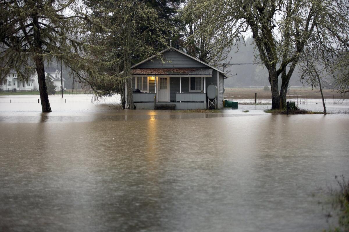
A home is flooded along Oregon 47 from the Nehalem River on Wednesday.
A powerful El Niño continues to gain strength, the latest forecast released Thursday said. And while El Niño rains are still weeks away from hitting California, another weather phenomenon that has exacerbated the state’s drought has lifted, allowing heavy storms to target the Pacific Northwest and Northern California.
“Of all the years in which there was a strong El Niño present in the tropical Pacific Ocean, this is the wettest start to any of those years that we’ve observed in the Pacific Northwest, both in Portland and Seattle,” said Daniel Swain, a climate scientist at Stanford University.
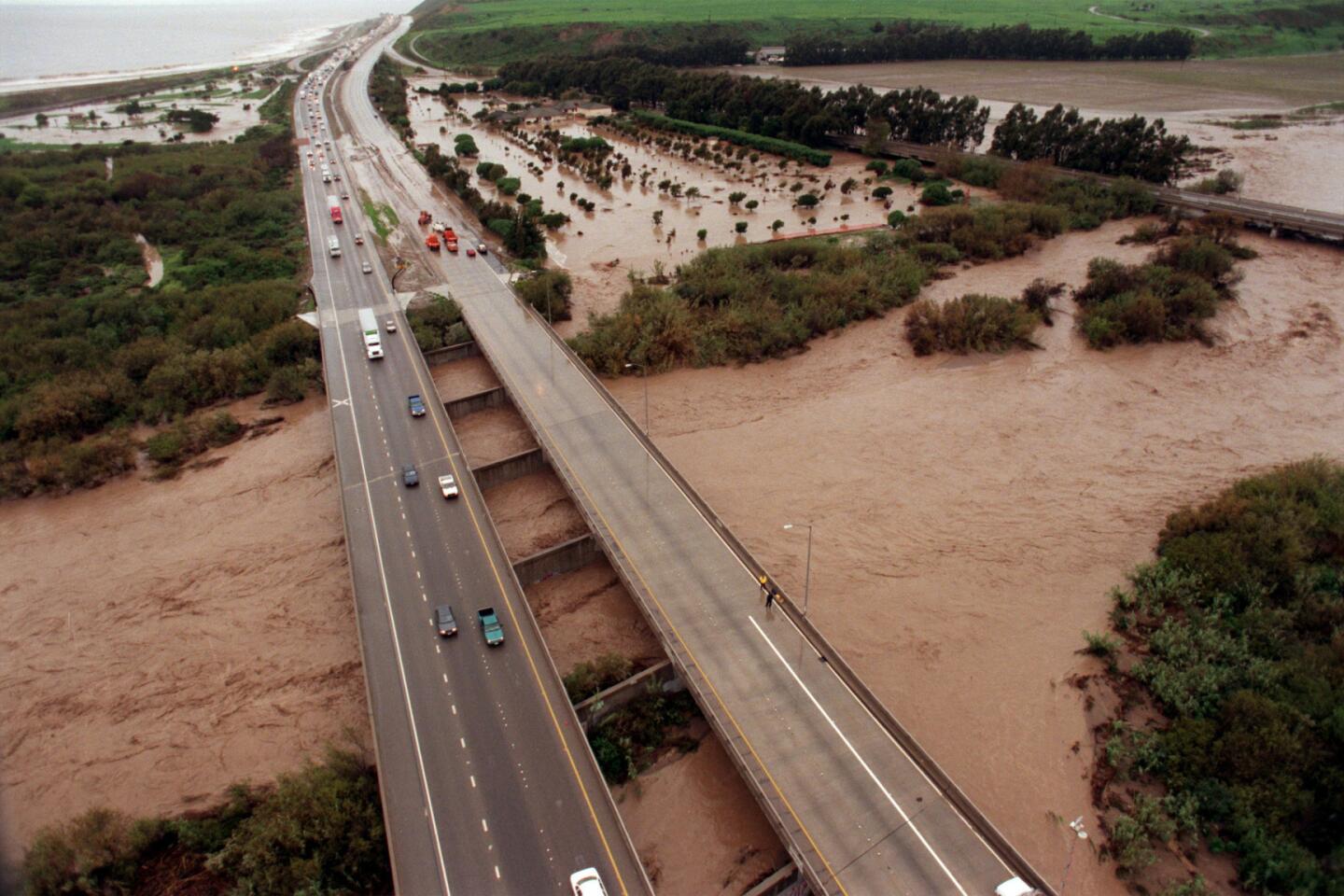
Powerful rains have struck Oregon hard over the past three days, according to the National Weather Service. On Wednesday, one woman drowned when her car entered floodwaters, and another woman was killed after a falling tree crushed her Portland home, according to local news reports.
A photo published in the Tillamook County Pioneer showed the town of Nehalem covered in floodwaters. The newspaper reported that several families have been flooded out of their homes and U.S. 101 was closed there.
A storm system also is targeting Northern California this week. It’s expected to bring as much as 8 inches of rain along the North Coast, 3 inches to the San Francisco Bay Area, and feet — not inches — of snow in the Sierra Nevada mountains over the next few days, climate experts said.
Southern California could see the tail end of this storm by the end of the week, though precipitation here is not expected to be significant.
These heavy rains show that the infamous “ridiculously resilient ridge” of high pressure — the weather phenomenon that pushed storms away from California and fueled years of severe drought — has not returned this winter. The absence of the high pressure mass now allows powerful storms to barrel in from the North Pacific.
The forecast comes as a new report Thursday morning by the National Weather Service’s Climate Prediction Center announced this year’s El Niño is still on track to be one of the strongest on record.
Of all the years in which there was a strong El Niño present in the tropical Pacific Ocean, this is the wettest start ... that we’ve observed in the Pacific Northwest
— Daniel Swain, climate scientist at Stanford University
“The current El Niño remains strong and is likely to stay strong through the winter,” Mike Halpert, the center’s deputy director, said.
This week’s storms in the Pacific Northwest and California, however, are not directly related to El Niño.
“The key season is really still to come,” Halpert said. “California so far has been somewhat normal in the northern part of the state and drier than average in the south.”
But the heavy rains hitting the Pacific Northwest are a preview of the effects of El Niño expected to sweep through California in the coming winter months, said Swain, the Stanford climate scientist.
“These rains are shifting southward,” Swain said. “The northernmost part of California is now starting to get in on it this week, and it will see some decent rains down to the Bay Area between now and Sunday.”
“Even Southern California will see some rain,” he said. “It won’t be particularly significant, but it will rain at some point over the next week.”
Water and Power is The Times’ guide to the drought. Sign up to get the free newsletter >>
For Southern California, the biggest rains of the season won’t be coming for at least a few more weeks — possibly before the end of December; El Niño storms generally peak in California in January, February and March.
Bill Patzert, a climatologist with NASA’s Jet Propulsion Laboratory in La Cañada Flintridge, said the recent storm system clearly shows the breakdown of the drought-causing mass of high pressure.
“This is not an El Niño storm yet,” Patzert said. “The El Niño storms will be riding a subtropical jet stream. It’ll look like a convoy coming straight out of the west.”
Patzert offered another explanation for the storm system hitting the Pacific Northwest: “This is an ‘atmospheric river’ that’s hosing Washington and Oregon,” he said. “It originated near the Philippines and moved in a northeasterly direction. It’s a very narrow band of high moisture.”
But the storm impacts still offer a good preview for California, Patzert said. “In some ways, atmospherically, it’ll be different. But the impact that they’re getting is exactly what we’re expecting in January and February in California.”
El Niño is a phenomenon involving a section of the Pacific Ocean west of Peru that warms up, causing alterations in the atmosphere that can cause dramatic changes in weather patterns globally.
Strong El Niños strengthen the track of winter storms targeting California and the southern United States, while the jungles of southern Mexico and Central America see less rain, and the northern United States, like the Midwest and Northeast, see milder winters.
This year’s El Niño is expected to remain strong through the winter, with a key location of the Pacific Ocean clocking in hotter than ever recorded in at least 25 years, according to the Climate Prediction Center.
The weather pattern already has proved its strength this year in other parts of the world. El Niño has been blamed for drought and wildfires in Indonesia, and the United Nations is warning about millions at risk from hunger in eastern and southern Africa and Central America from drought.
El Niño is believed to have played a role in the storms this spring that caused floods and ended droughts in Colorado, Texas and Oklahoma. It’s also a factor in an unusual hurricane season. In October, an eastern Pacific hurricane, Patricia, became the strongest such cyclone recorded in the Western Hemisphere before it slammed into Mexico.
FULL COVERAGE: PREPARING FOR EL NIÑO
“El Niño has been here since January. It’s been strong all through the summer,” Patzert said. “For the U.S., many of El Niño’s biggest impacts is expected in early 2016.”
But don’t expect it to be a drought-buster, experts said.
“Even though we have this really high confidence in a wet January, February, March, that does not mean that we have high confidence that the drought will be over by the end of winter,” Swain said. “These long-running precipitation deficits are just so big that they’re almost insurmountable in a single year.”
By one calculation, California’s mountainous north would need 2 1/2 times to three times its average precipitation to end this drought. The record is just nearly double the average annual rain and snowfall, which occurred in 1983, during the second biggest El Niño on record.
Follow us for the latest news in earthquake safety, El Niño, and the drought: @RosannaXia and @ronlin
MORE ON EL NIÑO
El Niño could be the most powerful on record, scientists say
El Niño may trigger floods, famine and sickness in much of the world
How temperatures in the Pacific Ocean have surpassed the previous 1997 record
