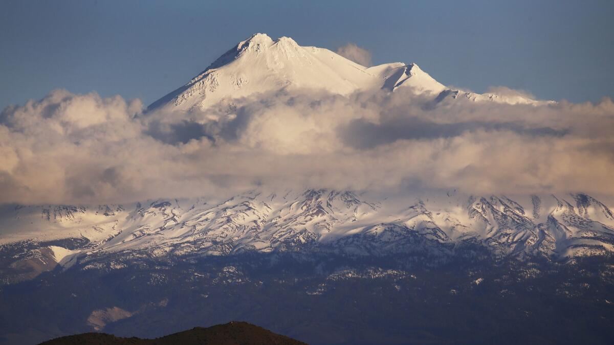
3 California volcanoes are at the top of federal volcano threat list

California is earthquake country.
But the state’s complex geology offer another less known threat.
For the record:
2:30 p.m. Feb. 14, 2019Lassen Peak: This article says that the 1915 eruption of Lassen Peak was the first volcanic eruption within the boundaries of the present-day contiguous 48 states since the country’s founding, and the last until Mt. St. Helens erupted May 18, 1980. There were eruptions before that, such as the intermittent eruptions at Mt. St. Helens between 1800 and 1857.
Three of California’s volcanoes are considered to be a very high threat, along with 15 others nationwide, according to the first update of the federal government’s volcano threat assessment in more than a decade.
Mt. Shasta in Siskiyou County, the Lassen Volcanic Center in Shasta County and the Long Valley Caldera that includes the Mammoth Lakes area in Mono County remain in the highest risk category as defined by the U.S. Geological Survey.
The USGS’ list of the 18 “very high threat volcanoes” remains the same as the last such list updated in 2005. They include two such volcanoes on Hawaii’s Big Island: Kilauea, which underwent a new eruption earlier this year and sent oozing lava to destroy hundreds of homes; and Mauna Loa, considered the largest active volcano on the planet.
Four are in Oregon, including such areas as Mt. Hood and Crater Lake, and four in Washington state, including Mt. Rainier and Mt. St. Helens, which underwent a deadly eruption in 1980 and is the most active volcano in the Pacific Northwest. Along the West Coast, explosions and volcanic activity under snow and ice can send hazardous projectiles long distances into populated areas, the USGS said.
Five are in Alaska and near populated areas and economic infrastructure, or below busy air traffic corridors, the agency said.
There have been 10 eruptions in California over the last 1,000 years, and in any given year the chance of a major volcanic eruption in the state is about the same as the risk of a major earthquake on the San Andreas fault.
Some of California’s most scenic wilderness spots are threatened by volcanic activity. More than 190,000 Californians live within a volcano hazard zone; among them are people who live or work in the Long Valley region, home to Mammoth Lakes, a favorite destination of skiers from Southern California, and areas in the shadow of Mt. Shasta, such as the towns of Mount Shasta and Weed. Those cities are close enough to volcanoes that they may be in harm’s way in the next eruption.
Volcanoes in the Lassen, Shasta and Long Valley areas are capable of producing pyroclastic flows or surges when they do erupt — fast-moving flows of hot ash, rock and gas sweeping down the sides of mountains, of the type that killed 57 people when Mt. St. Helens erupted in 1980.
How the Mt. St. Helens eruption unfolded caught scientists by surprise. There were signs that magma was moving underneath Mt. St. Helens in the months before the eruption. But instead of from the top, the eruption occurred from the side of the volcano — sending magma pressurized with gas erupting out horizontally instead of vertically.
Because the initial direction of the pyroclastic flow was aimed horizontally, it traveled much farther on land from the summit than had been anticipated, and killed people who were beyond an evacuation zone. Such pyroclastic flows are so hot they will burn flesh and sear lungs; too much ash can also make it hard to breathe. Those who died generally had been within 15 miles of the volcano.
Most higher risk volcanoes are far from California’s largest cities and several produce heat that’s used to generate electricity in what are the world’s most productive geothermal power plants, such as the Salton Buttes, 160 miles southeast of Los Angeles, and the Clear Lake Volcanic Field 85 miles north of San Francisco that powers the Geysers steam field. Those areas are considered to be at the second-highest risk category, as is Medicine Lake volcano in Siskiyou and Modoc counties.
But volcanic eruptions could have lasting repercussions that affect all of California. Volcanic ash could bring down jetliners and disrupt hundreds of flights daily passing through Northern California or the Mammoth Mountain area. In 2010, the eruption of Iceland’s Eyjafjallajökull volcano forced the cancellation of 100,000 flights in a week.
Volcanic ash, when wet, is conductive and can disrupt high-voltage lines that supply electricity to millions of California homes. Ash could disrupt travel on Interstate 5, the main route between California and Oregon, masking windshields and making roads slippery, even impassable. And it could contaminate water supplies to much of the state; California’s largest reservoirs are close to the Shasta and Lassen volcanoes.
If there’s any good news, it’s that major volcanic activity is usually accompanied by warning signs, and scientists have become much better at forecasting major events before they happen, enabling authorities to sound warnings to reduce the chance of deaths.
California’s volcanoes were more prolific in prehistoric times. About 760,000 years ago, a super eruption occurred at what is now known as the Long Valley Caldera, erupting an astonishing 140 cubic miles of magma, covering much of east-central California in glowing hot ash and blowing ash as far away as present-day Nebraska.
The Yellowstone volcanic system in Wyoming underwent its own super eruption 640,000 years ago, sending out 240 cubic miles of magma, dumping ash as far away as California, Louisiana and Iowa. (Mt. St. Helens, by contrast, erupted only 0.05 cubic miles of material.)
There is no sign that there is enough magma underneath Yellowstone or Long Valley to cause another super eruption, USGS scientists say.
About a century ago, Lassen Peak underwent years of volcanic activity. In one of the most significant events about 103 years ago, Lassen Peak created a gigantic mushroom cloud that reached an altitude of 30,000 feet. It could be seen as far away as Eureka and Sacramento and sent volcanic ash up to 280 miles away, reaching Elko, Nev. It was the first volcanic eruption in the contiguous 48 states since the founding of the United States, and the last until Mt. St. Helens erupted on May 18, 1980.
A couple of America’s cities are close to volcanoes. Hilo, Hawaii, is on the flanks of Mauna Loa. In Arizona, Flagstaff is at the edge of an extensive field of more than 600 volcanic vents centered around San Francisco Mountain.
Twitter: @ronlin
UPDATES:
Oct. 27, 4:25 a.m.: This article was updated with more context on a prehistoric super eruption at Yellowstone, and to note a couple of U.S. cities that are close to volcanoes.
Oct. 26, 9:35 a.m.: This article was updated with more context on how the Mt. St. Helens eruption unfolded.
Oct. 25, 2:55 p.m.: This article was updated with information that Salton Buttes, in Imperial County, and Clear Lake Volcanic Field, in Lake County, are considered to be at the second-highest risk category, as is Medicine Lake volcano in Siskiyou and Modoc counties.
This article was originally published on Oct. 25 at 12 p.m.
More to Read
Sign up for Essential California
The most important California stories and recommendations in your inbox every morning.
You may occasionally receive promotional content from the Los Angeles Times.


