Not just earthquakes but volcanoes, too? Study details California’s volcanic hazards
Nearly 200,000 people live, work or pass through California’s volcanic hazard zones on a daily basis, researchers said Monday in a report broadly assessing what could be at risk from an eruption.
The repercussions of an eruption — estimated to have a probability of 16% in the next 30 years — would probably extend well beyond local areas due to effects on lifeline utilities spanning power, telecommunications, water and transportation systems, the researchers said.
The study, intended to characterize the exposure of population, infrastructure, resources and the economy, was conducted by the U.S. Geological Survey in cooperation with the California Governor’s Office of Emergency Services and the California Geological Survey.
“It is a compilation of who and what is located in mapped volcano hazard zones,” said Margaret Mangan, scientist in charge of the USGS California Volcano Observatory in the Bay Area’s Menlo Park. The observatory uses an array of sensors to detect signs that an eruption may be coming.
“Our intention with releasing this report on a statewide level is that it will be a springboard to launch site-specific vulnerability studies,” she said in a conference call with reporters.
The research spotlights a natural hazard that receives less attention than wildfires, earthquakes, floods and landslides that happen more frequently. The most recent of at least 10 eruptions in the last 1,000 years occurred at Northern California’s Lassen Peak from 1914-17.
Lassen is one of eight volcanic areas in the state that are designated as having a moderate, high or very high threat of eruption.
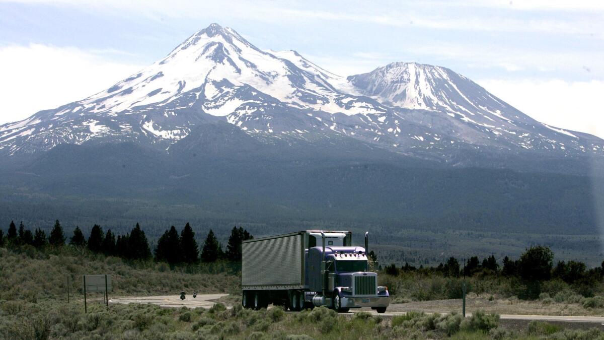
The group includes California’s most iconic volcano, snow-capped Mt. Shasta, which towers over the landscape south of the Oregon border, and the less-recognizable Long Valley volcanic region, a 20-by-10-mile basin left by a cataclysmic explosion 767,000 years ago on the eastern side of what is now Yosemite National Park.
They have the two largest populations of volcanic areas — nearly 104,000 around Mt. Shasta and more than 63,500 around the four volcanoes in the Long Valley region.
Thousands more live near the other volcanic areas, the report said, adding that determining a total number of people who could be affected is problematic because of such factors as the millions of visitors to numerous national and state parks.
Furthermore, 500 to 1,000 passenger jets fly over California volcanoes daily, Mangan said, noting the hazard volcanic ash poses to aircraft engines.
Mangan said California’s volcanoes present a variety of threats: lava flows; explosive eruptions; huge flows of pressurized gas, volcanic rock and ash known as pyroclastic flows; and flows of slurries of melted snow called lahars that have the consistency of watery concrete.
The report looked at the potential for disruption of community facilities and services, counting 162 primary and secondary schools, 45 police stations, 179 fire stations, 95 medical facilities, and more than 2,800 miles of primary and secondary roads within the hazard zones.
But it made clear that an eruption could have statewide effects by disrupting major electrical transmission lines, hydro and geothermal power production, and natural gas transportation pipelines.
Similarly, California’s river systems and complex system of gathering, storing and distributing water could be at risk, along with crops, livestock and timber.
In addition to Shasta, Lassen and Long Valley, the other five areas on the USGS “watch list” are Medicine Lake Volcano in Siskiyou and Modoc counties, Clear Lake Volcanic Field in Lake County — about 90 miles north of San Francisco — Coso Volcanic Field on the east side of the Sierra Nevada at the northern end of the Mojave Desert, Ubehebe Craters in Death Valley National Park and the Salton Buttes in the state’s southeast corner.
In all, the state’s volcanic hazard zones cover 22,000 square miles, extending into 17 counties with 14 incorporated cities.
The intensity of volcanic hazards is not uniform across a zone and may range from life-threatening within a few miles of a “vent” to disruptive of daily activities or perhaps merely a nuisance at distances farther away, Mangan said.
The report should not be taken as a “doomsday scenario,” she said.
“It’s a call for the state and all of our citizens and the agencies responsible for governance of our state to understand volcano hazards and to prepare for them,” she said.
More to Read
Sign up for Essential California
The most important California stories and recommendations in your inbox every morning.
You may occasionally receive promotional content from the Los Angeles Times.

