As effects of drought linger, California snowpack measures below average — but better than last year
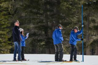
Bundled up in royal blue puffy jackets, surveyors with the California Department of Water Resources waddled through a field Thursday in the Sierra Nevada, the snow crunching beneath their feet. They plunged a pole into the frozen ground, probing for an important measurement: the first snowpack of the year.
The result wasn’t perfect, but it’s an OK start, officials said: 25.5 inches deep. That’s 80% of average to date, and 36% of the April 1 average in that location, said John King, a water resources engineer with the state department.
“That suggests we’d be standing in 9 inches of water right now if all the snow were to be melted,” he said. “While these results are below average, they are a stark contrast to where we were last year.”
Earlier in the morning, spokesman Chris Orrock guessed as much when looking at the department’s Phillips station, one of many sites surveyors return to every month between January and April.
This time last year, Phillips station — a large field 30 miles west of Lake Tahoe at a private residence — was grassy and dry when surveyors attempted to measure the snowpack.
Water departments look to the result of the April 1 measurement, when snowpack is typically at its highest, to make supply decisions for the remainder of the year. This time last year, the snowpack levels were far lower, although snowfall picked up later in the winter.
“Last year, when we came up here, there were two small patches of snow in the whole field,” Orrock said. “As I’m looking at it right now, the whole field is blanketed in some nice white snow. It’s a better start than we had last year.”
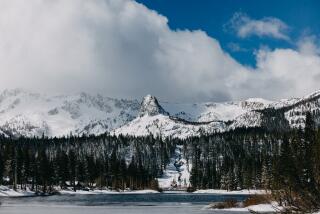
The Sierra Nevada had a dry December, but cold temperatures in the 20s and 30s have maintained the snow level that fell in late November and early December.
After a monthlong break, storms are expected to return this weekend and into next week.
Julie Malingowski, a meteorologist with the National Weather Service, said the northern Sierra will see rain as early as Saturday morning. At 4,000 feet elevation, 1 to 2 feet of snow is expected. The storm will spread to Southern California in the evening, bringing rain and 2 to 5 inches of snow at higher elevations.
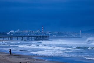
In Northern California, there won’t be much of a break in either snow or rain through early next week, according to the weather service. The San Francisco area will see 1 to 3 inches of rain in coastal areas and up to an inch in urban locations. Southern California could get a quarter of an inch of rain in the valleys and up to 2 inches in the mountains.
A moderate El Niño weather pattern is brewing in the eastern tropical Pacific Ocean, which is bringing more precipitation to some regions of California, said Michael Anderson, a state climatologist with the Department of Water Resources.
“How that influences our weather patterns up here relates to the strength and behaviors of the jet streams,” he said. “We’ve seen a couple storms have a more southerly track … with wetter conditions in the San Joaquin, drying as you go north.”
Despite the dry December, Malingowski said, the weather outlook for the next couple of weeks indicates above-normal precipitation. And looking toward the next couple of months, the odds are also in favor of above-average precipitation, she said.
Officials are cautiously optimistic. The increased snowpack is a good sign, but a continued warming climate is still a cause for concern.
“To date, we’re running 2 to 4 degrees warmer than average,” Anderson said. “The warming pattern is consistent with what we’ve seen…. It’s been warmer than average for a number of years now, consistently since 2013.”
That means every year, more precipitation will come down as rain rather than snow. The snowpack will hold water through the season, but rain dissipates more quickly, leaving the state with a smaller water supply. Rainfall levels across the state were mostly below average last year, according to Golden Gate Weather Services.
Climatologist Bill Patzert said people should remember California is still recovering from a years-long drought that isn’t easily remedied.
“We got a couple of nice little storms, and everything looks so refreshed and the air so clean, but we’re really behind the curve here in terms of our water supply,” Patzert said when the storms in late November and early December left above-average snowpack levels. “It takes you many years to get into a drought and into these deficit situations, and one wet year is not a drought-buster.”
Twitter: @r_valejandra
More to Read
Sign up for Essential California
The most important California stories and recommendations in your inbox every morning.
You may occasionally receive promotional content from the Los Angeles Times.


