Santa Ana winds pose extreme fire danger amid record heat and dry conditions across Southern California

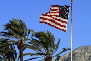
The hot dry Santa Ana winds can fuel wildfires in Southern California, but they start as a cool breeze over a Nevada desert.
When the Charlie fire broke out in Castaic over the weekend, it exploded to 3,000 acres within hours as the flames chewed through dry brush.
But for as fast as the blaze moved, firefighters said it could have been so much worse if the Santa Ana winds had been blowing. Without the winds, firefighters were able to keep the Charlie fire away from homes, and by Tuesday it was 72% contained.
“We could have been there much longer,” said Tony Imbrenda, a captain with the Los Angeles County Fire Department.
The luck isn’t expected to last much longer. Southern California is entering its most destructive fire season, as hot winds from the east move in. Santa Ana winds pose a fire danger every year. But 2018 has been particularly brutal because record high temperatures and a lack of rain have left brush ready to burn.
From October 2017 through Sept. 24, 2018, downtown Los Angeles received about 4.7 inches of rain, making it the third-driest in 141 years, said former JPL climatologist William Patzert.
And in the seven Southern California counties, this year was the hottest summer in 124 years of records, according to data by the National Oceanic and Atmospheric Administration. In Los Angeles County, average temperatures between June and August in 2017 and 2018 were tied for the highest on record.
These factors, combined with the ominous Santa Ana winds, are cause for concern, Patzert said.
“This is the time where we really have to be vigilant,” he said. “In the fall, two things happen. One is the beginning of the rainy season and the other thing is the arrival of the Santa Ana winds. So it’s a race to see which one arrives first.”
Last year, the rains never got here, and that spelled disaster. In December, a series of wind-whipped fires destroyed homes from San Diego north to Sylmar, Bel-Air and into Ventura and Santa Barbara counties.
The worst of those, the Thomas fire, for a time became the largest wildfire in modern California history as it swept from Ventura to Montecito. It burned more than 280,000 acres and destroyed more than 1,000 structures. It was surpassed in size this summer by the Mendocino Complex fire in Northern California.
The Santa Ana winds begin in September and slowly gain speed and intensity through December. This has been the period of some of Southern California’s worst blazes, including the 2003 October firestorm that destroyed thousands of homes.
Santa Ana winds are strong, extremely dry, downslope winds. They originate inland in desert regions of Southern California and northern Baja California and occur mainly in the fall and winter.
Most Santa Ana events are caused by high pressure in the Great Basin and lower pressure off the coast. Air from areas of high pressure flows toward those of lower pressure, and the gradient, or difference, causes the intense winds.
When that air moves over the ridges and valleys and toward the California coast, it warms up because it’s under increasing pressure and lower elevation, said Mike Wofford, a forecaster with the National Weather Service.
“Our largest, most destructive fires are in the month of December, because of the winds,” said Imbrenda, the L.A. County Fire captain. “They directly relate to rapid spread.”
The National Weather Service said it cannot predict how severe the winds will be this season but will send out alerts when conditions become potentially dangerous.
“We’re starting to get into that time period now,” Wofford said. “If we see a weather pattern developing, we have a process in place to let [firefighters] know and give them as much a head’s up as possible.”
Santa Ana winds are more of a problem in some years than others. Last year was considered a particularly bad wind year, with gusts reaching 70 mph during the height of the Thomas fire. There were 14 Santa Ana days, more than twice the norm, in October 2017. But previous years had seen fewer wind events than average.
As is typical during the fall, fire departments are staffing up. The Los Angeles County Fire Department pre-deploys strike teams consisting of several fire engines in areas prone to ignition and rapid spread, such as Santa Clarita and Malibu, where areas of brush meet structures and urban dwellings, Imbrenda said.
The agencies are in constant communication with fire behavior and weather experts who help fire departments determine where and when to deploy their resources. Typically, development of a Santa Ana wind can be forecast about a week in advance, which gives firefighters plenty of time to marshal resources.
Twitter: @r_valejandra
UPDATES:
8:15 a.m.: This article was updated with containment numbers on the Charlie fire.
This article was originally published at 4 a.m.
More to Read
Sign up for Essential California
The most important California stories and recommendations in your inbox every morning.
You may occasionally receive promotional content from the Los Angeles Times.


