Blizzard warnings in effect for Sierra Nevada as major storm slams Northern California
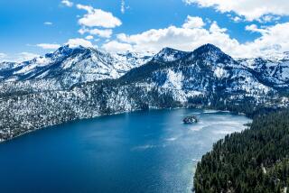
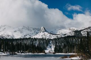
A frigid storm moving in from the Gulf of Alaska will dump several feet of snow on Northern California mountains over the next few days, bringing whiteout conditions and dangerous wind chills.
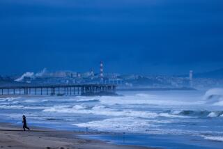
The storm will span most of the Golden State and has triggered blizzard and avalanche warnings in the Sierra Nevada and flash flood watches and the threat of floods and mudslides across the burn areas of Southern California.
“It’s the biggest storm of the season,” said Jim Mathews, a meteorologist with the National Weather Service in Sacramento. “Of course, February was a dud of a month, so March is coming in like a roaring lion.”
Forecasters are predicting up to 7 feet of snow in the Sierra Nevada, with up to 10 feet possible in the highest elevations in the mountain range “where no man lives,” Mathews said.
“We’re measuring snow by the yardstick instead of by the foot rulers this time,” he said.
It’s too early to say whether the storm portends a March miracle capable of pulling California’s snowpack out of the doldrums, said Michael Anderson, the state climatologist with the Department of Water Resources.
The snowpack in the Sierra Nevada had a snow-water equivalent of 24% of average on Thursday, state officials said. Sierra snowpack traditionally makes up one third of the state’s water supply.
But thanks to the historically wet winter of 2016, the picture isn’t as dire as it could be after the last several months of dry conditions, Anderson said.
“In terms of having a base flow coming out of the Sierra into the larger reservoirs, it still seems to be holding up despite the dry winter,” he said.
When the current storm passes, the snowpack could see an increase of 25%, he said.
By mid-morning Thursday, the Boreal Mountain Ski Resort near Donner Lake had received a foot of snow. The Squaw Valley Alpine Meadows Resort near Lake Tahoe had received 7 inches, and Bear Valley between Lake Tahoe and Yosemite had received 4 inches.
The fresh powder was a welcome sight for Kristyn Lucero in Tahoe City, who was cleaning snow off her car by 4:15 a.m. on Thursday.
By typical standards, the snow hitting Tahoe City and much of the Sierra Nevada is par for the course this time of the year. But meteorologists have noted that California’s rain and snowfall have been alarmingly missing for much of the last five months — the bulk of the state’s rain season.
“It’s finally back again; I know a lot of people are excited about it,” said Lucero, who works behind the counter at Tahoe House Bakery & Gourmet. “Cinnamon rolls were popular today, and a lot of warm drinks are going out the door.”
Much of the Sierra Nevada range is under a blizzard warning from Thursday morning through Friday morning, with heavy winds, blinding snow and dangerously cold temperatures.
“Even a short walk could be deadly in these conditions,” the National Weather Service in Reno said in a tweet.
Forecasters also have warned of power outages throughout Northern California because of the gusty winds.
Drivers on numerous roadways through the Plumas, Tahoe and Eldorado national forests were required to have tire chains or snow tires Thursday morning.
A 52-mile stretch of Interstate 80 from Colfax to Truckee was closed Thursday afternoon, according to the Placer County sheriff.
The Sierra Avalanche Center has issued an avalanche warning for much of the central Sierra Nevada through 7 a.m. Friday, putting the danger level at 4 on a 1-5 scale.
The storm will bring Northern California snow levels lower than they have been since about 2011, said Mathews of weather service. Snow will fall between 1,500 to 3,000 feet, with some areas at 2,000 feet possibly getting a foot of snow.
The storm, which is centered off the Oregon coast, will reach as far south as San Diego County, which could receive light showers over the next few days, said Anderson, the state climatologist.
According to long-term forecasts, California is expected to remain drier than average into the spring. There is the potential for another storm next week, but it is still too early to say if it will materialize, Anderson said.
Twitter: @haileybranson
UPDATES:
1:00 p.m. This story was updated with information from Michael Anderson.
This story was originally published at 11:55 a.m.
More to Read
Sign up for Essential California
The most important California stories and recommendations in your inbox every morning.
You may occasionally receive promotional content from the Los Angeles Times.
