Why did El Niño miss SoCal? It’s complicated, National Weather Service says

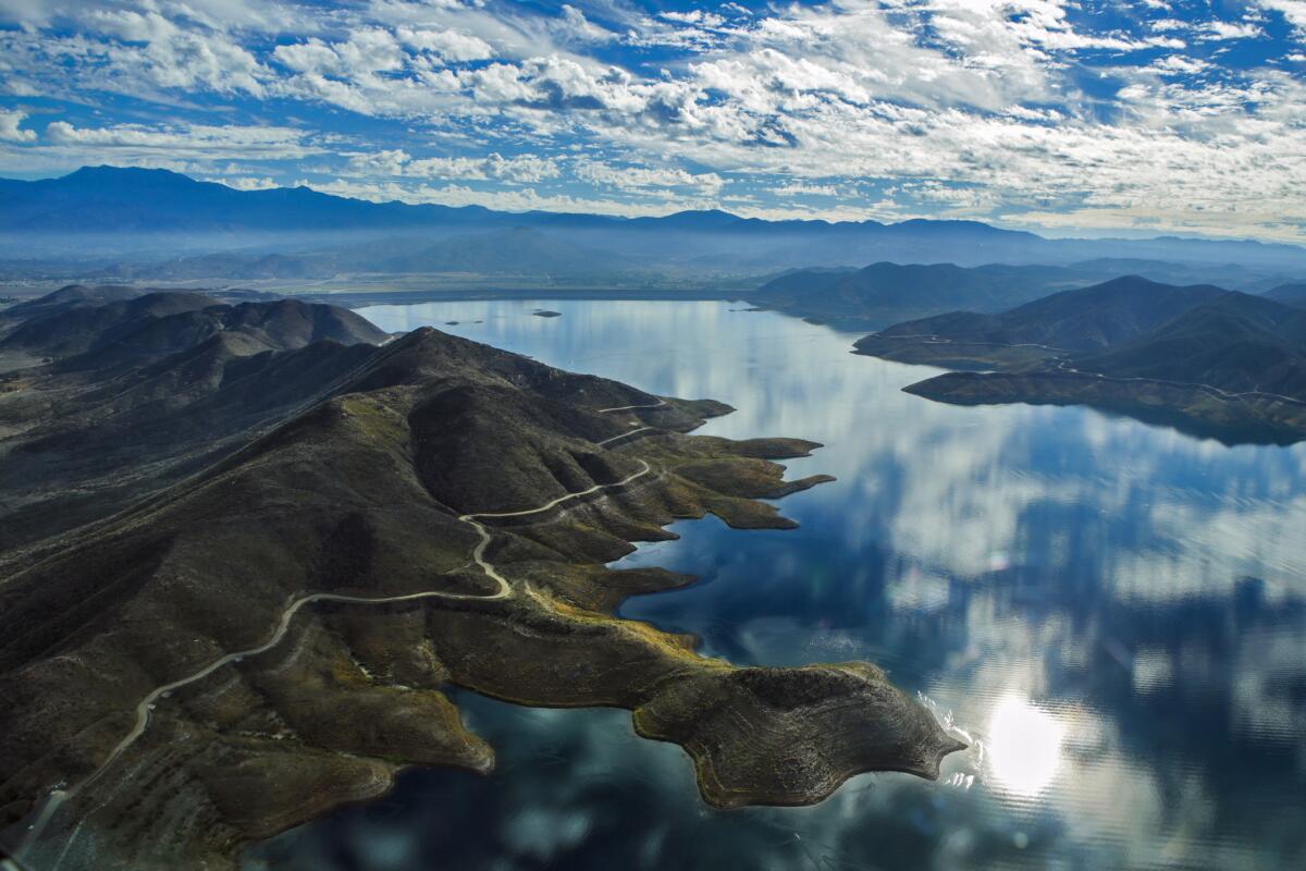
The water levels in Diamond Valley Lake, Southern California’s largest reservoir, are now at the lowest level they’ve been since the lake was filled between 1999 and 2006. A ‘bathtub ring’ showing the maximum extent of the lake can be seen just under the perimeter roadway.
A mix of rising global temperatures, mysteriously warmed waters off Baja California and unusually far-reaching storms in the western Pacific Ocean conspired to block this year’s El Niño storms from hitting Southern California, the National Weather Service said this week.
Despite plenty of indicators suggesting that the 2015-16 El Niño rains would be as strong -- if not stronger -- than previous Southland El Niños, heavy precipitation failed to materialize. Instead, the storms flowed north from the Bay Area to Washington, drenching the Northern Sierra Nevada and refilling some of the state’s biggest reservoirs.
In recapping this year’s El Niño phenomena -- the first since the winter of 1997-98 -- the National Weather Service said the pattern “flipped” from prior El Niños that left the Northwest relatively parched and the Southwest soaking wet.
See more of our top stories on Facebook >>
Although experts anticipated that February would be the wettest month of the year for Southern California, because of El Niño’s influence, it was actually the driest in 30 years.
Data suggests this was due in part to “the blob,” an unrelated warming of the waters along the North American West Coast from Alaska south to the Baja California Peninsula. The warmer waters off Baja may have helped “enhance” a high pressure ridge that stretched up to California, diverting incoming storms to the north, the weather service said.
Experts suggested also that rising global temperatures may have affected the jet stream over the Pacific, which further helped to steer incoming storms north toward the Bay Area and beyond, the weather service said.
“It’s important not to assume that El Niño events of the future will behave the same,” the report stated. “But there is much to learn about how changing background conditions impact such atmospheric [conditions] ... through the remainder of this century.”
The National Weather Service said that as El Niño continues to weaken, it appears that it will soon make way for its counterpart, La Niña, which could bring a drier than average winter.
ALSO
L.A. city attorney shuts down second pot delivery service
Redlands teacher charged with engaging in sex acts with underage student
Space shuttle external tank, en route to L.A., plays role in sea rescue off Baja coast
For breaking California news, follow @JosephSerna.
More to Read
Sign up for Essential California
The most important California stories and recommendations in your inbox every morning.
You may occasionally receive promotional content from the Los Angeles Times.


