Destruction from sea level rise in California could exceed worst wildfires and earthquakes, new research shows

L.A. Times Today airs Monday through Friday at 7 p.m. and 10 p.m. exclusively on Spectrum News 1.
In the most extensive study to date on sea level rise in California, researchers say damage by the end of the century could be far more devastating than the worst earthquakes and wildfires in state history.
A team of U.S. Geological Survey scientists concluded that even a modest amount of sea level rise — often dismissed as a creeping, slow-moving disaster — could overwhelm communities when a storm hits at the same time.
The study combines sea level rise and storms for the first time, as well as wave action, cliff erosion, beach loss and other coastal threats across California. These factors have been studied extensively but rarely together in the same model.
The results are sobering. More than half a million Californians and $150 billion in property are at risk of flooding along the coast by 2100 — equivalent to 6% of the state’s GDP, the study found, and on par with Hurricane Katrina and some of the world’s costliest disasters. The number of people exposed is three times greater than previous models that considered only sea level rise.
And at a time when marshes are drowning, cliffs eroding, beaches disappearing and severe storms likely to become more frequent, scientists say even a small shift in sea level rise could launch a new range of extremes that Californians would have to confront every single year.
“It’s not just some nuisance that’s going to pop its head up once in a while,” said Patrick Barnard, research director of the USGS Climate Impacts and Coastal Processes Team and lead author of the study. “These are significant events that are going to recur and be ten times the scale of the worst wildfires and earthquakes that we’ve experienced in modern California history.”
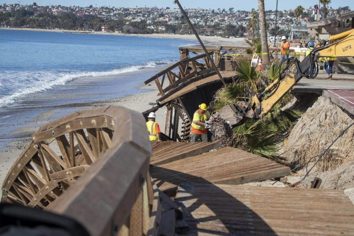
The stakes are high for the millions of Californians who have chosen to build and live along the edge of the Pacific. In recent months, winter storms eroded Capistrano Beach so much that a boardwalk collapsed and crews had to haul in tons of boulders to form a barrier that could protect the basketball courts from disappearing into the ocean.
In Imperial Beach, large waves coupled with some of the highest tides of the season sent water crashing past seawalls — flooding roads and garages and much of the Tijuana River Estuary. From San Diego County to Humboldt County, coastal officials continue to grapple with increasing erosion, cliff collapses and emergency permits.
The new USGS study underscores how these events will continue along the coast — and amplify each other as the sea continues to rise.
“This sort of science is absolutely critical to our planning,” said Jack Ainsworth, executive director of the California Coastal Commission, which has used the USGS coastal modeling to plan for sea level rise. “It may seem like a slow-moving disaster, but we see how the fires amped up really quickly and destroyed communities… We really need to work with a sense of urgency.”
Translating sea level rise into economic risk and property loss advances a tricky issue that many communities have been reluctant to confront. A blockbuster study last year by the Union of Concerned Scientists analyzed Zillow data and found that hundreds of thousands of homes across the nation are at risk of chronic flooding in the coming decades. A Stanford study last month found that downtown Annapolis, Maryland’s state capital, lost 3,000 visits in 2017 due to high-tide “sunny-day” flooding — as much as $172,000 in revenue for local businesses.
The latest National Climate Assessment, a major scientific report by 13 federal agencies, concluded $1 trillion in coastal real estate is threatened by rising sea levels, storm surges and high-tide flooding exacerbated by climate change.
“Scientists are getting more sophisticated in communicating this information to people so that they understand and care about the implications,” said Heather Cooley, research director of the Pacific Institute, an Oakland-based think tank that has also studied how sea level rise puts communities and critical infrastructure at risk.
“You’re seeing more and more communities grapple with these impacts — what it’s going to cost them, whether they should limit development in certain areas. Those are the real tough questions we need to be confronting.”
In the USGS study, published Wednesday in the Nature journal Scientific Reports, researchers brought together a number of models that examined wave action, tides, coastal erosion and flooding in California under sea level rise scenarios ranging from 0 to 2 meters (6.6 feet). On top of these projections, they added four different storm scenarios: average daily conditions, typical annual storm, 20-year storm, and 100-year storm.
They then overlaid these integrated projections, known as a dynamic model, with a sophisticated analysis of population data, property assessment values, as well as data from various state agencies, the U.S. Department of Homeland Security and the Department of Defense.
Previous efforts to understand potential coastal impacts of climate change have mainly focused on long-term sea level rise, with little consideration of how these other elements could affect the overall flood risk — in both the long and short term — to a built-out community.
Emergency managers and planning officials, in turn, rarely incorporate 100-year storm models in tandem with sea level projections — vastly underestimating a city’s risk.
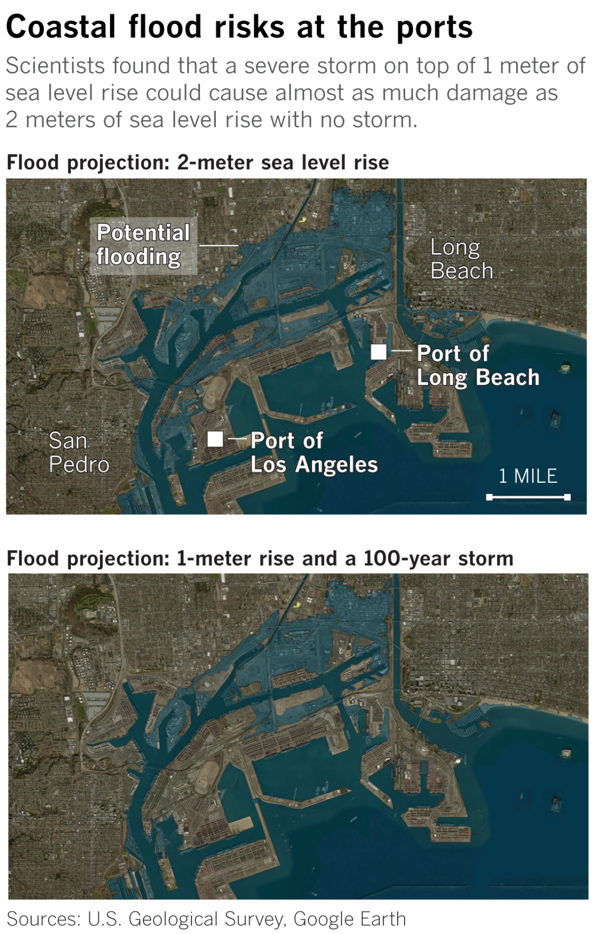
For example, with only 0.25 meters of sea level rise projected to occur by about 2040, the number of Californians exposed to flooding might not seem too significant — but add a 100-year storm, and almost seven times as many people are at risk.
All told, with a 2-meter rise by 2100 and a 100-year storm, the projected flood risks could represent 6.3% of the state’s GDP — despite only directly affecting 0.3% of the state’s land area, according to the study, which did not speculate on future population growth or inflation rates.
Researchers noted these projections might even be on the conservative end, given that California policymakers are now considering 3 meters as the higher end of expected sea level rise.
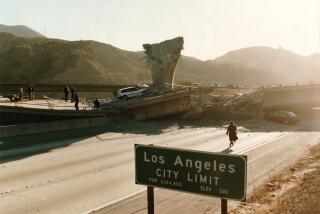
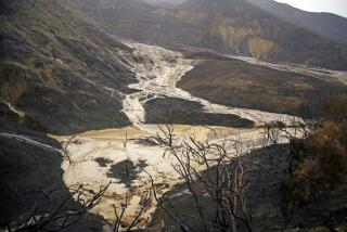
They were also surprised by what the model showed with less severe storms. Under the same 2-meter sea level rise scenario, a typical annual storm also poses a sobering reality check: About 483,000 residents and $119 billion in property (based on 2010 census data and dollars) could be exposed by 2100. That is many times higher than the costliest natural disasters in modern California history: the 1989 Loma Prieta earthquake ($10 billion) and the 2017 wildfire season ($18 billion).
Katrina, in comparison, cost about $127 billion. And a truly catastrophic earthquake could cause $200 billion in damage, more than 1,800 deaths and tens of thousands of injuries, according to a separate USGS study that examined the potential impacts of a magnitude 7.8 earthquake on the southern San Andreas fault.
Scientists and emergency planners, researchers acknowledged, often focus on extremes — 100-year storms, 1% chance disasters that people can’t wrap their minds around.
“We need to focus more on the kinds of things that happen every month, every year,” Barnard said. “For those annual storms to expose $50 billion to more than $100 billion of property by end of century, that’s just a massive number. That’s something that could happen every single year, not just maybe once a mortgage or once a lifetime.”
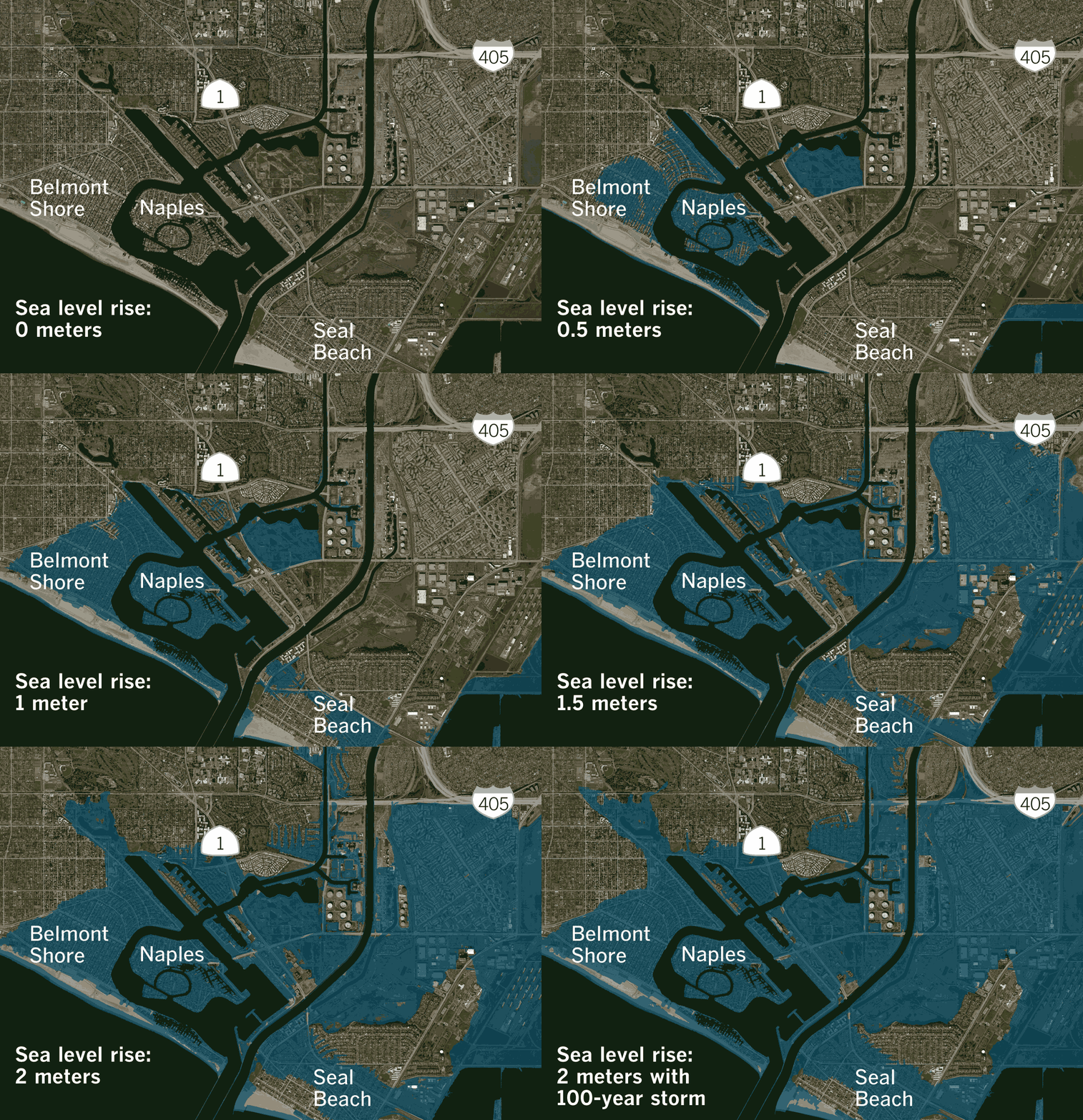
The vulnerabilities from sea level rise combined with storms, both extreme and annual, are particularly evident in areas like Alamitos Bay in Long Beach, Del Mar in San Diego County and other cities built on top of former marshes, near river mouths or in low-lying areas. Entire blocks of homes, parks and public facilities could be flooded under such projections.
Along the San Francisco Bay, which accounts for two-thirds of the flooding impacts projected for all of California, the cost of building levees, seawalls and other measures to withstand 2 meters of sea level rise and a 100-year storm could cost as much as $450 billion – twice as much as prior estimates looking at just the cost of defending against sea level rise.
In the model, scientists assume that the Bay Area’s existing levees and lines of defense are stable and remain in place through 2100, but “the engineering integrity of most of these structures is poorly understood,” the study said.
The same goes for sea walls, berms, rock revetments and other infrastructure across the state in smaller estuaries, according to the study. “There is no accommodation for the potential failure of these structures when stressed by future flooding events, yet some will undoubtedly fail and expose more residents and assets to flooding than estimated here.”
At the ports, where coastal flooding could affect rail lines and the movement of goods in and out and across the United States, the cost of adaptation is high. The Ports of Los Angeles and Long Beach alone, the study found, handle $478 billion in cargo annually and support 2.8 million jobs across the United States. The cost to elevate and retrofit the major commercial ports in California to adapt to 2 meters of sea level rise, according to the study, could be more than $9 billion.
Researchers hope this information will help communities better understand their short-term risks and the long-term consequences of their decisions. More studies and risk analysis will also continue to make these projections more accurate for specific communities.
Future population trends, economic conditions, human changes to shoreline infrastructure and greater understanding of El Nino cycles, for example, are all factors that could be added to make more sophisticated models.
The choices people make in the coming decades, of course, could also affect these projections. As the Earth continues to get warmer and land ice continues to melt into the ocean — in large part fueled by human-produced greenhouse gases — efforts to rein in these emissions could play a role in temperature, wind patterns and how fast the sea will rise.
Then there are the “cascading” socioeconomic impacts that this study doesn’t even get into.
“If you have a major flood event that shuts down the port for three to five days, what kind of effect does that have on the economy?” Barnard said. “How does flooding affect lost jobs and loss of income and distribution of goods and services throughout the country?”
“The effects I think are far, far greater than even what I think these numbers suggest. And these numbers,” he said, “are already massive.”
Interested in coastal issues? Follow @RosannaXia on Twitter.
More to Read
Sign up for Essential California
The most important California stories and recommendations in your inbox every morning.
You may occasionally receive promotional content from the Los Angeles Times.
