Atmospheric rivers pound California with season’s ‘biggest storm’
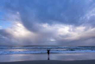
California is having a very wet and cold winter, and atmospheric rivers are one of the reasons.
These storms have caused mudslides in the Southland, snow along the West Coast, white-out conditions in the Sierra and rain totals well beyond normal.
On Wednesday, a new atmospheric river was moving in — with fears of stream flooding in Northern California and potential mudslides in Southern California.
“It’s going to give us the biggest storm we’ve seen so far this season,” said Jimmy Taeger, a meteorologist with the National Weather Service in San Diego.
So what are atmospheric rivers?
Atmospheric rivers are long plumes of water vapor that can transport tropical moisture across the Pacific Ocean and disperse it in California.
They get their name because such storms carry so much water, they’ve been likened to a river in the sky.
A strong atmospheric river can carry 7½ to 15 times the average flow of liquid water at the mouth of the Mississippi River.
What is the impact of these storms?
Some of them are weak. But the strong ones leave a big mark. In 2016, a series of intense atmospheric rivers helped ease California’s epic drought by producing record rain and snow in Northern California.
Just a few atmospheric river events can provide West Coast states such as California with one-third to one-half of their annual precipitation.
Atmospheric rivers can also create storms with intense rainfall and flooding, triggering mudslides and sometimes leading to deaths.
How do we assess these storms?
Earlier this year, researchers at UC San Diego announced a new scale to describe the strength of atmospheric rivers, weather events that cause many of the West Coast’s heaviest rains.
Unlike other scales that focus on potential damage — such as the Fujita scale for tornadoes or the Saffir-Simpson scale for hurricanes — the atmospheric river scale will also characterize how beneficial storms can be for the water supply.
The new scale characterizes the intensity of atmospheric rivers — measured by how fast the storm’s water vapor is flowing — from “weak” to “exceptional.”
Based on the storm’s intensity and duration, the weather event is given an overall category from 1 to 5.
What does an atmospheric river look like?
Here’s video of a plane flying through one of the storms.
What is Southern California’s forecast?
Southern California has already taken a pounding from storms this winter, but this one could be the biggest, noted meteorologist Taeger.
The amount of precipitation from the most recent storm will vary depending on the region, with San Diego, Orange and Riverside counties likely to be pounded with up to 2 inches of rain along the coast and up to 10 inches at higher elevations. This could create a dangerous situation for residents in recent burn areas, according to the National Weather Service.
Forecasters predict the Holy fire burn scar will see 2.5 to 6 inches of rain, while the area affected by the Cranston fire last year will likely experience 3 to 8 inches of precipitation through Thursday. That has the potential to trigger debris flows and flooding, according to the weather service.
More to Read
Sign up for Essential California
The most important California stories and recommendations in your inbox every morning.
You may occasionally receive promotional content from the Los Angeles Times.


