7 perfect L.A. spots beyond the beach for a tranquil walk by the water
Of all the images L.A. is famous for — the Hollywood sign perched above teetering palm trees, the mansion-lined streets stocked with free-range celebrities — few shine brighter in the public imagination than our coastline, that blue-and-gold border where the city and ocean momentarily blur. So it sometimes comes as a shock to visitors when an L.A. resident like myself will casually say that I — gasp — don’t live near the beach.
Of course, “near” is a relative term. Siberia is near the North Pole, but Burbank is nowhere near Santa Monica. (I don’t make the rules, sorry.) And while no one in L.A. is ever more than 20 or so miles from the coast, the reality of city life is that the beach isn’t always the easiest option for those of us who like to get outside without losing hours to bumper-to-bumper traffic.
Planning your weekend?
Stay up to date on the best things to do, see and eat in L.A.
That doesn’t mean that walking by the water is a pastime reserved only for Westsiders. (Unlike, say, rollerblading, which they can keep.) Luckily for the rest of us, it turns out the inland areas of L.A. County — not always known for plentiful water — are actually full of postcard-worthy spots where you can enjoy a waterside stroll.
In fact, there are so many that I had to come up with a set of helpful criteria just to pick my favorites. The walks here range from immaculate gardens to rugged lakes, but every single one of them is:
- Far from the ocean. Again, this is highly relative. Should we allow Willowbrook’s lovely Magic Johnson Park, just under nine miles from Manhattan Beach? I vote yes; anyone who has spent nine miles in summer beach traffic would be happy to have that time back. Still, this rule means losing some lovely strolls (e.g., the Venice canals, Ballona Creek) that happen to be a little too close to the coast.
- Guaranteed to have plenty of water. Spots that dry up during our seemingly endless summers — including delightful paths along the L.A. River and other seasonal streams — are out. What good is this list if it sends you to an empty creek bed? If it’s water you’re after, you’ll find it here any time of year.
- Free (at least some of the time). L.A.’s beaches are free for everyone, so I don’t see why the locations on this list should be any different. That meant dropping places like Huntington Gardens and the L.A. County Arboretum, which boast plenty of picturesque water but also charge you for the privilege of walking by it. A few spots here do have admission fees for certain parking areas — but I’ve got a few tips below to help you get around those, too.
- Accessible. If you use a wheelchair to get around, or you just want to be able to push kids in a stroller, this list has you covered. With one exception (Debs Lake), every entry has paved walking paths, plus easily accessible parking. Looking for more challenging, water-filled hikes on rougher terrain? Check out our excellent list of waterfall hikes, with plenty of options for intrepid explorers.
- Not too famous. Odds are, you’ve already been to Echo Park Lake, the Silver Lake reservoir, Lake Balboa, and Lake Hollywood — or at least seen them in countless Instagram posts. To make this list useful, I focused on my favorite places outside the upper edge of the A-List. Even so, every spot here is well loved by its local community, so don’t expect to be the only person enjoying the views.
- All over the L.A. area. I could easily have made a list of seven great walks just within the San Gabriel Valley or L.A. city limits. But hopefully, spreading out the picks means that at least one of these walks is within a reasonable drive, no matter where you live in the area.
Whether you like birdwatching, lake-hopping, reenacting the Revolutionary War, or just strolling by a gurgling creek, this map has something for everyone. Ready to get your feet wet?
Adam Markovitz is a writer and editor based in Los Angeles.
Debs Lake
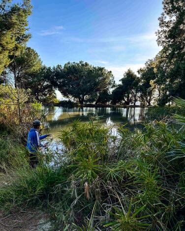
Still, Debs Lake feels like a hidden treasure that wouldn’t be out of place in the Sierra wilderness. If you start in the park’s main parking lot by the picnic area, you have at least two options for getting up there: a steep dirt path departing from the northwest end of the lot, or a paved road that starts in the middle. The road climbs at an easier pace, but they both lead you up about a third of a mile to the lake, which is technically a small reservoir that was originally built to supply the park with year-round water.
(Note: The perimeter of the lake itself is unpaved, which preserves its rustic charm but makes it a challenge for wheels.) You could walk up and back in about 20 minutes, but you won’t want to. Debs Lake is a treat to be savored at a slower pace.
Puddingstone Lake
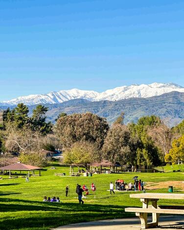
On a recent visit, I grabbed a trail map from the visitors center at the main entrance and made a 3½-mile clockwise loop that took me along the water to the East Shore, then back through the playgrounds and cookout spots of Picnic Valley. Along the way, I opted for a northern spur near the “back entrance” parking lot that led to lofty views of the sandy swim beach (open from Memorial Day weekend through Labor Day weekend), paddleboat area, Puddingstone Dam and the San Gabriel Mountains.
During the summer, and on weekends in the winter, it costs $12 to park at one of the ample lots near the lake. But there are a few ways around the fee. Parking is free on weekdays in the winter and after 6 p.m. in the summer — perfect for an after-work walk when the days are long. And if you’re willing to put in a few extra steps, you can always leave your car at the Park & Ride just across the 57 freeway and walk into the park for free.
Magic Johnson Park
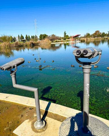
A leisurely 1.3-mile walk around this attraction-stuffed park will lead you by a playground and through open fields, passing workout stations and a large rec center. But the park’s crown jewels are a pair of photogenic artificial lakes connected by a rocky, trickling stream. A smoothly paved path laces around the shoreline, offering peeks into the tall reeds that circle the waters.
This is a bird-watcher’s paradise, with mounted binoculars available to help you get an even closer look at all the fowl behavior. On my last visit, I spotted at least 10 species, including one snowy egret and enough waddling geese to cause a brief traffic jam on the walking path. Give yourself at least a half an hour to enjoy a full tour around the park, although there are plenty of benches to beckon you for a longer stay. If you’re as lucky as I was on a recent weekend, there might even be an ice cream truck waiting in the parking lot when you’re done.
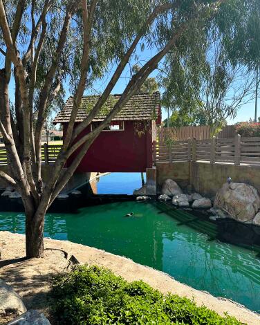
Heritage Park
Think Disneyland’s Adventureland, except with a weirdly specific focus on Paul Revere, whose statue greets visitors near the main parking lot. Follow his legendary midnight ride in miniature by heading from the parking lot through the covered bridge and onto the island itself. Winding around web-like trails, you’ll see a pint-size battleship, hidden slides for little kids and enough 18th-century kitsch to put a smile on any visitor’s face, young or old.
As for water, a rushing cascade plunges from the top of the isle into a wide moat filled with sun-bathing turtles. The island itself doesn’t offer much mileage, but you can stretch the walk to just under a mile by tracing the outer edge of the grounds, which includes a softball diamond, basketball courts and picnic areas. Best of all there’s one thing about the park that feels decidedly un-Disney-like: It’s completely free.
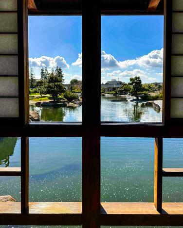
The Japanese Garden
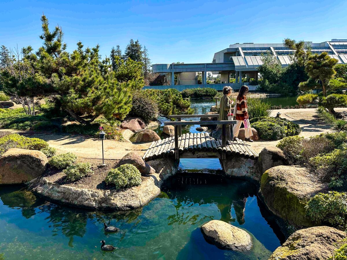
If you’re looking for a unique date spot — or even just an out-of-the-ordinary place to stroll with friends — the garden’s winding paths and quiet nooks are perfect for one-on-one conversations. The east side of the park is currently closed for construction, but there are still plenty of open pathways along the west side, offering full views of the entire garden. To keep the atmosphere tranquil, the park requires free reservations that generally fill up three to four days out. Though at the time of writing, the reservation system is down indefinitely, meaning no booking is required.
Still, it’s always best to call ahead since the park has slightly finicky hours. (In addition to being closed from noon to 1 p.m. daily, the garden’s website warns that the grounds are “closed Friday through Sunday; closed on all Federal & City of Los Angeles Holidays; and closed within 24 hours of rain.”) If you do happen to get shut out, don’t head home — the Sepulveda Basin has plenty of other watery wonders nearby, including bustling Lake Balboa and the marshy Sepulveda Basin Wildlife Reserve.
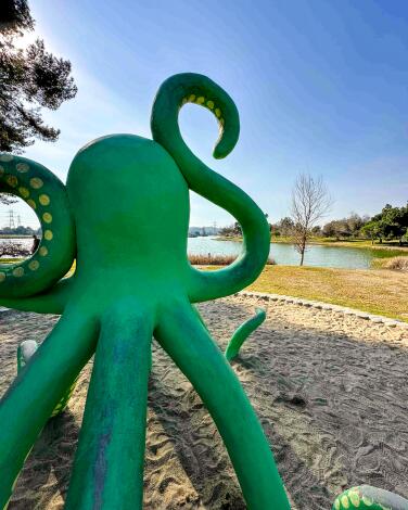
Whittier Narrows Recreation Area
But you came for the water, and there’s plenty of it. Three large lakes, connected by paved footpaths, offer a playground for all types of recreation, from paddle boating to fishing to waterside lounging. During a recent visit on a quiet afternoon, I was surprised at how often I felt pleasantly lost amid the tangle of paths around the lakes. The pastoral atmosphere was slightly frayed by the trafficky hum of the highways on the park’s borders, but there was plenty of natural splendor to distract from the noise, including jet black cormorants fanning their wings in the sun and massive pelicans patrolling the lake, slicing their bills through the air like broadswords.
This area in the San Gabriel Valley also has a fascinating history of human use that stretches back thousands of years — perfect for pondering during a mid-walk break on one of the park’s many lakeside benches. Entrance is free every day with the exception of weekends and holidays, when admission is $7 per vehicle for parking in one of several lots.
Hansen Dam Recreation Area
For an easy and entertaining introduction, start with the quick loop around Hansen Lake, a 10.5-acre artificial pool that’s popular for swimming, fishing and even non-powered boating. During winter, the adjoining swimming pool and its soaring waterslides are closed, offering a more peaceful — though less festive — atmosphere.
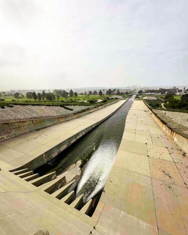
For a longer walk, head to the park’s namesake dam, where you can traverse the paved two-lane path that stretches about 1.7 miles across its shoulders. (It’s great for strollers and bikes, too.) Built in 1940, Hansen Dam was once the largest structure of its kind in the world, and it still offers commanding views of the San Fernando Valley and the flood control basin below it.
When I visited right after heavy rains, there was an impressive torrent of water gushing out of the sluice gates below — sure to dazzle kids (or the hydraulic engineering geek in your family). To get even closer to the water, head down into the basin itself, where dirt paths wander up to muddy washes. You might even cross a few horse riders coming from the nearby stables in the park.
Sign up for The Wild
We’ll help you find the best places to hike, bike and run, as well as the perfect silent spots for meditation and yoga.
You may occasionally receive promotional content from the Los Angeles Times.


