Winter storms boost Central Valley water supplies, but aquifer levels remain depleted

The historic winter storms that filled California’s reservoirs and covered the Sierra Nevada with snow have brought a major boost to water supplies across Central Valley watersheds — an increase that measurements from NASA satellites show is the largest year-over-year gain in more than two decades of records.
Satellite data analyzed by researchers at NASA’s Jet Propulsion Laboratory show that the series of atmospheric river storms this winter alleviated some of California’s water deficit, but that groundwater levels remain depleted from years of drought and chronic overpumping in the Central Valley.
The two satellites, a joint U.S.-German mission called GRACE Follow-On, measure changes in the total volume of water contained in snowpack, soil, rivers, lakes and groundwater.
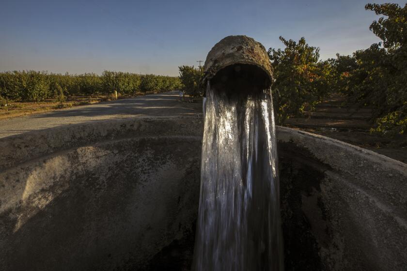
Excessive groundwater pumping has long been depleting aquifers in California’s Central Valley. Now, scientists say the depletion is accelerating.
NASA scientists found that between October 2022 and March, the rain and snow increased the region’s total water supplies substantially, equating to a rise of about 20 inches if that water were spread across the watersheds of the Central Valley.
That amounts to about 2.5 times the total storage capacity of Lake Mead, the country’s largest reservoir, or about 58% of the volume of Lake Tahoe.
The water gain was about double the annual average recorded in satellite data since 2002. Even with this influx of water, however, scientists said they don’t yet know how much of it will make its way underground, and that it will likely only recoup a portion of the groundwater that has been extracted to supply agriculture during years of severe drought.
“One good winter of rain and snow won’t make up for years of extreme drought and extensive groundwater use,” said Felix Landerer, a research scientist at the Jet Propulsion Laboratory.
“We have accumulated quite a bit of water debt, groundwater debt, over the last 20 years,” Landerer said.
Plotted on a chart, the satellite measurements of the total amount of water in the region form a line that, through seasonal ups and downs, has declined dramatically during the droughts from 2012-2016 and 2019-2022, reflecting major losses in total water resources. In 2023, the line has risen sharply.
“Even though we had a lot of water gain, much of that is in the surface,” Landerer said. That means much of the water remains in rivers, lakes, reservoirs and the soil, as well as frozen in the snowpack. So far, he said, not much has percolated down to aquifers.
“It’s actually pretty dry still down below,” Landerer said. “The key point is now, how much groundwater recharge will there be?”
He and other scientists plan to track that as the snow melts and runoff courses through the Central Valley over the next several months.
In other recent research, scientists have found that the pace of groundwater depletion accelerated in recent years during the drought.
Data for the last two decades — and earlier data going back to the 1960s — reveal successive drops in average water levels in a step-like pattern, with brief wet periods that have only temporarily slowed the declines.
“Over the long term, groundwater is in a pretty steep decline,” said J.T. Reager, a scientist at JPL.
“In wet years, we get a little bit of a recovery, and then in dry years, when there’s not a lot of surface water or snowmelt, we tend to hit the groundwater really hard,” Reager said. “We never get the recovery to replace what we’re drawing down, what we’re using during the dry years.”
The Central Valley is one of the world’s major farming regions, producing almonds, pistachios, grapes, walnuts, tangerines, rice and other crops, as well as cattle and dairy products.
In the San Joaquin Valley, 1,800 families rely on state-funded water deliveries to fill household tanks. The list of those waiting for fixes has been growing.
The research is based on data collected from two NASA satellite missions. The current pair of satellites, which launched into orbit in 2018, track changes in Earth’s gravity field to measure shifts in the total amounts of water, above and below ground.
“The big question for this year, with all of the snow and rain that we received, is really how much of that rain and snowmelt is going to recharge that groundwater?” Reager said. “How much of that water can infiltrate the soil?”
If all the water could be channeled underground, it would bring a tremendous recovery, he said. But he said it’s possible a lot of the water may not reach the aquifer.
Part of the reason relates to the valley’s geology. There are clay layers in many areas that hinder the downward movement of water, while in other areas, water passes swiftly through permeable layers of sediment.
The water streaming down from the Sierra Nevada has inundated vast farmlands in the southern San Joaquin Valley, re-forming Tulare Lake, which according to state officials now covers more than 113,000 acres, an area nearly as large as Lake Tahoe.
State water officials have sought to make it easier for local water districts and farms to use floodwaters to recharge depleted aquifers.
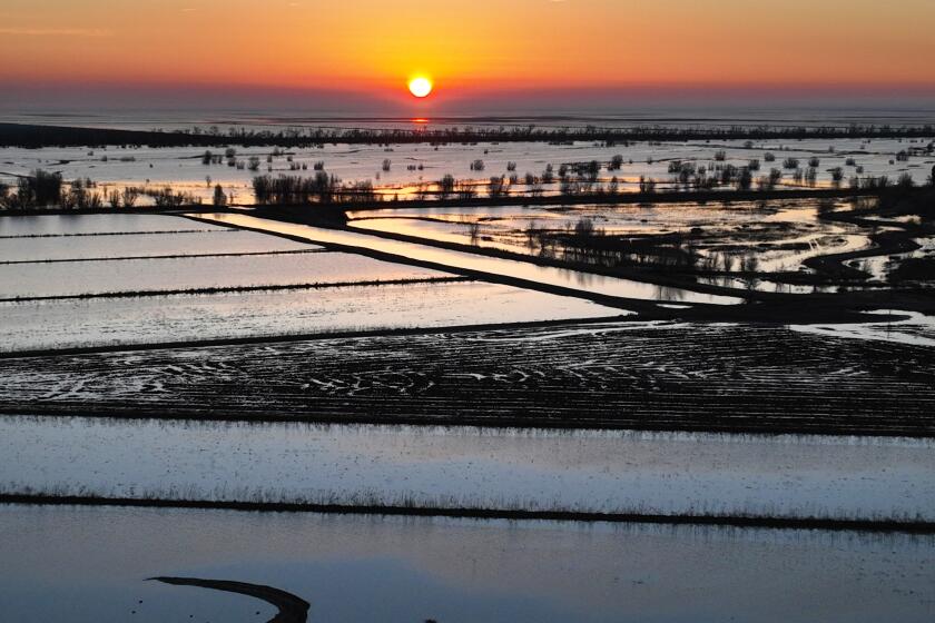
In parts of California’s Central Valley, farmlands are being used to soak up storm water and replenish depleted groundwater.
Since December, the State Water Resources Control Board has issued 10 temporary permits for agencies to divert water for groundwater recharge projects, all but one of them in the Central Valley. The board also approved a request by the U.S. Bureau of Reclamation to divert floodwaters from the San Joaquin River and send much of that water flowing to lands where it spreads out and soaks into the ground.
These approvals allow for the diversion of more than 1.2 million acre-feet of water — more supplies than Folsom Lake reservoir can hold — for groundwater recharge, wildlife refuges and other purposes. State officials say it’s the largest amount of water they have made available for groundwater replenishment in such a short period.
“The state has taken unprecedented action to leverage the benefits of our recent wet weather by replenishing our groundwater resources,” said Yana Garcia, secretary of California’s Environmental Protection Agency. She said it’s an example of how the state is taking steps to become more resilient as climate change makes extreme droughts and floods more intense and more frequent.
State water officials have also been conducting aerial surveys to map optimal areas for groundwater recharge, using helicopters equipped with electromagnetic imaging systems that peer underground to reveal fast pathways for replenishing aquifers.
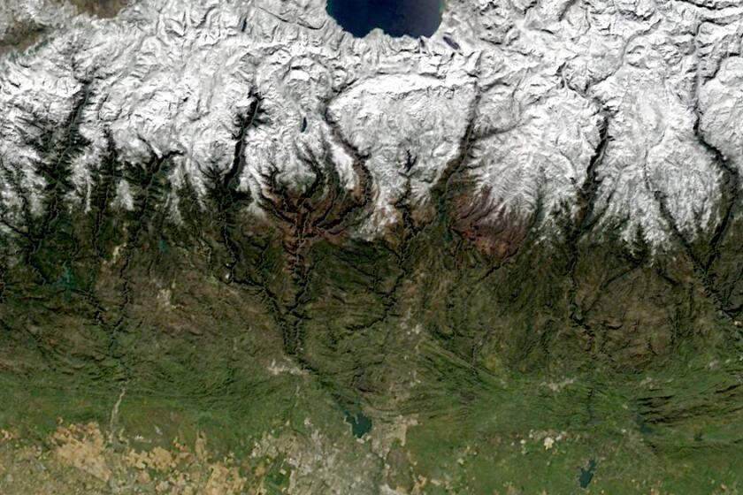
This year California’s snowpack reached record-high levels — 40 million acre-feet at its peak in April. Melted, that would be enough to hypothetically drape almost 5 inches of water across the entire state of California.
Meanwhile, the effects of overpumping have continued to affect rural communities, where some residents whose wells have gone dry rely on trucked shipments of water to fill their household tanks. The state has received reports of 249 dry household wells this year. State regulators have told local groundwater management agencies in large portions of the San Joaquin Valley that their plans for combating overpumping are inadequate.
Researchers have said addressing the long-term groundwater deficit will likely require taking large portions of farmland out of production and that planning will be key in transitioning some agricultural land to other purposes, such as solar farms, crops that consume less water or habitat restoration areas.
This extremely wet year, and the historic levels of snowpack that remain, offer the conditions for a rare experiment to see how much the groundwater levels might rise in the Central Valley, Reager said.
“This year, we’ve got this nearly infinite supply of recharge,” he said. “How much can you actually get in the ground? And that’s what we’re looking to see.”
