California braces for flooding, snowmelt from a warm atmospheric river set to slam state
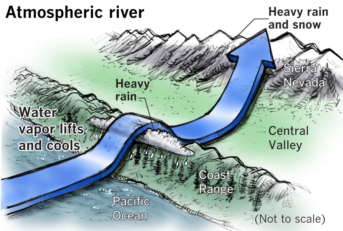
Another atmospheric river system has set its sights on California, raising considerable concern about flooding and structural damage as warm rain is expected to fall atop the state’s near-record snowpack this week, forecasters say.
“It now appears increasingly likely that a potentially significant and very likely warm atmospheric river event will probably affect some portion of Northern or Central California sometime between about late Thursday and Saturday,” UCLA climate scientist Daniel Swain said during a briefing Monday.
Last week, the odds of such a system developing were about 20%. By Monday, the chances had increased to “7 or 8 out of 10, if not higher, for a warm atmospheric river event of some magnitude,” Swain said. At least one more storm could follow this month.
The forecast comes as California is mired in remarkably deep snowpack amid one of its wettest winters on record. A series of nine atmospheric river storms hammered the state in early January, causing levee breaches, widespread flooding and nearly two dozen deaths.
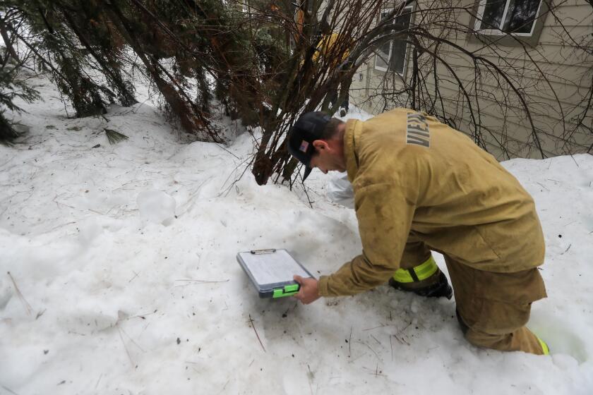
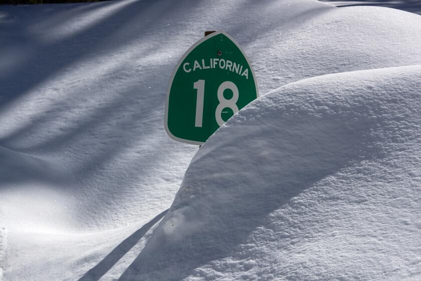
In recent weeks, strong winter storms dropped piles of fresh powder across the Sierra Nevada and other areas, including the mountains of Los Angeles and San Bernardino counties, where some residents remain trapped behind feet of snow.
Officials said the bounty made a dent in the state’s extreme drought conditions and offered some hope for strained water supplies after three bone-dry years. But heavy snowpack can also become a hazard if it meets with warm rain that melts it too quickly.
“We’re going to see rain on top of snow, and for elevations of say 2,000 feet to about 4,000 feet, a lot of that snow is going to melt,” said Carlos Molina, a meteorologist with the National Weather Service in Hanford, Calif. “We’re going to basically lose a lot of the snow that fell from the previous storms. We’re looking at potential for flooding.”
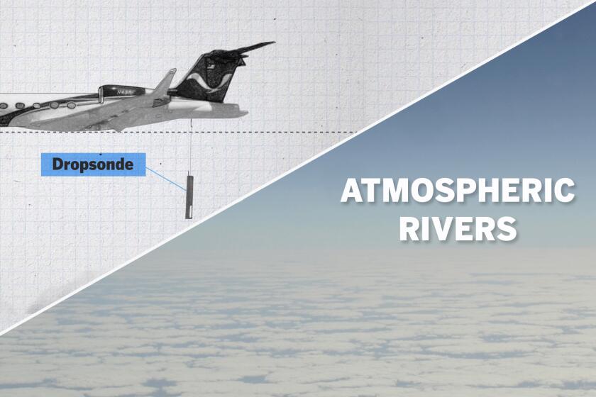
Meteorologists on board a specially equipped hurricane-reconnaissance jet were trying to answer one question: How bad would the next atmospheric river be?
Indeed, the highest likelihood of flood-related impacts are in lower-elevation areas with unusually deep snowpack, Swain said. Small rivers and streams in those areas will see significant potential for runoff issues, as will some urban areas — particularly in places where storm drains are already clogged by snow.
There may also be problems at elevations above 5,000 or 6,000 feet, he said. Though snowpack in such areas is probably too deep and too cold to be melted by the incoming storm, it can become heavier as it absorbs more water. That could cause roof collapses and other structural issues.
“If you can go out and try and remove some snow from structures that might be vulnerable, do it,” Swain said. The state has already seen a spate of roof collapses from mounting snow, including a grocery store providing critical supplies in snowbound Crestline.
Scott Rowe, a meteorologist with the weather service in Sacramento, said the incoming low-pressure system is originating in the north but is expected to link with “very warm” subtropical moisture coming from Hawaii. Such storms are sometimes referred to as a Pineapple Express and are known to drop heavy moisture in California.
“We’re essentially transitioning from one storm track to another, where the moisture origins are coming from a warmer, juicier location,” Rowe said.
California’s deadly storm season continued Friday as the first of two atmospheric river storms descended on the state, prompting evacuation orders.
Though there is growing certainty that such a system will arrive, its precise timing, location and impacts will become clearer as the week goes on, forecasters said.
“Buckle up, it’s going to be quite the weather ride,” the weather service wrote in its forecast for the Central Coast and San Francisco Bay Area. As much as 6 inches of rainfall are possible in the coastal ranges from Thursday morning into Saturday afternoon, and up to 2 inches are possible in other parts of the region, the agency said.
The weather service in Sacramento similarly warned of several inches of rain and higher snow levels. It also said there is as much as a 40% probability that small rivers and streams will rise, along with the risk of potential roadway flooding, particularly on Friday.
In the central part of the state, areas above 8,000 feet — including Yosemite National Park — could see up to 6 feet of snow, while areas from about 5,000 to 8,000 feet could see up to 4 inches of rain. The Central Valley floor could see 1½ inches of rain, and flooding along the Merced River is possible.
Though the brunt of the storm is currently expected to hit Northern and Central California, Southern California may feel impacts as well, including potential river and small-stream flooding in portions of Santa Barbara and San Luis Obispo counties, said David Gombert, a meteorologist with the weather service in Oxnard.
“Probabilities get higher as you go from Santa Barbara northward, but we don’t want to ignore L.A. and Ventura completely, because there could be issues there,” he said.
Statewide snowpack is hovering just below a record set in the winter of 1982-83, with more storms on the horizon, state officials announced Friday.
On Tuesday, the Los Angeles Fire Department rescued a homeless man who was swept away in the fast-moving storm runoff in the Pacoima Wash and carried 2½ miles. The 23-year-old man was hospitalized with hypothermia and abrasions after he was pulled from 3-foot-deep water.
In advance of the coming storm, Fresno County issued evacuation warnings for 17,000 foothill and mountain residents for possible flooding.
Also of concern is the chance for more rain and snow in the San Bernardino County mountains, where crews on Monday were still struggling to clear roads and help trapped people. Increasing chances of precipitation there are expected to begin early Friday morning and last through most of the day Saturday, said Elizabeth Schenk of the National Weather Service’s San Diego office, which covers the San Bernardino area.
Very high snow levels of 8,000 or 9,000 feet are likely in the area, “which means that the majority of the precipitation that’s going to fall is going to be falling as rain,” she said, including amounts of up to 1½ inches.
“It’s not great,” she added, “because any rain that’s going to fall on the snow is going to accelerate the snowmelt in that area, and with how much snow they already got over the last week and a half or so, that is a lot of snow water equivalent, so that’s going to lead to rapidly accelerating snowmelt potentially.”
Although the incoming storm is most likely to have moderate impacts, Swain said he feared it may prime the state for bigger problems. Forecasts show that at least one more system could follow close behind.
“There is some potential for greater flooding if we do get additional successive warm atmospheric rivers following the first,” he said. “There’s about a 1 in 3 possibility of that, so the odds are not that low right now.”
There are also other factors that can increase hazards. Wildfire burn scars — such as those of the Dixie and Caldor fires, which burned across the Sierra in 2021 — can exacerbate runoff because they are known to have waxy soil that is water repellent. They also lack vegetation, making them more susceptible to debris flows. That could affect some downstream watersheds and tributaries during the storm, particularly along the Sacramento and San Joaquin river systems.
“We haven’t had a big, warm atmospheric river atop a major snowpack in these regions, really, since we had these big wildfires, so we might be doing some science experiments in real time over the coming couple of weeks,” Swain said.
Snowplows were no match for blizzard conditions, leaving San Bernardino Mountain residents stranded
In 2017, heavy rainfall and erosion damaged spillways at Oroville Dam, one of California’s largest reservoirs, and sent more than 100,000 people fleeing from a potential surge of overflowing water. The crisis was averted but left many on edge about what similar bursts of moisture can do.
Sean de Guzman, chief of water supply forecasting with the California Department of Water Resources, said Oroville — as well as the state’s other largest reservoirs, Lake Shasta and Lake Trinity — remain far below capacity and have more room to fill.
“We should see an increased amount in runoff but nothing that the reservoirs shouldn’t be able to capture,” he told reporters Friday.
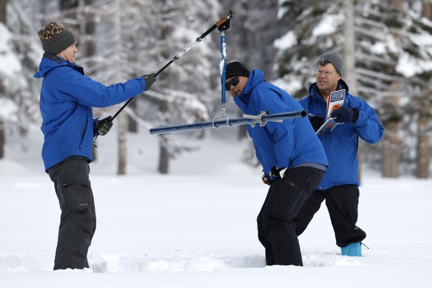
Earlier that day, the department’s third snow survey of the year found that statewide snowpack was 190% of average for the date — just below a record set in the winter of 1982-83. In the southern Sierra, snowpack was at a near-record 263% of average.
As the state gets drier, and wildfires climb to higher elevations, snow is melting faster and earlier than before — even in the middle of winter.
The deep snow came as something of a surprise after fall forecasts leaned toward a drier-than-normal winter. Over the weekend, San Bernardino County officials acknowledged they were unprepared for the historic storms that swept through the mountains.
As of Monday, tens of thousands of Californians in several snow-packed counties remained without power.
Times staff writer Terry Castleman contributed to this report.
