Lake fire in Santa Barbara County grows, but threat to Santa Ynez, Los Olivos weakens

The Lake fire in Santa Barbara County, California’s largest so far this year, has grown to 37,742 acres, but firefighters have worked to contain the blaze around the Santa Ynez and Los Olivos region where structures were threatened.
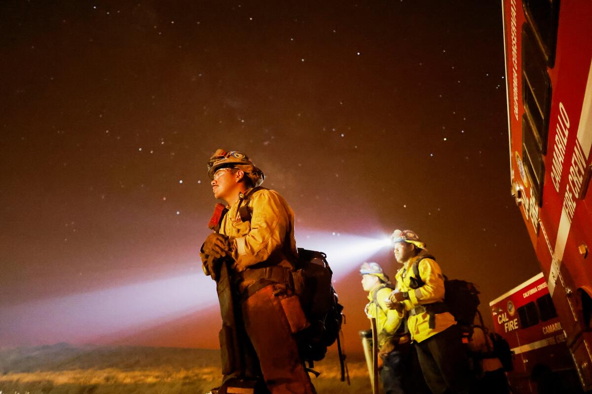
Capt. Scott Safechuck, spokesperson for the Santa Barbara County Fire Department, said Saturday morning that more than 3,400 personnel were working around the clock to extinguish the blaze, which was almost 20% contained Saturday morning.
Crew members have made a “visible difference” on the south side of the fire, where flames could previously be seen from Santa Ynez and the Lake Cachuma area, Safechuck said.
Despite unusually high-temperature evenings over the last week that worsen fire risk, firefighters had made some nighttime progress with controlled burns of dry vegetation and a water-dropping helicopter. Those coordinated efforts have “really been successful for us eliminating a lot of the threat on the south side,” Safechuck said.
“That is really good for community safety, because that’s where a lot of the structures were threatened,” he said. “We are making a huge improvement in that area.”
More than two dozen helicopters were dispatched to the fire Friday, Safechuck said.
“We have huge aerial support here which is instrumental working with ground resources to combat this fire,” he said.
The wildfire is a little more challenging in the backcountry, where there’s more wilderness and challenging terrain to navigate. Fire personnel wrapped structures in aluminum foil-like material to protect them from the blaze.
The fire ignited July 5, but the cause is still under investigation.
An evacuation warning was upgraded to an order for the areas of KP Ranch, west of Alisos Road, according to a Friday afternoon Cal Fire report, which includes parts of Estelle Vineyard Drive, Santa Agueda Creek and Brinkerhoff Avenue.
Other areas under an evacuation order include:
- The area east of La Brea Creek and Forest Route 10N06, south of the Los Padres National Forest boundary, and north of the Sisquoc River.
- Woodstock (areas north of Calzada Avenue, east of East Oak Trail Road, west of Happy Canyon and south of the Sisquoc River).
- Goat Rock Areas (area of Goat Rock, east of Figueroa Creek, north of the U.S. Forest Service entrance at Happy Canyon Road and south of Cachuma Mountain).
- Parts of the Figueroa Mountain area: south of Tunnel House at Sisquoc River, east of Figueroa Creek, north of the southern end of Cachuma Mountain, and west of Los Padres National Forest areas.
All areas from Figueroa Mountain Road at Junction Camp (including Tunnel Road) to Chamberlin Ranch and all areas from Zaca Lake Road at Foxen Canyon Road north to the Sisquoc River.
Evacuation warnings, which mean people should be prepared to leave but are not under a mandate, have been issued for the following areas:
- Area east of Kelly Canyon, north of Sisquoc River, west of La Brea Creek and Forest Route 10N06, and south of the Los Padres National Forest.
- Area starting at the south end of Cachuma Creek, northeast of Santa Cruz Creek to Santa Cruz Peak, west through Grand Spring, and to the northern part of Cachuma Creek.
- Area east and north of Alisos Road (L-shaped road), west of Cachuma Creek, and south of the U.S. Forest Service entrance at Happy Canyon Road.
- Area east of Highway 154, north of Armour Ranch Road/Secretariate Street, west of Alisos Road, and south of the Woodstock and KP Ranch areas.
- Areas north of Zaca Creek Road to Rancho Sisquoc and south of the Sisquoc River.
- Area east of Figueroa Mountain Road, north of Highway 154, west of Calzada Avenue/West Oak Trail Road and south of Woodstock Road.
Highway 154 is not under an evacuation warning and remains open, according to Cal Fire.
Safechuck said a new monsoon-like weather pattern rolling into the region could bring dry lightning to the area, which could ignite new fires.
California’s fire season is already off to an unprecedented start as the state grapples withweather conditions like extreme heat. More than 3,600 fires have been reported so far this year, and 228,756 acres have burned. One death has been recorded so far, after officials said human remains were found in a structure that burned Monday in the Mina fire near Covelo.
More to Read
Sign up for Essential California
The most important California stories and recommendations in your inbox every morning.
You may occasionally receive promotional content from the Los Angeles Times.


