Deadly storm continues to batter Southern California amid new flood, mudslide fears
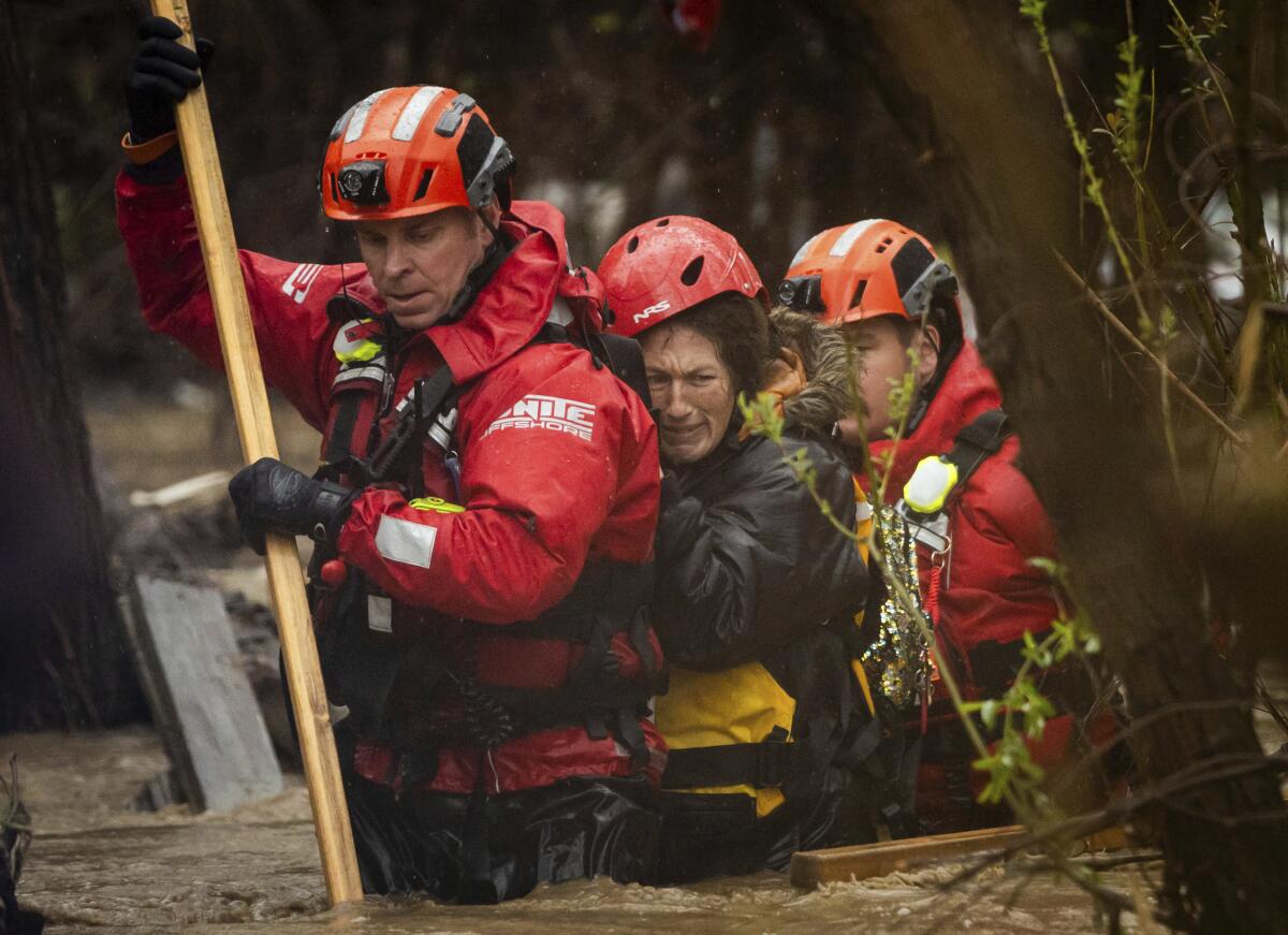
The toll from the atmospheric river poised over California climbed tragically after three people were killed by falling trees as the storm spawned flooding and mudslides while blazing a damaging trail across the state.
Despite being battered by record-setting rain since Sunday, Southern California can expect a wet Tuesday as the storm continues to linger over the region. The National Weather Service said that showers will continue into the evening and that “rainfall rates would likely produce more flooding and the flood watch will continue into this afternoon.”
Three people died Sunday in Northern California in separate incidents of downed trees, according to Brian Ferguson, spokesperson for the governor’s Office of Emergency Services.
In Sacramento County, 41-year-old Carmichael resident Chad Ensey suffered blunt-force trauma and died at a hospital after a tree fell on him in his backyard amid strong winds. In the rural Santa Cruz County community of Boulder Creek, Robert Brainard III, 45, was killed when a tree fell on his home. And in Sutter County, 82-year-old David Gomes was found dead beneath a fallen redwood tree in his backyard, authorities said.
The storm — which parked itself over the Los Angeles metropolitan area after hammering the Bay Area, Sacramento Valley and Central Coast — was not yet over Monday. But weather officials say the most dangerous conditions may have passed.
Chilling rain, swirling gray clouds and blustery winds rolled into Southern California on Sunday as what was anticipated as the strongest storm of the season promised near-record rainfall and flash flooding through Tuesday.
“The worst part to the storm was last night, but there’s still a risk,” Ryan Kittell, a National Weather Service meteorologist in Oxnard said Monday, noting that flood advisories remain in effect across the region, including some flash flood warnings through the evening for north L.A. County.
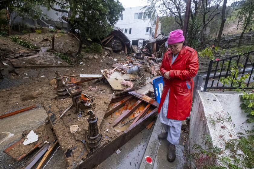
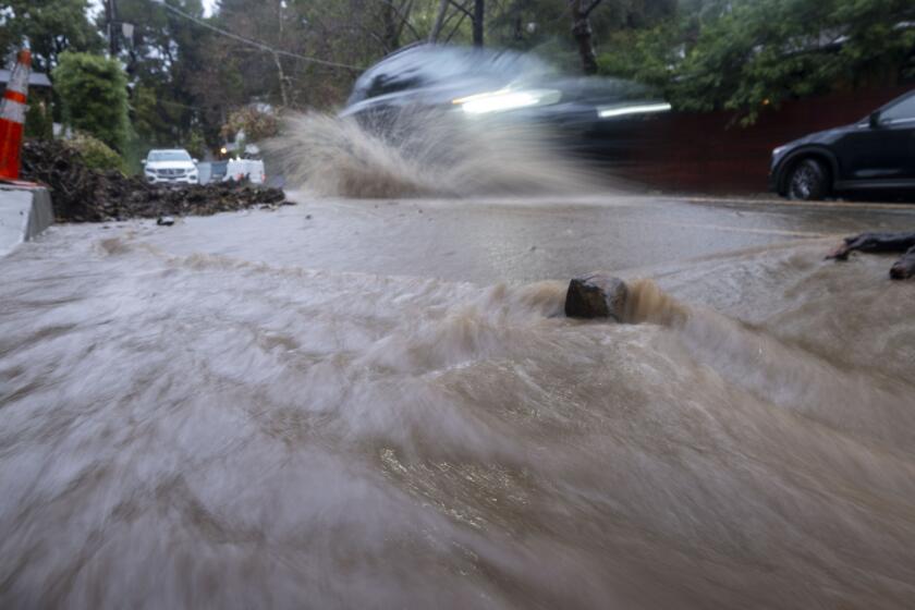
Already, the Southland has been inundated by astonishing rainfall, with many areas, including downtown Los Angeles and Culver City, receiving more than 6 inches in a 24-hour period and communities across the Santa Monica Mountains reporting more than 10 inches, according to the National Weather Service. The deluge — which is expected to continue through the night and possibly beyond — flooded streets, closed major roadways, forced water rescues and sent mud and debris down canyon walls and hilly streets, including in Hollywood Hills, the Santa Monica Mountains and Studio City, where multiple homes were damaged and dozens were forced to evacuate.
As Californians face non-stop rain from an atmospheric river this week see how rainfall totals in your area compares to other regions and previous years.
Since the storm began, the Los Angeles Fire Department has responded to 130 flooding incidents, 49 mud and debris flows, half a dozen structure fires and several water rescues for stranded motorists, Fire Chief Kristin Crowley said Monday. A dog and its owner were rescued by firefighters from the L.A. River, while the county said it had saved five cats from rushing waters.
The storm prompted a state of emergency declaration from Gov. Gavin Newsom along with evacuation orders and warnings for residents in and around wildfire burn scars in Sun Valley, Topanga, Juniper Hills and other areas. Los Angeles Mayor Karen Bass signed a declaration of a local emergency on Monday to help the city respond to the storm. Though the worst of the storm was past, Bass warned city residents to remain vigilant.
“We need Angelenos to be cautious, to be careful, to be safe and please, stay home,” she said at a Monday evening news conference.
President Biden called the mayor during the news conference, and she held her phone to the microphone so reporters could hear the president’s remarks.
“We’ll get any help on the way as soon as you guys request it,” Biden said, adding that the Federal Emergency Management Agency was ready to aid the rain-drenched state.
Dangerous winds kicked off the storm late Saturday across Northern and Central California, where gusts of more than 80 mph were recorded in some spots, causing fallen trees, power line damage and widespread outages.
“In terms of total outages, this was one of the top three most damaging, single-day storms on record, comparable to storms in 1995 and 2008,” PG&E officials said in a statement Monday, with updated estimates reporting 440,000 still without power. “This resulted in damage to trees and electric infrastructure, and led to other debris contacting electric equipment and lines.”
Some 7,200 of L.A. Department of Water and Power’s 1.5 million customers were without power Monday afternoon, mostly in West L.A., Mid-Wilshire and Tarzana, DWP spokesman Joe Ramallo said. More than 5,000 Southern California Edison customers were also without power, mostly in L.A. and Orange counties, according to the utility.
Flows of mud have damaged some homes, forcing some residents to evacuate in Los Angeles. Life-threatening landslides and flooding continue across Southern California.
Rainfall totals were continuing to pile up, including 11.34 inches in the Topanga area, 11.64 inches around Bel-Air and 7.01 inches in downtown Los Angeles — with 1 to 3 more inches possible through Wednesday as the plume of moisture lingers over the area, Kittell said. Higher elevations, including the hills and mountains, will get even more rainfall through Wednesday — an additional 3 to 6 inches — on top of the already impressive amounts they have recorded, he said.
“There’s still a lot of rain to come,” Kittell said. “It’s definitely declining starting Wednesday ... [but] it’s not until after Friday that we get the all-clear.”
The storm has yet to hit its stride to the south and east of Los Angeles County, officials said, but forecasts were looking more favorable Monday: Warnings no longer included “catastrophic” flooding for Orange County and the Inland Empire.
“The rain has been more so a moderate, steady rainfall as opposed to just pockets of really heavy rainfall rates,” said Elizabeth Adams, a meteorologist with the National Weather Service in San Diego. “The way that it’s playing out right now has just been a lot steadier, and hopefully this trend continues so we can avoid some of that catastrophic flooding that we were worried about.”
Here are areas in L.A, Ventura, Orange and San Bernardino counties with evacuation orders or warnings in place. Sand and sand bags are available.
Still, rain continues to increase in these areas, with Coto de Caza in Orange County recording 4.69 inches of rain by Monday afternoon and southwestern San Bernardino County getting 3 to 7 inches — including 9 inches at Lytle Creek. Officials there issued evacuation warnings in the mountain communities of Forest Falls, Seven Oaks, Barton Flats and Angelus Oaks for possible mud and debris flows.
And several more inches of rain are still forecast as the storm shifts slowly to the south, creating more flooding concerns.
Six Flags Magic Mountain, Knott’s Berry Farm and SeaWorld San Diego closed Monday because of the storm. Disneyland was expected to shut at 8 p.m. — earlier than normal — in anticipation of heavy rain through the night, according to a park spokesperson.
The storm was “remarkable and in some ways historic,” said Daniel Swain, a climate scientist with UCLA. He noted that the system reached bombogenesis — or “bomb cyclone” — status as it zeroed in on the state Sunday, indicating a sustained drop in pressure and a rapid strengthening.
“The concern right now in Southern California is that the rain and the atmospheric river has been stalled, mainly over the same place it has been for the past 18 hours,” Swain said during a briefing Monday.
In Los Angeles County, residents awakened Monday to a soggy, muddy mess, including dozens of road closures and delays due to flooding and debris, according to the California Department of Transportation, California Highway Patrol and other agencies.
The atmospheric river smashed several daily rainfall records Sunday in Southern California, and Swain said it is likely that the region will come close to — or even exceed — an all-time 24-hour rainfall record when all is said and done.
At least five homes were significantly damaged in a debris flow in the 1900 block of North Beverly Drive in Beverly Crest, said Los Angeles Fire Department spokesperson Nicholas Prange. No one was trapped, he said, but about 10 people were displaced.
Chilling rain, swirling gray clouds and blustery winds rolled into Southern California on Sunday as what was anticipated as the strongest storm of the season promised near-record rainfall and flash flooding through Tuesday.
Mud was also flowing across the Hollywood Hills, where at least two homes were damaged as debris flowed down Lockridge Road near Fryman Canyon in Studio City, and nine others were evacuated out of concern for soil instability. Firefighters also evacuated residents from three homes on Boris Drive in Tarzana due to flowing debris.
Topanga Canyon Road was closed for about a mile south of Woodland Hills due to flooding.
In the Westside neighborhood of Beverly Crest on Monday afternoon, firefighters showed up at Dennis Hacela’s home on Beverly Drive and informed him about the severe mudslide nearby. They evacuated residents on the other side of his street and told him to be ready to evacuate, just in case.
“I’m hoping there’s enough barrier between me and the mud that it won’t come down here,” the 73-year-old said. He had rerouted his downspouts in preparation for the storm and continued to watch the news — but he said the rain Sunday night hit his roof harder than he’d ever heard.
“In my 35 years of being in this canyon,” he said, “this is the scariest it’s ever gotten.”
Times staff reporters Ruben Vives, Hannah Fry, Dakota Smith, Priscella Vega and Rong-Gong Lin II contributed to this report.
More to Read
Sign up for Essential California
The most important California stories and recommendations in your inbox every morning.
You may occasionally receive promotional content from the Los Angeles Times.
