Emergency declaration and urgent warnings as Southern California storm gains ferocity
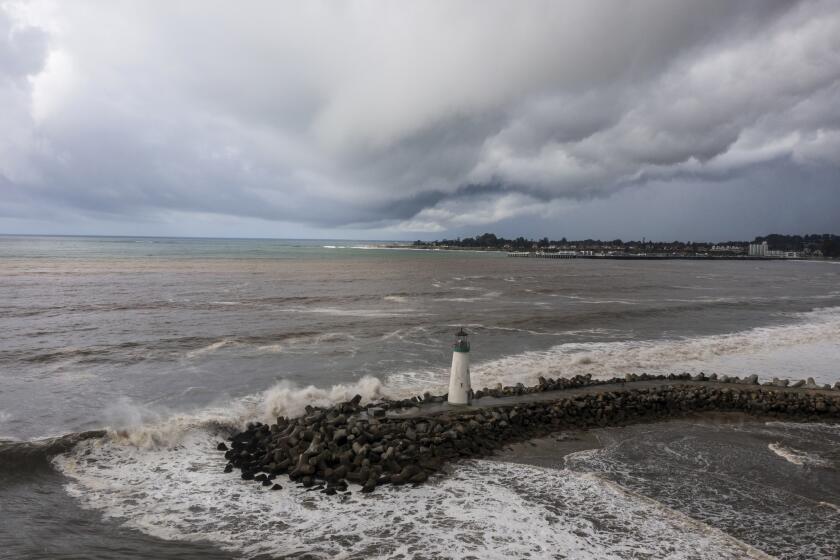
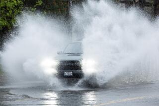
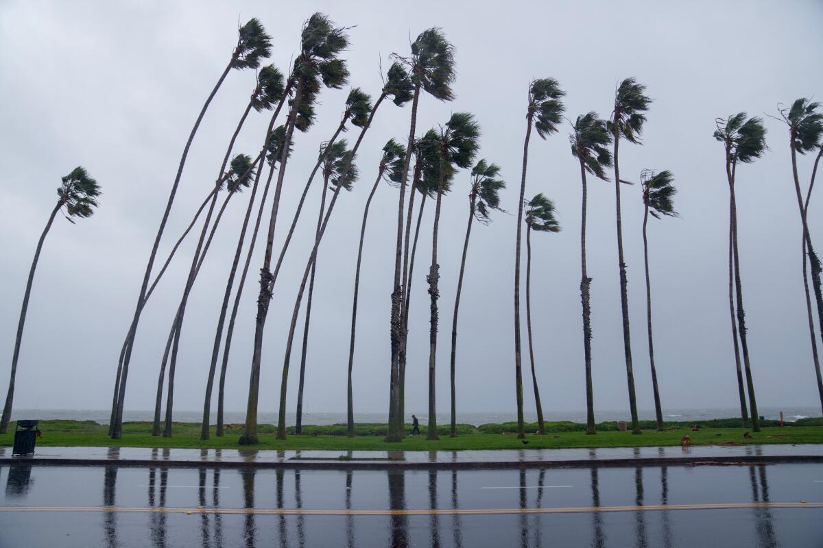
Chilling rain, swirling gray clouds and blustery winds rolled into Southern California on Sunday as the strongest storm of the season geared up to deliver near-record rainfall and life-threatening flash flooding through Tuesday.
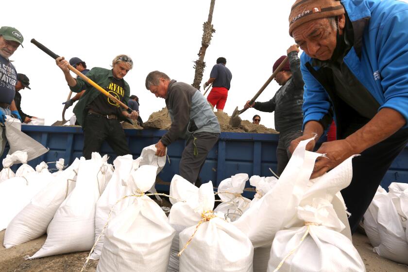
The slow-moving atmospheric river gathered strength Sunday afternoon, spurring Gov. Gavin Newsom to declare a state of emergency in eight Southern California counties: Los Angeles, Orange, Riverside, San Bernardino, San Diego, San Luis Obispo, Santa Barbara and Ventura. The National Weather Service in Oxnard warned that “all systems are go for one of the most dramatic weather days in recent memory.”
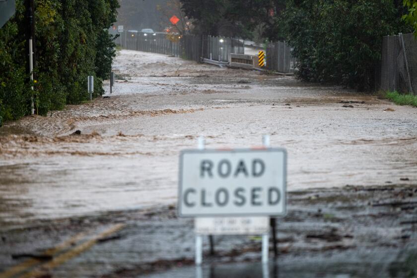
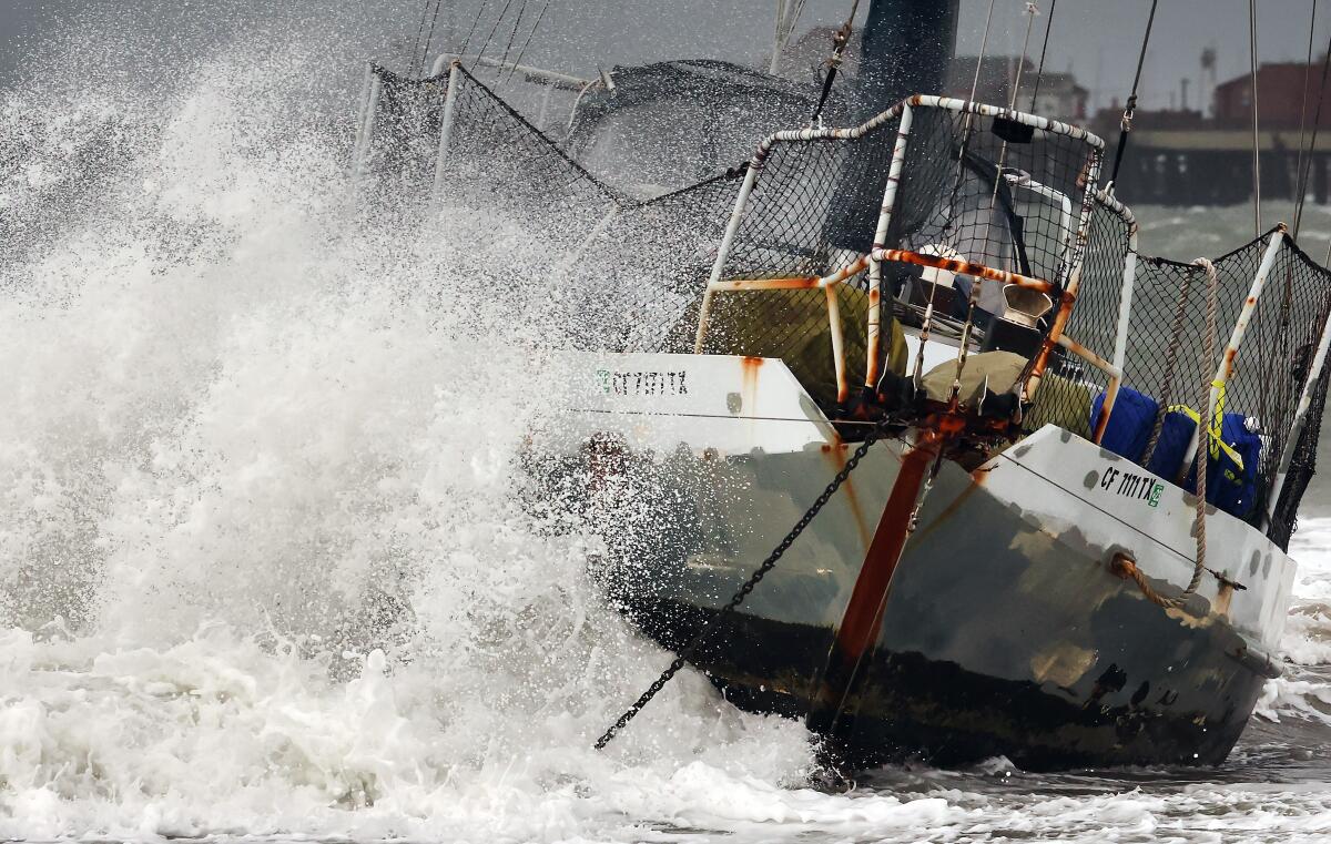
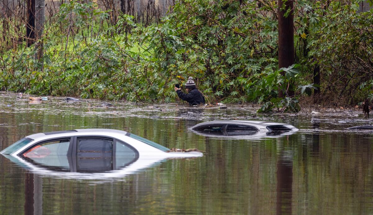
By Sunday evening, reports of storm damage and rescues were multiplying: Whipped by powerful winds, power lines toppled and trees fell across Northern California; one tree crushed a car on Highway 101 near Santa Rosa, injuring a motorist. Santa Barbara Airport closed due to flooding on the airfield. Nineteen people were rescued off Long Beach after the mast of the boat they were on broke in high winds. In Tarzana, swift water rescue teams responded to motorists stuck in floodwaters at West Oxnard Street and Donna Avenue, while firefighters in San Jose rescued stranded people and dogs from an island in the flooding Guadalupe River.
“Storms can change quickly, but let me be clear: This storm is a serious weather event,” Los Angeles Mayor Karen Bass said at a news conference Sunday afternoon. “This has the potential to be a historic storm — severe winds, thunderstorms and even brief tornadoes.”
Forecasters said the storm appeared to be focused on the Los Angeles area, where it could park itself for the next few days. The storm could drop up to 8 inches of rain on the coast and valleys and up to 14 inches in the foothills and mountains. Snowfall totals of 2 to 5 feet are likely at elevations above 7,000 feet.
At a briefing Sunday afternoon, Los Angeles Unified Supt. Alberto Carvalho announced that schools would remain open Monday, except for Vinedale Span School in Sun Valley, which is affected by city-ordered mandatory evacuations. He called on parents and staff to look for updates Sunday night and Monday at 6 a.m.
Santa Barbara County school districts opted to close Monday. Meanwhile, at least seven Cal State campuses — Dominguez Hills, Fullerton, Los Angeles, Northridge, Pomona, and San Bernardino — alerted students and staff that classes would move online.
The weather service issued dozens of flood watches and storm advisories across the state, including flash flood warnings in parts of San Luis Obispo, Santa Barbara, Ventura and Los Angeles counties.
Ryan Kittell, a meteorologist with the weather service in Oxnard, said the storm could make a mess of the Monday-morning commute in L.A. County, which could see freeway flooding.
“If anyone has an opportunity to work remotely on Monday, that’s definitely the day to do it,” he said.
Forecasters were also warning of “torrential” rain in areas of Orange County, the Inland Empire and coastal slopes of the San Bernardino Mountains. The weather service warned in the afternoon of “locally catastrophic and life-threatening flooding,” stating that the storm system would “stall, bringing heavy rain through Monday afternoon.” From 5 to 7 inches of rain could drench Anaheim, Irvine and Ontario.
Orange County issued an evacuation warning Sunday night for areas in the Santa Ana Mountains, including along sections of the Santiago, Silverado, Williams, Modjeska, Trabuco, Live Oak, Rose, Holy Jim and Black Star canyons, as well as around Irvine Lake. Also, late Sunday night, San Bernardino County declared a state of emergency “in anticipation of extreme rain and snow.”
At Ventura Harbor, just north of L.A. County, rain was beating down on shops and restaurants Sunday. It had been hours without a customer at Harbor Market and Liquor, at a nearby hair salon, stylist Danielle White was weighing whether she should hit the road, worried that she could get stranded by flooding.
“We’re clearly not going to get any inquiries,” she said, gazing out at the rain.
In Long Beach on Sunday afternoon, one person was hurt in the rescue of 19 people off the rocky Long Beach breakwater. The boat’s mast broke amid strong winds. The injury was not life-threatening.
“It was a really a positive outcome but very difficult,” said Brian Fisk, firefighter and Long Beach Fire Department public information officer. “The weather not only caused the accident but hampered our rescue effort.”
Evacuation warnings and notices were issued in portions of Ventura, Santa Barbara, Monterey and Los Angeles counties — including Topanga near the Owen and Agua fire burn scars; the Juniper Hills and Valyermo areas near the Bobcat fire burn scar; the Lake Hughes and King Canyon area near the Lake fire burn scar; and the La Tuna Canyon area of Sun Valley near the Land fire burn scar.
Burn scars are subject to an increased risk of flooding and debris flows.
“Make your personal safety your top priority,” said Los Angeles Fire Department Chief Kristin Crowley. “Follow all evacuation orders, avoid travel. ... If you do have to travel, please, please, slow down and avoid any flooded areas.”
Swift-water rescue teams, urban search-and-rescue teams and other personnel were standing by in preparation for the storm, Crowley said.
Newsom also mobilized a record 8,500 emergency response personnel across the state to assist communities in the path of the storm, his office said.
Headlights on. Foot off the gas pedal. And if you see a flooded street, turn around. Here are tips for driving safely as California gets drenched.
In addition to a risk of flash flooding, the storm was expected to deliver damaging winds. San Luis Obispo and Santa Barbara counties were forecast to get winds up to 70 mph through 6 p.m. Sunday, with isolated gusts up to 90 mph possible in mountain areas.
Ventura and Los Angeles counties were expected to see gusts of up to 50 mph between 1 p.m. and 1 a.m., with isolated gusts of up to 70 mph in mountains and hills. The Ventura River was expected to swell and reach its flood stage around 11 p.m. Sunday.
Inside Ventura’s Pierpont Tacos on Seaward Avenue, Joseph Kenton and Anna Tyler were taking a break from delivering firewood from Ojai on Sunday morning.
“People were freezing in this weather,” said Kenton, who had been driving for hours making deliveries, between bites of tacos. “They want wood to stay warm. Anna got up at 5 o’ clock and started splitting wood.”
As the rain started, “it was real dangerous,” he said. “We had to go real slow.”
On Sunday evening, celebrities began arriving for the 2024 Grammy Awards at Crypto.com Arena in downtown L.A. Several stars were spotted scrambling from their cars to the red carpet with umbrellas.
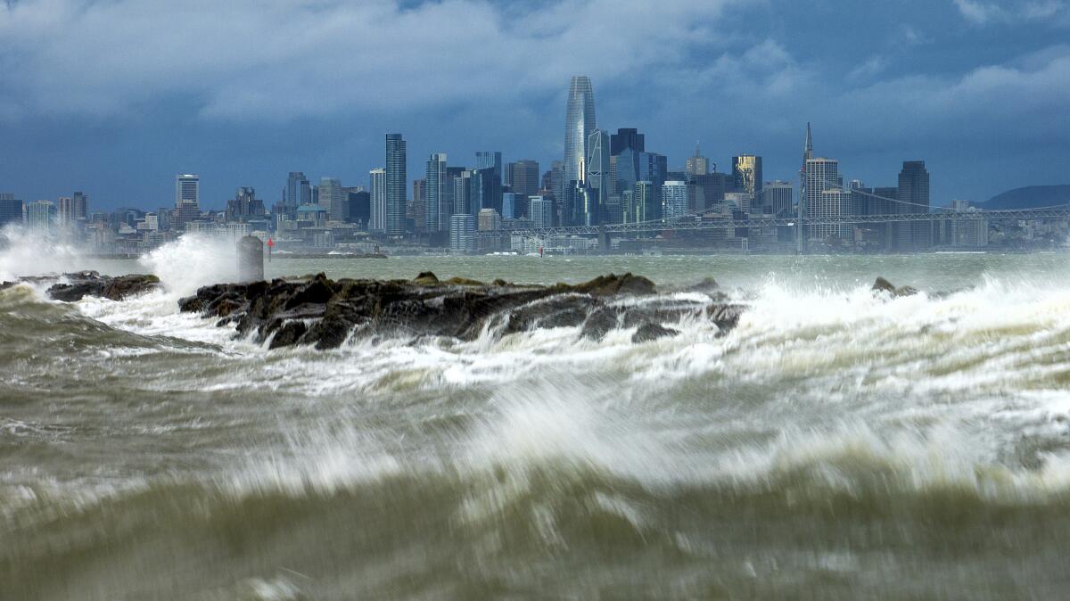
The storm barreled through Northern and Central California before making its way south.
Monster winds and downpours began to inundate Northern California late Saturday, with the worst of the weather kicking in early Sunday. Thousands were without power by late morning, as officials scrambled to respond to downed trees and power lines across the Bay Area and Central Coast, as well as growing concerns about flooding.
San Francisco International Airport led the nation in delays and cancellations Sunday morning. Almost a third of incoming and outgoing flights were delayed as of noon Sunday, according to FlightAware.
Bob Rotiski, spokesperson for SFO, said the airport reduced its capacity for flights because of the weather, expecting delays through 1 a.m. Monday. He said the average flight was delayed more than four hours as of noon Sunday, and that could increase.
In Sonoma County, a tree fell onto a home early Sunday; in Palo Alto, a tree blocked the eastbound lanes of the Oregon Expressway. Downed power lines closed a stretch of State Road 1 in San Mateo County, and in San Francisco, fallen lines forced traffic detours.
Some of the highest winds early Sunday were recorded in the Big Sur area — up to 88 mph, said Sarah McCorkle, a National Weather Service meteorologist in the Bay Area. Gusts had reached as high as 60 mph in the East Bay and were expected to remain a major threat throughout the day, with a high wind warning in effect for much of the state through late Sunday or Monday.
In San Jose, city officials declared a state of emergency ahead of expected flooding along the Guadalupe River, fueled by rain in the Santa Cruz Mountains, where 6 inches was expected through Monday. Officials ordered the evacuation of people living along the river’s banks, offering free rides and shelter. The river was expected to peak at more 11 feet — almost 2 feet over flood stage.
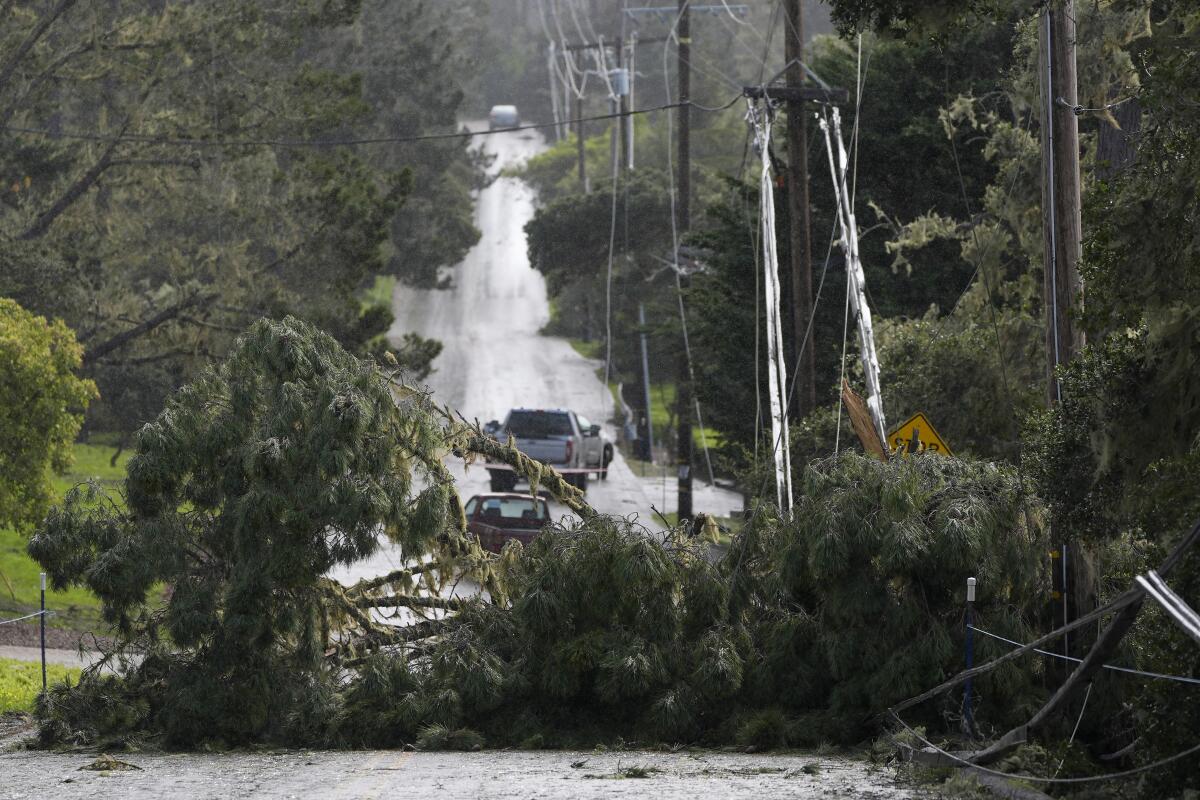
The Carmel River at Robles Del Rio in Monterey County was also expected to flood, reaching almost a foot over its 8.5-foot flood stage by Sunday night, according to the California Nevada River Forecast Center.
McCorkle said the storm uniquely strengthened directly off the Northern California coast, where a low pressure system dropped down from the Pacific Northwest to merge with a moisture-heavy system moving in from the eastern Pacific.
“That helped intensify the storm from the eastern Pacific,” she said. That rapid intensification Saturday could mean the storm underwent a bombogenesis, often referred to as a bomb cyclone, but McCorkle said that would require post-analysis to confirm.
“Once it strengthened, [the low pressure system] helped draw in the moisture from the subtropics,” McCorkle said, forming a type of atmospheric river that has become known as a “Pineapple Express.” Those two dynamics — the intensified low pressure system and heavy moisture — have helped drive the dangerously high winds and severe rainfall moving across the state.
Warm ocean waters are upping the odds of significant downpours and offering a preview of the state’s future in a warming world, experts say.
Conditions in Orange County, the western Inland Empire and the San Bernardino Mountains were expected to deteriorate Sunday into Monday as the storm moved toward San Diego and the Mexican border, according to the National Weather Service in San Diego.
“Precipitation intensity will only increase across these areas on Monday, and life-threatening flash flooding will be possible. By Monday night into Tuesday, the axis of the moisture plume begins to shift farther south and east, reaching Riverside and San Diego Counties,” the agency said.
Rainfall rates in the southernmost part of the state will be modest — up to 0.30 inch per hour — but the relentlessness was expected to lead to impressive totals through Tuesday, the agency said.
That includes the probability of up to 7 inches in the Santa Ana Mountains, 5 inches in Orange County, 4 inches in the Riverside County Mountains, 2 inches in the Apple and Lucerne valleys, 1.5 inches in the Coachella Valley and 0.75 inch in the San Diego County deserts. The San Bernardino County mountains were forecast to see up to 11 inches on south-facing slopes.
The dangerous, intense storm will move into Southern California this weekend, lingering for days and bringing the potential for widespread flooding, power outages, downed trees and debris flows.
Regional public utilities, including California Edison and the Los Angeles Department of Water and Power, were preparing to respond to service outages and downed power lines. About 900,000 people were without power statewide by late Sunday evening.
The LADWP said it would “monitor the storm system closely and respond accordingly, with the ability to schedule crews to be available around the clock.” The utility also beefed up staffing at call centers to respond to customers without power.
“During the storm, winds could blow down large objects such as trees, or cause branches and palm fronds to strike power lines, which could cause power outages,” LADWP said. “This is especially true when soil becomes oversaturated by the rain, causing it to loosen and uproot trees.”
In addition to downed trees, flooding and water intrusion into underground electrical systems may cause power outages. Repairs may be slower if the affected equipment is underground and crews need to go from vault to vault to identify the source of the damage.
The utilities urged caution around downed power lines, which can electrify puddles, wet grass and surrounding areas.
“Always assume a downed wire is energized,” Edison said. “Stay away and call 911 immediately.”
As steady rain fell Sunday, George Camarena, a lifeguard and longshoreman in Ventura, brought his Nintendo down to play video games with friends Pierpont Tacos. Earlier in the day, he had gone out to keep an eye on the beach.
“You never want to see someone down in the water” in this weather, he said. A faraway seal had made him look twice, but he was relieved to see no one in the water — just a few neighbors walking their dogs on the beach.
When a rogue wave hit the area in December, he saw people standing on top of their trucks to avoid the water, seniors with scraped faces and women whose keys had been swept away, he said.
“Today I’m just keeping my eye out,” he said.
Times audience engagement editor Nicholas Ducassi contributed to this report.
More to Read
Sign up for Essential California
The most important California stories and recommendations in your inbox every morning.
You may occasionally receive promotional content from the Los Angeles Times.
