2 more homes red-tagged on Palos Verdes Peninsula as ground movement escalates

Landslides have shaped the Palos Verdes Peninsula for the last several generations, but recent damage to homes across the affluent area of the South Bay shows the earth is moving dramatically faster than in recent years.
Residents are watching cracks develop in and around their homes, desperately worried that they will end up like the dozen houses that collapsed over the summer in Rolling Hills Estates, one of four cities on the peninsula.
Officials in the region are bracing for more movement, trying to slow down or stop the shifting ground beneath their feet with updates to existing water and sewer lines and other infrastructure, along with ongoing monitoring.
Most recently, two homes in the Seaview neighborhood of Rancho Palos Verdes were red-tagged due to visible cracks and structural damage. One home was deemed unsafe and red-tagged June 30 by city officials. A second home was red-tagged on Aug. 31, said Megan Barnes, a senior administrative analyst with the city.
Seaview is in the southeast corner of Rancho Palos Verdes, not far from a landslide complex that covers about 240 acres of the peninsula and has been a slow-moving hazard for years but that has now, alarmingly, picked up pace.
Rancho Palos Verdes Councilmember Eric Alegria asked city staff whether it would be possible to declare a state of emergency due to the ground shifting more markedly and an increase in water line breaks over the last several months.
“I think declaring a state of emergency will give us an opportunity to summon all the resources we’re going to need to coordinate,” Alegria said, and streamline “processes with the agencies that we want to bring in to support us in this effort.”
The council did not declare an emergency at its regular meeting Tuesday, but the city did approve a contract agreement for engineering and construction work to reduce existing water saturation of soil and improve runoff outside of areas already affected by land movement.
The city also asked for utility companies that serve the area to come back with a report on short- and long-term solutions to address the ground shifts and how the existing infrastructure could be updated to accommodate more movement.
The Daily Breeze first reported on Tuesday’s City Council meeting, which brought out about 20 residents who spoke about their concerns on the ground shifts and their worry for the upcoming rainy season.
It could be up to two months before geological experts evaluating the Rolling Hills Estates landslide have any preliminary answers.
Many residents are worried that what happened in Rolling Hills Estates earlier this summer could happen elsewhere on the peninsula.
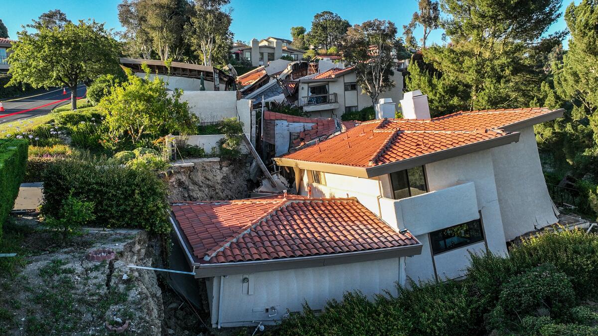
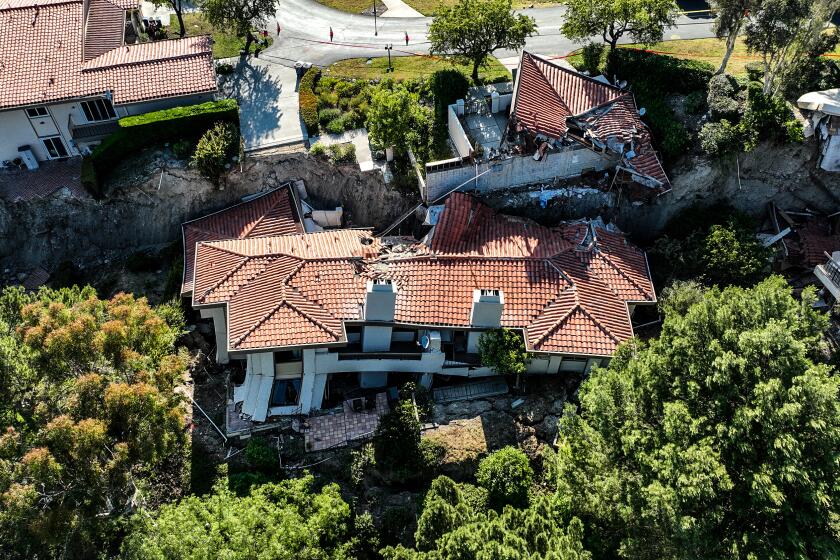
The ground gave way in early July beneath homes bordering a canyon, collapsing roofs, cracking driveways and splitting open walls. The official cause of the damage has not been determined, but Los Angeles County officials speculate that the ground was saturated due to record winter rainfall.
The homes descended toward the bottom of a canyon as the ground actively shifted for several days. Now, residents in the Seaview area are worried that the problem they’re watching unfold in their own neighborhood will only get worse.
“I think we’re past just measuring” land movement, resident Joe Cruz said during Tuesday’s council meeting. “We need action now.”
The water lines to his neighborhood have had multiple breaks due to the ground shifting, Cruz said, and residents are worried that leaks will lead to more water saturating the soil.
Nikki Noushkam said cracks had developed in and around her home over the last several weeks. She lives across the street from a home that was recently red-tagged.
“We are dealing with a situation that requires urgent action,” Noushkam told the City Council.
Mark Koch said he’d seen more land movement outside his home in the last two years than he’d seen in the 35 years since he moved to the city.
“I’m literally at the end of the line where everything drains out into the ocean,” he said. “The amount of water that’s coming through our system is unprecedented.”
City officials agree that the ground is moving at a faster rate than in previous years. Between 2007 and 2018, the rate of movement in the area of the peninsula known as the landslide complex remained consistent, but starting in 2018 that ground movement increased by 3 to 5 times, Rancho Palos Verdes officials said in a recent report.
Although only two homes were red-tagged in the Seaview neighborhood, several other homes are damaged but have not been red-tagged by city inspectors, according to Barnes. The Los Angeles County Fire Department also inspected other homes in the neighborhood.
The city report echoed residents’ observations, noting that in the last several months more ground movement had resulted in broken water lines and sewer pipes.
The landslide complex includes Abalone Cove, the Klondike Canyon Landslide Abatement District and the Portuguese Bend landslide.
City staff are in contact with homeowners and have instructed them how to report any observations and concerns, or request an inspection.
“Since the accelerated land movement was observed in late June, Public Works has been working with a geotechnical engineer to monitor the movement,” Barnes said. “This is in addition to regular monitoring throughout the year in the City’s overall landslide complex.”
More to Read
Sign up for Essential California
The most important California stories and recommendations in your inbox every morning.
You may occasionally receive promotional content from the Los Angeles Times.


