How heat waves spread wildfires in California -- even when it isn’t windy
If you live near the coast, wildfire season starts with Southern California’s notorious Santa Ana winds, which usually arrive in the fall.
But inland, the fire season is already well underway.
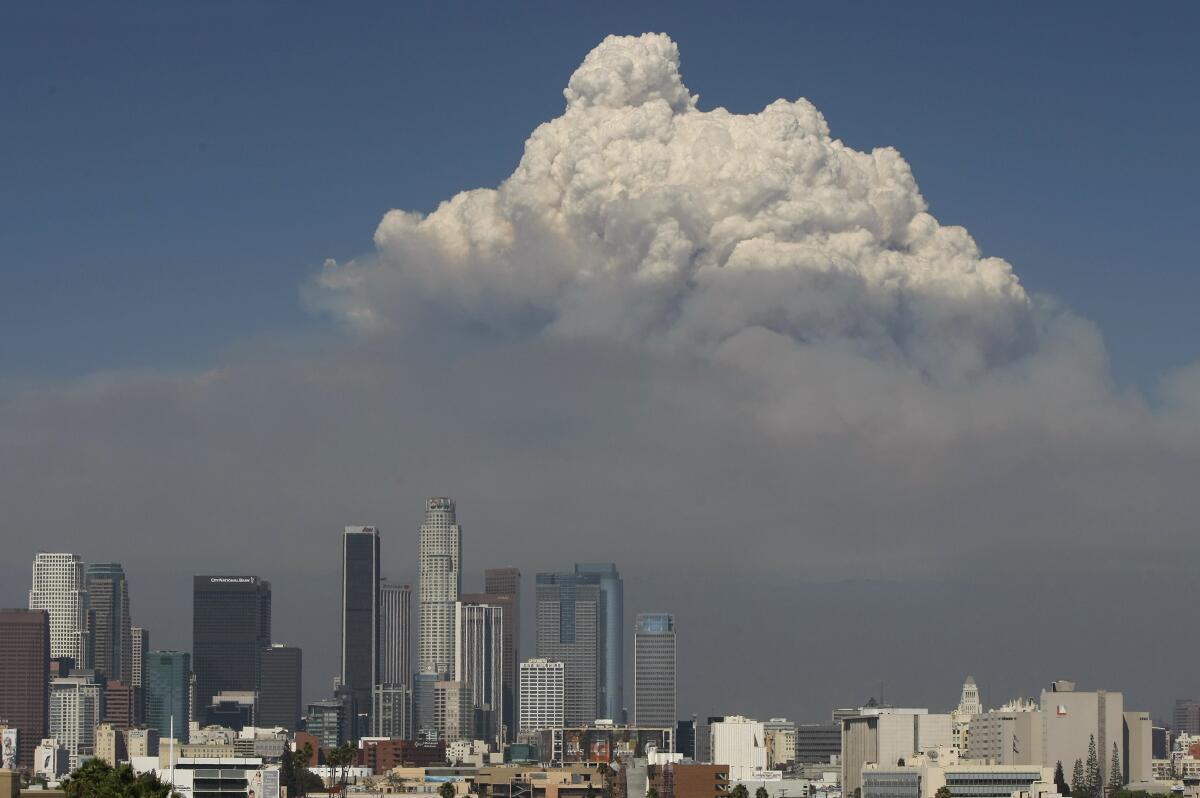
It’s as if there are two separate fire seasons, said David Gomberg, a forecaster and fire weather program manager with the National Weather Service in Oxnard. His forecast office has warned for more than a week of the potential for fires that can explode into monsters, sending smoke plumes thousands of feet into the sky. And they do it without any significant winds, such as a Santa Anas.
“Strong winds are not a requisite condition for large uncontrollable fires,” said John Abatzoglou, a professor of climatology at UC Merced who has studied the bifurcation of Southern California fire activity.
These fires, he said, are driven by a trifecta of fuels, topography, dryness and heat — of which there has been plenty in the Southwest this summer.
But there’s another important but little understood factor — a product of the heat that fire forecasters study closely. It’s called mixing height.
Mixing height is a measurement of how high a smoke column or plume can rise from a fire.
The measurement can be used as a proxy for estimating fire danger, said Darren Clabo, South Dakota’s state fire meteorologist.
Knowing the mixing height can help scientists determine the potential vertical plume growth of a fire, Gomberg said.
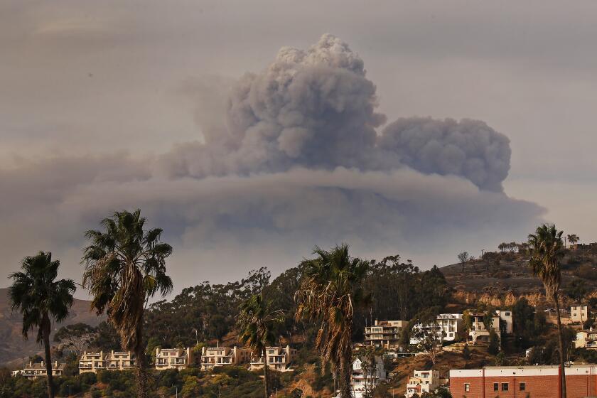
A fire with a high vertical plume or convective column of smoke, ash, particulates and other gases is dangerous because it acts like a giant chimney. Air rushes in to replace the heated air rising in the column, creating erratic winds on the ground that provoke extreme fire behavior.
Hotter temperatures tend to result in higher mixing heights, Gomberg said.
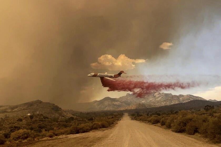
The York fire, which began in the Mojave National Preserve and spread into Nevada over the weekend, is uncontained.
“During a typical heat wave, it is common to see mixing heights between 10,000 and 15,000 feet across inland areas, and sometimes as high as 20,000 feet during major heat waves, such as what we saw during the Station fire and Bobcat fire.”
Elevated heat and mixing heights of 10,000 to 15,000 feet in the Inland Empire have contributed to recent plume-dominated fires such as the Bonny fire in Riverside County. Forecaster Brian Adams said that on Friday he could watch a pyrocumulus cloud soaring above the Bonny fire from his window at the San Diego weather service’s office in Rancho Bernardo.
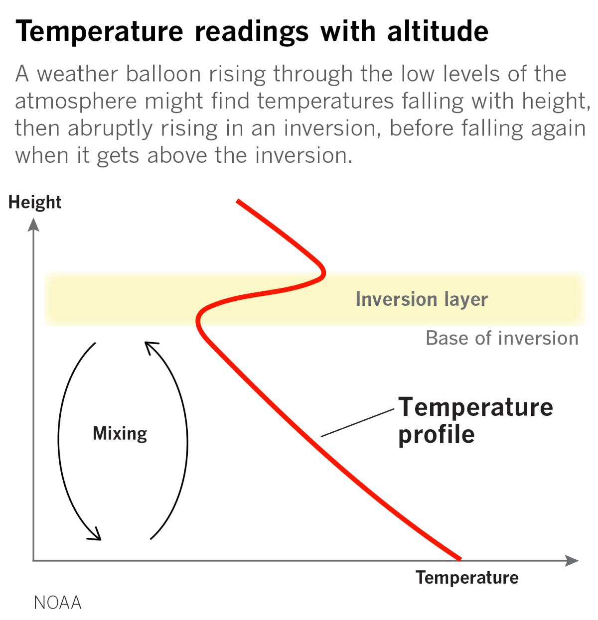
The mixing height marks the top of the planetary boundary layer, which is the section of the atmosphere affected by Earth’s surface, such as the heating of land and sea by the sun and the obstruction of wind by trees and buildings.
At night and during cooler times of the year, the planetary boundary layer contracts as the sun’s heat does less to warm Earth’s surface. (If there’s a fire, this is why the smoke is held close to the ground at night and the blaze is said to lie down.)
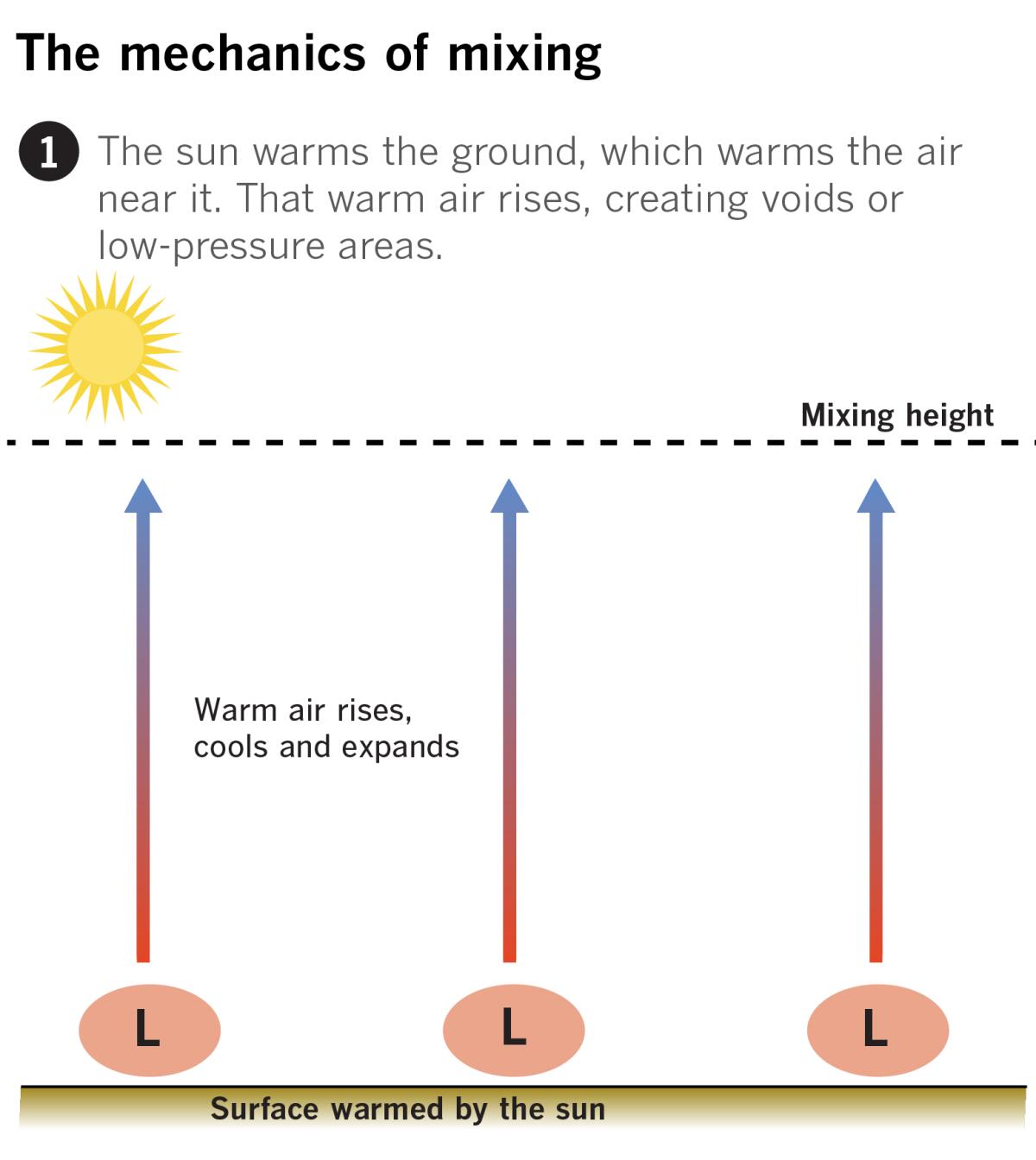
If you sent up a weather balloon first thing in the morning, it might encounter warmer air just above Earth’s surface before detecting progressively cooler temperatures as it rises higher. That’s because at night the sun isn’t heating the ground and the air immediately above it.
When the sun comes up, it warms the ground, which heats the air above it. Air that’s warmer than the surrounding air rises; air that’s cooler than the surrounding air sinks.
Like other destructive wildfires this season, the Mountain View fire was plume-dominated. What’s the science behind such clouds?
As the summertime sun’s heat increases, the planetary boundary layer expands. If there’s a fire, the smoke no longer hugs the ground; instead, it abruptly soars thousands of feet into the sky. That means the mixing height is suddenly dramatically higher, with important implications for fire behavior.
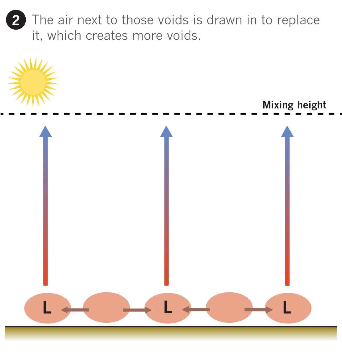
As warm air near the surface rises, it leaves behind voids or low-pressure areas. Since the atmosphere is constantly trying to restore equilibrium, higher pressure always flows toward lower pressure. Air next to those voids flows in to fill the vacant space. That creates more voids, which too must be filled, this time by air sinking from above.
But when air sinks it is heated due to compression, like how a bicycle pump gets hot because the air is being squeezed into a smaller space. The further the air sinks because of the high mixing height, the more it is forced to heat.
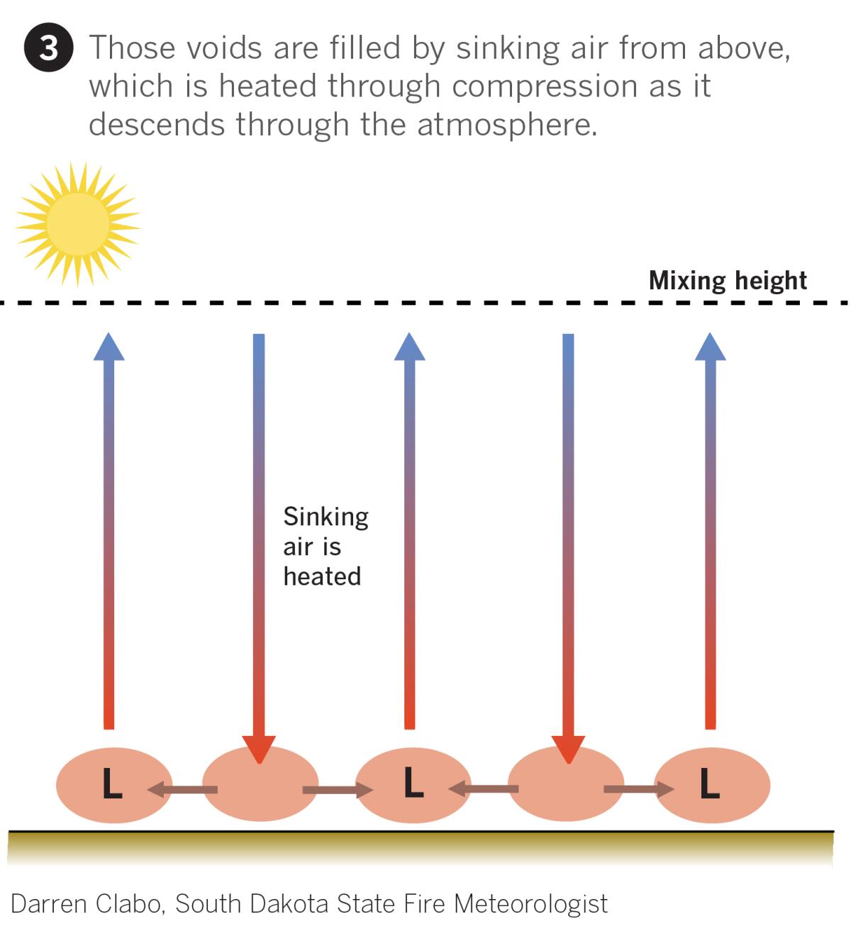
On top of that, the air sinking from higher in the atmosphere is bone dry compared to the more moist air hanging around Earth’s surface.
“A day with high mixing heights lowers surface dew points [humidity] and increases surface temperatures,” Clabo said. “Higher mixing heights tend to promote larger fire growth because of these processes.”
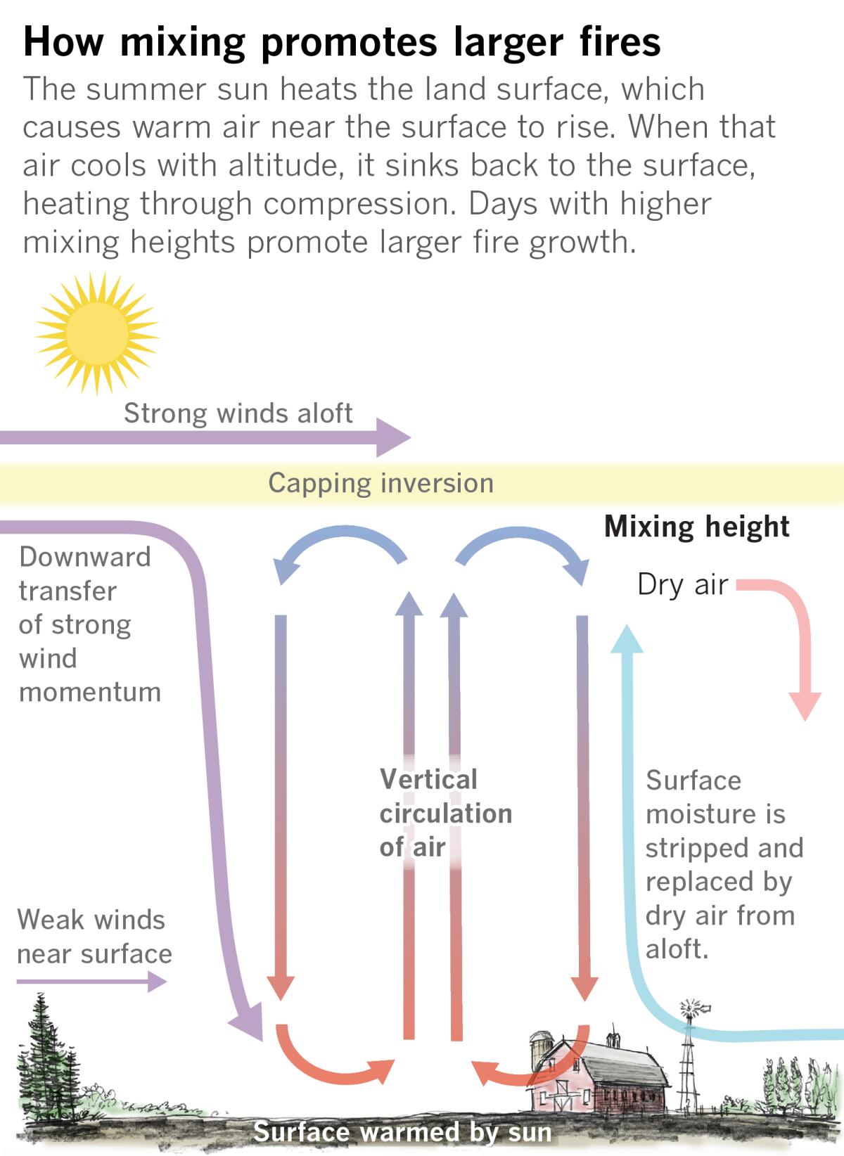
If there’s a fire in these conditions, heated air will rise very rapidly, quickly creating a convective column or plume and with it dangerous conditions, Clabo said.
Experts warn that warming from human-caused climate change is a factor in the persistent heat gripping the West. The strong ridge of high pressure, sometimes referred to as a “heat dome,” besieging the Southwest may be stuck in place because the jet stream, the upper-level air currents that steer weather patterns around the globe, has become more wavy.
Even without climate change, more heat is likely on the way. In Southern California, inland valleys are the hottest in mid-August, somewhat later than the rest of the country. Closer to the coast, the hottest weather is delayed just a fraction toward late August to Sept. 1, said Eric Boldt, a meteorologist with the National Weather Service in Oxnard.
Wildland vegetation in Southern California has been drying out over the last several weeks, Abatzoglou says, but the cool spring weather that lasted into June has helped. “Should things be persistently and unusually hot and parched for another few weeks in the mountains, the switches that likely are limiting high fire potential may turn on.”
By that time, Southern California will be on the cusp of its other fire regime, the one fueled by hot, dry Santa Ana winds.
More to Read
Sign up for Essential California
The most important California stories and recommendations in your inbox every morning.
You may occasionally receive promotional content from the Los Angeles Times.
