California’s wild storm: The Fujiwhara effect, a bomb cyclone, even landspout, tornado warnings

Even on the heels of an unusual winter of intense rain, wind and snow, the storm that slammed California on Tuesday came with some surprising conditions.
The storm was marked by powerful winds in the Bay Area and other parts of Central and Northern California that downed trees, created treacherous commuting conditions, broke windows in downtown San Francisco and caused power outages.
The system prompted the National Weather Service to issue high wind warnings for a stretch of the coast from San Francisco to San Diego, as well as inland areas, including Palmdale, Lancaster and the Antelope Valley.
Fujiwhara effect
On Tuesday afternoon, as the storm approached the Bay Area, the system developed two “eyes,” or areas of low pressure, resulting in a “doubled-barreled blow” to San Francisco and Santa Cruz, said Bay Area National Weather Service meteorologist Brian Garcia.
The rare occurrence, known as the Fujiwhara effect, intensified winds as the low-pressure areas danced around each other.
Rick Canepa, a National Weather Service meteorologist in Monterey County, cited the two low-pressure centers “and possibly a third one that are just kind of rotating around each other.”
The phenomenon was contributing to peak gusts upward of 60 to 75 mph in the Santa Cruz Mountains, Canepa said, with 50- to 60-mph winds across Santa Cruz and Santa Clara counties.
Bomb cyclone
UCLA climate scientist Daniel Swain pointed to other unusual attributes of the weather system, including a “sting jet,” or localized acceleration of winds next to a low-pressure center.
“The name comes from the 3D visualizations of this feature,” he said, “which look a little bit like a scorpion’s tail descending from the sky.”
Swain said in a briefing Tuesday that the system had reached the benchmark for bombogenesis, or a “bomb cyclone,” which indicates a rapid drop in pressure.
Unlike an earlier bomb cyclone this winter about 1,000 miles southwest of San Francisco, this one “is very close to the coast,” Swain said. “So the impacts are actually more immediate and greater than they were back then.
“The storm is really raking Santa Cruz and San Mateo counties in particular,” he added as he reviewed radar images. “I have never seen anything quite like it.”
SoCal winds
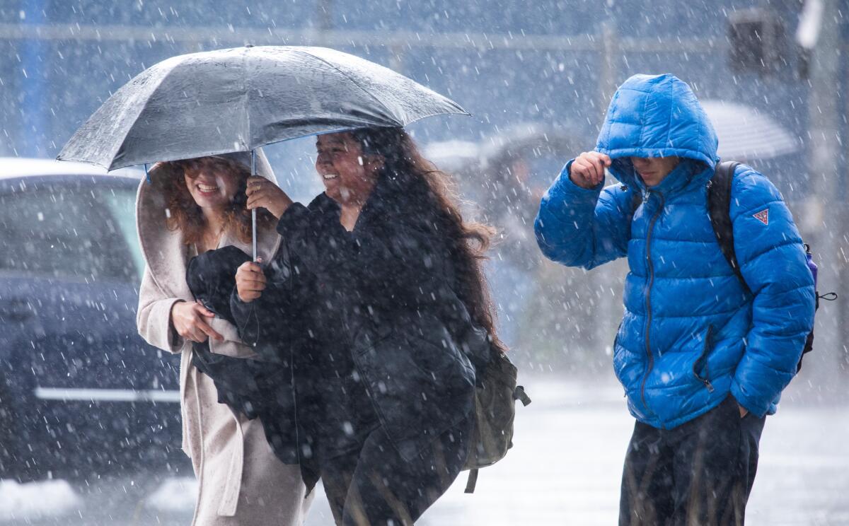
Conditions were not as bad in Southern California, which saw steady rain Tuesday, with more set for Wednesday.
Winds were strong from the south — uncommon for the region, where they typically come from the west, northwest or southeast, said Jonathan Porter, chief meteorologist at Accuweather.
When winds originate from uncommon directions, it increases the risk of toppling trees, because root systems “build up” over time in response to more typical patterns, Porter said. That’s especially concerning given how saturated the ground is from recent rainfall — another factor that can make trees susceptible to falling.
Landspout warning
The weather service issued special statements covering large swaths of Ventura and Los Angeles counties, citing the potential for pea-size hail and the possibility of landspouts through late Tuesday afternoon.
Landspouts are similar to tornadoes, but the circulation from the funnel starts at ground level and is pulled up into towering cumulus clouds, according to the National Oceanic and Atmospheric Administration.
It is unclear if any developed.
There was even a tornado warning issued in Ventura County, but none were reported.
More to Read
Sign up for Essential California
The most important California stories and recommendations in your inbox every morning.
You may occasionally receive promotional content from the Los Angeles Times.


