Another atmospheric river storm to hit soaked California, raising fears of more floods
An atmospheric river storm bearing down on California will drop more rain and snow this week, sparking fresh concerns about additional flooding and snowmelt in the already soaked state.
The storm, which originated near Hawaii, is expected to intensify Monday into Wednesday. It will create “considerable flooding impacts below 5,000 feet elevation across much of the California Coast and Central Valley and over the southern Sierra Nevada foothills,” the National Weather Service said.
Rivers, creeks and streams in several areas are once again forecast to overtop — including some, such as the Cosumnes, Salinas and Russian rivers, that are still swollen from a similar storm last week.
“Antecedent conditions are extremely wet and the watersheds are primed, so it’s not going to take a whole lot of precipitation to result in immediate runoff and rises on rivers and streams, and flooding in urban areas,” UCLA climate scientist Daniel Swain said during a briefing Monday.
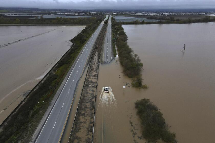
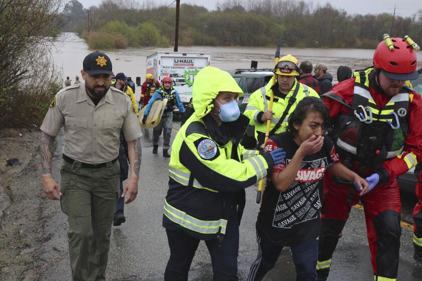
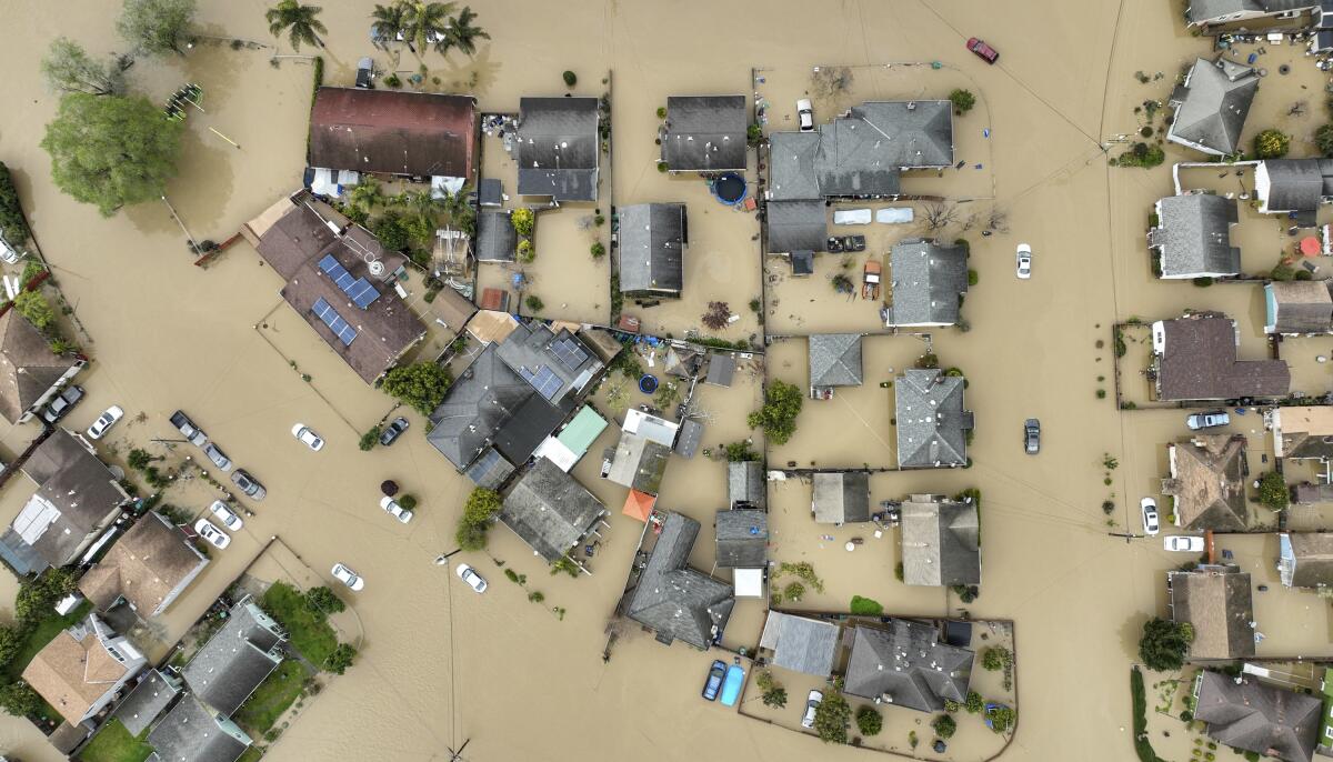
Last week’s storm spurred dozens of water rescues and saw thousands of Californians under evacuation orders. Friday night, heavy rain breached a levee on the Pajaro River, flooding an entire town and trapping scores of residents — many of them migrant farmworkers.
For years, experts had been warning Monterey and Santa Cruz County that the levee along the Pajaro River could fail.
Along the nearby Salinas River, evacuation orders and warnings remained in effect for more than 10,000 people, with Monterey County officials warning of a “probable inundation of roadways between the Monterey Peninsula and the rest of the county” due to the incoming storm.
Gov. Gavin Newsom expanded his storm-related state of emergency to include Calaveras, Del Norte, Glenn, Kings, San Benito and San Joaquin counties, bringing the total number of counties under the declaration to 40.
President Biden issued an emergency declaration Friday, authorizing the Department of Homeland Security and the Federal Emergency Management Agency to support state and local responses to the series of storms.
Biden is closely monitoring the heavy rain and flooding, including the breach of the Pajaro River levee, White House Press Secretary Karine Jean-Pierre told reporters aboard Air Force One on Monday. Biden, who is traveling to California for a two-day visit that includes stops in San Diego and Monterey Park, spoke with Newsom over the weekend, Jean-Pierre said.
Heavy rain remains a top concern with the incoming system, and the weather service has issued more than 40 flood watches and warnings, with the heaviest impacts expected as the system moves from the Central Coast toward the southern Sierra foothills. Flood watches have also been issued in Northern California, including portions of Del Norte, Humboldt and Trinity counties.
Although the total precipitation from the incoming storm may not be higher than that of the storm last week, the flood risk could be significantly greater because of more intense rainfall and already moist conditions, Swain said.
“We just got all this rain, rivers are already running high, there’s still some residual snowmelt — all of those things point toward elevated flood risks with this event compared to the last,” he said.
In addition to Monterey County, evacuation orders and warnings are also in effect in portions of Fresno, Merced and Tulare counties, among other areas, and more than 30 evacuation shelters are open statewide. An evacuation order will be in effect beginning at 8 a.m. Tuesday for areas associated with the Alisal and Cave Fire burn scars in south Santa Barbara County.
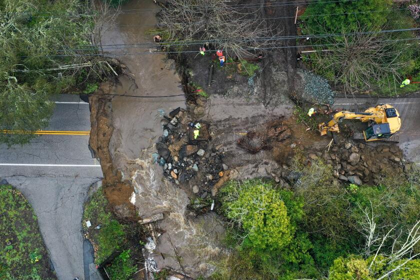
The San Francisco Bay Area has already seen urban flooding, rockslides and debris flows, said weather service meteorologist Eleanor Dhuyvetter.
“Things are very saturated; the ground is ready to move,” Dhuyvetter said, adding that forecasters are “definitely looking at some flooding impacts for the heavier amounts going into Tuesday.”
A boy was rescued Sunday after being swept away down the Santa Ana River after getting too close to the water, the Orange County Fire Authority said.
The storm started as convection near Hawaii before maturing into a strong low-pressure system, Dhuyvetter said, and was expected to link with some upper-level energy Monday.
“We’ve been watching it, and it’s definitely been intensifying over the past 24 hours. Once it meets up with that upper-level energy, it’s going to quickly move and crash into the coast there, right by the Bay Area,” she said.
The storm is expected to be strongest in the Bay Area overnight Monday and into Tuesday, while the Central Valley and areas farther inland should see the brunt Tuesday afternoon into Wednesday, said Brian Ochs, a meteorologist with the weather service in Hanford.
Inland areas of particular concern are Merced County near Bear Creek as well as portions of Mariposa, Fresno, Madera and Tulare counties, which will see the most rain, Ochs said. “Kern won’t be quite as much, but there could still be some local flooding impacts.”
Up to 6 inches of rain could fall in mountain areas as high as 7,000 feet, with up to 3 inches possible in foothills and 1.5 inches in the San Joaquin Valley, Ochs said.
A levee failure on the Pajaro River in Monterey County triggered massive flooding and prompted hundreds of evacuations and dozens of water rescues.
Heavy, wet snow is also expected to fall in higher elevations, particularly in the Sierra Nevada, which will “further compound snow load impacts and issues,” the weather service said. The state has already seen a spate of roof collapses from heavy snow.
Tioga Pass and Mt. Whitney could see up to 48 inches of fresh powder, with up to 24 inches of snow at Mammoth Lakes.
Widespread rainfall is also expected in Southern California, including up to 7 inches in the mountains of southeastern Santa Barbara County and western Ventura County, with the peak of the storm expected Tuesday. The Ventura River may get close to flood stage, and smaller creeks and streams are expected to fill, said Mike Wofford, a meteorologist with the weather service office in Oxnard.
“In Santa Barbara County, there’s a ton of streams — the mountains are right there in their backyard — and so all that water just comes streaming down,” Wofford said. “There’s tons of them, and they are going to be filling up, and some of them spill out onto the highway, so there will probably be some issues on 101.”
Freeway closures, mudslides and debris flows are likely, he said. In the Los Angeles metropolitan area, up to 3 inches of rain is possible, along with associated clogged storm drains and flooded intersections, he said.
The storm is “a little shorter in duration than the last one was, but it’s higher intensity — we’re going to end up with more rain in L.A. that we did with the last one,” he added.
The Governor’s Office of Emergency Services said Monday that it was positioning resources to fight flooding and respond to potential emergencies in nearly 20 counties across the state, including swift-water rescue teams in Fresno, Inyo, Sacramento, Monterey, Tulare, Los Angeles and San Luis Obispo counties.
The state’s water managers are continuing to lower dam levels to make room for incoming flows, including Lake Oroville, the state’s second-largest reservoir, which is at 76% of its capacity. Releases from its dam into the Feather River continued Monday at about 15,000 cubic feet per second, said Molly White, operations manager with the Department of Water Resources.
“We continue to closely monitor lake levels, weather and runoff forecasts,” White said, “and we’ll be making adjustments as needed to manage lake levels.”
At least one fatality has been confirmed in the first of a series of new atmospheric river storms that rolled into California on Friday.
The weather service is warning that the system may also bring the potential for thunderstorms and strong winds, with high wind warnings in effect in several regions. Coastal areas from Cloverdale to Big Sur could see gusts of up to 70 mph, while the Sacramento Valley, San Joaquin Valley and surrounding areas could see gusts of up to 60 mph.
The storm arrives on the heels of one of California’s wettest, snowiest winters on record. Nearly two dozen people were killed during nine back-to-back atmospheric rivers in January, and at least 13 people were found dead after heavy snow piled up in the San Bernardino Mountains in late February and early March.
Statewide snowpack on Monday was 212% of normal for the date, while Lake Shasta — the state’s largest reservoir — was 63% full.
Though conditions are expected to clear in most areas soon after the storm, relief will be short-lived, said state climatologist Mike Anderson. Another atmospheric river may arrive in California between March 19 and 22, with potentially another one after that.
“We get a little bit of clearing, which is good,” Anderson said. “But we’re not done yet.”
Times staff writers Courtney Subramanian, Susanne Rust and Ian James contributed to this report.
More to Read
Sign up for Essential California
The most important California stories and recommendations in your inbox every morning.
You may occasionally receive promotional content from the Los Angeles Times.
