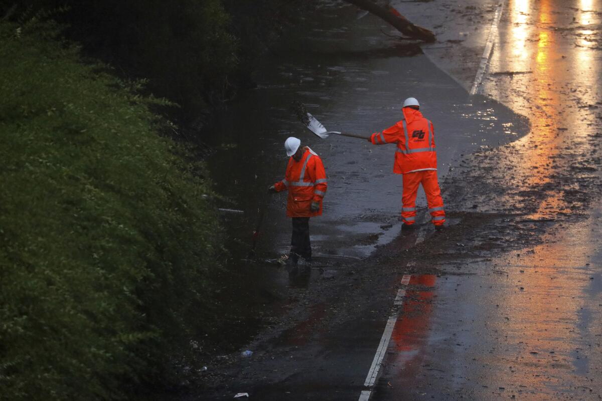
Significant rain comes to Bay Area; emergency responders say, ‘It’s just winter’

It’s rain in the San Francisco Bay Area as far out as Brian Garcia’s crystal ball can see.
Garcia, a meteorologist for the National Weather Service, said the coastal region is likely to see an accumulation of 8 to 12 inches over the next 12 days.
Emergency responders in the region are reacting with cautious optimism that the wet weather won’t unleash significant floods and mudslides.
Like much of California, the Bay Area and surrounding counties have been scorched by wildfire.
In 2020, there were the LNU, SCU and CZU Lightning Complexes which set fire to the north, east and coastal Bay Area — burning a collective 850,000 acres. In 2017, there was the Tubbs fire, which burned more than 86,000 acres in Sonoma County, as well as the Glass, Nuns and Valley fires, which scarred both Sonoma and Napa counties.
The denuded slopes left behind by these fires makes debris flows and mudslides more likely — particularly in areas with steep terrain.
But Jason Hoppin, a spokesman for Santa Cruz County, said that so far, no emergency orders have been issued despite the soaking that’s predicted.
In the two years since the region was hit by the CZU lightning fire complex, he said, the area has sustained several large storms. “And thankfully, nothing much happened.”
He said there was one debris flow in 2021, but no structures were damaged and nobody was hurt.
Nate Armstrong, a deputy chief for the state Department of Forestry and Fire Protection, said he’d been told by geologists that the risks of debris flows “decrease from the first rainy season to the second rainy season and then fall off dramatically in the third rainy season (this one).”
As a result, debris flow hazard warnings have been retired. But people who live in low-lying areas along streams flowing from the burn area “should maintain situational awareness during periods of wet weather and should consider evacuating if the National Weather Service issues a flash flood watch for the CZU burn area or nearby areas, at least during the peak of the storm.”
Assemblywoman Gail Pellerin, who represents parts of Santa Cruz and Santa Clara counties, said she’s been in touch with emergency responders at the local and state levels and that although no one seems overly concerned, “we’re keeping an eye on things.”
Pellerin, who resides in Santa Cruz, used to live in Felton — in the heart of the Santa Cruz Mountains, where she said everybody has an evacuation plan and probably a chainsaw in the back of their car.
“It’s just how you live in the mountains,” she said. “You’re always prepared.”
Mark Bingham, chief of the nearby Boulder Creek Fire Protection District, said the mountain hamlet was doing well. “So far it’s just winter in Boulder Creek.”
He said the community has been keeping sandbag and sand bunker locations stocked in partnership with the county public works, and he’s in touch with the state Transportation Department — making sure their lines of communication are open.
There’s been no call from the county’s Office of Emergency Services, yet, but “of course we’re keeping a close watch on the storm’s progress and responding to 911s as they get called in,” Bingham said.
In Sonoma County, 2 to 4 inches have fallen and there have been a couple of road closures, but nothing major, a county spokesman said.
Garcia, the weather service meteorologist, said the rain was likely to taper off Tuesday evening and there’ll be a “break on Wednesday and another around New Years Day.”
It’s a lot of rain, he said. “But that’s the thing about California. We get the extremes.”
He said climate change is altering what is considered normal, but things have never really been “normal” in California.
More to Read
Sign up for Essential California
The most important California stories and recommendations in your inbox every morning.
You may occasionally receive promotional content from the Los Angeles Times.


