California pushed to the limit by a relentless heat wave that broke the mold

A heat wave that has shattered temperature records nearly broke California’s overtaxed electric grid Tuesday evening, pushing it to the brink of rolling blackouts but narrowly averting widespread power loss.
But those extremes don’t do justice to what is shaping up to be the most brutal September heat wave in California history, expected to last nine days. Even at night, record-high low temperatures are offering little relief to residents or power suppliers. And coastal areas — often a refuge from heat — were also hit with scorching temperatures.
It all offers a disturbing preview of the state’s future battles with extreme heat amid a warming climate.
“This will be essentially the worst September heat wave on record, certainly in Northern California, and arguably for the state overall,” said Daniel Swain, a UCLA climatologist. “It might be one of the worst heat waves on record period in any month, given its duration and its extreme magnitude. ... There really isn’t going to be substantial relief in that part of the state until at least Friday or Saturday.”
The Bay Area and Sacramento broke records Tuesday and saw sweltering lows overnight, remaining in the high 70s. Temperatures in the 100s set records across parts of Southern California, and humidity aggravated the already grueling conditions.
Forecasters say the Antelope Valley could see temperatures as high as 113 degrees during the ongoing heat wave.
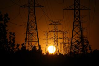
The California Independent System Operator, which runs the state power grid, upgraded emergency alerts Tuesday afternoon and warned residents to be “ready for rotating power outages,” after narrowly escaping that outcome Monday.
According to the ISO, the grid Tuesday evening hit a peak demand of 52,061 megawatts, “a new all-time record.” ISO officials said that despite the strain, they did not order “load sheds” that would have cut power, thanks to conservation efforts. But a few cities — including Alameda, Palo Alto and Healdsburg — reported temporary losses of power in some areas, at the direction of the grid operator.
The unprecedented demand and oppressive temperatures across huge swaths of the state have imposed continuous stress on the power grid. The drought has diminished hydropower, a low-cost resource used to quickly ramp up electricity. Solar energy levels off in the evening, when temperatures subside, but Californians are continuing to crank their air conditioning.
The challenges are a test of how the state can balance the system when it’s under pressure, said Jan Smutny-Jones, executive director of trade group Independent Energy Producers and former chair of the ISO’s governing board.
“Our resource base has changed, how it operates has changed. We don’t have a lot of excess in the system that if something goes wrong, we’ve got other resources that we can skate on,” Smutny-Jones said. “I think this is why you’ve got the ISO pretty concerned about the ability to meet the demand.”
The West has long experienced episodes of extreme temperatures, but studies have shown that human-caused climate change is making heat waves more prolonged, frequent and intense.
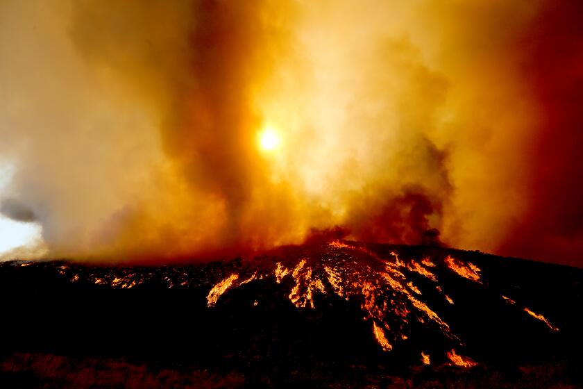
The fire tore through 2,000 acres around Hemet on Monday and continued to grow Tuesday .
Last week, Gov. Gavin Newsom declared a state of emergency to buoy energy supplies by temporarily allowing power plants to work overtime and deploying backup generators. And, in a first for the state, the ISO requested the activation of temporary emergency power generators deployed by the Department of Water Resources in Roseville and Yuba City.
An excessive heat warning remains in effect for much of California through Friday, with temperatures expected to reach the triple digits in many regions. Forecasters predict that the heat will begin to break over the weekend, as the system shifts east.
Northern California saw historic highs Tuesday, including downtown Sacramento, which hit 116 degrees, surpassing a nearly century-old record.
The low temperature at the Sacramento Executive Airport broke the record for September, at 73 degrees Tuesday morning, according to the National Weather Service. Lows in downtown Sacramento and Stockton tied all-time records for warm temperatures, at 77 and 75, respectively.
“It’s a real big problem when the nighttime lows don’t cool down much,” said Bill Rasch, meteorologist at the National Weather Service in Sacramento. “That adds to the heat risk, especially for underserved communities.”
He said he expected historic temperatures across the region Tuesday night into Wednesday.
For the record:
9:48 a.m. Sept. 7, 2022An earlier version of this story stated that Sacramento was poised to set a record for the most consecutive days with temperatures 100 degrees or higher. The city is expected to break a record for the most days in a calendar year at 100 degrees or higher.
Sacramento is also expected to break a record for the most days in a calendar year at 100 degrees or higher, Rasch said. If temperatures reach that level through Friday, as forecast, the city will hit 44 days this year, blowing past a 1988 record of 41.
Six cities in the Bay Area set all-time records Tuesday, including Santa Rosa at 116 and Napa at 115, according to the National Weather Service.
In San Francisco, the conditions caused delays for BART trains, which were forced to run at slower speeds, as hot tracks can cause dangers such as derailment.
Livermore, an inland city in Alameda County, topped out Tuesday at 116, tying the all-time record high set Monday, according to National Weather Service meteorologist Roger Gass. He said the Bay Area could see temperatures dip slightly Wednesday, but they would probably rise again Thursday.
“This heat event is a marathon,” Gass said.
Southern California is also bracing for a midweek spike. Burbank is expected to reach 110 on Wednesday, smashing a record of 106 set in 1944. Woodland Hills is expecting 110 degrees Wednesday, beating the 109 degrees set in 1955. Lancaster is expected to tie its record of 109 degrees.
Temperatures are expected to level off this weekend just as forecasters are preparing for the effects of Hurricane Kay, including scattered showers and increased humidity Saturday and Sunday. Mark Moede, a meteorologist at the National Weather Service, said this will be an “extraordinary” weather event: shifting from hot and dry to warm and wet in 48 hours or less.
“It’s going to be a very dynamic end of the week regarding weather,” Moede said.
More to Read
Sign up for Essential California
The most important California stories and recommendations in your inbox every morning.
You may occasionally receive promotional content from the Los Angeles Times.

