Rash of California wildfires sparked by lightning stresses resources

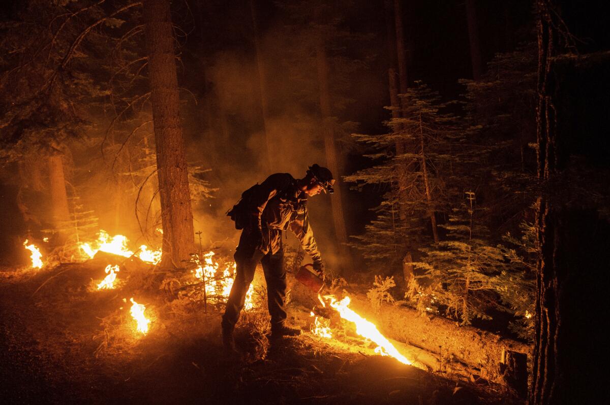
Two lightning-sparked fires burning in remote Northern California forests prompted evacuation warnings and strained firefighting resources already stretched thin by an unusually early and active burning season.
The Monument and McFarland fires were two of at least nine ignited in the Shasta-Trinity National Forest as thunderstorms rolled through Thursday to Saturday.
The Trinity County Sheriff’s Office issued evacuation warnings for the communities of Big Bar and Del Loma on both sides of the Trinity River about 10 p.m. Saturday as the Monument fire grew rapidly, threatening about 22 homes. By Sunday afternoon, the McFarland fire had spurred an evacuation order for residents of the town of Wildwood, which includes about 60 homes.
The fires were burning amid historically dry conditions and a series of heat waves linked to human-caused climate change. It was the area’s third-warmest July on record, with the average high in Ukiah over 100 degrees, according to the National Weather Service. Temperatures there remained about 5 degrees above normal Sunday.
“We’re seeing growth that is really extreme on all of these fires,” said Adrienne Freeman, public information officer for the national forest. “We talk a lot about the probability of ignition, and what that means is: If a source hits vegetation, how likely is it to start a fire?”
The probability, which is based on factors including fuel moisture and wind, has consistently been in the 90th percentile, she said.
“Lightning, cigarettes, hot engines — if there’s a heat source,” she said, “the likelihood that it’s going to start a fire is extremely high.”
The Monument fire was burning on the south side of the Trinity River through low-elevation brush and timber in extremely steep terrain. Infrared mapping put the fire at about 800 acres Saturday night, and it had grown to about 1,800 acres by Sunday evening, according to authorities, who reported 0% containment.
There are no roads that lead to the area, Freeman said, so officials mounted an aggressive initial attack with aircraft and smokejumpers — specially trained firefighters who are dropped in by parachute.
The fire was progressing to the east, pushed by the steep river canyon’s strong daily wind pattern, with winds that blow upslope with the heating of the day and then downslope at night, Freeman said. Although it was burning in the scar of the 2008 Cedar fire, that blaze took place too long ago to have any ameliorating effect on its behavior, Freeman said.
“Since 2008, we have had time to have regrowth,” she said, “especially a brush component in that area.”
Firefighters were also working to protect natural resources.
“The Trinity River is famous for its recreation,” Freeman said, “so the economic impact is a major concern for us, as well as, obviously, life and property safety.”
The U.S. Forest Service lets some blazes burn. California officials say that practices should be updated as blazes explode, partly because of climate change.
About 32 miles southeast, the McFarland fire was burning in a densely forested low-elevation area south of Wildwood. As of Sunday evening, about 234 personnel were assigned to the fire, which was 3,200 acres and 5% contained.
That blaze was also being fought aggressively by air and ground crews, Freeman said. It burned actively overnight into Sunday, particularly on the southern and western flanks. Crews were working to construct a “dozer line” around its west side digging such a fire barrier on the east.
The McFarland fire was detected Thursday evening, and the Monument fire was discovered about 6 p.m. Friday.
“I couldn’t tell you exactly when they started, because when they start to send up smoke is dependent on what kind of fuel the lightning hit in,” Freeman said. “If it hit a big mature tree, it might take a while to show smoke.”
All the other fires detected in the forest after the lightning burst were contained at less than an acre except the Underwood fire, which was contained at 1¾ acres, and the Tamarack fire, which was 6½ acres and 65% contained as of Saturday morning, Freeman said. All were believed to have been sparked by lightning except the Underwood fire, the cause of which remained under investigation.
It’s possible that more holdover fires are burning but haven’t been found yet, Freeman said.
Firefighters were hoping to get a break in the weather, with conditions expected to be less windy and more stable starting Sunday, and temperatures expected to drop down closer to normal later in the week.
“It’s still going to be pretty dry out there since it’s pretty far out into the interior mountains, but the temperatures are going to be coming down a few degrees in the afternoon, and relative humidity values are going to be coming up,” said Scott Carroll, meteorologist with the National Weather Service in Eureka.
The possibility of thunderstorms in southern Oregon late Sunday had authorities on edge, particularly in the area of the Monument fire.
“What happens when a thunder cell collapses is it spits out a downburst of wind that is totally erratic, and those downbursts can affect fires from a long ways away,” Freeman said. “Some of our most dangerous firefighting situations have been due to those erratic, strong winds caused by thunder cells collapsing.”
She contrasted that with daily wind patterns, which can push fires around but are at least predictable.
“When you introduce thunderstorms or convective activity,” she said, “that’s a wild card about how it’s going to affect a fire.”
Some 90 miles to the southeast, California’s largest wildfire of the season so far continued to burn in the Lassen and Plumas national forests.
The Dixie fire was 248,570 acres and 33% contained as of Sunday evening, with 5,463 personnel working to keep flames away from populated areas. Earlier in the day, authorities said about 10,435 structures remained threatened.
Pacific Gas & Electric Co. has said its equipment may have sparked the fire in Feather River Canyon on July 13. A worker wasn’t able to get to the site and discover the flames until 9½ hours later, PG&E said.
Firefighters have been challenged by the remote location and conditions conducive to burning.
“We continue to face fire in rugged terrain that’s difficult to get crews to,” said Capt. Mitch Matlow, public information officer on the fire. “The weather is hot and dry, and we tend to have lots of winds in the afternoon.”
Under the right conditions, the fire will build up a large pyrocumulus cloud during the heat of the day that collapses as things cool off, which can generate erratic winds and send embers in all directions, he said.
“So we have lots of changing wind conditions as those develop,” he said.
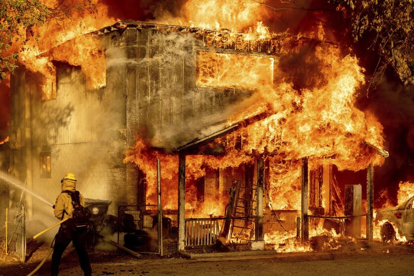
The fire has destroyed 45 primary structures, which can include homes, commercial buildings and barns, and 22 minor structures, which can include sheds or outbuildings, according to officials. Areas where homes burned included Belden, Rich Bar and Indian Falls, according to a map of the damage, which was being updated as assessment teams were able to get into more communities.
About 16,600 people were under evacuation warnings or orders from the fire as of Sunday morning, although that number declined later in the day after the Plumas County Sheriff’s Office rolled back some of the restrictions.
Still, Matlow said, it’s important for people who have been evacuated to stay out of their homes until officials give them the green light.
“When we get into this phase of the fire, it’s often common for people to say, ‘The fire’s out where I live. Why can’t I go back?’” he said. “There are a lot of things that can contribute: narrow roads, heavy equipment on those roads, maybe the road was damaged by the equipment. Utility crews could be in there fixing or replacing utilities. All of that stuff needs to be completed before we let people back in.”
In Los Angeles, firefighters quickly snuffed out a brush fire Sunday afternoon that scorched half an acre in the Hansen Dam Recreation Area, according to the Los Angeles Fire Department.
Another blaze broke out in nearby Irwindale: The Los Angeles County Fire Department said it had stopped the forward march of that fire in the Santa Fe Dam Recreation Area, which had burned 15 acres as of Sunday evening.
Times staff writer Emily Alpert Reyes contributed to this report.
More to Read
Sign up for Essential California
The most important California stories and recommendations in your inbox every morning.
You may occasionally receive promotional content from the Los Angeles Times.


