Hiker rescued from inhospitable peak in Angeles Forest with help from a GPS sleuth
Hungry. Lost. Tired. Cold.
Rene Compean, 45, wasn’t sure he’d survive another night in the remote region of the Angeles National Forest he disappeared into on Monday.
Search and rescue teams dispatched by the Los Angeles County Sheriff’s Department found him before the Palmdale resident had to attempt it.
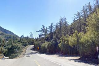
About 3:45 p.m. Tuesday, a low-flying helicopter team spotted Compean in the unforgiving terrain between Triplet Rocks and the east bump of Twin Peaks in the San Gabriel Mountains, according to Sgt. John Gilbert of the Sheriff’s Department’s Crescenta Valley station.
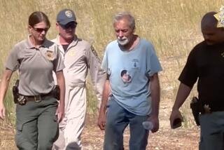
Compean was hoisted into the aircraft; he appeared to have no major injuries.
The happy ending was facilitated with the help of a tech-savvy good Samaritan who used satellite images to pinpoint Compean’s location.
When a concerned friend reported Compean missing about 6 p.m. on Monday, officials didn’t have many leads. Compean’s car was found near the Buckhorn Campground, but they didn’t know which trail he took from there. The friend offered a grainy photo Compean had sent him that day of his legs hanging off a rocky cliff.
With no ridgelines visible in the the photo and the terrain looking like much of the other terrain in the area, search and rescue teams had only a general idea of where to look in the large expanse of the mountains, Gilbert said. Windchill likely drove temperatures into the 30s Monday night. Time was was of the essence.
After obtaining some cellular information from Compean’s provider, officials were able to locate a cell tower he “pinged” nearby and come up with a general location based on it. But it was still a large area to efficiently scour by foot. In an attempt to crowdsource ideas, authorities posted the image of the dangling legs on social media, news outlets — anywhere hiking enthusiasts or sleuths might see it.
Thousand Oaks resident Ben Kuo identifies as both. An avid hiker, Kuo said he has a “strange hobby”: He loves looking at photos and figuring out where they’re taken.
When he saw the photo posted by the Sheriff’s Department, he set to work pulling publicly available satellite images and matching them to the vegetation and terrain below the hiker’s legs.
Kuo sent authorities the GPS coordinates he came up with. The rescue team found Compean about three-quarters of a mile from the spot, according to Kuo.
Triplet Rocks, near where Compean was found, is considered “the least accessible peak in the San Gabriel mountains,” according to summitpost.org, a mountaineering website. There is no maintained route to the peak, according to the site, and getting to it can involve bushwhacking, navigating steep and loose slopes, and class 3 climbing.
Gilbert said it would have taken rescue teams hours to get there on foot.
An amateur ham radio user, Kuo, who goes by the handle @Ai6yrham on Twitter, has provided information to law enforcement before. But he said he’s never aided in anyone’s rescue.
“I’m very happy that he’s safe,” Kuo said of Compean. “It’s gratifying that sitting behind a computer at my desk was so helpful to somebody.”
According to Gilbert, this was a novel experience for him as well. In the old days, he might hand out fliers with the photo at a trailhead and ask for help. This is first time that he can remember tech and social media playing a potentially lifesaving role in a rescue.
“It worked wonderfully this time,” he said.
More to Read
Sign up for Essential California
The most important California stories and recommendations in your inbox every morning.
You may occasionally receive promotional content from the Los Angeles Times.


