Storm spurs mudslide fears, evacuations in Santa Cruz; Grapevine and other highways close

The second in a series of winter storms rolling through California closed the Grapevine area of the 5 Freeway in Southern California on Monday and forced evacuations along the Central Coast.
The wild weather brought hail and snow to areas that do not typically see such conditions. Mountain highways were clogged with traffic; they finally closed as plows worked to keep up with the snowfall.
The heavy rain and high winds in coastal Santa Cruz County prompted evacuation orders, with officials warning of the increased potential for debris flows in the San Lorenzo Valley and Santa Cruz Mountains.
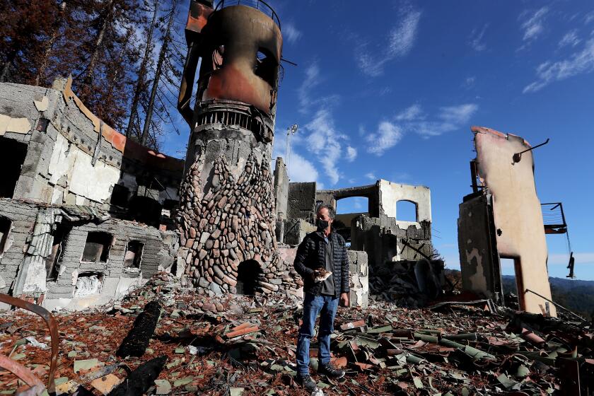
A massive procession of wildfires, the CZU Lightning Complex, burned some 86,000 acres in the fall, killing one person and spreading into areas that hadn’t seen fire in generations. The soil is now weak without vegetation to hold it in place and at heightened risk for debris flows and mudslides, experts warn.
An atmospheric river, slated to arrive Tuesday, threatens to dump excessive amounts of rain on the region, potentially triggering large swaths of scarred, untethered land to slough from hills and mountainsides onto roads, houses and towns below.
The National Weather Service and geologists have prepared for such an occurrence for months, noting that evacuation orders would be triggered if a rain event is forecast to meet or exceed certain thresholds: 0.3 inches in 15 minutes, 0.5 inches in 30 minutes or 0.7 inches in an hour.
“These thresholds, we’re going to meet them,” Chief Deputy Chris Clark of the Santa Cruz County Sheriff’s Office said at a news conference Monday. “And not only are we going to meet them; there’s a whole other component of this storm that, frankly, really concerns me and concerns all of us that are involved in this throughout the county, and that’s the wind.”
Still cleaning up from fires that swept through the Santa Cruz Mountains this year, residents are now prepping for the next disaster — mud slides.
Forecasters are predicting gusts of 30 to 50 mph along the ridges and coast as the storm approaches, potentially downing power lines and trees — making evacuations and rescue attempts difficult and potentially impossible.
Santa Cruz County sheriff’s deputies are knocking on doors and urging people to leave, said Clark, estimating that 2,800 structures and 5,000 people could be affected.
Matt Machado, the county’s director of public works, said the area is at risk every rainy season for mudflows “because of the geology and nature of our mountains,” but he said the upcoming storm is unlike anything seen recently and could prove extremely dangerous.
“I think this is a really unique situation,” he said. “I think with this type of rain event and winds, and with the recent fire, I think it’s a one-off for sure.”
He noted previous mudslides, including one in 1982, when Love Creek overflowed in Ben Lomond after a severe, prolonged rainfall, killing 22 people. “But I think this one is even more unique than that because of the large burn scar,” he said.
The next storm is expected to reach L.A. by Monday morning after the first in a series of winter storms dropped rain and snow in the region.
In addition to rain across the coastal and valley areas of the state, the latest storm brought heavy snow to the Grapevine area near Gorman, prompting the California Highway Patrol to close the north-south route for more than six hours and to escort vehicles off the freeway.
The two right lanes opened shortly after noon in both directions, only to be shut down again at 4 p.m. between Parker Road in Castaic and Grapevine Road in the Kern County community of Grapevine, a stretch of about 60 miles. As of 8 p.m. Monday, the highway was still closed, and Caltrans had no estimate for when it might reopen.
State Route 58 over the Tehachapi Pass was closed at about 4:30 p.m. between the Tower Line Road exit east of Bakersfield and Exit 165 in Mojave. The roadway had reopened earlier in the day with a CHP escort, but snow and “traffic incidents” prompted Caltrans to close it again. The route remained closed late Monday evening.
Snow was expected as low as 1,500 feet, with 1 to 3 inches in the Antelope Valley foothills and a dusting possible in the Santa Clarita Valley. Forecasters were calling for 2 to 4 inches of snow along mountain passes and up to 8 inches at higher elevations.
Strong winds were expected along the coast in Los Angeles and Ventura counties, with gusts of 40 mph to 50 mph, and in the Antelope Valley, with gusts potentially exceeding 60 mph.
Forecasters were calling for large surf, with waves of 8 to 12 feet on west-facing beaches Monday and Tuesday.
The heaviest precipitation is expected in a third storm Tuesday night into Thursday. That system will connect to an atmospheric river, a stream of high-moisture-content air that creates a pipeline of water. It is expected to dump 2 to 3 inches of rain over much of Los Angeles County, said Kathy Hoxsie, a meteorologist with the National Weather Service in Oxnard.
The first in the series of storms sprinkled up to half an inch of rain over the area Saturday into Sunday, and as much as 2 inches of snow fell at higher elevations. In Malibu, residents shared social media images Saturday of impromptu sledding sessions, a rarity for the coastal area. But what looked like snow was actually small-pellet hail, Hoxsie said.
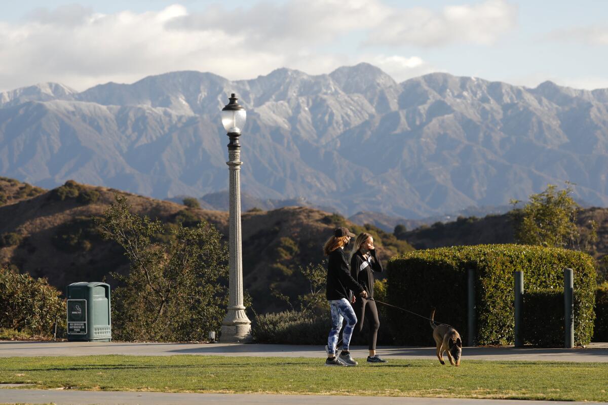
Hail fell Monday afternoon in Pasadena and surrounding foothill communities. The NWS said the area around Mt. Wilson could see up to half an inch of snow through Monday night.
Hail, graupel and snow were also reported in Riverside, Moreno Valley, Yorba Linda and other areas.
The weather service forecast heavy rains coming to Los Angeles, Orange and Riverside counties through the end of the week. The rainstorms, expected to begun in earnest Wednesday, could bring enough water to flood roadways and cause debris flow or rockslides in areas recently scorched by wildfires.
Times staff writer Alex Wigglesworth contributed to this report.
More to Read
Sign up for Essential California
The most important California stories and recommendations in your inbox every morning.
You may occasionally receive promotional content from the Los Angeles Times.
