Unusually warm May contributes to expanding drought in the West

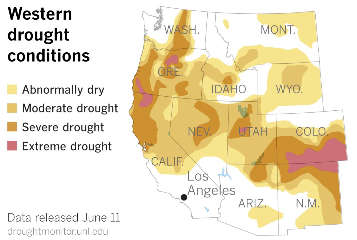
The Western drought has continued to expand and intensify, according to U.S. Drought Monitor data released Thursday.
Wet late-spring weather resulted in a slight decrease in the area deemed to be in extreme drought in Northern California.
Severe drought receded a little in parts of northeastern Utah and southwestern Washington. Unseasonably heavy precipitation, including high-elevation snow, fell in northeastern Utah, the Drought Monitor reported.
But conditions worsened east of the Cascades, and abnormal dryness spread into southeastern Arizona. Drought developed and intensified in northern and eastern New Mexico.

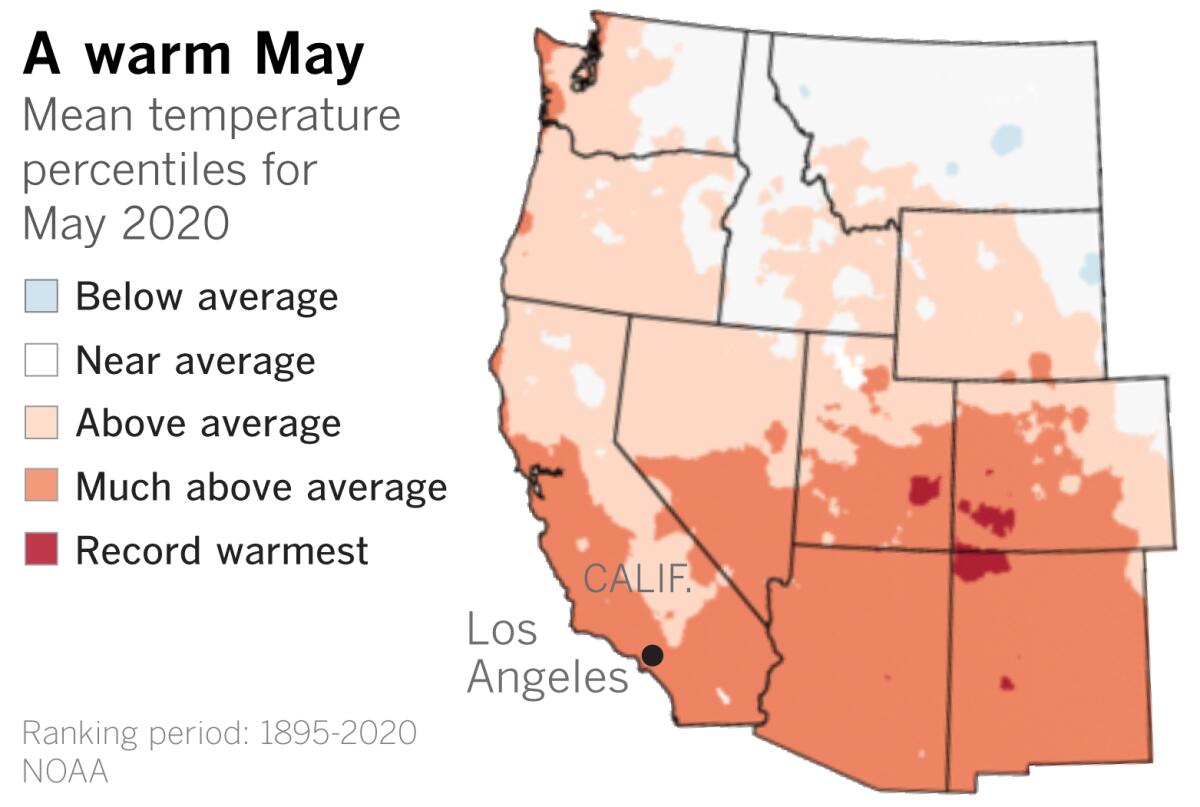
One factor in the expanding drought is the fact that May 2020 was the fifth-warmest May on record. This probably exacerbated the dryness and contributed to a number of wildfires, according to the Drought Monitor’s summary.
A ridge of high pressure over Alaska and the West Coast in the first half of May drove the warm temperatures in the West. Above-average temperatures extended from the Pacific Northwest to Texas and across parts of Florida. During the same period, parts of the East were unseasonably cold.
Persistent drought and warm temperatures in the West continue to fuel fears of an early fire season in Northern California and the Pacific Northwest.
May 2020 was the fourth-warmest May on record in Alaska, according to the National Oceanic and Atmospheric Administration. Average ice extent during May on the Bering Sea was the highest since 2013 but was only 71% of the 1981-2010 average.
Cooler weather is expected to return to Southern California in the next few days after a spate of heat and what the National Weather Service called an unusual late-season Santa Ana condition. Temperatures may dip below average and some mountain showers are possible in Northern California.
But as UCLA climate scientist Daniel Swain points out, there are already hints of the next big heatwave on the horizon for the last 10 days of June. Whereas the recent bout of heat primarily affected Central and Southern California, the broad ridge of high pressure that may be in the offing for late June could encompass the entire West Coast.
More to Read
Sign up for Essential California
The most important California stories and recommendations in your inbox every morning.
You may occasionally receive promotional content from the Los Angeles Times.


