First heat wave of 2020 will arrive in Southern California this week

A ridge of high pressure off the coast will spread over California, bringing the first heat wave of 2020, the National Weather Service said. High temperatures of 85 to 95 will be common, with the hottest readings on Friday and Saturday.
Several days of above-normal temperatures could last from Thursday into early next week. Readings could be 15 to 20 degrees above normal. Nighttime lows are expected to be 55 to 65, about 5 to 10 degrees above normal.
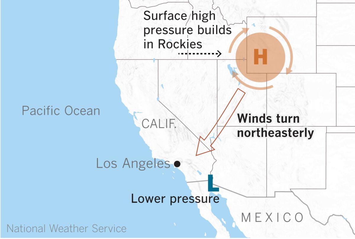
Moderate to strong northwest to north winds are expected, peaking in the afternoon and overnight hours Wednesday night through Thursday. Wind-prone areas such as southern Santa Barbara County, the Interstate 5 corridor and the Santa Clarita and Antelope valleys are expected to see the strongest winds. Winds will weaken and turn more northeasterly into Saturday.
High-wind watches are in effect for the mountains of L.A., Ventura and Santa Barbara counties from Wednesday evening through Thursday afternoon.
High pressure to the north of the region will cause gusty northwest to north winds through Thursday, said Eric Boldt of the National Weather Service in Oxnard. Then as high pressure builds over the Rockies on Friday, the winds will swing around to the northeast.

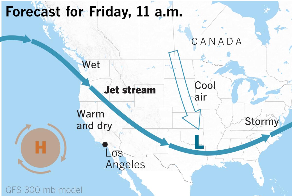
Winds always blow from high pressure toward lower pressure, and are created by the pressure gradient — essentially the difference in pressure. In this instance, the lower pressure is mostly over southern Arizona and northern Mexico. This setup occurs at the surface. Higher in the atmosphere, the jet stream may lend upper-level support.
Winds are expected to be 15 to 30 mph with gusts of 30 to 50 mph in wind-prone areas. Gusts could reach 65 mph through the I-5 corridor and in the Montecito Hills and through the Gaviota Pass.
Downed trees and branches are possible, as are power outages.
The offshore winds will combine with the warming air mass to cause an extended period of unseasonable warmth during which some daily records could be broken.
The jet stream that plunged into California earlier this month, bringing uncommonly chilly, wet conditions, has shifted to the north, funneling rain and mountain snow into the Pacific Northwest. That wintry early-April pattern will be replaced by summery conditions, courtesy of a ridge of high pressure that will expand into California and the Southwest.
Fire weather concerns are minimal because of high fuel moisture, but relative humidity will dip to 12% to 25%, with the lowest readings Thursday and Friday.
The ridge of high pressure, if it persists, could keep conditions very warm into early next week. There is no rain on the horizon for the foreseeable future.
More to Read
Sign up for Essential California
The most important California stories and recommendations in your inbox every morning.
You may occasionally receive promotional content from the Los Angeles Times.


