No rain in sight for L.A. area for next few weeks; critical fire weather warnings extended
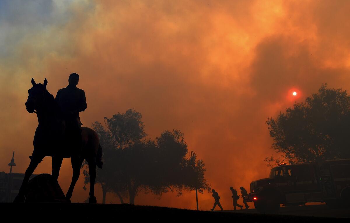
The unusually long Santa Ana wind event is expected to ease Thursday evening. And with it, the fire risk will be reduced as well.
But there is not much good news on the horizon, with forecasters seeing little chance of rain in the next few weeks.
Critical fire weather warnings have been extended through Friday night for the windiest spots of Los Angeles and Ventura counties, continuing red-flag conditions for an additional 24 hours. The red-flag warnings, which sound the alarm for high winds, dry air and parched vegetation, will persist for inland mountains and valleys in Los Angeles and Ventura counties and the Santa Clarita Valley because of ongoing winds from the northeast and very dry air. Other areas were expected to see red-flag warnings expire as gusts ease Thursday evening to 25 mph to 35 mph.
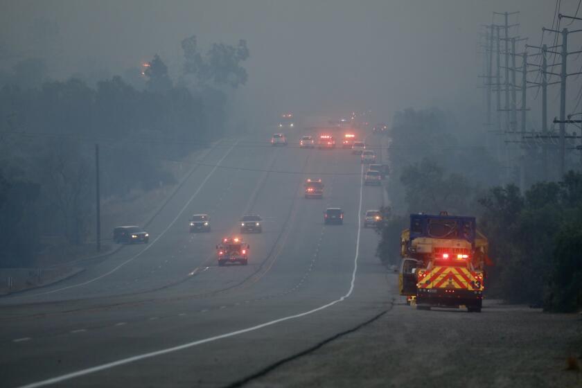
Heavy concentrations of smoke pollution plagued an area from Santa Monica to Long Beach early Thursday. Friday morning may bring a similar pattern.
Top wind gusts recorded Thursday were still strong — 67 mph in a Ventura County coastal valley, the National Weather Service reported, not much weaker than a peak recorded Wednesday of 78 mph at Boney Peak in the Santa Monica Mountains. The air is still bone dry, with relative humidity levels in Simi Valley, the site of the fire that threatened the Ronald Reagan Presidential Library, at 8% Thursday.
Gusts of up to 54 mph were recorded close to the Cajon Pass, near where the Hillside fire in San Bernardino spread Thursday morning. At Riverside Municipal Airport, gusts of 25 mph to 30 mph were recorded near a fire in Jurupa Valley, said Jimmy Taeger, meteorologist with the National Weather Service office in San Diego.
When fire weather risks will drop
Red-flag warnings were expected to end for the less windy locations of Southern California by Thursday at 6 p.m.. A powerful mass of cold, high-pressure air over the Rocky Mountains that’s sending supercharged winds to California is expected to weaken, reducing the winds in the south.
Elevated fire danger could persist through the weekend, said meteorologist Lisa Phillips of the National Weather Service’s Oxnard office, even after red-flag warnings expire.
“Luckily, we are not seeing any more Santa Ana winds within the next week,” Phillips said.
Why California has been hit with strong winds
This Santa Ana wind event was fueled by an unusually strong mass of cold, high-pressure air parked over the Rocky Mountains and the Great Basin over Nevada and Utah; on Thursday, a record low of negative 14 degrees was recorded in Randolph in northern Utah, breaking a 28-year-old record low of minus 1 degree in 1991.
That cold air mass dropped in from the Arctic to the Rockies because there’s such a big mass of high pressure over Alaska, which has been seeing record warmth on a recurring basis and where there is effectively no sea ice on the Arctic Ocean coast in October for the first time in recorded history. That warm mass of air over Alaska had the effect of placing the cold air over the Rockies — creating an extreme contrast in temperatures that sends supercharged dry winds closer to the California coast.
The expected 30-hour “extreme red-flag” warning largely arrived according to expectations, said Daniel Swain, climatologist with UCLA and the National Center for Atmospheric Research.
No signs of rain in early November
Through mid-November, there are no clear signs of rain anywhere in the forecast for California, Swain said. And the less rain California sees at the traditional start of the rainy season, statistically, the more likely it is that the entire wet season will be below average, Swain said.
Still, “a dry autumn doesn’t necessarily portend a dry winter,” Swain said. “We’ll have to take the seasons as they come.”
Though October and November are not California’s rainiest months — the rains in the winter are typically the wettest — they’re arguably especially important because, when they hit, they reduce the fire weather risk from strong, dry Santa Ana and Diablo winds coming from Nevada and Utah toward the Pacific Ocean, Swain said.
Southern California hasn’t had significant rains in seven months, said climatologist Bill Patzert.
Santa Ana wind event a little less severe than expected
The good news, though, is that the difference in air pressure between the coast, measured at Los Angeles International Airport, and inland areas, recorded at the community of Daggett in the San Bernardino County desert, was less severe than expected. A lower difference in air pressure between the coast and the high desert generally leads to a less severe Santa Ana wind event.
Instead a reading of perhaps negative 10 millibars, the air-pressure difference came in at a more modest negative 9.3 millibars, the weather service said.
That “may have made the difference between a historic event than just a severe, strong one,” Swain said, sparing Southern California from widespread damage that can happen with extremely strong events. “They did cause some damage, but not the widespread damage that you can see during these extreme events sometimes.”
The Thomas fire, which killed two people and destroyed more than 1,000 structures in Ventura and Santa Barbara counties in one of California’s most destructive wildfires on record, ignited and spread during a two-week red-flag event in Southern California from Dec. 3 to Dec. 17, 2017.
This week’s extreme red-flag warning was longer than normal — about 30 hours. Though it was shorter than the 2017 event, “our conditions were drier than they were before the Thomas fire,” said Phillips of the weather service’s Oxnard office.
More to Read
Sign up for Essential California
The most important California stories and recommendations in your inbox every morning.
You may occasionally receive promotional content from the Los Angeles Times.
