Southland slogs through storm system of a decade
As Southern California slogged through a deluge not seen in years, forecasters warned that three more powerful storms will target Los Angeles before Thursday.
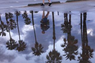
The subtropical drenching came from a weather system so rare that it arrives about once every decade. In the last four days, downtown Los Angeles has received 3.75 inches of rain — a quarter of the rainfall it typically receives for the entire year.
The warm Pacific storm swept the entire state. It rattled Cape Mendocino with thunder, dumped 9 feet of snow on Mammoth Mountain, flooded streets in usually dry Bakersfield and tossed 2 feet of floodwater onto a residential street in La Crescenta.
Sunday’s precipitation broke records across the Southland. Downtown L.A. saw 2.3 inches, shattering a record set in 1921. More than 3 inches of rain fell in Pasadena and San Gabriel, breaking decades-old records.
The rain was expected to taper off overnight. The first of the next three storms was predicted to arrive Monday night, with more pulses arriving Tuesday and Wednesday.
Accuweather.com meteorologist Carl Erickson said 3 to 5 additional inches of rain could fall on L.A.’s coast and valleys. By Wednesday night, the total may have hit 5 to 7 inches of rain in those regions and more than 10 inches in the foothills and mountains.
“I think you guys are going to see a lot of flooding problems,” said meteorologist Mike Pigott.
Some Los Angeles areas had already seen flooding Sunday.
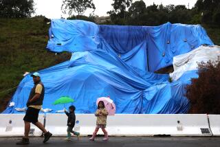
Floodwaters rose knee-high on Pineridge Drive in La Crescenta, but crews were able to protect homes. On L.A.’s Westside, a retaining wall behind a home on West Chalon Road collapsed under the weight of mud and rain, forcing a family to evacuate. Mud flowed down Astral Drive in the Hollywood Hills.
And the rains caused a huge fig tree to fall in Mar Vista, leaving its gnarly roots dangling in the air.
Power outages were reported across the Southland late Sunday night. Electricity was out at some stores at the Santa Anita Shopping Mall in Arcadia.
Farther north, at Sequoia National Park, flooding, mud and rockslides caused most guests at Wuksachi Village & Lodge to voluntarily evacuate.
Some feared that the worst was yet to come. In La Cañada Flintridge, residents feared a sequel of the flooding that damaged 40 homes in February.
“You come up here Thursday, and there’s going to be 2 feet of mud everywhere,” fretted one resident who asked not to be named for risk of offending city and county officials working to protect the area.
The rains put a damper on the last weekend before Christmas — one of the busiest shopping times of the year.
“Rain hurts retail most of the time. But we can’t push back Christmas,” said Michael Merritt, co-owner of Place Vendome, a jewelry shop in Pasadena.
David Baylon, co-owner of the Jumping Jellyfish toy store, hoped for the best. “Nothing is going to stop shoppers,” he said.
The rain scared off some shoppers from open-air malls at the Grove in the Fairfax district and Americana at Brand in Glendale. But there were more shoppers at the enclosed Beverly Center this weekend compared with the same period last year.
Warm, subtropical storms striking Southern California in December are highly unusual, said Bill Hoffer, spokesman for the National Weather Service in Oxnard.
Normally, a region of high pressure over the central Pacific Ocean deflects storms away from California and into Oregon and Washington. But that pressure has weakened, allowing moist, warm Pacific storm systems to stretch from Asia through Hawaii into California.
“It just keeps on coming,” Hoffer said. Such a weather pattern pops up once every 10 to 15 years, he said.
The warm nature of the storms is one reason rain, not snow, has fallen in the San Gabriel and San Bernardino mountains. But ski resorts farther north were celebrating Sunday. “Measuring snow in inches is *so* last week: we busted out the yardstick,” Mammoth Mountain ski resort boasted on Twitter.
The Pacific storms will head east, moving through the Rocky Mountains, and could reach Minneapolis in time to dump 3 to 6 inches of snow for Monday night’s football game between the Minnesota Vikings and the Chicago Bears. The match will be played outdoors at the University of Minnesota after last week’s collapse of the Metrodome due to heavy snowfall.
The storm could hit the East Coast by the end of the week, dumping significant snowfall on Philadelphia, New York City and Boston on Christmas Day for the first time since 2002, said Pigott, an Accuweather.com forecaster.
Times staff writers Esmeralda Bermudez and Andrea Chang contributed to this report.
More to Read
Sign up for Essential California
The most important California stories and recommendations in your inbox every morning.
You may occasionally receive promotional content from the Los Angeles Times.
