Nature Reclaims Its Turf at Yosemite
YOSEMITE VALLEY — Behind the empty Ahwahnee Hotel, fresh bobcat tracks mark the morning snow. A pack of coyotes trots between shuttered cabins at nearby Yosemite Lodge.
Mother Nature has briefly reclaimed a domain that was hers for eons, and she is making the most of her reconquest. Even the black bears have roused themselves from hibernation to saunter through the silenced valley and revel in the aftermath of what humans are calling a 100-year flood.
The bears probably will return to their dens to sleep out the winter. But the people who live and work here won’t soon put out of their mind the images of the flood that left this glacially carved national treasure a changed place, and it may take some months to sort out all that will be different.
After a deluge of tropically warm rain fell on deep snowpack in the high country around New Year’s, so much runoff poured over Yosemite Falls that the roar of North America’s highest cataract rattled windows half a mile away. Water rose higher in the valley than at any other time since Yosemite became a national park in 1890, forcing stranded visitors to scramble to safety on the lone available boat.
Washing over campgrounds and picnic areas, forging new channels, erasing popular swimming beaches, turning meadows into frosty sloughs, upending cabins, and expanding the boundaries of its flood plain, the Merced River may have permanently altered the valley’s geography and the way people fit into it.
Visited last year by 4.1 million people, the park that is California’s most popular remains closed to all but essential workers, and won’t reopen before March. It could be closer to summer before visitors can stay overnight in the valley, and renovation could go on for years. There is too much to clean up, too much to fix and make whole again--as much as $50 million in damage to roads and facilities.
A fresh blanket of snow makes it difficult to see exactly how wide a swath the Merced and its feeder creeks cut. But the river left plenty of clues: a jumble of overturned cabins, motor homes and smashed cars at Camp 6, where nearly 100 park concession employees escaped with little more than their clothes; the septic smell of sewage-laden flood waters that rose to pew level inside the valley’s historic chapel; the field of giant boulders where a 200-foot stretch of the “All-Weather Highway” to the Arch Rock entrance was washed away.
At Yosemite Lodge, nearly 300 rooms and cabins were flooded, as were three-fourths of the units in the park’s riverside housekeeping camp. The employee enclave known as Ozone near Yosemite Lodge was destroyed, its 54 winter residents dispossessed. Several campgrounds were inundated, including much of Upper and Lower River, Lower Pines, part of Upper Pines and all of the valley’s large group camp.
Steeped in traditions, sought out by the same families year after year, the canvas-topped housekeeping cabins and many of the campgrounds are now on the short list for relocation. They are simply too close to the river.
“A lot of people need to prepare themselves for the fact their favorite cabin or campsite may no longer be here,” said B.J. Griffin, the park superintendent since November 1994.
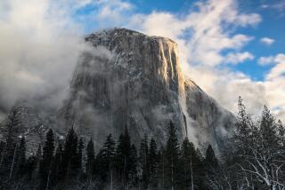
Like the daredevils who scale the granite cliff of El Capitan in summer, the few people who remain here cling to fragile lifelines. Two of the three roads into the valley are impassable. Three of the four water wells are out of commission. Electricity depends on the uncertain durability of a single power pole, knocked partly off its moorings on an island in the Merced.
“Nature has said to us, ‘You don’t get it. This isn’t yours to do whatever you want.’ And we’re fools not to heed the message,” Griffin said.
But in disaster might come opportunity to enhance the Yosemite experience for the millions of annual visitors, she added. As part of the rebuilding, she wants to shrink the human footprint by relocating campgrounds and outdoor facilities away from the river and finally--after decades of discussion and delays--moving many worker accommodations and offices out of the valley.
Griffin sees in the flood’s aftermath a chance to carry out the master plan, written 17 years ago, to keep the valley’s lodgings intact but eliminate about one-quarter of the other buildings in the valley, vacating more than 100 acres of riverfront and meadows and letting them revert to nature.
If she succeeds, Griffin will set a precedent that will reverberate throughout the national park system, said Park Service Director Roger Kennedy. “She will be showing her peers that the job can be done right, and that will be especially encouraging to the big parks where we are struggling hardest with the impacts of huge crowds and traffic,” he said.
Meanwhile, even rangers and other veterans of a score of winters in Yosemite cannot recall it ever being this deserted.
Ghostly quiet, the 70-year-old Ahwahnee Hotel’s crepuscular public rooms look like a set for an Emily Bronte novel. Complete with silverware, wine glasses and pink linen, all of the tables in the cavernous dining room are still meticulously set.
“There isn’t a single reason we couldn’t be open for business right now,” said hotel manager Debbie Price, who is used to the frenzied pace of 97% occupancy even in winter.
The hotel is on high ground and never was in danger of flooding. On Jan. 3, the day the park was evacuated, “our primary concern was keeping the cappuccino flowing and the classical music playing,” Price said.
Historic Curry Village also escaped flooding, the only minor damage inflicted by a rockslide.
Near Yosemite Village, the park’s administrative complex has taken on the trappings of a military camp. Hand-lettered signs point to the “Incident Command Post.”
A commissary for employees and emergency workers operates out of the Yosemite Lodge dining room. Green and beige portable outhouses line the sidewalks, substituting for the park’s main sewer line, which came apart where the 200-foot section of road fell into the Merced three miles east of Arch Rock.
About 400 people--a handful of remaining employees, park rangers and trouble-shooting government repair crews from around the country--gather daily to receive work orders. Their numbers represent about 5% of the normal January population of staff and visitors.
Inside the command post, federal disaster recovery experts talk about the unique challenges of making a national park functional again after a disaster.
“It’s not as if you can run a bulldozer down a river channel that you need to clear, or build levees or an infrastructure designed to withstand what nature can throw at you,” said Steve Holder, who has led recovery teams at several national parks.
“The idea is to live with the environment here, not to try and subdue it.”
As demolition experts try to figure the best ways to blow up house-size boulders and other flood debris that have obliterated the highway beside the Merced, the park’s cultural stewards remind them of other responsibilities.
The rock retaining wall built by the Civilian Conservation Corps in the mid-1930s is to be restored. The cobble remnants of the park’s first roadway along the Merced, built by the U.S. Cavalry a century ago for Ft. Yosemite, are not to be covered up.
“Repairing the roads isn’t just a matter of complying with federal highway standards,” said Laurie Lee Jenkins, a Yosemite resource specialist. “This is a unique cultural landscape. When you drive in, the road narrows, the metal guardrail is replaced by a hand-laid rock wall. You sense you are in a special place, and we have to keep it that way.”
The most painstaking rebuilding chores may have to wait until spring or summer, when the snow clears from the high country, thousands of feet above the valley. There, the park’s network of wilderness trails and footbridges was hard hit by the unexpected midwinter flooding.
A helicopter reconnaissance before the recent snowfall revealed damage along several of the most popular routes--to Glacier Point, along the Mirror Lake Loop Trail, across Falls Creek at Wapama Falls near the Hetch Hetchy Reservoir, through Pate Valley to the grand canyon of the Tuolumne River, below Glen Aulin High Sierra Camp at the foot of Water Wheel Falls and across Emerald Pool on the Nevada Falls Foot Trail.
More than 20 footbridges, including virtually all of those in Yosemite Valley, were damaged or destroyed.
In the back country, where airlifting of materials is prohibited and all supplies must be transported by pack animals, it can cost $60,000 to $80,000 and take a year to rebuild a single footbridge over a major stream, park officials said.
For Griffin, the first rule of recovery is remembering that “nature unbridled is what we are all about. . . . All decisions must flow from the understanding that the natural process prevails.”
Now and again, Yosemite officials have observed that principle in the past.
“In the ‘20s, the old Sentinel Hotel and all of Yosemite Village were built near the river’s edge, around where the chapel stands today,” said Jim Snyder, who doubles as the park’s historian and demolition expert. The relic hotel is long gone, and the entire village was eventually relocated to higher ground.
But as Griffin talks about moving more buildings away from the river and even out of the valley, her enthusiasm is not universally shared.
“If you take employee housing down, where do you house employees come spring?” asked Gary Fraker, president of Yosemite Concession Services, which operates lodging and food services in the park. “Without a full complement of employees, you won’t be able to accommodate all the visitors you would like.”
While Park Service personnel talk about the flood and the engorged waterfalls as a breathtaking natural phenomenon, Fraker and his staff tend to focus on the human toll.
“If you’re thinking about this event as some kind of John Muir deal where blessed solitude finally returns to Yosemite, forget it,” said Bill Germany, director of hospitality under Fraker. “What it was really like was standing in two feet of freezing water full of raw sewage in 35-degree temperatures filling sandbags all night long.”
Nearly 1,000 people, from ski instructors to store clerks, have been laid off. At least 300 lost their household possessions to the rising waters. Yosemite Concession Services says it is losing nearly $150,000 in gross revenue each day the park is closed. For surrounding communities, the losses quickly mount into the millions.
“We have people on the brink of ruin. First, they lose their belongings. Then, they get laid off,” Fraker said. “We had to have an emergency clothing drive in the valley to make sure people had enough on to stay warm.”
On Thursday, Griffin left the park for Washington to discuss her recovery strategy with Clinton administration officials.
Under any plan, said Griffin and Kennedy, the park faces $30 million to $50 million worth of rehabilitation. Using the opportunity to relocate out of sensitive areas, and to restore the river’s edge to a more natural state, will slow down Yosemite’s return to normal.
“Doing things right could take more time,” Griffin said. “And we are concerned about people’s financial health. But we are more concerned about repeating the mistakes of the past, about building in a flood plain that is clearly larger than anyone thought.”
(BEGIN TEXT OF INFOBOX / INFOGRAPHIC)
After the Deluge
During New Year’s week, the worst flooding in the history of Yosemite National Park inundated campgrounds and facilities and reshaped the Merced River. Here is the status of many popular Yosemite Valley landmarks. The park will remain closed at least until March.
NOT DAMAGED
Park Service headquarters
Yosemite Village
Sunnyside campground
Ahwahnee Hotel
North Pines campground
Curry Village
Upper Pines campground
****
FLOODED STRUCTURES
Yosemite Creek bridge
Guest lodging
Community chapel
Yosemite Lodge
Sewer lift station
Concessionaire housing
Residence 1
Three water wells
Housekeeping camp
Camp 6
Fire station
Lower Pines campground
River campgrounds
Group campground
Concessionaire housing
Happy Isles bridge and road
****
Merced River: Changed course at the confluence of Bridalveil Creek. The main channel moved 200 yards northward. Several swimming beaches vanished. In places near El Portal the river is three times as wide as before.
****
Road Damage
Several roads in the park were damaged:
All Weather Highway/California 140
Closed by major collapse three miles east of Arch Rock.
*
Big Oak Flat Road/California 120
500-foot section blocked by mud and rocks; other damage.
*
Wawona Road/California 41
One lane open just south of Badger Pass Road.
*
Glacier Point Road
30-foot section collapsed.
*
Tioga Pass Road
Suspected failure near Tenaya Lake.
More to Read
Sign up for Essential California
The most important California stories and recommendations in your inbox every morning.
You may occasionally receive promotional content from the Los Angeles Times.
